New River Gorge National Park: The Perfect One-Day Itinerary
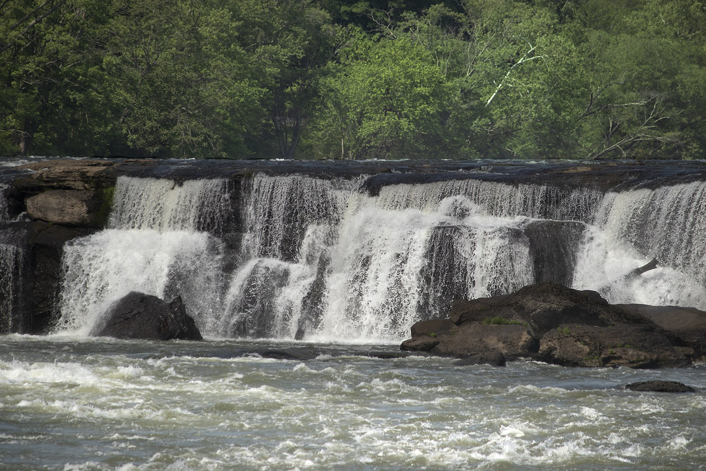
Photo: watts_photos via Flickr (CC BY 2.0)
New River Gorge National Park and Preserve protects more than 70,000 acres along 53 miles of a north flowing river in southern West Virginia. In one well-planned day, you can look down on the New River Gorge Bridge, drive to the river beneath it, complete a three-mile hike, and finish at Grandview, where the river bends around forested sandstone ridges.
Our one-day route runs from Canyon Rim through Fayetteville and south to Grandview. That order limits backtracking and places fuel, food, and the longest drive in sensible parts of the day. Expect roughly 60 miles of driving, plus two to four miles on foot, depending on which trail you choose.
How New River Gorge National Park fits into one day
The park is long and fragmented rather than arranged around a single loop road. Canyon Rim, Fayette Station Road, Long Point, and Grandview are reached from different local roads, while Sandstone Falls lies much farther south. Trying to include every major district produces a windshield-heavy day, so this itinerary concentrates on the bridge area and Grandview.
Understand the gorge before choosing stops
The New River has cut through Pennsylvanian sandstone, shale, and coal-bearing layers approximately 300 million years old. Resistant sandstone forms the cliffs used by climbers, while softer rock erodes into steep forested slopes. Elevation changes from river level to the rim create noticeably different temperatures and plant communities. Hemlock and rhododendron favor shaded ravines, while oak and pine occupy warmer, drier exposures.
Why the route ends at Grandview
Grandview sits above a broad river bend about 40 road miles from Fayetteville. Saving it for the afternoon keeps the morning focused on the bridge district and avoids driving south, returning north, and then descending to Fayette Station. The Main Overlook requires only a short walk, so it also works well after the more strenuous Long Point Trail.
New River Gorge National Park: The Perfect One-Day Itinerary at a glance
Begin early enough to reach Canyon Rim before the busiest part of the day. Fayette Station Road and Long Point then occupy the late morning, followed by lunch and the drive to Grandview. Daylight varies sharply through the year, so treat the times below as a sequencing tool rather than a fixed schedule.
Stop-by-stop driving plan
The drive times assume ordinary conditions and no prolonged stops. Narrow roads, fog, bridge traffic, and autumn visitation can add time. Fayetteville is the practical place to refuel and obtain lunch before continuing toward Grandview, where services are limited and mobile reception can be inconsistent.
| Day | Stop | Primary highlight | Approximate drive time |
|---|---|---|---|
| Morning | Canyon Rim | Visitor center area and bridge overlooks | Starting point |
| Morning | Fayette Station Road | Historic descent beneath the bridge | About 40 minutes without stops |
| Late morning | Long Point Trail | Three-mile round-trip hike to the bridge view | About 15 minutes from central Fayetteville |
| Midday | Fayetteville | Lunch, water, and fuel | About 10 minutes |
| Afternoon | Grandview | Main Overlook and optional woodland walk | About 45 to 50 minutes |
Prepare before leaving the bridge district
Download an offline map because navigation can drop out below the rim. Carry water for the hike, food for the afternoon, and a light layer even in summer. Weather at the overlook can differ from conditions beside the river. Current road status, operating hours, fees, and any temporary restrictions should be confirmed on the official park site.
- Fill the fuel tank before driving toward Grandview.
- Pack at least one liter of water per hiker for Long Point.
- Wear shoes with traction for roots, mud, and sandstone ledges.
- Keep food secured because black bears and raccoons inhabit the park.
- Bring a paper map or saved screenshots as a backup.
Morning in the New River Gorge National Park bridge district
The first half of the day explains the park’s scale better than any single viewpoint. Canyon Rim shows the gorge from above, Fayette Station Road reveals its depth, and Long Point provides the classic side-on profile of the bridge. Allow roughly four hours for these stops, including the hike.
Begin at Canyon Rim
Canyon Rim Visitor Center stands near the north end of the New River Gorge Bridge. Exhibits provide useful context on coal mining, rail transportation, river ecology, and bridge construction. The bridge opened in 1977, spans 3,030 feet from end to end, and carries the highway 876 feet above the river.
Walk to the bridge overlook
A boardwalk descends from the visitor center area to overlooks facing the steel arch. The upper viewpoint is the easier option. Reaching the lower platform requires several hundred steps, which become a substantial climb on the return. Morning often brings fog in the gorge, but shifting cloud can reveal the arch while the river remains partly hidden below.
Descend Fayette Station Road
This narrow scenic road follows portions of the former route used before the modern bridge reduced a winding gorge crossing to less than a minute. The drive drops through forest, passes close views of sandstone walls, crosses the New River on the Tunney Hunsaker Bridge, and climbs toward Fayetteville. Pullouts are small, so use designated spaces and keep the travel lane clear.
See the bridge from river level
Near the river, the bridge’s arch rises across the entire opening overhead, while traffic produces a distant hum high above the water. The air is cooler beside the river, and exposed sandstone, dense rhododendron, and the sound of rapids replace the broad landscape visible from Canyon Rim. The vertical separation makes the gorge feel much deeper than it appears in photographs.
Hike the Long Point Trail
Long Point Trail is approximately three miles round trip and generally takes 90 minutes to two hours. The route crosses relatively level woodland before descending toward an exposed sandstone outcrop. The final approach contains roots, rocks, and short steeper sections, but the overall hike is moderate and requires no scrambling under normal conditions.
Approach the signature viewpoint carefully
At Long Point, the forest opens abruptly onto bare sandstone with the entire bridge centered across the gorge. The rock can feel warm underfoot on a sunny afternoon, while wind rising from the river cools the exposed ledge. There are substantial unguarded drops near the viewpoint, so children should remain close and hikers should stay back when sandstone is wet or icy.
Use Endless Wall as the hiking alternative
Choose the Endless Wall Trail if cliff scenery matters more than a centered bridge photograph. The trail follows the gorge rim through hemlock and hardwood forest, with access to Diamond Point and numerous climbing routes. The main trail is about 2.4 miles point to point, and connecting the trailheads by road creates an outing of roughly 2.9 miles. Limited trailhead parking can make Long Point the simpler choice during busy periods.
Finish the afternoon at Grandview
After lunch in Fayetteville, follow US 19 south toward the Grandview area near Beaver. The route stays on faster roads until the final approach, which climbs through forest to the rim. Budget close to an hour for the drive so traffic and a short food stop do not compress your time at the overlooks. Arriving at least two hours before sunset leaves enough daylight for the Main Overlook and one optional walk.
Start with the Main Overlook
The Main Overlook faces a tight horseshoe bend where the New River wraps around Turkey Spur. Active railroad tracks follow both banks, showing how engineers used the narrow strip between the river and steep slopes. The overlook also reveals the gorge’s exposed sandstone benches and densely wooded ravines. Deciduous foliage can obscure some details during summer, while leafless months provide clearer views of the tracks and river channel.
Choose one short Grandview walk
The Grandview Rim Trail extends approximately 3.2 miles one way toward Turkey Spur, making the entire out and back too long for this itinerary. Walk only the first section if daylight permits. Castle Rock Trail provides a rougher alternative beneath sandstone cliffs, with narrow tread, rock overhangs, and uneven footing. That route becomes slippery after rain and is poorly suited to anyone uncomfortable with exposed edges.
Save Turkey Spur for a longer visit
Turkey Spur offers another elevated perspective over the river, but reaching its upper viewpoint involves a long staircase. Include it only if you skipped the morning hike or still have ample daylight. The overlook faces a different section of the gorge than the Main Overlook, so photographers gain changing light and a clearer sense of how tightly the river curves through the Appalachian Plateau.
Decide what deserves priority
A successful New River Gorge National day depends on protecting time for the stops that explain the landscape. Canyon Rim, Fayette Station Road, one rim hike, and Grandview form the essential route. Optional additions should replace another activity rather than expand an already full schedule. Mountain roads and short walks routinely consume more time than navigation estimates suggest.
Keep these four experiences
- Canyon Rim: Best overview of the bridge’s engineering and the gorge’s width.
- Fayette Station Road: The only stop on this route that reaches river level.
- Long Point or Endless Wall: Choose one substantial rim hike.
- Grandview: Best view of the river’s horseshoe bend and railroad corridor.
Leave distant districts for another day
Sandstone Falls spans roughly 1,500 feet across the New River near Hinton, but reaching it requires a substantial drive south and then a riverside approach on the opposite bank. Thurmond preserves an important railroad town within the gorge, although its winding access road also demands dedicated time. Either location works better as the centerpiece of a second day than as a rushed detour after Grandview.
Adjust the route for weather and season
Conditions vary considerably between the river and rim. Fog may cover Canyon Rim while the lower gorge remains visible, and shaded trail sections can retain ice after sunny roads have cleared. Summer thunderstorms make exposed overlooks a poor place to linger. If thunder is audible, leave Long Point or Grandview’s rim and return to a vehicle or substantial building.
Use daylight to set the hiking limit
| Season | Likely conditions | Best itinerary adjustment |
|---|---|---|
| Spring | Mud, high water, cool mornings, emerging foliage | Allow extra trail time and carry a waterproof layer |
| Summer | Heat, humidity, dense leaves, afternoon storms | Hike Long Point early and reserve overlooks for later |
| Autumn | Cooler air, colorful hardwoods, heavier visitation | Reach Canyon Rim early and expect slower parking turnover |
| Winter | Short daylight, bare views, possible snow and rim ice | Skip exposed trails when icy and finish well before dark |
Know when to shorten the plan
During heavy rain, replace Long Point with additional time at Canyon Rim and Grandview’s developed overlook area. Persistent fog can justify reversing the emphasis: descend Fayette Station Road first, then revisit the rim if visibility improves. In winter, prioritize road conditions over mileage. Bridges, shaded curves, stairs, and sandstone ledges can freeze before nearby highways.
Plan dinner and the overnight stop
Fayetteville is the most convenient overnight base for repeating a bridge district hike the following morning. Beckley places travelers closer to major highway connections and the park’s southern districts. Visitors continuing toward Hinton or Sandstone Falls should stay farther south, reducing the next morning’s drive through the gorge corridor.
Refuel before leaving the main highway
Purchase dinner and fuel near Fayetteville, Beckley, or another established highway community. Food choices become sparse around remote river access roads, and reception weakens in steep hollows. Keep the offline map active until returning to a major route. If fatigue sets in after Grandview, avoid adding a sunset detour on narrow roads and proceed directly to lodging.
Gear & Essentials
Tell us about your trip and we will add what else you will want:
The basics
Worth having in the car whatever the park.
For this trip
Traveling with kids
Bringing a pet
RVing
Backcountry
Winter conditions
On the water
Photography
Accessibility
As an Amazon Associate we earn from qualifying purchases, at no extra cost to you.
Complete your perfect one-day New River Gorge National Park itinerary
This sequence uses elevation and geography efficiently: begin above the bridge, descend to the New River, hike to a rim viewpoint, then follow the highway south to Grandview. Each stop presents a different layer of the park, from engineering and railroad history to sandstone cliffs, rapids, and Appalachian hardwood forest.
Allow the weather to determine your final walking distance, and treat Sandstone Falls and Thurmond as future destinations. With an early start, a prepared lunch stop, offline navigation, and one carefully chosen hike, the day remains full without becoming rushed.
Want to keep exploring? Browse all our New River Gorge guides and articles for more trip-planning tips and ideas.