










Forest Canyon Overlook
| Type | Trailhead |
|---|---|
| Facilities | Parking |
At a glance
- Place type: Trailhead and scenic viewpoint
- Area: Rocky Mountain
- Elevation: About 11,716 feet
- Walk: About 5 minutes on a paved asphalt path
- Facilities: Auto parking
- Best for: Panoramic views and photography
- Road access: Trail Ridge Road generally closes from mid-October through Memorial Day
Why visit
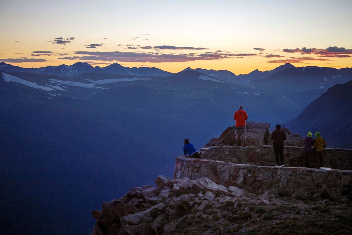
Forest Canyon Overlook provides a broad view into Forest Canyon from about 11,716 feet. The overlook also reveals Hayden Gorge, Gorge Lakes, and smaller canyons feeding the main valley.
The landscape clearly displays the effects of glacial erosion. Visitors can reach the view with a short walk from the parking area.
Getting there
Forest Canyon Overlook is reached from Trail Ridge Road in the Rocky Mountain area of the park. Auto parking is available at the trailhead, and the listed parking lot is at the site.
From the parking area, follow the paved asphalt path for about 5 minutes. Remain on the pavement throughout the visit to avoid damaging alpine plants and soil.
Beaver Meadows Visitor Center is about 8 miles away. Estes Park, Colorado, is about 10 miles away in a straight line. Grand Lake, Colorado, is about 12 miles away in a straight line.
Denver International Airport, identified by the code DEN, is the listed airport for the park. The provided information does not include airport transportation or driving details.
What to see and do
Walk the paved path to the overlook for panoramic views across Forest Canyon. Hayden Gorge and Gorge Lakes are visible within the network of tributary canyons.
The overlook is also designated as a scenic view and photo spot. Its broad perspective helps visitors recognize the canyon’s glacial shape.
Stay on the paved asphalt path while viewing or photographing the landscape. Enjoy alpine flowers without picking them so they remain for future visitors.
History and nature
Forest Canyon records a major change in the valley’s shape. Before glaciation, flowing water had formed a V-shaped stream valley below the overlook.
A glacier about 1,500 feet thick later moved through the valley. Its grinding ice removed rock and broadened the channel. That process created the U-shaped valley visible today.
The overlook also sits among fragile alpine tundra plants. Research has found that trampled alpine vegetation and soil may need decades to recover.
Leaving the path can damage this slow-growing community. Staying on the pavement and leaving flowers in place protects the tundra and preserves the experience for later visitors.
When to go
Rocky Mountain National Park remains open 24 hours a day throughout all 365 days of the year. However, some roads and facilities close during winter.
Trail Ridge Road generally closes from mid-October through Memorial Day, limiting seasonal access to Forest Canyon Overlook. Severe weather can alter the road’s status at any time.
Conditions may shift rapidly because of the park’s mountains and elevation. Elevations across the park extend from about 7,800 feet to more than 14,000 feet on its highest peaks.
Weather can also change repeatedly during a single day. Check the park’s detailed weather page and the National Weather Service forecast for Rocky before traveling.
Accessibility
The route from the parking area is a paved asphalt path. The walk to the overlook takes about 5 minutes, and auto parking is available at the site.
The supplied information does not provide details about grades, curb cuts, resting places, accessible parking spaces, or wheelchair access. Visitors needing those details should check current NPS accessibility information before arriving.
Fees and rules
Rocky Mountain National Park lists these entrance fees:
- Private vehicle: $30 or $35
- Per person: $15
- Motorcycle: $25
The provided fee information lists both private-vehicle prices but does not specify when each applies. Check current NPS fee information before visiting.
Visitors must stay on the paved asphalt path at Forest Canyon Overlook. This rule protects alpine tundra plants and soil that recover very slowly after trampling.
Do not pick the flowers. Follow all posted rules and leave no trace.
Nearby trails and places
The parking lot is at Forest Canyon Overlook. It provides auto parking beside the trailhead and access to the short paved walk.
Ute Trail East is about 0.9 miles away. The supplied information identifies it as a trailhead but does not provide route, distance, difficulty, or connection details.
Beaver Meadows Visitor Center is about 8 miles away. It is the park’s listed main visitor center.
Estes Park, Colorado, is about 10 miles away in a straight line. Grand Lake, Colorado, is about 12 miles away in a straight line. These figures are not driving distances.
Before you go
Check current conditions, weather, road status, and park alerts on the NPS website. Trail Ridge Road access may change suddenly during extreme weather, so prepare to adjust travel plans.
Altitude sickness can cause head pain, dizziness, exhaustion, stomach upset, vomiting, or loss of consciousness. High elevation may also worsen existing heart or lung conditions.
Move slowly, carry and drink water, eat, and rest. Descending to a lower elevation is the only cure for altitude sickness.
Pack layers for rapidly changing mountain conditions. Remain on the paved path, follow posted rules, leave flowers untouched, and leave no trace.
Questions
What is Forest Canyon Overlook in Rocky Mountain National Park?
It is a trailhead and scenic photo spot with a paved path to panoramic views of Forest Canyon.
How long is the walk to Forest Canyon Overlook?
The walk takes about 5 minutes on a paved asphalt path from the parking area.
What can visitors see from Forest Canyon Overlook?
Visitors can see Forest Canyon, Hayden Gorge, Gorge Lakes, and tributary canyons within a glacially carved landscape.
What is the elevation of Forest Canyon Overlook?
Forest Canyon Overlook is at about 11,716 feet.
Is parking available at Forest Canyon Overlook?
Yes. Auto parking is available at the site.
When is Forest Canyon Overlook accessible by Trail Ridge Road?
Trail Ridge Road generally closes from mid-October through Memorial Day. Extreme weather can change its status at any time.
Why must visitors stay on the paved path at Forest Canyon Overlook?
The path protects fragile alpine tundra plants and soil, which may take decades to recover from trampling.
How did Forest Canyon get its shape?
A glacier about 1,500 feet thick scoured an earlier V-shaped stream valley into the U-shaped valley visible today.
Nearby
Places
- Parking Lot
- Ute Trail East
On the map
12 trails7 places to see15 visitor services
Facts on this page draw on the National Park Service: Forest Canyon Overlook (nps.gov)