7 Best Easy Hikes in Yosemite National Park
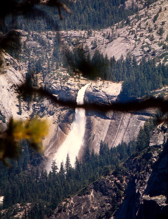
Photo: Ladycliff via Flickr (CC BY 2.0)
The Best Easy Hikes Yosemite has to offer reveal waterfalls, polished granite, giant sequoias, and high country meadows without requiring an all day climb. The surprising part is that several of Yosemite’s defining views sit less than a mile from a road or shuttle stop. Trail length alone can be misleading, however. Elevation, summer heat, winter ice, and the climb back from a grove can turn a short walk into a demanding outing.
Our team selected seven routes across Yosemite Valley, Glacier Point, Wawona, and Tuolumne Meadows. Together they provide a practical introduction to the park’s glacial geology and enormous elevation range, from Yosemite Valley at roughly 4,000 feet to the subalpine landscape above 8,000 feet along Tioga Road.
How We Chose the 7 Best Easy Hikes in Yosemite National Park
We treated an easy hike as a route that most active visitors can complete in two hours or less, with limited climbing and no scrambling. The list includes paved paths, meadow loops, and short woodland walks. Some have exposed edges or uneven surfaces, so “easy” describes the physical effort rather than an absence of hazards.
Seven routes at a glance
Distances can vary slightly depending on the parking area, shuttle stop, or turnaround point. The figures below reflect the most useful version of each walk rather than every possible extension.
| Hike | Area | Distance | Typical effort | Defining feature |
|---|---|---|---|---|
| Lower Yosemite Fall Trail | Yosemite Valley | 1 mile loop | Easy, mostly level | Base view of Lower Yosemite Fall |
| Cook’s Meadow Loop | Yosemite Valley | About 1 mile | Easy and level | Open views of Half Dome and Yosemite Falls |
| Bridalveil Fall Trail | Yosemite Valley | About 0.5 mile round trip | Short with a modest incline | Mist and a close waterfall view |
| Mirror Lake | Yosemite Valley | About 2 miles round trip | Easy to moderate | Tenaya Canyon beneath Half Dome |
| Glacier Point Walk | Glacier Point | About 0.6 mile round trip | Easy, paved in places | High view over Half Dome and the Sierra crest |
| Soda Springs and Parsons Memorial Lodge | Tuolumne Meadows | About 1.5 miles round trip | Easy but high elevation | Subalpine meadow and mineral springs |
| Wawona Meadow Loop | Wawona | About 3.5 miles | Easy, longer than the others | Quiet forest and meadow habitat |
Why elevation changes the difficulty
A level trail in Yosemite Valley usually feels easier than the same distance in Tuolumne Meadows, where much of the terrain lies near 8,600 feet. Visitors arriving from sea level may breathe harder and tire sooner there. Glacier Point stands at 7,214 feet, while the Valley floor is approximately 3,200 feet lower. Sun exposure also matters because granite, pavement, and sandy paths radiate heat during summer afternoons.
Waterfalls create the opposite seasonal issue. Spray can soak paths near Lower Yosemite Fall and Bridalveil Fall during peak snowmelt, generally in spring and early summer. In colder months, shaded pavement may hold ice even when nearby roads appear dry.
Planning around Yosemite’s roads, seasons, and crowds
Yosemite’s easy hikes are spread across a park larger than many visitors expect. Yosemite Valley contains four selections and works well without repeated driving once you are parked. Glacier Point, Wawona, and Tuolumne Meadows occupy separate road corridors, so combining all seven in one day would mean spending much of that day in a vehicle.
Build the day around one park zone
From Yosemite Valley, Wawona is generally about an hour away under normal conditions. Glacier Point also requires roughly an hour by road when its seasonal access road is open. Tuolumne Meadows is farther, usually around 90 minutes from the Valley without traffic or stops. Glacier Point Road and Tioga Road commonly close because of snow, while Yosemite Valley and Wawona remain reachable during much of the year.
Road status, entrance reservations, shuttle operations, parking rules, and trail closures can change. Confirm current details on the official park site before choosing a corridor. Once inside Yosemite Valley, walking between nearby trailheads often saves time because parking areas can fill early during summer and holiday periods.
Carry enough for short walks
Easy trails still cross exposed terrain and areas with limited services. For a half day linking several routes, we recommend carrying:
- At least one liter of water per person, with more during hot weather
- Sun protection, including a hat and sunscreen
- A warm layer for Glacier Point or Tuolumne Meadows
- Footwear with grip for wet granite and sandy paths
- A paper or downloaded map because mobile coverage is inconsistent
- Food secured according to Yosemite’s bear storage rules
Two of the Best Easy Hikes Yosemite Valley Visitors Should Walk First
Yosemite Valley was deepened and widened by repeated glaciers moving through the Merced River corridor. Those glaciers left a broad, comparatively level floor beneath cliffs rising approximately 3,000 feet. That geography explains why visitors can reach monumental scenery on short walks with little elevation gain.
1. Lower Yosemite Fall Trail
This approximately 1 mile loop leads to the base of Lower Yosemite Fall, the final 320 foot drop in the 2,425 foot Yosemite Falls sequence. The eastern side of the loop is generally the most direct approach from Yosemite Village. The western side passes through woodland and provides additional views toward the upper falls.
Near the viewing area, the temperature drops and the roar begins to overpower conversation. Granite underfoot can feel slick from drifting spray, while Lower Yosemite Fall fills the opening between dark conifers and pale cliff walls. During spring runoff, wind pushes bursts of mist across the footbridge. By late summer, the waterfall may shrink dramatically or dry up after a low snow year.
Best timing and trail conditions
Walk early in the morning for lighter foot traffic and softer light on the cliff. Spring delivers the strongest water flow, but it also produces the wettest pavement. The route remains worthwhile when flow is low because it shows the talus, forest, and immense recess carved below the falls. Wheelchair and stroller access is possible on portions of the paved route, although ice, construction, or seasonal detours can affect usability.
2. Cook’s Meadow Loop
Cook’s Meadow provides one of the simplest ways to understand Yosemite Valley’s scale. A roughly 1 mile circuit uses boardwalks and paved paths near Yosemite Valley Chapel, Sentinel Bridge, and the Yosemite Falls area. Depending on the exact connection chosen, hikers can look toward Half Dome, Glacier Point, Sentinel Rock, and the full Yosemite Falls complex.
Stay on the boardwalk where provided. The meadow is seasonally wet and supports sedges, grasses, and riparian habitat that compact quickly under foot traffic. Sentinel Bridge is a useful extension because the Merced River frames Half Dome upstream. Evening light often reaches the upper cliffs after the meadow has entered shade, creating strong contrast for photography.
A high overlook among the 7 Best Easy Hikes in Yosemite National Park
Glacier Point provides a different reading of the same landscape. Instead of looking upward from the Valley floor, visitors stand above Yosemite Valley and face Half Dome, Nevada Fall, Vernal Fall, and the higher Sierra Nevada. The short walk is physically easy, but the elevation and unguarded areas near cliff edges require attention.
3. Glacier Point Walk
The main viewpoint circuit is approximately 0.6 mile round trip, depending on the paths used from the parking area. The route has only modest elevation change and reaches several overlooks rather than a single fixed platform. Glacier Point itself stands at 7,214 feet, almost directly above Curry Village and the eastern end of Yosemite Valley.
Reading the landscape from above
Half Dome’s steep northwest face and rounded eastern shoulder show how glacial quarrying and exfoliation shaped Yosemite’s granite. Farther east, Nevada Fall drops 594 feet beside Liberty Cap, while Vernal Fall is partly visible lower in the Merced River gorge. Snow often limits road access from late autumn into spring, making this primarily a warm season easy hike for most visitors.
Two short walks at opposite ends of Yosemite Valley
Bridalveil Fall and Mirror Lake occupy different geological settings. Bridalveil Creek launches from a hanging valley near Yosemite Valley’s western entrance, while Mirror Lake sits below Half Dome where Tenaya Canyon meets the main valley. Visiting both shows how tributary glaciers entered the deeper Merced River glacier from above and from the east.
4. Bridalveil Fall Trail
Bridalveil Fall drops 620 feet from a cliff west of Cathedral Rocks. The approximately 0.5 mile round trip climbs gently through mixed conifer forest before reaching the viewing area. Peak snowmelt produces heavy spray that can saturate clothing and make the final pavement slippery. Later in summer, wind frequently shifts the thinner ribbon of water sideways, a movement that inspired the waterfall’s English name.
When the spray becomes part of the route
Waterproof outerwear helps during spring, but umbrellas are cumbersome in gusty conditions. Keep children close around wet rocks and remain behind barriers near the viewpoint. Bridalveil Fall receives less morning foot traffic than many central Valley stops because visitors often postpone it until they are leaving the park.
5. Mirror Lake
The usual easy option follows a paved and packed path for about 2 miles round trip to the lake area. Mirror Lake is a seasonal widening of Tenaya Creek rather than a deep alpine lake. Reflections are most reliable during calm spring mornings. By late summer, exposed sand and stones may replace much of the water, but the close view beneath Half Dome and Mount Watkins remains rewarding.
Choose the correct turnaround
- Turn around at the first lake viewpoints for the easiest outing.
- Continue farther along Tenaya Creek for quieter forest and additional canyon views.
- Avoid committing to the full Mirror Lake Loop unless prepared for roughly 5 miles of hiking.
Easy hiking beyond the Valley walls
For readers comparing the Best Easy Hikes Yosemite offers across different elevations, Soda Springs and Wawona Meadow provide the clearest contrast. One crosses open subalpine terrain beside the Tuolumne River. The other circles a lower meadow through forest near the park’s southern corridor. Their seasons, shade, and altitude differ substantially.
| Route | Approximate elevation | Most dependable season | Main consideration |
|---|---|---|---|
| Soda Springs | 8,600 feet | Summer to early autumn | Altitude, thunderstorms, and limited shade |
| Wawona Meadow Loop | 4,000 feet | Spring through autumn | Longer distance and summer heat |
6. Soda Springs and Parsons Memorial Lodge
This approximately 1.5 mile round trip begins near the Lembert Dome area and crosses Tuolumne Meadows toward rust colored mineral springs enclosed by a small log structure. Carbonated groundwater carries dissolved iron that stains the surrounding soil. Nearby Parsons Memorial Lodge, built from local granite in 1915, commemorates conservationist Edward Taylor Parsons and the early work of the Sierra Club.
Protecting Tuolumne Meadows
Follow established paths and boardwalks where present. Snowmelt saturates the meadow’s shallow soils, and footprints can damage sedges that endure a growing season of only a few months. Afternoon thunderstorms develop quickly along the Sierra crest, so morning is preferable when clouds are forecast.
7. Wawona Meadow Loop
At about 3.5 miles, Wawona Meadow Loop is the longest selection but remains gently graded. The path follows an old road around meadow edges and through stands of ponderosa pine, incense cedar, white fir, and black oak. Spring wildflowers and autumn oak color reward a slower pace, while the forested western side provides welcome shade on warm afternoons.
A quieter southern corridor
This route works well on an arrival or departure day using the park’s southern entrance. It is separate from the giant sequoia trails in Mariposa Grove, so allow additional time if combining the two areas. Watch for mule deer near meadow margins and avoid approaching any black bear encountered beside the trail.
Choosing Among the 7 Best Easy Hikes in Yosemite National Park
Match the route to conditions
Start with Lower Yosemite Fall and Cook’s Meadow when waterfalls are strong or when road access is limited to lower elevations. Add Bridalveil Fall and Mirror Lake for a fuller Valley day. Glacier Point supplies the broadest overlook, Soda Springs introduces Yosemite’s high country, and Wawona Meadow provides the least crowded extended walk among these seven choices.
Leave room for Yosemite’s scale
Two or three short hikes usually create a better day than rushing between every corridor. Select one geographic zone, begin early, and adjust for altitude, heat, wet pavement, or approaching storms. That approach turns these easy routes into a coherent introduction to Yosemite’s waterfalls, glacial landforms, subalpine meadows, and lower elevation forests without requiring a strenuous climb.
Want to keep exploring? Browse all our Yosemite guides and articles for more trip-planning tips and ideas.
Gear & Essentials
Tell us about your trip and we will add what else you will want:
The basics
Worth having in the car whatever the park.
For this trip
Traveling with kids
Bringing a pet
RVing
Backcountry
Winter conditions
On the water
Photography
Accessibility
As an Amazon Associate we earn from qualifying purchases, at no extra cost to you.