











Great Smoky Mountains National Park
West Prong Trail
| Length | about 2.7 miles as mapped by NPS |
|---|---|
| Surface | Native |
| Route | One way (out and back doubles it) |
| High point | about 2,030 ft |
| Low point | about 1,360 ft |
| Up and down (one way) | about 970 ft up, 390 ft down |
| Difficulty | Moderate |
At a glance
- Length: About 2.7 miles one way as mapped by the National Park Service; 5.4 miles round trip
- Route: Out and back
- Typical time: 2 hours
- Difficulty: Moderate
- Surface: Native soil with occasional rocks, roots, water crossings, and log footbridges
- Elevation: About 1,360 feet to about 2,030 feet
- Area: Cades Cove / Townsend
- Pets: Not permitted
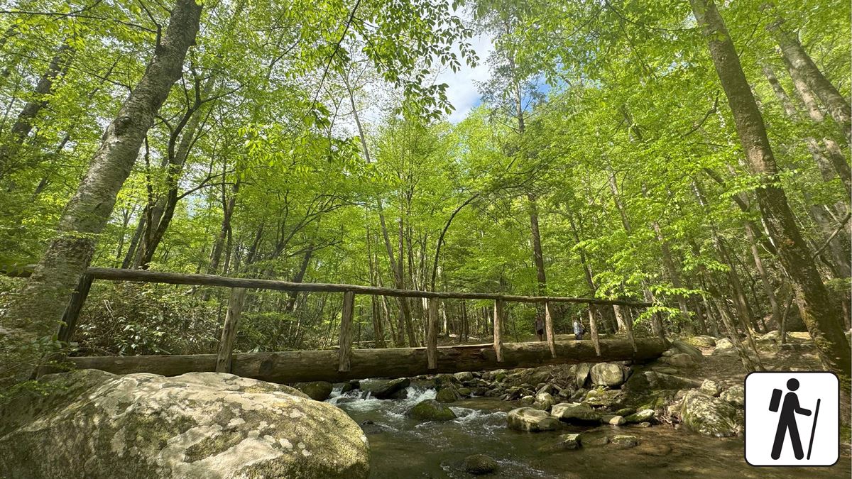
The trail follows a stream corridor through hardwood forest. Pines, sourwoods, chestnut trees, seasonal wildflowers, deer, black bears, and invasive wild hogs may be seen.
Getting to the trailhead
The route begins near West Prong Trail Trailhead on Tremont Road. Parking is across from the Great Smoky Mountains Institute at Tremont.
From the main parking area, look uphill and left for a pump house. The trail begins behind it. Additional and large-vehicle parking lies beyond the main lot.
Accessible parking spaces are available at the trailhead. Sugarlands Visitor Center is about 9 miles away. Gatlinburg is about 11 miles away, and Pigeon Forge is about 13 miles away.
On the trail
Loan Branch Cascade is near the beginning. At about 0.3 miles, a fork leads right toward Walker Valley Cemetery while West Prong Trail continues left.
The cemetery spur is 100 yards and visits graves of area residents from the late 1800s and early 1900s. Return to the fork after visiting. An unmaintained path also reconnects with West Prong Trail at about 1.1 miles.
The route climbs along Fodderstack Mountain, with West Prong Little River below. A creek crossing at about 2 miles may require stepping across rocks.
A large group campsite sits beside the river at about 2.1 miles. It has a fire ring and bear cables. Continue through the campsite and cross the foot-log bridge on the right.
Turn left at the hemlock tree. A sign for campsite A means the trail has been missed within the camping area.
West Prong Trail ends at the Bote Mountain Trail junction at about 2.7 miles. Return along the same route for a 5.4-mile round trip.
The one-way route gains about 970 feet and descends about 390 feet. Its highest point is about 2,030 feet.
When to go
Seasonal wildflowers grow along the route, with spring noted for wildflower viewing. Check current conditions and park alerts before choosing a date.
Before you go
A parking tag is required when parking in Great Smoky Mountains National Park for more than 15 minutes.
Pets are not permitted on West Prong Trail. Carry water, pack layers, follow posted rules, and leave no trace. Expect moderately steep grades, rocks, roots, water crossings, and log footbridges.
Check the park’s National Park Service website for current trail, weather, and parking information.
Questions
How long is West Prong Trail?
It is about 2.7 miles one way as mapped by the National Park Service, or 5.4 miles round trip.
How difficult is West Prong Trail?
The trail is rated moderate, with moderately steep grades and about 970 feet of one-way climbing.
Where does West Prong Trail start?
It starts behind a pump house near Tremont Road, across from the Great Smoky Mountains Institute at Tremont.
Are pets allowed on West Prong Trail?
No. Pets are permitted only on Gatlinburg Trail and Oconaluftee River Trail among the park’s trails.
Does West Prong Trail reach Walker Valley Cemetery?
A 100-yard spur at about 0.3 miles leads to Walker Valley Cemetery.
Nearby
Places
- Tremont Road Parking Area #4
- Tremont Road Trailer Parking
- Tremont Road Parking Area #3
- Tremont Road Trailer Parking Access
- West Prong Trail Trailhead
- Tremont Institute Parking #2
- Tremont Event Parking
- Great Smoky Mountains Institute at Tremont
On the map
2 trails4 places to see2 visitor services
Facts on this page draw on the National Park Service: Hike West Prong Trail (nps.gov)