











Great Smoky Mountains National Park
Alum Cave Bluffs
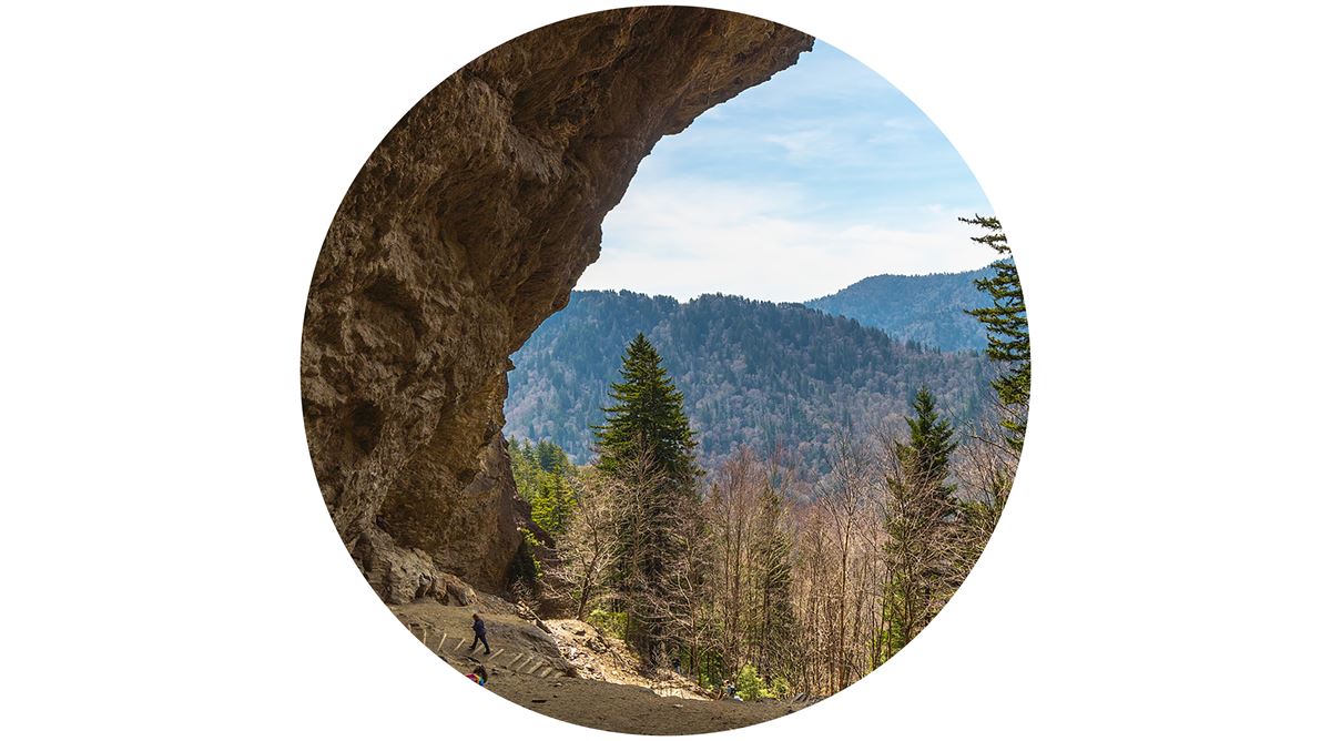
| Type | Cave |
|---|
At a glance
- Place type: Rocky overhang and point of interest
- Trail: About 4.6 miles roundtrip
- Typical time: 2 hours
- Bluff height: About 75 feet overhead
- Amenities: Scenic view and photo spot
- Nearby restroom: About 0.7 miles away
- Nearby parking: Alum Cave Bluffs Trailhead Parking, about 0.7 miles away
Getting there
Reach Alum Cave Bluffs by hiking about 4.6 miles roundtrip on Alum Cave Trail. The route passes through old-growth forest and crosses mountain streams. It also goes through Arch Rock.
The trailhead is on Newfound Gap Road, also called US 441. It is 6.8 miles south of Sugarlands Visitor Center by road. Parking is popular, so arrive early or consider a shuttle.
Gatlinburg is about 6 miles away in a straight line. Pigeon Forge is about 12 miles away, and Cherokee is about 13 miles away. Nearby airports include McGhee Tyson Airport and Asheville Regional Airport.
What to see and do
Alum Cave Bluffs is not a cave. It is a rocky overhang rising about 75 feet above the trail. The area beneath the bluff stays dry, even during very wet weather.
The hike offers views, old-growth forest, mountain streams, and a passage through Arch Rock. Peregrine falcons are among the rare species that visitors may see.
Nearby features include Peregrine Peak, about 0.1 miles away, and Little Duck Hawk Ridge, about 0.2 miles away. Trout Branch Falls is about 0.3 miles away. Arch Rock is about 0.4 miles away.
When to go
In cold weather, falling icicles and trail ice can create hazards. Check current conditions and alerts on the park’s National Park Service website before leaving.
Arrive early to improve the chance of finding parking at this popular trailhead. A shuttle is another option.
Before you go
Prepare for about 4.6 miles of roundtrip hiking, typically taking 2 hours. Carry water, pack layers, and follow posted rules.
Watch for ice on the trail and icicles above during cold conditions. Leave no trace and check current park alerts before the hike.
Questions
Is Alum Cave Bluffs an actual cave?
No. It is a rocky overhang that rises about 75 feet above the trail.
How long is the hike to Alum Cave Bluffs?
The roundtrip hike on Alum Cave Trail is about 4.6 miles.
How long does the Alum Cave Bluffs hike take?
The typical time is 2 hours.
Where is the Alum Cave Trailhead?
It is on Newfound Gap Road, or US 441, 6.8 miles south of Sugarlands Visitor Center.
What can visitors see along Alum Cave Trail?
The route includes old-growth forest, mountain streams, Arch Rock, views, and possible peregrine falcon sightings.
Nearby
Places
- Peregrine Peak
- Little Duck Hawk Ridge
- Trout Branch Falls
- Arch Rock
- Huggins Hell
- Big Duck Hawk Ridge
- North Trout Branch Falls
- Huggins Hell
On the map
9 trails23 places to see8 visitor services
Facts on this page draw on the National Park Service: Alum Cave Bluffs (nps.gov)