










Best Hikes in Big Bend National Park: Why Fall Is Prime Time
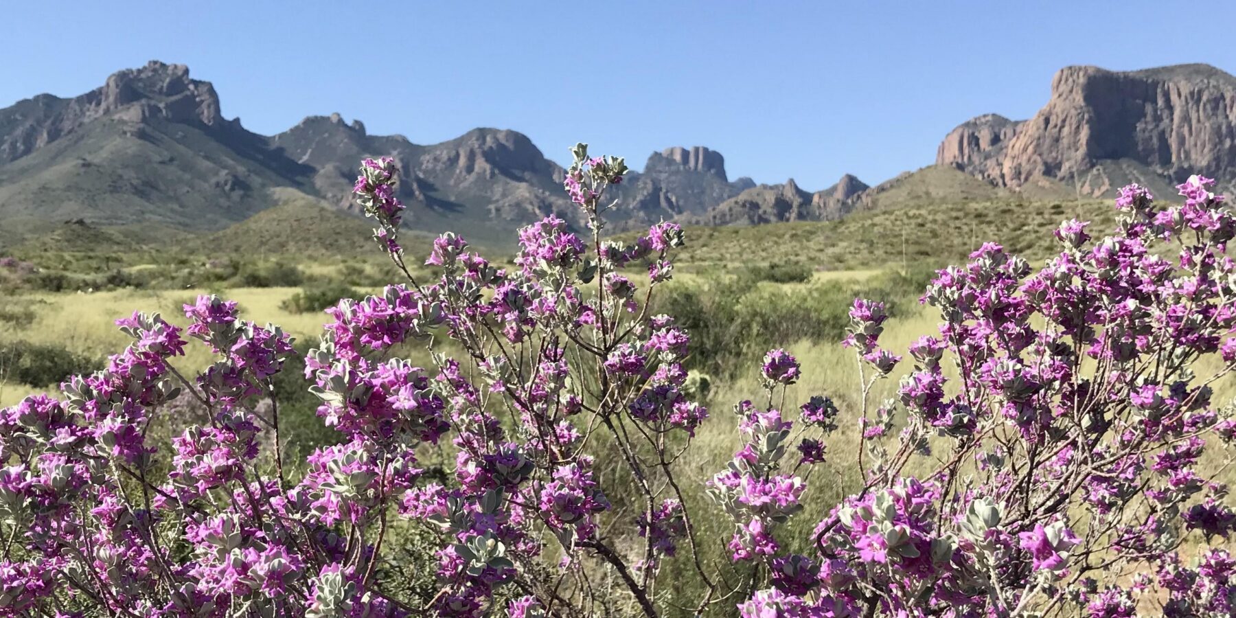
The best fall hikes in Big Bend pair cooler desert temperatures with clear views, and our seven strongest choices are Lost Mine Trail, South Rim, Emory Peak, Window Trail, Santa Elena Canyon, Balanced Rock, and Upper Burro Mesa Pour Off. Most visitors should plan for late October through November. September and early October can remain dangerously hot at lower elevations, while December brings shorter days and increasingly frequent freezes in the Chisos Mountains.
Big Bend covers more than 800,000 acres where the Chihuahuan Desert meets the Rio Grande and the Chisos Mountains. Elevation controls hiking conditions: Rio Grande Village sits near 1,850 feet, the Chisos Basin is about 5,400 feet, and Emory Peak reaches 7,825 feet. Temperatures can differ by 15 to 25 degrees across those elevations on the same afternoon, so choosing a fall trail requires more than checking one park forecast.
When Big Bend’s Hikes Reach Their Prime
November provides the most dependable balance of moderate temperatures, long enough hiking days, and access across the park. October works well in the Chisos Mountains, particularly on Lost Mine Trail and the South Rim routes, but exposed desert and river hikes can still become punishing by midday. Thanksgiving week brings heavier traffic, especially around Chisos Basin and the Ross Maxwell Scenic Drive.
September and early October favor higher elevations
September remains summerlike across much of Big Bend. Afternoon temperatures near the Rio Grande commonly climb well above comfortable hiking levels, and lingering monsoon moisture can produce thunderstorms, flash flooding, and humid conditions. The Chisos Mountains are cooler, but exposed ridges create lightning risk. Lost Mine Trail and the wooded portions of the Pinnacles Trail are the most practical choices when an early start and a stable forecast align.
By early October, nights begin cooling at middle and high elevations. Daytime heat still dictates plans in Santa Elena Canyon, Grapevine Hills, and the Burro Mesa area. Our team treats these lower trails as sunrise outings during this period, with the Chisos reserved for longer hikes that continue into late morning.
Late October through November offers the broadest choice
Cold fronts begin reaching West Texas more regularly in late October, reducing afternoon heat and improving visibility across the desert. November often supports full day routes such as the South Rim, while Santa Elena Canyon and Balanced Rock become comfortable beyond the first hours after sunrise. Nights can approach freezing in the Chisos Basin, and exposed campsites along the high rim feel colder when wind crosses the escarpment.
Fall color appears selectively rather than as a continuous forest display. Bigtooth maples, Arizona cypress, oaks, and other mountain plants add pockets of yellow, orange, and red in protected Chisos canyons. Cottonwoods along the Rio Grande usually turn yellow later, producing a narrow ribbon of color against limestone canyon walls and pale desert gravel.
How Big Bend’s seasons compare
| Season | Typical hiking conditions | Crowd pattern | Access considerations | Best suited to |
|---|---|---|---|---|
| Fall | Hot at low elevations early, then progressively cooler and drier | Moderate in October, busy around Thanksgiving | Most roads and trails are generally usable after monsoon damage is assessed | Combining mountain, desert, and river hikes |
| Winter | Mild desert afternoons, freezing mountain nights, occasional snow or ice | Busy during holidays and pleasant weekends | Temporary weather closures can affect mountain roads and trails | Exposed desert routes and canyon walks |
| Spring | Comfortable early, increasingly hot by April and May | Highest around spring break | Seasonal wildlife closures can affect portions of high Chisos routes | Wildflowers, birding, and early season backpacking |
| Summer | Extreme low elevation heat, warmer nights, monsoon storms | Lower overall, concentrated in the Chisos | Flash floods and heat restrict practical hiking windows | Short mountain outings with very early starts |
The 7 Best Hikes at a Glance
The seven routes cover the park’s three defining landscapes: the Chisos Mountains, the open Chihuahuan Desert, and the Rio Grande canyons. Distances below are approximate round trip figures. Junction choices can lengthen South Rim and Emory Peak itineraries, while flood deposits occasionally alter footing near the river.
Compare distance, elevation, and terrain
| Trail | Approximate distance | Difficulty | Primary landscape | Best fall window |
|---|---|---|---|---|
| Lost Mine Trail | 4.8 miles | Moderate | Forested mountain slopes and volcanic ridges | October through November |
| South Rim | About 12.6 to 14.5 miles | Strenuous | High Chisos forest and broad desert overlooks | Late October through November |
| Emory Peak | About 10.5 miles | Strenuous | Mountain woodland, exposed summit rocks | October through November |
| Window Trail | About 5.6 miles from the Basin trailhead | Moderate | Oak woodland and a narrow pour off | Late October through November |
| Santa Elena Canyon | About 1.7 miles | Easy to moderate | Rio Grande floodplain and limestone canyon | November |
| Balanced Rock | About 2.2 miles | Moderate | Granite boulders and open desert | Late October through November |
| Upper Burro Mesa Pour Off | About 3.6 miles | Moderate | Volcanic wash and dry waterfall | November |
Choose mountain trails for views and cooler air
Lost Mine Trail gives the best return for a half day, climbing roughly 1,100 feet through pinyon, juniper, oak, and Mexican pine. South Rim demands most of a day but reaches an escarpment overlooking hundreds of square miles of desert. Emory Peak adds the park’s highest summit, including a rough final ascent over exposed rocks where hands may be useful.
Near the Lost Mine overlook, compacted mountain soil gives way to angular volcanic rock. The air often feels several degrees cooler than in the Basin below, and wind moves through pine needles overhead. After the final switchbacks, the ridge opens abruptly toward Casa Grande and the folded desert beyond, revealing how sharply the Chisos rise from the surrounding basin and flats.
Choose desert and river routes for geology
Santa Elena Canyon enters a cleft in the Mesa de Anguila, where the Rio Grande has cut through limestone walls rising roughly 1,500 feet above the river. Balanced Rock crosses open desert to a cluster of rounded intrusive rocks in the Grapevine Hills. Upper Burro Mesa Pour Off follows a gravelly wash into volcanic terrain, ending beneath a high dry waterfall polished by episodic floods.
Fall Crowds, Roads, and Reservation Strategy
Big Bend’s immense size disperses visitors on many desert roads, but several bottlenecks remain. Chisos Basin has limited parking and a single winding approach road. Lost Mine Trail has a small roadside parking area that can fill early. The Ross Maxwell Scenic Drive concentrates traffic at Santa Elena Canyon, particularly from late morning through midafternoon on holiday weekends.
What crowd levels change on the ground
A full trailhead lot can force a change of hike because roadside parking may be unsafe or prohibited. Crowds also slow the final rocky section of Emory Peak and create congestion on Santa Elena Canyon’s narrow entrance path. Starting at first light improves parking prospects, reduces heat exposure, and leaves time for a backup trail if the first choice is unavailable.
- Use Lost Mine Trail early in the morning, then save short roadside overlooks for later.
- Schedule Santa Elena Canyon before tour traffic builds or near the end of the afternoon.
- Keep Balanced Rock as a flexible option only if your vehicle and current road conditions suit Grapevine Hills Road.
- Allow substantial driving time between districts. Park roads are slower than their mileage suggests.
Road surfaces shape the hiking plan
Paved roads reach Chisos Basin, Rio Grande Village, and the Ross Maxwell corridor. Balanced Rock requires travel on unpaved Grapevine Hills Road, where washboarding, loose rock, and storm damage can increase driving time. Upper Burro Mesa Pour Off also begins from an unpaved road. Passenger vehicles may manage these roads in favorable conditions, but clearance and tire condition matter after heavy rain.
Permits and overnight planning
Day hiking generally requires no trail specific permit, while backcountry camping and overnight South Rim itineraries require authorization for designated sites or zones. Chisos lodging and developed campsites can fill well ahead of popular fall weeks. Entrance fees, reservation procedures, road status, campground availability, and backcountry rules can change, so confirm current details on the official park site before finalizing the trip.
How to Choose the Right Fall Route
Distance alone understates difficulty in Big Bend. Elevation gain, direct sun, rough footing, and the drive to the trailhead all affect the day. A five mile Chisos route can involve sustained climbing, while a short desert trail can feel harder in exposed heat. Select the route using the forecast for its specific elevation and district.
Match the hike to time and fitness
Visitors with two or three hours should prioritize Balanced Rock, Santa Elena Canyon, or a partial Lost Mine outing. A half day supports the complete Lost Mine or Window Trail. South Rim and Emory Peak require an early start, strong conditioning, ample water, and enough daylight to absorb slower progress on steep or rocky sections.
Use these decision points before committing
- Check the forecast for the trail’s elevation rather than the nearest town.
- Calculate driving time from your lodging to the correct trailhead.
- Compare the route’s elevation gain with your recent hiking experience.
- Carry a backup hike in the same district to avoid crossing the park unnecessarily.
- Set a turnaround time based on sunset, temperature, and remaining water.
Prepare for Big Bend’s Fall Weather and Exposure
Fall reduces the park’s most severe heat, but it does not remove heat illness from the equation. South facing desert slopes can remain hot into November, and shade is scarce on Balanced Rock and Upper Burro Mesa Pour Off. Carry at least one gallon of water per person for a full hiking day, plus salty food or electrolytes. Natural water sources are unreliable, and river water requires treatment because of sediment and contamination risks.
Cold fronts can change a mountain hike quickly
A calm morning in Chisos Basin can become cold and windy along the South Rim. Pack a warm layer, wind resistant shell, sun protection, and a headlamp even when the forecast appears mild. Freezing temperatures can leave ice on shaded sections of the Pinnacles, Laguna Meadow, and Emory Peak trails. Trekking poles improve stability on loose switchbacks and steep descents.
Floodwater affects canyons and washes
Santa Elena Canyon begins with a crossing of Terlingua Creek, which is often dry or shallow but can become impassable after rain. Upper Burro Mesa Pour Off follows a drainage where runoff can arrive from storms beyond the immediate trailhead. Avoid narrow washes when thunderstorms are developing, and never drive across moving water on desert roads.
Carry these essentials on every route
- A printed map or downloaded offline map, since cellular coverage is limited
- More water than the planned distance appears to require
- Sun hat, sunscreen, sunglasses, and clothing that covers exposed skin
- Headlamp, first aid supplies, and an emergency insulation layer
- Food for delays caused by route finding, traffic, or slow footing
Build an Itinerary Without Crossing the Park Repeatedly
Big Bend trips work best when each day stays within one geographic corridor. Chisos Basin trails belong together, while Santa Elena Canyon and Upper Burro Mesa Pour Off fit naturally into a Ross Maxwell Scenic Drive day. Balanced Rock sits north of the Chisos on the Grapevine Hills Road approach, making it useful on an arrival or departure day through the park’s northern entrance.
A two day plan for first time visitors
Use the first morning for Lost Mine Trail, then spend the afternoon at Basin overlooks or complete part of the Window Trail if daylight and energy permit. On the second day, drive Ross Maxwell Scenic Drive and hike Santa Elena Canyon early. Add Upper Burro Mesa Pour Off afterward only when temperatures, road conditions, and remaining daylight support another exposed outing.
A three day plan for stronger hikers
Reserve a complete day for either South Rim or Emory Peak rather than attempting both automatically. The combined route adds distance and a steep summit spur to an already demanding mountain day. Use another day for Santa Elena Canyon and the western desert, then place Balanced Rock on the third morning. This structure gives tired legs a shorter outing after the Chisos climb.
Choose Dates According to Your Main Priority
The phrase Best Fall Hikes Big Bend covers several different trip goals. High elevation hikers gain better temperatures earlier than visitors focused on river canyons. Travelers seeking quieter trails should avoid Thanksgiving week and choose weekdays. Photographers benefit from November’s lower sun angles, although the Chisos can cast deep afternoon shadows across the Basin and Window.
A practical fall decision table
| Priority | Recommended period | Best trail choices | Main tradeoff |
|---|---|---|---|
| Cool mountain hiking | Mid October through November | Lost Mine, South Rim, Emory Peak | Cold wind and occasional ice at higher elevations |
| Comfortable desert walking | November | Balanced Rock, Upper Burro Mesa Pour Off | Shorter daylight for combining distant trailheads |
| River canyon scenery | November into early winter | Santa Elena Canyon | Terlingua Creek may obstruct access after rain |
| Smaller crowds | Weekdays outside holiday periods | Window Trail and Upper Burro Mesa Pour Off | Some services may operate on reduced seasonal schedules |
Let daylight set the final limit
Late fall sunsets arrive early enough to matter on South Rim and Emory Peak. Start long Chisos routes near first light and establish a firm turnaround time before leaving the trailhead. On shorter hikes, finish unpaved road travel before darkness when possible. Washouts, livestock guards, loose rocks, and sharp turns are harder to identify after sunset.
Plan Your Fall Hiking Days With Flexibility
Late October and November provide the strongest overall combination of cooler weather, broad trail access, and manageable daylight. Choose Lost Mine for an efficient mountain introduction, South Rim or Emory Peak for a strenuous full day, and Santa Elena Canyon for the park’s defining river landscape. Balanced Rock, Window Trail, and Upper Burro Mesa Pour Off fill shorter windows without sacrificing geological variety.
Build each day around elevation, district, and forecast rather than a rigid trail checklist. Start early, carry desert appropriate water and sun protection, and keep a nearby alternative ready when parking, storms, ice, or road conditions interfere. That approach turns the seven routes into a practical fall plan while leaving enough flexibility for Big Bend’s scale and rapidly changing conditions.
