Denali National Park and Preserve
5 Best Hikes in Denali National Park
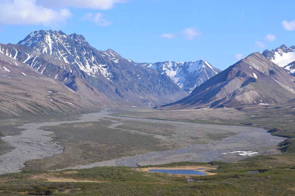
Photo: larrywkoester via Flickr (CC BY 2.0)
Searching for the Best Hikes Denali National Park visitors can complete reveals a useful surprise: most of Denali has no trails. The park protects roughly six million acres, yet its maintained paths cluster near the entrance and the first 15 miles of Denali Park Road. Beyond that corridor, hiking usually means choosing an off trail route across tundra, gravel bars, or brushy drainages.
That concentration makes five maintained hikes especially valuable. Horseshoe Lake and Savage River introduce Denali’s boreal forest and river corridors, while Mount Healy, Savage Alpine, and Triple Lakes provide increasingly demanding climbs. Our selections emphasize distinctive landscapes, practical trailhead access, and routes that work without committing to backcountry navigation.
Why Hiking in Denali Works Differently
A Trail System Concentrated Near the Park Entrance
The principal trail network begins around the Denali Visitor Center, approximately 1.5 miles inside the park. Mount Healy Overlook, Horseshoe Lake, and Triple Lakes are all reached from this entrance district. Farther west, Mountain Vista at road mile 13 and Savage River at mile 15 anchor the Savage trails. Private vehicle access generally ends around Savage River during the main visitor season, which makes park transportation part of planning a point to point hike.
Road access changes substantially with snow conditions and seasonal opening procedures. The first section often becomes available before transit service begins, while later sections remain controlled or closed. Our report on the seasonal opening toward Teklanika illustrates how access expands in stages. Check current road limits, transportation, fees, and trail notices on the official park site before departure.
Forest, Tundra, and Glacial Rivers in a Short Corridor
Denali’s entrance lies within the taiga, a boreal forest dominated by white spruce on warmer, better drained slopes and black spruce where cold soils and permafrost restrict drainage. Climbing several hundred feet can replace forest with willow, dwarf birch, alpine tundra, and exposed rock. This compressed transition is clearest on Mount Healy and Savage Alpine, where hikers move between ecological zones within a few hours.
The Savage River represents another defining Denali landscape. Glaciers and seasonal runoff grind Alaska Range rock into fine sediment, producing silty water and broad gravel channels. The range itself continues to rise as tectonic forces compress southern Alaska. Frost cracking, landslides, glaciers, and rivers then carve that uplift into steep ridges and U shaped valleys.
How We Chose the 5 Best Hikes in Denali National Park
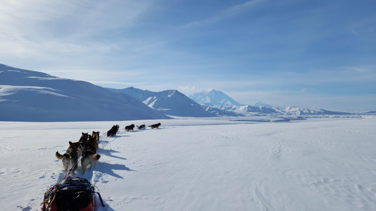
5 Best Hikes in Denali National Park for Different Abilities
These distances reflect complete outings rather than only the distance to a viewpoint. Recorded mileage can vary slightly by mapping method and trailhead connection. Elevation figures are approximate because rolling trails accumulate ascent differently across devices.
| Hike | Distance | Approximate climb | Best feature |
|---|---|---|---|
| Savage Alpine Trail | 4.1 miles, one way | Up to 1,500 feet | Open tundra and Alaska Range views |
| Mount Healy Overlook Trail | 5.4 miles, round trip | About 1,700 feet | High viewpoint near the entrance |
| Triple Lakes Trail | 9.5 miles, one way | About 1,000 feet, direction dependent | Denali’s longest maintained trail |
| Horseshoe Lake Trail | About 2 miles, round trip | About 250 feet | Lake, river, and beaver habitat |
| Savage River Loop | About 2 miles, loop | Minimal | Accessible river canyon scenery |
How We Ranked These Hikes
Our team ranked complete trail experiences rather than elevation alone. Savage Alpine leads because it combines tundra travel, a sustained ridge traverse, and broad views without requiring backcountry route finding. Mount Healy offers the strongest climb from the visitor center area. Triple Lakes rewards endurance, while Horseshoe Lake and Savage River deliver high ecological and scenic value with shorter distances.
- Choose Savage Alpine for the best balance of effort and expansive scenery.
- Choose Mount Healy when transportation beyond the entrance is limited.
- Choose Triple Lakes for a half day or full day woodland hike.
- Choose Horseshoe Lake for beaver signs and a manageable family outing.
- Choose Savage River for a short walk beneath rocky canyon walls.
Savage Alpine Leads Our List of the Best Hikes in Denali National Park
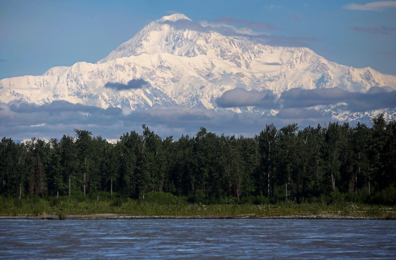
Route Between Mountain Vista and Savage River
Savage Alpine connects Mountain Vista and Savage River rather than returning to one trailhead. Hiking west from Mountain Vista spreads much of the ascent across a longer approach, followed by a steep descent toward Savage River. Starting at Savage River creates a sharper initial climb. Either direction requires transportation planning, since the trailheads sit roughly two road miles apart and walking the road is a poor substitute for arranging a bus or vehicle connection.
What the Ridge Actually Feels Like
Above the last dense willows, the tread crosses springy tundra where low shrubs brush against your boots and wind moves without obstruction. The Savage River appears below as a pale, braided line, while rounded foothills stack toward the sharper Alaska Range. On a clear day, distant snowfields brighten the western horizon. The exposed ridge feels colder than the trailhead, and the long descent demands more attention than its smooth profile suggests from above.
Conditions That Change the Difficulty
The trail’s elevation and exposure magnify Denali’s quick weather shifts. Rain can turn rocky steps slick, while low cloud removes the long views that justify the climb. Snow may linger during early summer and return in autumn. Willows around the lower trail can conceal wildlife at close range, so hikers should make noise where visibility narrows and carry bear spray where it can be reached immediately.
Pack a wind resistant layer even when Mountain Vista feels warm. Treeless sections provide little shelter from rain or strong gusts, and reliable drinking water is absent along the ridge. Sturdy footwear helps on the steeper descent, particularly after rainfall. Allow additional time for photographs, wildlife pauses, and the transportation connection at the opposite trailhead.
Mount Healy Overlook From the Entrance District
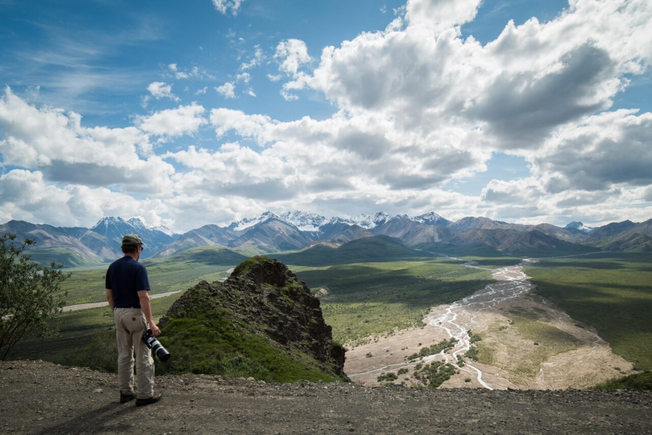
A Steady Climb Above the Nenana Valley
Mount Healy Overlook begins through the Taiga Trail network near the Denali Visitor Center, making it the strongest high viewpoint accessible without traveling west on the park road. The route climbs through spruce forest before becoming steeper and rockier. Switchbacks lead toward an official overlook near 3,500 feet, about 1,700 feet above the starting area.
The view looks across the Nenana River valley, the park entrance, and the lower ridges of the Alaska Range. Denali itself is generally obscured by intervening terrain, so hikers should choose this trail for the climb and valley perspective rather than expecting the park’s namesake summit. The maintained trail ends at the overlook; ridgeline paths continuing higher are unmaintained and introduce loose footing, exposure, and route finding.
Best Timing for the Ascent
Starting early reduces afternoon heat on exposed upper slopes and leaves more time to manage the descent. South facing sections can dry quickly, but shaded forest may retain mud or snow. In June and July, mosquitoes can be persistent below treeline, while wind often suppresses them near the overlook. Late summer brings cooler temperatures, ripe berries, and increased chances of encountering bears feeding along shrub covered slopes.
Three Distinctive Trails Round Out the List
For travelers comparing Best Hikes Denali National Park routes, the remaining choices cover three different environments: the spruce and aspen country around Triple Lakes, the active beaver habitat at Horseshoe Lake, and the narrow river corridor at Savage River. None requires off trail navigation, yet each reveals a process that shapes Denali, from wildfire succession and wetland engineering to erosion along a glacially fed river.
Triple Lakes for Distance and Solitude
Triple Lakes Trail runs approximately 9.5 miles between the visitor center area and a southern trailhead near mile 231 of the George Parks Highway. The route crosses Riley Creek, climbs forested benches, and passes three elongated lakes beneath the eastern Alaska Range foothills. Hiking south generally places more descent late in the day, while a northbound trip finishes closer to park transportation and visitor facilities. Arrange a drop-off or pickup rather than walking the busy highway shoulder.
Horseshoe Lake for Beaver Ecology
Horseshoe Lake descends roughly 250 feet from the entrance trail network to a curved oxbow lake beside the Nenana River. Look for gnawed trunks, lodges, dams, and flooded margins created by beavers. Their engineering slows water, traps sediment, and produces habitat used by waterfowl and moose. The climb back to the trailhead accounts for most of the effort. Mud develops near the shoreline after rain, so waterproof footwear is useful even though the outing is short.
Savage River Loop Beneath the Canyon Walls
The Savage River Loop follows both banks for about two miles, using a footbridge to complete the circuit. Rocky slopes rise abruptly above the braided channel, creating potential habitat for Dall sheep, marmots, and arctic ground squirrels. Scan high ledges with binoculars rather than expecting wildlife beside the trail. Wind funnels through the canyon, and the open gravelly terrain offers little protection during cold rain. The modest elevation change makes this the easiest route among the five.
Match the Hike to Denali’s Short Walking Season
Snowmelt, daylight, insects, and autumn color change quickly at this latitude. Lower entrance trails commonly become usable before exposed alpine routes, where lingering snow can conceal tread or create slick traverses. By late August, nights are colder and tundra vegetation begins turning red and gold. September storms can cover upper slopes with snow even when the entrance road remains bare.
Seasonal Conditions at a Glance
| Period | Likely trail conditions | Best match |
|---|---|---|
| May to early June | Patchy snow, mud, cold creek corridors | Horseshoe Lake or Savage River when open |
| Mid June to July | Long daylight, active insects, variable alpine weather | All five routes |
| August | Cooler nights, berries, increasing wildlife activity | Triple Lakes and alpine routes |
| Early autumn | Frost, possible snow, rapidly shortening days | Lower trails with flexible plans |
Carry Gear for Exposure Rather Than Mileage
Savage Alpine and Mount Healy require clothing suitable for wind and temperatures substantially colder than those at the trailhead. Triple Lakes demands enough food and water for a long point-to-point day. Every route can become wet underfoot, and cotton clothing dries slowly in Denali’s cool climate. A practical day pack should contain:
- Bear spray secured where it can be reached immediately
- A waterproof shell and an insulating layer
- Food, drinking water, and a paper or offline map
- Insect repellent or a head net during early summer
- Binoculars for observing animals without approaching them
Move Carefully Through Wildlife Habitat
Make noise around blind corners and dense willows, especially beside Horseshoe Lake and on lower sections of Savage Alpine. If a bear notices you, stay calm, do not run, and follow established bear encounter guidance. Moose also deserve substantial space, particularly cows with calves. Store snacks and scented items securely, pack out every scrap, and avoid headphones so moving water or wind does not prevent you from detecting nearby animals.
Choosing Among the 5 Best Hikes in Denali National Park
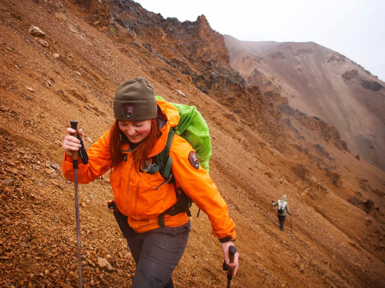
Savage Alpine provides the strongest all-around experience for hikers comfortable with climbing, exposure, and point-to-point transportation. Mount Healy is the practical alternative from the entrance district. Triple Lakes suits experienced walkers seeking mileage and quieter forest, while Horseshoe Lake concentrates wildlife ecology into a short outing. Savage River offers the gentlest introduction to the park’s open river landscape.
Choose according to conditions on the morning of the hike rather than committing solely to a photograph or ranking. Low cloud can erase alpine views, rain can make steep descents slow, and wildlife may temporarily occupy a trail. With a backup route, appropriate layers, and realistic timing, these five maintained paths reveal Denali’s major environments without requiring the navigation skills demanded by its vast trail-free backcountry.
Want to keep exploring? Browse all our Denali guides and articles for more trip-planning tips and ideas.
Gear & Essentials
Tell us about your trip and we will add what else you will want:
The basics
Worth having in the car whatever the park.
For this trip
As an Amazon Associate we earn from qualifying purchases, at no extra cost to you.