Best Hikes in Kings Canyon National Park for Waterfalls, Meadows, and Mountain Views
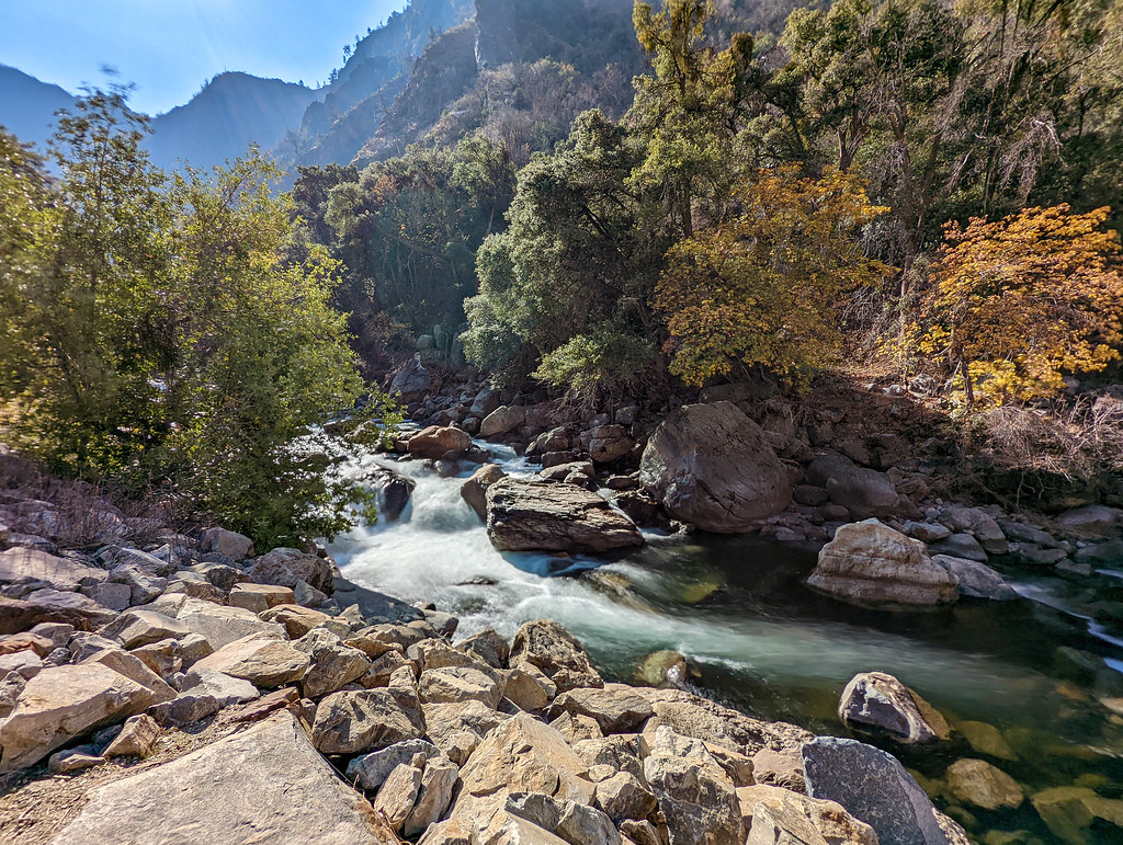
Photo: RuggyBearLA via Flickr (CC BY 2.0)
The Best Hikes in Kings Canyon National Park fall into three distinct groups: waterfall walks in Cedar Grove, giant sequoia routes around Grant Grove, and higher ridge trails with long Sierra Nevada views. Mist Falls is the strongest moderate day hike, Zumwalt Meadow provides the classic canyon floor experience, and Big Baldy offers broad mountain views without requiring a wilderness permit.
Choosing among them requires understanding the park’s unusual layout. Grant Grove sits near 6,500 feet in the western high country, while Cedar Grove lies roughly 35 winding road miles east at about 4,600 feet. Highway 180 descends between them through national forest before reentering the park beside the South Fork Kings River. The two districts feel separate, and driving from one to the other generally takes about an hour without scenic stops.
Match the trail to the landscape you want
Kings Canyon was shaped by glaciers cutting into resistant Sierra Nevada granitic rock. That process created a deep, broad canyon with polished walls, hanging valleys, and tributary streams that drop sharply toward the Kings River. Trails near Cedar Grove reveal that geology most clearly. Grant Grove presents a different landscape, with mixed conifer forest, rounded granite ridges, and old giant sequoia groves.
Compare the best day hikes in Kings Canyon National Park
Distances and elevation gains vary slightly among maps and GPS recordings, particularly where trailheads have multiple parking areas. The figures below are practical planning estimates for standard routes rather than every possible extension.
| Trail | Approximate distance | Elevation gain | Best feature | Typical difficulty |
|---|---|---|---|---|
| General Grant Tree Trail | 0.3 mile loop | Minimal | Giant sequoias | Easy |
| Big Baldy Ridge | 4.4 miles round trip | About 600 feet | High Sierra views | Moderate |
| Roaring River Falls | About 0.3 mile round trip | Minimal | Short waterfall walk | Easy |
| Zumwalt Meadow | Up to 1.5 miles | Minimal | Meadow and granite walls | Easy |
| Mist Falls | About 8.7 miles round trip | About 800 feet | Waterfall and river canyon | Moderate |
| Cedar Grove Overlook | About 5 miles round trip | About 1,200 feet | Canyon perspective | Strenuous |
Waterfall hikes are strongest during snowmelt
Mist Falls and Roaring River Falls usually carry their greatest volume during spring runoff and early summer, when snow is melting in the high basins above Cedar Grove. Mist Falls is a long, sloping cascade rather than a single vertical plunge. The river slides over smooth granite shelves before entering the South Fork Kings River drainage. By late summer, flow generally declines, but the route remains worthwhile for its canyon scenery.
Meadows and mountain views peak at different times
Zumwalt Meadow is typically greenest from late spring into early summer, although wet ground, mosquitoes, and high river levels can accompany that period. Big Baldy and similar ridge walks become more dependable after snow leaves the higher trailheads. Autumn brings cooler hiking temperatures and clearer air, but shorter daylight and early storms require more conservative turnaround times.
Grant Grove combines sequoias with accessible ridge walks
Grant Grove is the practical starting point for visitors entering from Highway 180. Its trailheads reach giant sequoias, quieter mixed forest, and exposed granite summits without the long descent into Cedar Grove. Because this district remains accessible for a longer portion of the year, it is also the more dependable choice when snow or seasonal road closures block the canyon interior.
General Grant Tree Trail delivers the essential sequoia walk
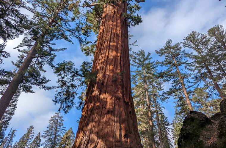
The short General Grant Tree Trail loops through one of the park’s most concentrated groups of giant sequoias. Its centerpiece is the General Grant Tree, among the largest living trees by trunk volume and designated the Nation’s Christmas Tree in 1926. The route also passes the Fallen Monarch, a hollow sequoia trunk once used for shelter, livestock, and other purposes before this landscape received modern park protection.
Our team recommends walking slowly and looking above the named trees. Incense cedar, white fir, sugar pine, and younger sequoias reveal how the grove functions as a forest rather than a collection of monuments. Giant sequoias depend on periodic fire to open cones, expose mineral soil, and reduce competing vegetation. Prescribed burns and managed fire therefore play a visible ecological role here.
Big Baldy trades forest shade for a broad granite summit
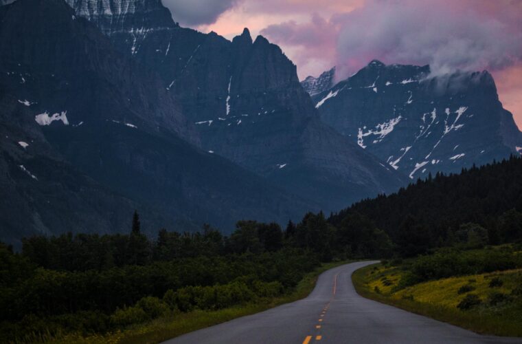
Big Baldy Ridge begins along the Generals Highway south of Grant Grove and climbs gradually through conifers before reaching open granite. The rounded summit stands near 8,200 feet, with views toward Kings Canyon, surrounding forest, and distant Sierra crest terrain. Its moderate grade makes it a useful step between short grove walks and the steeper trails rising from Cedar Grove.
Redwood Canyon rewards hikers who leave the main corridor
Redwood Canyon contains the world’s largest remaining grove of giant sequoias by area, yet it receives far fewer walkers than the General Grant Tree area. The Hart Tree and Redwood Creek routes enter a broad drainage shaped by wildfire, water, and sequoia regeneration. Access commonly involves an unpaved seasonal road, so vehicle suitability and current road conditions matter. Trail combinations can exceed six miles and include more climbing than the developed grove paths.
Cedar Grove holds the park’s signature canyon hikes
Cedar Grove follows the South Fork Kings River beneath granite walls that rise thousands of feet above the valley. The road ends at Roads End, where day trails continue toward Mist Falls and wilderness routes penetrate the High Sierra. Vehicle access is seasonal because winter snow closes Highway 180 beyond the Grant Grove area. Check current road, trail, permit, and facility details on the official park site before committing to a canyon itinerary.
Mist Falls is the best all around waterfall hike
The Mist Falls route begins near Roads End and follows the river corridor toward Paradise Valley. Early miles cross relatively open, sandy terrain with limited shade, then the trail climbs beside cascades and polished granite. Allow roughly four to six hours, carry more water than the cool river setting suggests, and start early during hot weather. Afternoon temperatures on the canyon floor can be much higher than conditions at Grant Grove.
Near the falls, granite underfoot changes from dusty trail to smooth slabs and broken stone. The river grows louder with each bend until conversation becomes difficult beside the main cascade. Spray cools the air close to the water, while sun exposed rock a few steps away radiates heat. Looking back reveals the flat canyon floor framed by pale walls, making the valley’s glacial scale easier to read than it is from the road.
Zumwalt Meadow puts walkers beneath the canyon walls
The Zumwalt Meadow route explores a wet meadow and wooded river margin near the eastern end of the road. North Dome rises above the valley, while the Grand Sentinel forms the opposing wall. Flood damage has periodically affected portions of the loop, but available segments still provide close views of the meadow, talus slopes, and Kings River corridor. Protect the saturated ground by remaining on established trail and boardwalk surfaces.
Plan Cedar Grove days around heat and limited services
A sensible canyon day starts at the farthest planned trailhead and works back toward Highway 180. This reduces the risk of sacrificing the primary hike to scenic stops and slow traffic. Useful preparation includes:
- Fill water containers before entering the canyon and carry treatment for backcountry sources.
- Pack sun protection for exposed river flats and warm granite sections.
- Keep food secured from black bears and never leave packs unattended.
- Carry a paper map because mobile coverage is unreliable or absent.
- Leave room in the schedule for the slow, curving drive back to Grant Grove.
Two quieter routes add depth to a hiking itinerary
Several worthwhile trails sit outside the main sequoia and river stops. Buena Vista Peak provides a compact summit hike near Grant Grove, while the Hotel Creek Trail climbs above Cedar Grove for a top down view of the canyon. Both routes reward an early start because exposed granite and south facing slopes warm quickly. They also help distribute a hiking day more effectively: choose Buena Vista Peak when staying near Grant Grove, and save Hotel Creek for a full day below the Highway 180 descent.
Buena Vista Peak offers a shorter summit option
The Buena Vista Peak Trail begins near the Generals Highway and covers roughly two miles round trip with about 400 feet of elevation gain. The path passes through red fir and lodgepole pine before climbing onto a granite dome near 7,600 feet. From the summit, hikers can identify Redwood Canyon, Big Baldy, and successive ridges leading toward the Sierra crest. Patches of loose gravel on sloping granite make footwear with dependable traction useful, particularly during the descent.
Hotel Creek reveals the canyon’s vertical scale
The Hotel Creek Trail begins near Cedar Grove and climbs through chaparral toward the Cedar Grove Overlook. Approximately 1,200 feet of gain is concentrated into a route of about five miles round trip, making it considerably steeper than Mist Falls. Shade becomes limited after the lower forest, but the overlook provides a clear view along the South Fork Kings River and across to the Monarch Divide. This route works best in cool morning conditions or during autumn, after summer heat has eased.
Season and elevation should shape the final choice
Conditions can differ sharply between Grant Grove and Cedar Grove on the same day. A cool morning among sequoias at 6,500 feet may become a hot afternoon beside the Kings River nearly 2,000 feet lower. Snow also lingers longer around ridge trailheads than on exposed canyon flats. The Best Hikes in Kings Canyon National Park therefore change with runoff, snow cover, wildfire smoke, and the seasonal opening of the Cedar Grove road.
| Period | Likely trail conditions | Strongest choices |
|---|---|---|
| Spring | Snow at higher elevations, strong runoff, possible wet or damaged paths | Grant Grove trails and lower routes as accessible |
| Early summer | Powerful waterfalls, green meadows, mosquitoes near standing water | Mist Falls, Roaring River Falls, Zumwalt Meadow |
| Late summer | Drier trails, lower streamflow, intense canyon heat | Big Baldy, Buena Vista Peak, early morning canyon hikes |
| Autumn | Cooler days, short daylight, possibility of early snow | Hotel Creek, sequoia groves, exposed ridge walks |
Runoff changes both scenery and risk
Snowmelt makes waterfall trails most dramatic, but it also raises the consequences of approaching the river. Granite beside cascades becomes slick from spray, and seemingly calm margins can conceal strong current. Stream crossings that appear minor on maps may be deeper during peak melt. Hikers should use established bridges, keep children away from swift water, and avoid scrambling onto polished slabs beside Mist Falls or Roaring River Falls.
A compact gear list covers most day hikes
Elevation and dry Sierra air can conceal dehydration until fatigue or headache develops. Carry enough water for the full outing unless the plan includes filtration from a reliable source. For routes beyond developed loops, pack:
- A topographic map and compass or an offline navigation app
- Sun protection, including sunglasses for exposed granite
- A warm layer for sudden temperature drops at higher elevations
- Food stored and handled according to bear safety rules
- A headlamp, even when the planned return is before sunset
- Blister care and a basic first aid kit
Frequently Asked Questions
Trail suitability in Kings Canyon depends on elevation, road access, and the amount of time available. The answers below cover the practical questions that most often determine which route belongs in a day plan.
Are dogs allowed on hiking trails?
Pets are generally prohibited on park trails, including Mist Falls, Zumwalt Meadow, Big Baldy, and the sequoia grove paths. They are allowed only in specified developed areas and along certain roads, subject to leash and local restrictions.
Do day hikers need a wilderness permit?
Standard day hikes do not require a wilderness permit. Overnight travel beyond frontcountry areas does require one, including backpacking trips through Paradise Valley toward Rae Lakes or other High Sierra destinations.
Which hikes work best for children?
The General Grant Tree Trail and Roaring River Falls have short distances and little climbing. Zumwalt Meadow can also suit families when accessible sections are dry, but adults should maintain close supervision near the Kings River and talus slopes.
How many days are needed for the main trails?
Two days provide a useful minimum. Spend one around Grant Grove and nearby summits, then devote a second to Cedar Grove, where Mist Falls or Zumwalt Meadow can anchor the itinerary.
Are black bears commonly encountered?
Black bears live throughout the park and occasionally appear near trails, campgrounds, and parking areas. Keep food within arm’s reach while hiking, use required storage systems, and give any bear a clear escape route.
Build the trip around one primary hike each day
The most efficient plan pairs one substantial route with one or two short stops in the same district. Around Grant Grove, combine Big Baldy or Buena Vista Peak with the General Grant Tree Trail. In Cedar Grove, give Mist Falls most of the day and add Roaring River Falls only if time, heat, and energy allow. Attempting several separated trailheads usually creates more driving than hiking.
Kings Canyon rewards matching effort to terrain. Choose waterfall routes during strong runoff, meadow walks when the canyon floor is green, and granite summits after higher trails lose their snow. With an early start, adequate water, and a realistic turnaround time, hikers can experience the park’s three defining landscapes: giant sequoia forest, the deep South Fork canyon, and open Sierra ridges.
Want to keep exploring? Browse all our Kings Canyon guides and articles for more trip-planning tips and ideas.
Gear & Essentials
Tell us about your trip and we will add what else you will want:
The basics
Worth having in the car whatever the park.
For this trip
As an Amazon Associate we earn from qualifying purchases, at no extra cost to you.