7 Best Summer Hikes in Grand Canyon National Park
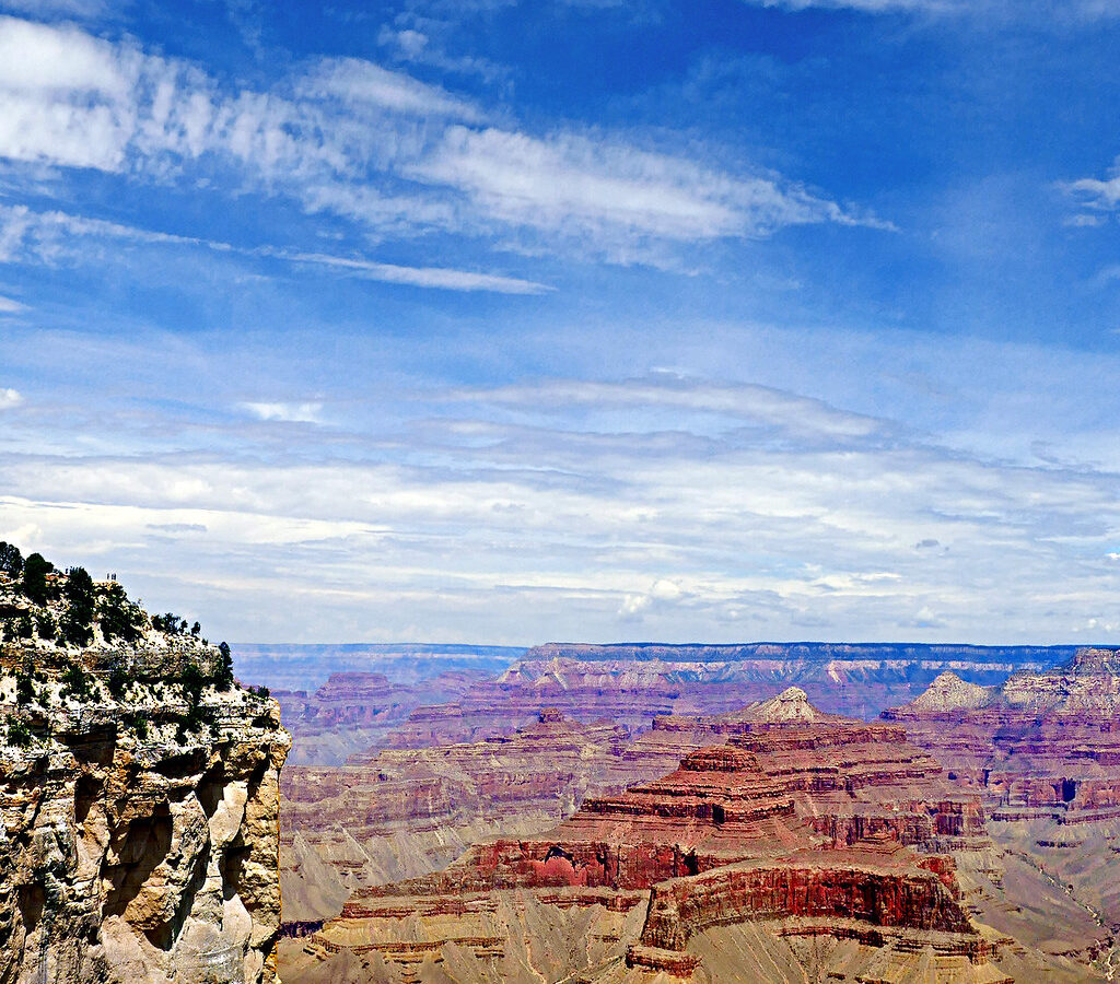
Photo: pom'. via Flickr (CC BY-SA 2.0)
Our Best Summer Hikes Grand Canyon guide focuses on routes that make sense when exposed inner-canyon temperatures can exceed 100°F, while the South Rim sits roughly 4,000 vertical feet above the Colorado River. Summer hiking here requires careful route selection: rim forests may feel comfortable in the morning, but every step below the rim adds heat and creates a demanding climb back to your starting elevation.
We have selected seven hikes spanning the South Rim and North Rim, from paved overlooks to forested day hikes and short descents through 270 million years of rock. This first half explains seasonal access, crowd patterns, trail selection, and the planning decisions that should happen before you leave the rim.
How summer changes hiking conditions at Grand Canyon
Elevation creates several climates in one park
Grand Canyon Village stands near 6,800 feet, while the North Rim rises above 8,000 feet and the Colorado River flows near 2,400 feet. That elevation range explains why no single forecast represents the entire canyon. A pleasant 75°F morning beside the South Rim can correspond with triple-digit heat along the river and lower Bright Angel Trail.
Temperatures generally rise as hikers descend. Shade also becomes scarce on exposed routes such as South Kaibab Trail, where the ridge-top alignment provides broad views but little protection. North Rim trails pass through cooler ponderosa pine, white fir, aspen, and spruce habitat, although their higher starting elevations can bring afternoon thunderstorms, hail, and sudden temperature drops.
Monsoon storms affect timing and route choice
July and August often bring the Southwest monsoon, with thunderstorms forming during the afternoon. Lightning is especially dangerous on exposed viewpoints, ridges, and open sections of the Rim Trail. Heavy rain can produce runoff, loose stones, and localized flash flooding in drainages even when rainfall at the trailhead seems modest.
Our team favors sunrise starts and aims to finish exposed hikes before storm development and peak heat. Turn around when clouds build vertically, thunder becomes audible, or wind begins carrying dust and abruptly cooler air. Trees offer poor lightning protection when they stand alone near an overlook.
Comparing Grand Canyon seasons before choosing a hike
Where summer fits within the annual hiking calendar
Summer provides the widest road access, especially when the North Rim is open, but it produces the harshest conditions below the rim. Spring and autumn usually offer better temperatures for longer inner-canyon routes. Winter can be excellent for quiet rim walking, although snow and ice frequently affect shaded switchbacks and high-elevation roads.
| Season | Typical conditions | Crowd effects | Road and trail access | Best hiking focus |
|---|---|---|---|---|
| Spring | Cool rims, rapidly warming inner canyon, occasional snow at elevation | Busy during school breaks | South Rim open, North Rim road commonly remains seasonally closed | Longer South Rim descents and rim walks |
| Summer | Mild to warm rims, extreme inner-canyon heat, afternoon storms | Congested parking, shuttles, overlooks, and narrow trail sections | Broadest general access when seasonal roads are open | Rim trails, shaded forests, short dawn descents |
| Autumn | Cooling days, crisp nights, possible early snow | Moderate, with busy holiday weekends | North Rim access ends seasonally; South Rim remains accessible | Day hikes below the rim and forest routes |
| Winter | Cold rims, snow and ice, milder temperatures deep in the canyon | Lowest annual visitation outside holidays | North Rim vehicle access generally closed; South Rim roads may face storms | Rim viewpoints and prepared inner-canyon trips |
What crowds change on the trail
Summer crowds affect more than atmosphere. South Rim trailhead parking can fill early, shuttle queues consume hiking time, and popular viewpoints become congested near sunset. The upper South Kaibab and Bright Angel trails also carry mule traffic, requiring hikers to follow wrangler instructions and stand quietly on the trail’s inside edge.
Crowds thin quickly once hikers move beyond paved overlooks, but quieter routes often provide less shade, water, or transportation support. Starting near sunrise improves parking odds and reduces heat exposure. Trailhead access, seasonal roads, fees, water availability, and shuttle operations can change, so confirm current details on the official park site before finalizing an itinerary.
7 Best Summer Hikes in Grand Canyon National Park: At a Glance
Comparing the 7 Best Summer Hikes in Grand Canyon National Park
These seven routes emphasize manageable summer objectives rather than river-reaching ambitions. Distances are approximate because exact mileage can vary with the chosen turnaround point, parking location, and Rim Trail segment. Elevation change matters more than mileage below the rim because Grand Canyon hikers descend first and complete the hardest climbing at the end.
| Hike | Area | Approximate distance | Elevation change | Primary summer concern |
|---|---|---|---|---|
| Rim Trail, Mather Point to Yavapai Point | South Rim | 1.4 miles one way | Minimal | Sun exposure and viewpoint crowds |
| Shoshone Point Trail | South Rim | About 2 miles round trip | Minimal | Limited shade near the point |
| South Kaibab Trail to Ooh Aah Point | South Rim | 1.8 miles round trip | About 760 feet | No natural shade or reliable trail water |
| Grandview Trail to Coconino Saddle | South Rim | About 2.2 miles round trip | Roughly 1,200 feet | Steep, loose, rugged tread |
| North Kaibab Trail to Coconino Overlook | North Rim | About 1.5 miles round trip | Roughly 500 feet | Uphill return and seasonal access |
| Cape Final Trail | North Rim | About 4 miles round trip | Moderate rolling terrain | Afternoon lightning near the viewpoint |
| Widforss Trail | North Rim | About 10 miles round trip | Roughly 1,000 feet cumulative | Distance, storms, and limited water |
Matching a Summer Hike to Your Ability
For families and heat-sensitive hikers
The Rim Trail between Mather Point and Yavapai Point provides the lowest-commitment option, with broad views into the Vishnu Schist and tilted formations around the central canyon. Shoshone Point adds a quiet ponderosa pine approach before reaching an exposed promontory. Both routes keep hikers near rim elevation and allow an easy retreat when weather deteriorates.
For a first hike below the rim
Ooh Aah Point provides a compact introduction to inner-canyon terrain. The South Kaibab Trail drops through pale Kaibab Limestone before crossing softer Toroweap Formation and Coconino Sandstone layers. At the point, gravel shifts underfoot, the rim rises sharply behind you, and the open ridge reveals side canyons that remained hidden near the trailhead. Heat radiates from the rock while voices and mule bells carry across the otherwise open space.
For experienced summer hikers
Grandview Trail is considerably rougher than its mileage suggests. Historic miners constructed parts of it using stone retaining walls and log cribbing, and the descent toward Coconino Saddle includes large steps, loose rock, and steep exposure. Cape Final and Widforss offer longer North Rim objectives with more forest shade, but both require weather awareness and enough water for an unsupported return.
How to Hike Safely in the Summer Heat
Use a summer-specific decision framework
Choose the route by combining forecast temperature, thunderstorm timing, elevation change, and the slowest person’s experience. A short below-rim hike can demand more effort than a longer rim walk. Our team uses the following order when selecting a summer objective:
- Check separate forecasts for the rim and inner canyon.
- Reject exposed descents when dangerous heat is forecast below the rim.
- Choose a turnaround time before starting, rather than deciding while descending.
- Begin early enough to avoid both peak heat and likely afternoon storms.
- Carry all required water unless a verified seasonal source is available.
- Leave enough energy and water for the uphill return.
Water, food, and conservation constraints
Grand Canyon water systems operate in a dry landscape and can experience breaks, shortages, or conservation measures. Never build a hike around an unverified tap. Carry water in durable containers, add electrolytes during prolonged sweating, and eat salty, calorie-dense food before hunger appears. Our coverage of South Rim services and continuing water conservation measures explains why visitors should treat water availability as a planning variable rather than an assumption.
Heat illness can begin with headache, nausea, dizziness, unusual fatigue, or poor coordination. Stop descending when symptoms appear, move into shade, cool the body, and seek assistance. Drinking excessive plain water without replacing salts can also cause a dangerous electrolyte imbalance, so steady hydration and regular food intake are safer than consuming large quantities at once.
Match trail access to the part of summer you visit
South Rim transportation requires an early plan
The South Rim remains the practical base when seasonal access elsewhere is limited. Mather Point, Yavapai Point, Shoshone Point, Grandview, and the South Kaibab corridor all begin from this side of the canyon. South Kaibab Trailhead normally requires park transportation or an additional walk because private vehicle access is restricted. Build that transfer into your turnaround time. Early summer mornings are also cooler than late summer afternoons, although June often brings intense sun before monsoon cloud cover develops.
North Rim hikes depend on seasonal roads
Cape Final, Widforss Trail, and Coconino Overlook become realistic choices only when the North Rim entrance road and connecting park roads are open. Snow commonly keeps State Route 67 closed well after lower elevations have warmed, and early autumn storms can end access abruptly. Cape Royal Road leads toward Cape Final but adds considerable driving time on a narrow, winding route. Widforss begins near the developed North Rim area, where its higher elevation produces cooler mornings and a later wildflower season.
Permits, reservations, and advance planning
Day hiking usually has the simplest requirements
The seven routes in this guide are day hikes and generally do not require backcountry permits. Park admission still applies, and transportation constraints may determine when you can reach a trailhead. A permit becomes necessary when an itinerary includes camping below the rim, even if the first section follows South Kaibab, Bright Angel, or North Kaibab Trail. Rangers evaluate overnight plans by use area and campsite, rather than treating a corridor hike as an unrestricted extension of a day trip.
| Plan | Typical requirement | Planning horizon |
|---|---|---|
| One of the seven listed day hikes | Park admission, usually no hiking permit | Choose route and transportation before arrival |
| Overnight trip below the rim | Backcountry permit and designated itinerary | Apply well ahead of summer travel |
| Developed campground stay | Separate campsite booking where reservations are offered | Reserve early for weekends and holidays |
| Rim lodging | Accommodation reservation | Book before fixing a multiday hiking schedule |
Overnight ambitions need a different season
Summer permit availability should never be interpreted as evidence that a route is safe in the heat. Rim to river day hikes expose visitors to thousands of feet of climbing during the hottest part of the day, while overnight corridor trips require campsite capacity, food storage, and a realistic heat strategy. Hikers seeking Phantom Ranch, Bright Angel Campground, or Cottonwood Campground should consider cooler months and submit a separate backcountry plan rather than extending one of these short summer outings.
Build an itinerary around effort and crowd tolerance
A single day favors one major objective
For one South Rim day, walk from Mather Point to Yavapai Point around sunrise, then choose either Shoshone Point or Ooh Aah Point after assessing the temperature. Grandview should replace, rather than supplement, a descent on South Kaibab because both demand a sustained uphill return. Visitors prioritizing quiet should favor Shoshone Point on a weekday morning. Those prioritizing geology gain more from Yavapai’s broad exposure of the inner gorge followed by a short descent through the upper sedimentary layers.
Two days create room for weather changes
A two day North Rim plan can pair Coconino Overlook with Cape Final, leaving Widforss for the cooler and more stable morning. Keep one shorter route available if thunderstorms develop or smoke reduces visibility. The Best Summer Hikes Grand Canyon visitors choose should reflect the forecast that morning, not a fixed checklist created weeks earlier. Use these priority matches:
- Coolest forest experience: Widforss Trail, started early.
- Short North Rim descent: Coconino Overlook.
- Broad sunrise views: Mather Point to Yavapai Point.
- Quiet picnic approach: Shoshone Point.
- Technical footing practice: Grandview to Coconino Saddle.
Choose a hike that leaves a safe margin
Summer route selection at Grand Canyon begins with elevation and exposure. Rim walks provide flexibility, North Rim forests reduce sustained sun, and short descents reveal the canyon’s geology without committing hikers to the river corridor. Ooh Aah Point and Coconino Overlook suit prepared first time canyon hikers, while Grandview and Widforss demand stronger conditioning, careful footing, and more conservative weather decisions.
Plan transportation before sunrise, carry water independently of trail infrastructure, and preserve enough time for an unhurried climb back to the rim. A successful summer itinerary may cover fewer miles than expected. That restraint creates space to respond to heat, lightning, traffic, and the slower pace imposed by elevation, while still reaching the viewpoints and forest trails that make these seven hikes worth planning around.
Want to keep exploring? Browse all our Grand Canyon guides and articles for more trip-planning tips and ideas.
Gear & Essentials
Tell us about your trip and we will add what else you will want:
The basics
Worth having in the car whatever the park.
For this trip
Traveling with kids
Bringing a pet
RVing
Backcountry
On the water
Photography
Accessibility
As an Amazon Associate we earn from qualifying purchases, at no extra cost to you.