










Theodore Roosevelt National Park
10 Best Winter Hikes in Theodore Roosevelt National Park
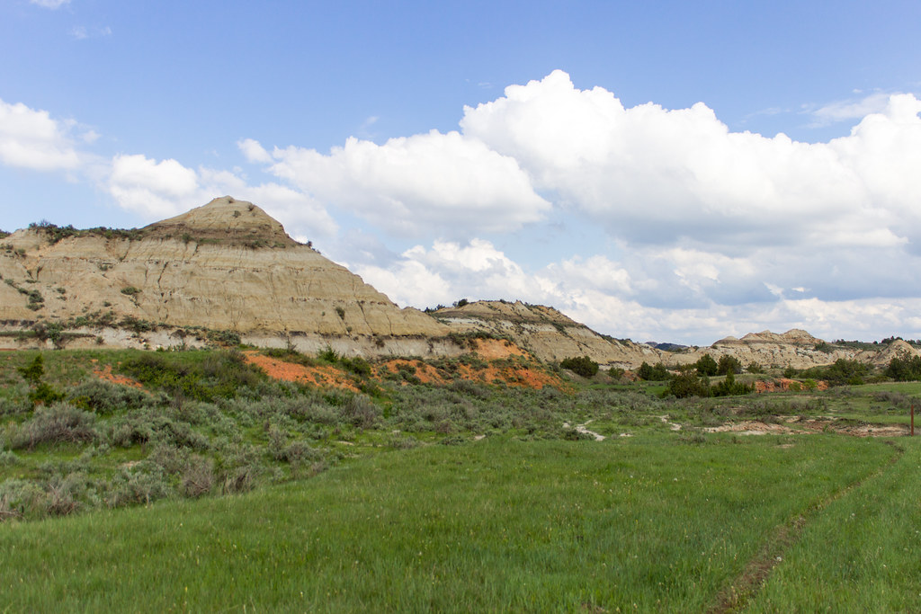
Photo: Matt-Zimmerman via Flickr (CC BY 2.0)
Our 10 Best Winter Hikes begin at Wind Canyon just after sunrise, when frost stiffens the shortgrass and the Little Missouri River moves silently below the bluff. Snow collects in the bentonite folds across the valley, while exposed scoria crunches underfoot and a northwest wind pours over the rim. The cold feels sharper here because the open badlands provide little protection, even on a trail only 0.4 mile long.
Theodore Roosevelt National Park has three separate areas in western North Dakota: the South Unit at Medora, the North Unit south of Watford City, and the remote Elkhorn Ranch Unit. Our selections concentrate on the first two, where marked trails and maintained approach roads make winter planning more practical. This guide explains which routes work best in cold weather, how the season changes access, and how to choose a hike based on snow, wind, distance, and road conditions.
How We Chose the 10 Best Winter Hikes in Theodore Roosevelt National Park
Winter suitability depends on more than mileage. A short trail can become difficult when packed snow covers bentonite clay, and an exposed ridge can feel severe when temperatures are moderate but winds are strong. We prioritized routes with recognizable tread, worthwhile scenery at short distances, and trailheads reached from the principal park roads. The list still includes longer North Unit options for hikers equipped to manage changing conditions and limited daylight.
Terrain That Remains Manageable in Cold Weather
The park’s badlands were carved into the soft sediments of the Fort Union Formation by water, wind, and repeated freezing and thawing. Bentonite, a clay derived partly from volcanic ash, becomes slick when wet and hard when frozen. Scoria ridges offer firmer footing because underground coal seams baked the surrounding sediment into red, rocklike material. Trails such as Ridgeline, Buck Hill, and Caprock Coulee reveal these contrasting surfaces within relatively short distances.
What the 10 Best Winter Hikes in Theodore Roosevelt National Park Have in Common
Most selections provide an overlook, geological feature, wildlife corridor, or river view without requiring a full winter day. Distances below are approximate because short access spurs and parking locations can alter a recorded route. Detailed trail descriptions follow later in this guide.
| Trail | Unit | Approximate distance | Winter difficulty |
|---|---|---|---|
| Skyline Vista | South | 0.2 mile round trip | Easy |
| Buck Hill | South | 0.2 mile round trip | Easy |
| Boicourt Overlook | South | About 0.3 mile round trip | Easy |
| Wind Canyon | South | 0.4 mile loop | Easy to moderate |
| Ridgeline Nature Trail | South | 0.6 mile loop | Moderate |
| Painted Canyon Nature Trail | South | About 1 mile loop | Moderate |
| Old East Entrance Station | South | About 1.6 miles round trip | Easy |
| Little Mo Nature Trail | North | About 0.7 mile loop | Easy to moderate |
| Sperati Point | North | About 2.4 miles round trip | Moderate |
| Caprock Coulee | North | About 4.3 miles loop | Moderate to strenuous |
Seasonal Context for the 10 Best Winter Hikes
Winter generally provides the smallest crowds, the clearest long views, and the greatest logistical uncertainty. Snowfall is often modest compared with mountain parks, but drifting can block pavement and erase trail tread. Cold snaps can push temperatures well below zero Fahrenheit, while sunny periods may thaw exposed slopes before they refreeze into polished ice. December through February brings the shortest days and most persistent cold. March can alternate between deep winter and muddy spring conditions.
How Each Season Changes the Badlands
The same trail can feel entirely different across the year. Spring moisture turns clay slopes slippery and supports brief bursts of prairie wildflowers. Summer supplies long daylight but also heat, thunderstorms, and exposed hiking. Autumn usually brings cooler air and active wildlife. Winter strips vegetation from the sightlines, making bison, mule deer, and the park’s layered topography easier to spot from a distance.
| Season | Typical crowds | Weather and footing | Road and trail access | Best suited to |
|---|---|---|---|---|
| Winter | Very low | Cold, windy, icy, with drifting snow | Most vulnerable to temporary closures | Solitude, photography, short hikes, wildlife viewing |
| Spring | Low to moderate | Rapid changes, mud, lingering frost | Improves as roads dry, but unpaved approaches remain sensitive | Wildflowers, cool hiking, bird activity |
| Summer | Highest | Hot sun, thunderstorms, exposed terrain | Broadest routine access | Long routes and extended daylight |
| Autumn | Moderate, then declining | Cooler temperatures and occasional early snow | Generally good before winter storms begin | Long hikes, wildlife, comfortable daytime conditions |
Why Winter Changes the Experience
Low visitation affects practical decisions as much as atmosphere. A quiet trailhead may remain empty for hours, so hikers should expect slower assistance after a fall, vehicle problem, or navigation error. Bison also use roads and packed trails because these routes conserve energy. Give them at least 25 yards, never pass closely between an animal and an escape route, and turn around if a bison holds its ground. Snow can conceal prairie dog burrows and uneven erosion channels beside the tread.
Planning a Day Around the 10 Best Winter Hikes in Theodore Roosevelt National Park
Choose the park unit before choosing the trail. The South Unit entrance sits at Medora beside Interstate 94, while Painted Canyon is reached from a separate interstate exit east of town. The North Unit entrance is roughly 15 miles south of Watford City. Driving between the two units takes well over an hour in good conditions, so combining them during a short winter day leaves little margin for ice, wildlife on the road, or early darkness.
Road Access, Fees, and Overnight Permits
The South and North Unit scenic roads provide access to most routes in this list, but storm closures and snow removal can determine which trailheads are reachable. The Elkhorn Ranch approach includes unpaved roads that can become unsuitable after snow or thawing. Day hiking normally requires no trail permit, while overnight backcountry travel requires authorization. Entrance charges, campground availability, road status, and permit procedures can change, so confirm current details on the official park site before departure.
Cold Weather Equipment That Solves Real Problems
Prepare for wind exposure rather than relying only on the forecast temperature. Cotton clothing holds moisture during climbs, then chills rapidly at overlooks. Traction devices help on compacted snow, but they offer limited grip when thawed bentonite becomes greasy. Snowshoes are useful only after sufficient accumulation and can be cumbersome on partly bare trails.
- Windproof outer layer: Essential on Buck Hill, Boicourt Overlook, and other exposed rims.
- Insulated boots and gaiters: Useful where drifts collect in coulees and shaded draws.
- Microspikes: Best for hard snow and refrozen trail surfaces.
- Trekking poles: Helpful on the descent into Painted Canyon and along Caprock Coulee.
- Offline map: Mobile coverage is inconsistent, particularly in the North Unit.
- Headlamp and spare batteries: Cold shortens battery life, and winter sunset arrives early.
- Water carried inside the pack: Exposed bottles and hydration tubes can freeze.
Matching the Route to the Day’s Conditions
Use visibility, wind, and surface condition as separate decision points. Skyline Vista, Buck Hill, and Boicourt Overlook suit very cold days because the viewpoint arrives quickly. Wind Canyon and Little Mo add a little shelter and varied terrain. Painted Canyon and Ridgeline require more care after thaw and refreeze cycles. Sperati Point works well when the road is open and winds are manageable, while Caprock Coulee should be reserved for stable weather, adequate daylight, and hikers comfortable navigating snow-covered badlands.
Choose Short Routes for Stormy or Bitter Days
When wind chills become hazardous, build the day around several brief walks rather than one exposed backcountry route. In the South Unit, Skyline Vista, Buck Hill, Boicourt Overlook, and Wind Canyon can be combined without committing to hours away from a vehicle. This approach also lets you reassess road conditions between stops. Painted Canyon Nature Trail begins from a separate interstate access point, making it a useful alternative when conditions prevent a longer drive through the main unit.
Overlooks With Fast Retreat Options
Skyline Vista provides a broad view above Medora, while Buck Hill reaches one of the South Unit’s highest road-accessible points at approximately 2,855 feet. Boicourt Overlook looks across deeply dissected badlands where snow emphasizes drainage channels and horizontal sediment layers. These exposed sites offer little protection from northwest winds, but their short approaches make them practical for photography near sunrise or sunset. Carry traction even when the parking area appears dry because shaded sections can retain smooth ice.
Lower Trails With Partial Wind Protection
Old East Entrance Station follows relatively open ground toward remnants associated with the park’s former entrance road. Little Mo Nature Trail uses the river bottom in the North Unit, where cottonwoods and terrain provide intermittent shelter. Wind Canyon also dips below its rim before climbing toward the river overlook. These routes can still collect drifts, particularly where vegetation catches blowing snow, but they generally provide more opportunities to step out of the wind than Buck Hill or Skyline Vista.
Save Longer Hikes for Stable Winter Weather
Sperati Point and Caprock Coulee require a larger margin for navigation, temperature changes, and fading daylight. Start early enough to finish before sunset without depending on a headlamp for route finding. Tracks from previous hikers can disappear within minutes during blowing snow, and wildlife trails may resemble the intended path. Before leaving the trailhead, identify turnaround times, prominent ridges, and the direction of the scenic road relative to the route.
Sperati Point Across the Prairie
Sperati Point begins near Oxbow Overlook and crosses rolling grassland to a viewpoint above the Little Missouri badlands. The grade is moderate, but exposure makes wind the principal challenge. Watch for bison before entering shallow swales where visibility narrows. The prairie section can hold deeper drifts than nearby ridges, so the outward walk may take longer than its mileage suggests. On clear days, the open route provides long sightlines that simplify navigation and wildlife avoidance.
Caprock Coulee Under Snow
Caprock Coulee passes through a sheltered drainage before climbing among caprock formations and exposed ridges. In the coulee, boots press through crusted snow into softer powder, cottonwood branches click overhead, and the air feels noticeably calmer. The climb then reaches open badlands where the wind returns abruptly and the Little Missouri valley spreads beyond the ridge. That transition explains why clothing adjustments matter: overheating below can leave damp layers dangerously cold on the exposed upper trail.
Use Crowds, Access, and Reservations to Pick Your Dates
Winter trailheads are usually quiet, especially on weekdays and after fresh snowfall. Solitude improves wildlife observation and removes pressure to maintain another group’s pace, but it also means fewer people are available to notice a disabled vehicle or overdue hiker. Summer brings fuller parking areas and more traffic on the scenic roads. Spring and autumn occupy the middle ground, with visitation concentrating around mild weekends and wildlife-active mornings.
A Practical Seasonal Decision Table
| Priority | Strongest period | Main compromise |
|---|---|---|
| Snow-covered scenery | January through February | Cold, drifting, and short daylight |
| Quiet trails with longer days | Late autumn or early spring | Mud, ice, and rapid weather changes |
| Maximum road access | Summer into early autumn | Heat, storms, and heavier visitation |
| Long backcountry hikes | Early autumn | Less reliable snow scenery |
When Advance Planning Matters
The 10 Best Winter Hikes are day routes, so they do not require overnight backcountry authorization. Travelers adding a backcountry camp need to complete the park’s current permit process before staying overnight. Campground reservation systems and booking windows matter more during the main visitor season than during midwinter, although limited cold-season services require greater self-sufficiency. Build lodging and campsite decisions before connecting the North and South units, since the distance between them makes last-minute changes costly in daylight.
A Simple Morning Decision Process
- Check which scenic-road segments can be reached safely.
- Compare wind speed and wind chill with the route’s exposure.
- Inspect the first shaded section for ice or thawed clay.
- Choose a turnaround time based on sunset, not mileage alone.
- Move to a shorter overlook if visibility or footing deteriorates.
This sequence prevents an ambitious itinerary from overruling evidence at the trailhead. A clear forecast in Medora does not guarantee equal conditions on Buck Hill, and dry pavement near Watford City says little about drifting inside the North Unit. Keep at least one short alternative in the same unit. That preserves the day without adding a long winter drive between entrances.
Gear & Essentials
Tell us about your trip and we will add what else you will want:
The basics
Worth having in the car whatever the park.
For this trip
Traveling with kids
Bringing a pet
RVing
Backcountry
Winter conditions
On the water
Photography
Accessibility
As an Amazon Associate we earn from qualifying purchases, at no extra cost to you.
Build a Winter Hiking Day You Can Adjust
Theodore Roosevelt National Park rewards flexible winter planning. Pair Skyline Vista, Buck Hill, or Boicourt Overlook with Wind Canyon when cold and wind limit exposure. Choose Little Mo or Old East Entrance Station for gentler terrain, then reserve Painted Canyon, Sperati Point, and Caprock Coulee for stable footing, good visibility, and sufficient daylight. Surface conditions should decide the route, even when distance and elevation appear modest on paper.
Start with the trail that matters most, carry equipment for ice and wind, and leave room to change plans after seeing the roads and ground firsthand. The best winter itinerary may contain several short overlooks or one carefully timed longer loop. Either approach provides expansive badlands views, visible geology, and realistic opportunities to watch wildlife while maintaining a safe route back to the vehicle.
Want to keep exploring? Browse all our Theodore Roosevelt guides and articles for more trip-planning tips and ideas.
