Capitol Reef National Park Travel Guide: Scenic Drives, Hikes, and Fruita Highlights
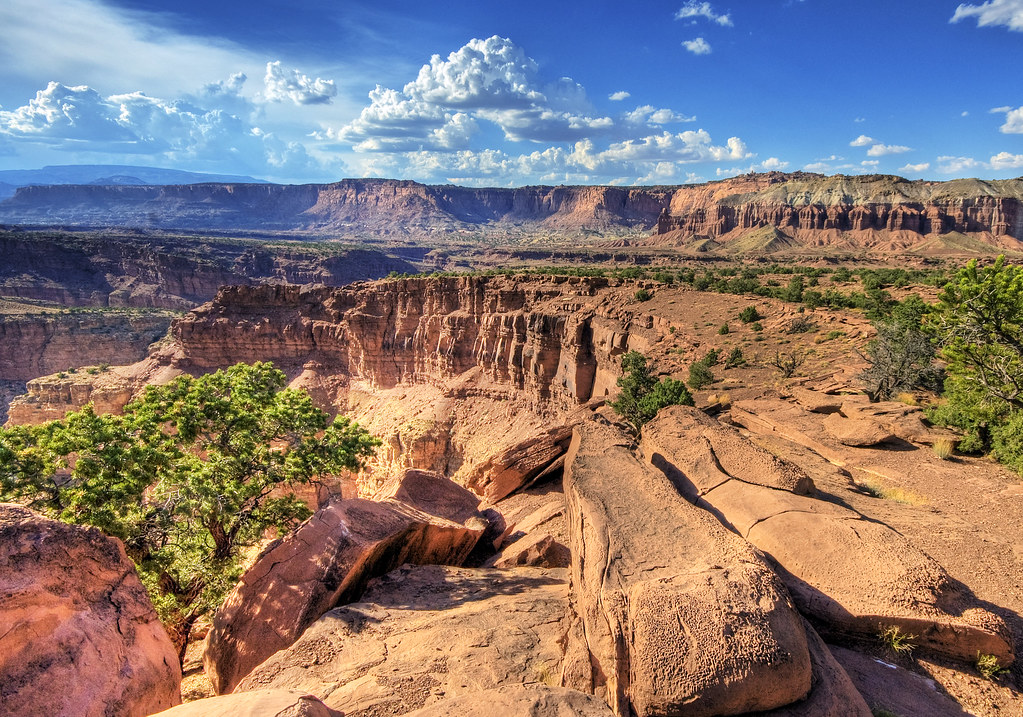
Photo: Wolfgang Staudt via Flickr (CC BY 2.0)
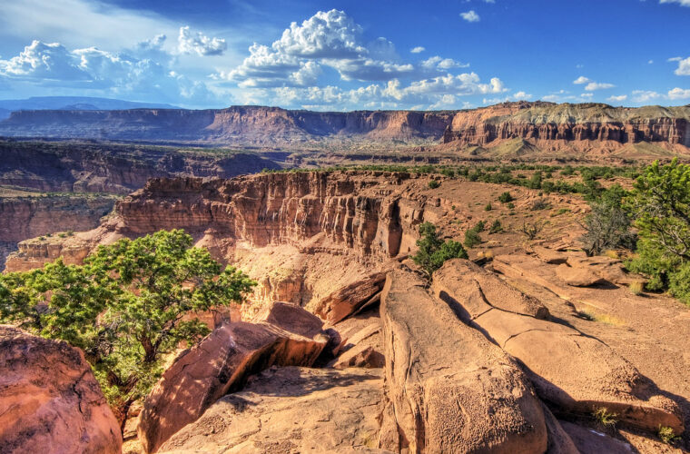
Our Capitol Reef National Park Travel Guide begins at sunrise beside the orchards of Fruita, where cool air settles along the Fremont River and the Waterpocket Fold catches the first orange light. Cottonwood leaves stir above irrigation channels, deer step between rows of century-old fruit trees, and pale cliffs rise abruptly beyond the valley floor. The scale becomes clearer as the sun reaches the Navajo sandstone domes above Utah Highway 24.
Capitol Reef protects the central portion of the Waterpocket Fold, a long wrinkle in Earth’s crust extending for nearly 100 miles across south-central Utah. Most first visits concentrate on the Highway 24 corridor, Fruita Historic District, and paved Scenic Drive. Remote roads lead north into Cathedral Valley and south through the Waterpocket District, but those areas require more time, suitable vehicles, and careful weather planning.
The Waterpocket Fold shapes every visit
Capitol Reef covers roughly 378 square miles, yet its geography channels visitors through a relatively narrow central corridor. Utah Highway 24 crosses the park from west to east, following breaks carved by the Fremont River and its tributaries. Fruita, the visitor center, major trailheads, and Scenic Drive all branch from this road, making the central district manageable during a one or two-day visit.
A monocline nearly 100 miles long
The Waterpocket Fold is a monocline, a one-sided fold in otherwise layered rock. Between about 50 and 70 million years ago, forces associated with the Laramide Orogeny lifted buried faults beneath the Colorado Plateau. The overlying sedimentary layers bent rather than breaking cleanly, creating a steep geological step. Subsequent erosion exposed sandstone cliffs, shale slopes, domes, canyons, and elongated basins called waterpockets.
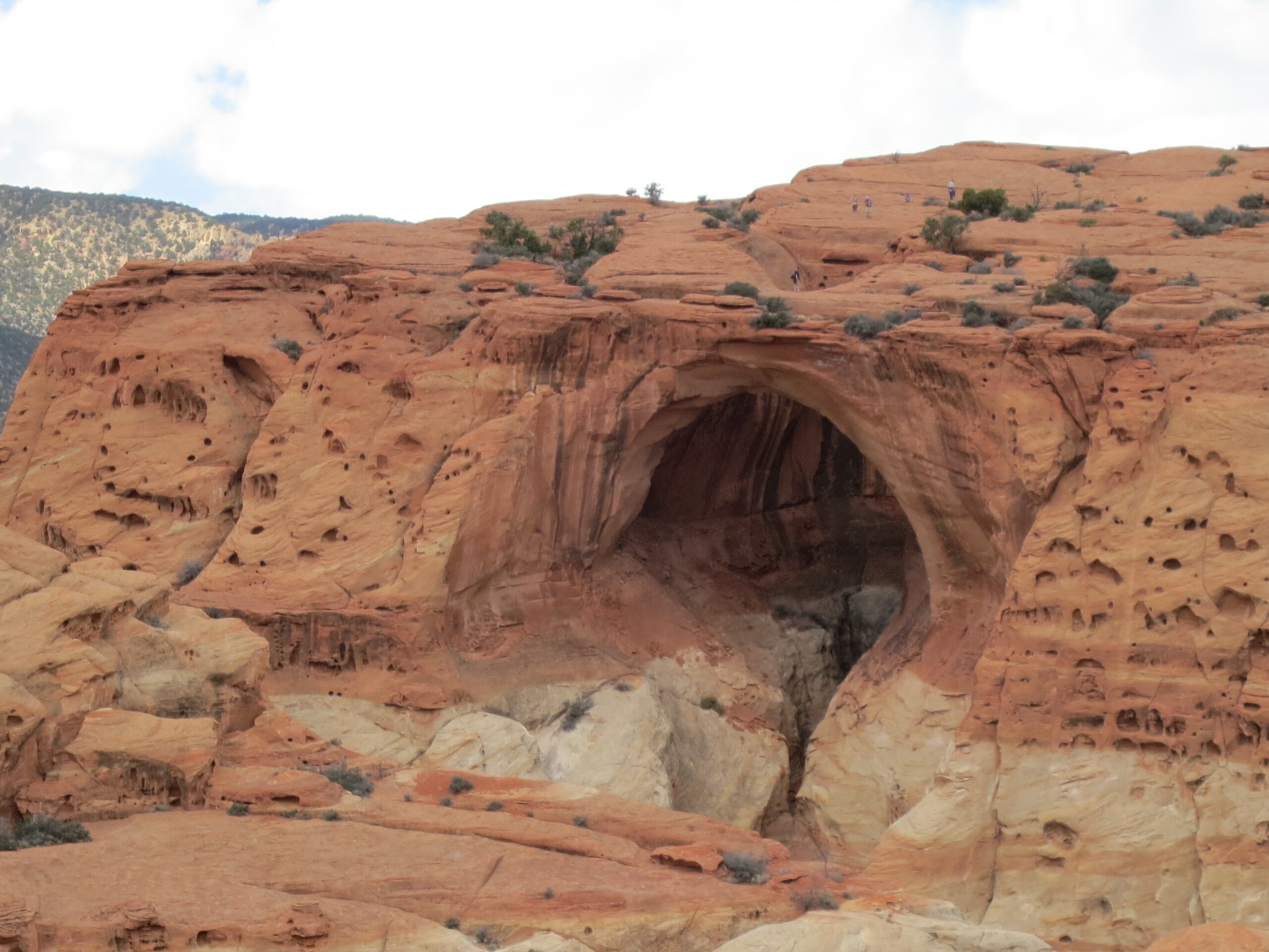
The park’s striped formations represent environments that changed repeatedly over hundreds of millions of years. Red Moenkopi and Chinle layers formed from ancient tidal flats, floodplains, and river systems. Wingate sandstone creates high vertical walls, while the lighter Navajo sandstone originated as windblown desert dunes. The rounded Navajo sandstone domes near Fruita reminded early visitors of the United States Capitol, contributing to the park’s name.
Elevation changes create several ecological zones
Elevations range from approximately 3,880 feet near Hall’s Creek to about 8,960 feet in the park’s higher western country. Desert scrub and blackbrush dominate lower, drier ground. Pinyon pine and Utah juniper appear on benches and slopes, while ponderosa pine grows at higher elevations. Along the Fremont River, reliable water supports cottonwoods, willows, orchards, and a narrow ribbon of greener habitat.
Mule deer commonly enter Fruita around dawn and dusk. Desert bighorn sheep inhabit rocky canyons and slopes, although sightings are less predictable. Ravens, golden eagles, wild turkeys, and canyon wrens are also present. Visitors should give wildlife space and keep food secured, particularly in picnic and camping areas.
How to orient a first visit
Torrey is the nearest gateway community, approximately 11 miles west of the visitor center. Travelers commonly approach from Bryce Canyon country via Utah Highway 12, from Interstate 70 through Utah Highway 24, or from southeastern Utah through Hanksville. Fuel, groceries, and lodging become limited outside these communities, especially when driving toward Cathedral Valley or the southern Waterpocket District.
The central corridor delivers the greatest return on limited time
Highway 24 remains open to through traffic and provides access to several major stops without requiring a backcountry vehicle. From west to east, useful stops include Chimney Rock, Panorama Point, Goosenecks Road, the Fruita Historic District, the petroglyph panels, Hickman Bridge, and Grand Wash’s eastern entrance. Scenic Drive begins near Fruita and travels south beneath the Fold’s cliffs.
| Area | Best use | Road character | Typical time |
|---|---|---|---|
| Highway 24 corridor | Overlooks, short walks, first visit | Paved highway | Half day |
| Scenic Drive | Cliff views and canyon access | Paved main road with unpaved spurs | 2 to 4 hours |
| Cathedral Valley | Monoliths and remote desert | Long backcountry loop | Full day |
| Waterpocket District | Quiet canyons and Fold panoramas | Remote roads with variable surfaces | Full day or longer |
Weather can redraw the day’s plan
Spring and autumn generally provide the most comfortable hiking temperatures, although cold fronts can bring freezing nights or occasional snow. Summer afternoons often exceed 90 degrees Fahrenheit at lower elevations. July through September also brings monsoon thunderstorms, which can send flash floods through Grand Wash, Capitol Gorge, and other confined drainages even when rain falls miles away.
Winter has lighter visitation and clear views, but shaded trails may retain snow or ice. Unpaved roads can become impassable after rain or snowmelt because clay-rich surfaces turn slick. Before leaving pavement, check the forecast, road conditions, entrance requirements, and any closures, and confirm current details on the official park site.
Scenic Drive and the canyons branching from it
Scenic Drive extends south from Fruita for approximately 8 miles before reaching Capitol Gorge Road. The route follows the western side of the Waterpocket Fold beneath walls of Wingate sandstone and rounded Navajo sandstone. Allow more time than the mileage suggests because overlooks, trailheads, and narrow unpaved spur roads account for most of the experience.
Grand Wash cuts directly through the Fold
Grand Wash Road branches from Scenic Drive and follows a dirt spur to the western trailhead. The Grand Wash Trail continues through a broad canyon that narrows between sheer walls. The complete canyon route is about 4.4 miles round trip when walked from one entrance to the other and back, although many visitors turn around after exploring the narrows.
Cassidy Arch adds height and exposure
From Grand Wash, the Cassidy Arch Trail climbs steeply onto slickrock benches. The route is approximately 3.1 miles round trip with about 670 feet of elevation gain. Painted cairns and rock markers guide hikers across open sandstone, where route-finding demands attention. The final approach reaches the top of the arch rather than a viewpoint below it, and exposed edges require particular care with children.
Capitol Gorge follows an early travel corridor
At the southern end of Scenic Drive, an unpaved road enters Capitol Gorge when conditions permit. Before Utah Highway 24 opened in 1962, this narrow canyon served as an important route through the Waterpocket Fold. The Capitol Gorge Trail follows the old roadbed past the Pioneer Register, where travelers carved names and dates into the canyon wall.
- Carry all drinking water needed for canyon walks because dependable natural water is scarce.
- Avoid Grand Wash and Capitol Gorge when thunderstorms threaten anywhere in the drainage.
- Keep vehicles off soft shoulders, where sand and bentonite clay can trap low-clearance cars.
- Start exposed trails early during summer because the rock radiates heat by midday.
Fruita combines human history with river ecology
Fruita occupies a rare pocket of cultivable land beside the Fremont River. Members of the Church of Jesus Christ of Latter-day Saints established the settlement in the 1880s, building irrigation systems that supported orchards, gardens, and small farms. The community never grew large, but its surviving landscape provides a clear view of how families lived within an isolated desert valley.
Orchards remain part of the historic landscape
Apple, pear, peach, cherry, apricot, plum, and other fruit trees grow across the district. Bloom and harvest timing varies with elevation, temperature, and late frosts. When designated orchards are open for harvest, visitors may pick fruit under posted rules. The trees are working cultural resources, so closures and collection limits protect both the crop and the historic planting pattern.
Earlier Fremont culture survives in rock art
Long before nineteenth-century settlement, people associated with the Fremont culture farmed, hunted, and gathered along this river corridor. Petroglyph panels beside Highway 24 include elongated human figures, bighorn sheep, and geometric forms pecked into darkened sandstone. A short boardwalk provides a close view, but binoculars help reveal smaller figures positioned higher on the cliff.
Choose a hike that matches the heat and daylight
Several central district trails climb quickly from Highway 24, so mileage alone understates their difficulty. Hickman Bridge works well early in the day, while Chimney Rock and Navajo Knobs receive prolonged sun. Cohab Canyon offers partial shade between sandstone walls, although its initial switchbacks are exposed. Carry more water than the short distances suggest because most routes have no reliable water source.
| Trail | Distance | Elevation gain | Primary feature |
|---|---|---|---|
| Hickman Bridge | About 1.8 miles round trip | About 400 feet | Natural bridge and canyon views |
| Chimney Rock Loop | About 3.3 miles | About 590 feet | Waterpocket Fold panorama |
| Rim Overlook | About 4.6 miles round trip | About 1,110 feet | View over Fruita |
| Navajo Knobs | About 9.4 miles round trip | About 1,620 feet | High, exposed summit viewpoint |
Hickman Bridge provides the best short introduction
The Hickman Bridge Trail crosses the Fremont River floodplain before climbing through Kayenta sandstone ledges. At the bridge, loose sand gives way to pale slickrock underfoot, and footsteps echo against the alcove behind the 133-foot span. The arch blocks part of the sky overhead, while gaps beside it frame the canyon and distant cliffs. The return descent can feel considerably hotter because shade is limited and the rock stores heat.
Rim Overlook and Navajo Knobs reward an early start
Both destinations use the same trail above Hickman Bridge. Rim Overlook provides a high view across Fruita’s orchards and campground, while Navajo Knobs continues over exposed sandstone to a far broader view along the Fold. The upper route includes cairn-guided slickrock and little shelter. Turnaround decisions should account for the return distance, rising temperatures, and afternoon thunderstorm development.
Beyond Fruita, the park becomes considerably quieter
Cathedral Valley and the southern Waterpocket District reveal the park’s full scale, but neither fits comfortably into a hurried central district itinerary. These areas have long stretches without fuel, food, dependable water, or cellular service. Download maps before leaving town, carry a full-size spare tire, and tell someone which road and exit point you intend to use.
Cathedral Valley surrounds isolated monoliths
The Cathedral Valley loop covers roughly 58 miles and passes the Temples of the Sun and Moon, tall Entrada sandstone monoliths rising from an open basin. Other stops include Glass Mountain, a mound of exposed selenite crystals, and the Gypsum Sinkhole. One common loop direction requires a Fremont River ford, while bentonite clay elsewhere can become nearly impassable when wet.
Notom Road follows the Fold’s eastern flank
Notom-Bullfrog Road runs south beside the tilted rock layers of Strike Valley. The Burr Trail switchbacks then climb through the Fold in a tight series of turns, connecting this remote country with the Boulder area. Side routes reach Upper Muley Twist Canyon and the Strike Valley Overlook, but rough access roads may require high clearance. This corridor deserves a dedicated day rather than an improvised detour from Scenic Drive.
- Fill the fuel tank before entering either remote district.
- Carry several gallons of emergency water in addition to hiking water.
- Use a paper topographic map as a backup to downloaded navigation.
- Leave low-clearance vehicles on maintained roads when ruts, sand, or rock ledges appear.
Frequently Asked Questions
These practical answers address the decisions that most often affect a first visit, including trip length, family suitability, pets, and communication in remote areas.
How many days do you need at Capitol Reef?
One full day covers Fruita, several Highway 24 stops, Scenic Drive, and one moderate hike. Two days allow a longer trail and more time in the historic district. Add a third day for Cathedral Valley or the southern Waterpocket District.
Is Capitol Reef suitable for children?
Fruita, the petroglyph boardwalk, Grand Wash, and the lower portion of Hickman Bridge suit many families. Cassidy Arch, exposed slickrock routes, and long desert hikes require closer supervision and an honest assessment of each child’s heat tolerance.
Are dogs allowed on the hiking trails?
Pets are generally excluded from hiking trails and the backcountry. Leashed pets are allowed in certain developed areas, along public roads, and in designated orchard areas, subject to posted rules.
Is there reliable mobile phone service?
Coverage is inconsistent in Fruita and frequently absent in canyons, Cathedral Valley, and the Waterpocket District. Save maps, directions, and emergency contacts offline before entering the park.
Can you drive through the park without using Scenic Drive?
Yes. Utah Highway 24 crosses the central park and reaches overlooks, petroglyphs, Fruita, and several trailheads. Scenic Drive is a separate out-and-back route extending south from the historic district.
Build the trip around landscape, distance, and weather
This Capitol Reef National Park Travel Guide works best as a framework rather than a checklist. Begin with Fruita and Highway 24, choose one trail suited to the temperature, then use Scenic Drive to enter the Fold’s canyon country. That sequence keeps driving efficient while preserving time for orchards, rock art, geology, and a hike.
Remote districts should be planned separately, with fuel, water, navigation, road conditions, and daylight treated as essential constraints. Visitors who make that distinction gain a clearer understanding of Capitol Reef: a settled river valley at its center, a nearly 100-mile geological fold around it, and large desert basins extending far beyond the paved corridor.
Want to keep exploring? Browse all our Capitol Reef guides and articles for more trip-planning tips and ideas.
Gear & Essentials
Tell us about your trip and we will add what else you will want:
The basics
Worth having in the car whatever the park.
For this trip
As an Amazon Associate we earn from qualifying purchases, at no extra cost to you.