Denali National Park in Summer: What to Expect and What to Do
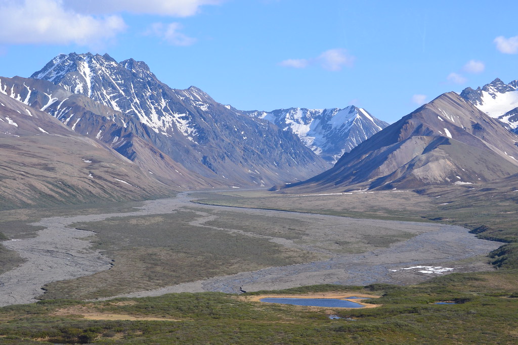
Photo: larrywkoester via Flickr (CC BY 2.0)
Denali National Park Summer travel revolves around a single 92-mile road entering a six-million-acre landscape of taiga, tundra, braided rivers, and glaciated mountains. Denali rises to 20,310 feet, but seeing North America’s highest summit depends on cloud cover as much as itinerary design. Summer provides the broadest road access, long daylight, active wildlife, and the most practical conditions for hiking, camping, cycling, and backcountry travel.
Our guide explains how conditions change from late May through early September, when crowds affect buses and lodging, and how to choose activities around the park road. Summer temperatures at the entrance commonly produce mild days and cool nights, yet snow, heavy rain, smoke, and sudden wind remain possible. The season rewards flexible travelers who understand that distance, transportation, and weather determine what can fit into a day.
How Travel Works in Denali National Park in Summer
Denali has one principal road rather than a network of scenic drives. The Denali Park Road begins near Alaska Highway 3, crosses forest around the entrance, and gradually enters open tundra. In the main visitor season, private vehicles generally travel only as far as Savage River around Mile 15. Buses handle most travel beyond that point, concentrating visitors along one corridor while leaving enormous areas without developed trails or roads.
The Park Road Defines the Experience
The full road historically extended 92 miles to Kantishna, but the Pretty Rocks landslide near Mile 45 has interrupted through travel while a bridge is constructed. In recent summers, buses have turned around near East Fork around Mile 43. That limit still reaches productive wildlife habitat and broad tundra views, though it prevents road access to Eielson Visitor Center, Wonder Lake, and Kantishna. Our Denali Park Road opening update explains how spring access advances toward Teklanika.
Why Mile Markers Matter
Travel times are longer than mileage suggests because the road becomes narrow and unpaved, buses stop for wildlife, and passengers may disembark at designated locations. Savage River can fill half a day when paired with hiking, while a trip toward East Fork usually consumes much of a day. Build itineraries around one road excursion rather than expecting to combine a deep park bus ride, several trails, and activities outside the entrance area.
Daylight, Weather, and Mountain Visibility
Near the June solstice, usable daylight lasts for most of the night, allowing hikes after dinner and early departures without darkness. Daylight contracts quickly in August. July afternoons near the entrance often reach the low 60s Fahrenheit, with nights around the 40s, while higher tundra can feel substantially colder in wind. Denali creates its own cloud patterns, so the mountain may remain hidden for days before appearing during a brief clearing.
Rain should shape packing rather than cancel plans. Trails can become muddy, brush stays wet after showers, and temperatures drop quickly when a front crosses the Alaska Range. Bring a waterproof shell, insulating layer, warm hat, gloves, and footwear suited to saturated ground. Mosquitoes are generally most persistent from June into July, especially near wetlands and sheltered forest; cooler August nights reduce insect activity.
Choosing the Right Part of Summer
Summer unfolds in distinct phases. Late May brings lingering snow and quieter roads, while June delivers maximum daylight and fresh vegetation. July usually has the greatest demand for buses and rooms. August brings berries, autumn color, and darker nights, followed by an increasingly wintry transition in early September. No period guarantees clear views or dry trails, so choose dates according to access, crowd tolerance, and preferred activities.
Denali National Park Summer Conditions Throughout the Season
| Period | Typical conditions | Crowd pattern | Access and activities |
|---|---|---|---|
| Late May to early June | Cool ground, possible snow patches, rapidly lengthening days | Lower than midsummer | Road and trail access may still be expanding; strong period for birding and snowcapped scenery |
| Mid June to mid July | Longest daylight, green tundra, mosquitoes, variable rain | High demand | Broad activity range, including bus trips, hiking, rafting, cycling, and backpacking |
| Mid July to mid August | Wildflowers, developing berries, mild average temperatures | Peak pressure on transportation and lodging | Most straightforward period for first visits and extended backcountry trips |
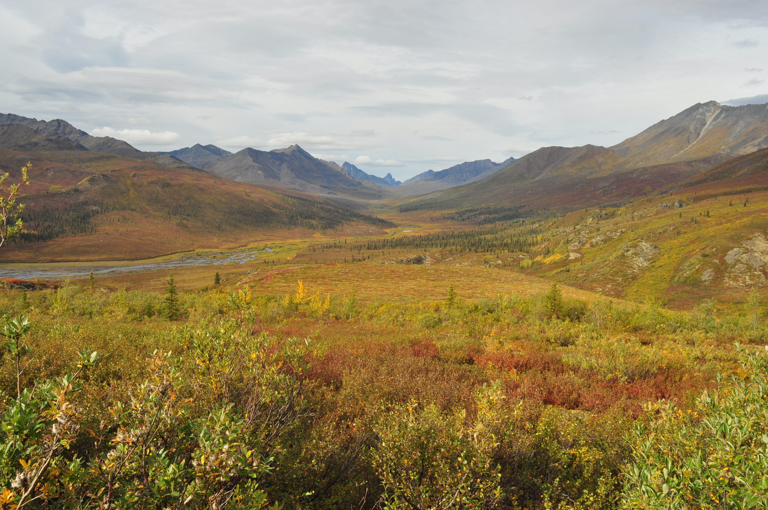
| Mid August to early September | Cool nights, tundra color, possible frost or snow | Gradually declining | Excellent photography and wildlife viewing, with shorter days and increasing weather risk |
A Decision Framework for Picking Dates
Choose June for long hiking windows and springlike landscapes, accepting wetter ground and heavier insect pressure. Choose July when schedule reliability and the widest range of commercial services matter most, but reserve early and expect fuller buses. Choose late August for red bearberry, golden dwarf birch, ripe blueberries, and potentially clearer air after cool nights. Early September suits flexible travelers prepared for closures, freezing temperatures, and snowfall.
- For first visits: Late June through early August provides the broadest practical access.
- For fewer people: Target the season’s edges and travel on weekdays.
- For photography: Late August combines autumn color with longer periods of low-angle light.
- For backpacking: July offers warmer averages, while August reduces insects and adds colder river crossings.
- For wildlife: Every period can be productive, but August berry crops may concentrate bears on tundra slopes.
Road Access, Buses, and Reservations
Crowds in Denali create specific logistical problems rather than constant congestion. Trailhead parking at Savage River can fill, popular bus departures sell out, and lodging near the entrance becomes expensive. Once a bus moves beyond the developed corridor, the landscape feels remarkably open. Travelers who secure transportation first can arrange hiking, lodging, and meals around a dependable framework.
Transit Buses and Narrated Tours
Transit buses emphasize transportation and allow passengers to leave at appropriate points, then board a later bus with available space. Narrated tours provide structured interpretation and remain with one vehicle. Both offer wildlife viewing from an elevated position. Drivers regularly stop for grizzly bears, caribou, moose, Dall sheep, and wolves, but sightings depend on distance, vegetation, and animal movement rather than a fixed route checklist.
Reserve limited bus departures and campgrounds as soon as booking becomes available, particularly for July. Backcountry backpackers also need an itinerary and authorization for the management units they enter. Entrance fees, booking procedures, road endpoints, campground operations, and permit systems can change, so confirm current details on the official park site before purchasing flights or nonrefundable lodging.
Private Vehicles and Savage River
The publicly drivable section reaches Savage River under normal summer operations. The 1.7-mile Savage River Loop follows both banks beneath rounded tundra ridges, while the more demanding Savage Alpine Trail runs about 4 miles between Savage River and Mountain Vista. The alpine route climbs steeply and is exposed to wind, making the direction and timing of transportation important.
At Savage River, gravel shifts underfoot beside fast gray water carrying sediment from the Alaska Range. The trail passes low willow where wind noise gives way to rushing water, then the valley walls tighten around the river. Climbing toward the alpine ridge replaces damp brush with springy tundra and broken rock. When clouds lift, the scale changes abruptly, revealing overlapping ridges and broad river flats far below.
What to Do in Denali National Park in Summer
A balanced visit combines a bus journey with a trail or independent outing. The park’s few maintained trails cluster near the entrance and Savage River, while much of the interior supports route finding across trail-free tundra. Three days allow time for one long road excursion, one frontcountry hiking day, and a weather buffer for rafting, cycling, or another attempt at mountain views.
Hikes Near the Entrance
The Mount Healy Overlook Trail climbs roughly 1,700 feet in about 2.7 miles one way from the visitor center area. Forest gives way to open slopes overlooking the Nenana River corridor and entrance development. Horseshoe Lake Trail forms a roughly 2-mile loop to an oxbow-shaped lake, with frequent evidence of beavers. The Taiga Trail provides a shorter forest walk through white spruce, paper birch, aspen, and mossy understory.
Use Trail Difficulty to Build the Day
Pair Horseshoe Lake or the Taiga Trail with arrival day because both begin near the main developed area. Reserve Mount Healy for a clear morning and carry layers for exposed upper slopes. Savage Alpine requires stronger footing and transportation planning. On any tundra route, avoid trampling wet vegetation, give moose and bears substantial space, and carry bear spray where it can be reached immediately.
How Crowds Change the Day
Peak summer demand is concentrated around the visitor center, bus depot, Riley Creek area, and commercial development near the park entrance. The interior does not feel continuously crowded because buses disperse along the road and passengers spread across overlooks and tundra. The practical effects appear earlier: limited departure choices, full parking areas, slower meal service, and fewer affordable rooms. Booking transportation before lodging can leave travelers stranded outside the park, so secure the bus and a place to sleep as a coordinated plan.
Use the Edges of the Day
Long daylight makes early mornings and evenings useful for frontcountry trails. Horseshoe Lake is quieter before visitor facilities become busy, while the McKinley Station Trail works well after a bus excursion. Wildlife also moves through the entrance area at these hours. Maintain at least 300 yards from bears and 25 yards from moose or other large animals. A moose with a calf can be especially defensive around brush where visibility is limited.
Protect a Weather Buffer
Clouds frequently hide Denali during otherwise productive days, so avoid tying the entire trip to one viewpoint or excursion. Keep one flexible half day for a second attempt from Mountain Vista, the Savage River area, or viewpoints along Highway 3 south of the park. Rain can delay flightseeing and rafting departures, while smoke from distant Alaska fires can reduce visibility. Travel insurance and refundable lodging become useful when weather dependent activities dominate the itinerary.
Backcountry Travel Requires a Different Plan
Most of Denali’s designated wilderness has no maintained trail system. Backpackers select management units, ride into the park, and navigate through tundra, willow, river bars, and passes. Mileage can be misleading: five off trail miles through knee high shrubs, boggy ground, or repeated stream channels may consume an entire day. Parties need map and compass skills even when carrying GPS, since batteries fail and broad valleys can make route choices difficult to judge.
Permits, Food Storage, and Route Selection
The permit process covers unit availability, wildlife safety, campsite placement, and approved bear resistant food storage. Build time into the schedule for orientation rather than planning to step off a bus immediately after arrival. First time Denali backpackers often fare better in open tundra units with manageable river crossings. Dense willow near waterways slows travel and increases the chance of surprising a bear, particularly where rushing water masks sound.
Cold Water Is a Primary Hazard
Glacial rivers can rise after warm afternoons or heavy rain, and their opaque water hides holes and unstable stones. Cross early when flows are often lower, unbuckle the pack waist belt, and turn back if water approaches knee depth with enough force to disturb balance. Solo crossings carry greater consequences. Trips involving major channels such as the Teklanika, Toklat, or McKinley rivers require route research and conservative judgment rather than reliance on mapped crossing points.
Match the Itinerary to Your Available Time
Denali National Park Summer trips work best when each day has one anchor activity. Bus travel consumes many hours, and wildlife stops make return times approximate. Leave space around fixed departures rather than scheduling dinner, a raft trip, or a train connection immediately afterward. Travelers arriving by rail should also account for luggage handling and transportation between the depot, lodging, and park facilities.
Sample Plans by Trip Length
| Time available | Primary plan | Useful addition | Main compromise |
|---|---|---|---|
| One full day | Park road bus excursion | Short entrance trail in the evening | Little weather flexibility |
| Two full days | Bus excursion and Mount Healy or Savage River hiking | Visitor center exhibits | Limited room for a canceled activity |
| Three full days | Road journey, hiking day, and flexible activity day | Rafting, cycling, or flightseeing | Requires three nights nearby |
| Five or more days | Frontcountry activities plus wilderness travel | Camping or multiple visibility attempts | More food and gear planning |
Prioritize According to Your Main Interest
Wildlife watchers should favor the longest practical road trip and keep binoculars accessible rather than packed overhead. Hikers gain more from two separate trail days than from forcing several steep routes into one outing. Photographers should reserve mornings and evenings for low light, carrying a telephoto lens for animals and a wider lens for braided river valleys. Families can combine sled dog demonstrations, visitor center exhibits, and Horseshoe Lake without committing to a demanding alpine route.
- Choose one day: Make the park road the priority.
- Choose two days: Add a maintained trail suited to the group’s ability.
- Choose three days: Preserve one block for weather dependent plans.
- Choose a longer stay: Consider camping, cycling, or permitted wilderness travel.
Planning a Denali National Park Summer Visit That Fits Your Priorities
The strongest Denali itinerary starts with dates matched to personal priorities. June brings exceptional daylight and active spring landscapes. July supports the widest activity range but places the greatest pressure on transportation and lodging. Late August brings tundra color, fewer insects, cooler nights, and a growing possibility of snow. None guarantees a view of the summit, so build the trip around landscapes, wildlife, and activities that remain worthwhile under clouds.
Reserve the hardest component first, usually the park road bus, campground, or nearby lodging, then add hikes and flexible activities around it. Pack for rain and near freezing conditions even when the forecast looks mild. With realistic travel times, a weather buffer, and respect for the park’s trail free wilderness, summer in Denali becomes manageable without losing the scale and unpredictability that define the Alaska Range.
Want to keep exploring? Browse all our Denali guides and articles for more trip-planning tips and ideas.
Gear & Essentials
Tell us about your trip and we will add what else you will want:
The basics
Worth having in the car whatever the park.
For this trip
Traveling with kids
Bringing a pet
RVing
Backcountry
On the water
Photography
Accessibility
As an Amazon Associate we earn from qualifying purchases, at no extra cost to you.