How to Plan a Trip to Hot Springs National Park
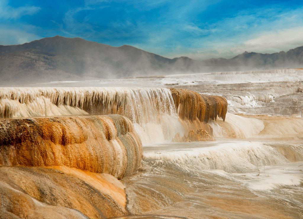
Photo: Unknown via Flickr (CC BY-NC-ND 2.0)
If you’re researching how to plan a trip to Hot Springs National Park, a little advance preparation goes a long way, because this compact but richly layered Arkansas park operates differently from almost every other unit in the national park system. Tucked into the Ouachita Mountains at roughly 600 to 1,400 feet in elevation, the park sits directly inside the city of Hot Springs, Arkansas, meaning Bathhouse Row, the thermal springs, and forested ridge trails are all within a few blocks or a short drive of each other. That urban integration is both an asset and a logistical puzzle worth thinking through before you arrive.
What makes the park genuinely distinctive is its dual identity. On one hand, it preserves 47 thermal springs that have been flowing at a remarkably consistent temperature of about 143 degrees Fahrenheit for centuries, long before the federal government set aside the land in 1832 as the first federally protected reservation in U.S. history. On the other hand, it contains more than 26 miles of hiking trails climbing the forested ridges of Hot Springs Mountain, West Mountain, North Mountain, and Sugarloaf Mountain, giving visitors a legitimate wilderness escape minutes from downtown. Understanding both sides of the park shapes every decision that follows.
How to Plan a Trip to Hot Springs National Park: Start Here
Location and Getting There
Hot Springs sits in central Arkansas, about 55 miles southwest of Little Rock via U.S. Highway 70 or Interstate 30 to U.S. 70 West. The drive from Little Rock takes roughly 55 to 65 minutes under normal conditions. From Dallas, the trip covers approximately 330 miles, typically around five hours via U.S. 67 North through Texarkana and then U.S. 70 West. Memphis is roughly 210 miles to the east along I-40 and then south.
The nearest commercial airport is Bill and Hillary Clinton National Airport in Little Rock, which receives flights from major hubs. Visitors flying in should plan to rent a car, as there is no direct shuttle service between the airport and the park. Within the city of Hot Springs, parking is available on Central Avenue near Bathhouse Row and at trailhead lots on Hot Springs Mountain Drive, though spaces fill quickly on warm weekends. Hot Springs Mountain Drive loops around the top of the mountain and connects to the observation tower area, making it the best vehicle access point for ridge-top views over the city and the Ouachita range.
Understanding the Park’s Layout
The park is divided into two distinct zones that require different mental models. The first is the historic district along Central Avenue, where Bathhouse Row presents eight grand bathhouse structures built between 1892 and 1923. These buildings reflect Gilded Age ambitions, clad in Spanish Colonial Revival and Italianate architecture, and several are now occupied by a brewery, a visitor center, an art gallery, and a restored bathhouse where visitors can still bathe in the thermal waters today. The second zone is the surrounding forested ridges, which the park service manages as natural area. These ridges rise abruptly from the valley floor, giving the terrain a more rugged character than the park’s small footprint might suggest.
The thermal springs themselves emerge along the western slope of Hot Springs Mountain. Most have been capped and channeled into the display springs and jug fountains visible along the Grand Promenade, a 0.7-mile brick walkway behind Bathhouse Row where visitors can observe flowing hot spring water and collect it in personal containers. The springs originate as rainwater that percolates down through the Ouachita Mountain rock, descends roughly 8,000 feet where geothermal heat warms it, and then rises back to the surface over a journey estimated at 4,000 years. That ancient cycling process is one of the more remarkable geological stories in the national park system.
Choosing the Right Time to Visit
Seasonal Conditions on the Trails and in Town
Hot Springs National Park sits in a humid subtropical climate zone, which means summers are genuinely hot and humid while winters are mild by most standards but can bring ice and occasional snow. Spring and fall offer the most comfortable conditions for hiking the ridge trails, and fall foliage on the forested slopes typically peaks in late October and early November, turning the views from the Hot Springs Mountain Tower particularly vivid.
Summer visits are workable if you plan outdoor activity for early morning and shift to indoor bathhouse experiences or the air-conditioned visitor center during midday heat. The park does not close seasonally, but some trail surfaces become slippery after winter ice events, and the mountain drive may close temporarily during those conditions. Wildflowers along the trail corridors, including native trilliums and phlox, peak in March and April, making early spring one of the most visually rewarding times on the forested trails.
| Season | Typical Conditions | Best For | Considerations |
|---|---|---|---|
| Spring (Mar-May) | Mild, occasional rain, wildflowers | Hiking, wildflower viewing | Some trail mud after rain |
| Summer (Jun-Aug) | Hot, humid, highs often above 90°F | Bathhouse experiences, early-morning hikes | Midday heat can be intense on exposed ridges |
| Fall (Sep-Nov) | Comfortable, low humidity, foliage color | All activities, photography | Peak visitation weekends in October |
| Winter (Dec-Feb) | Mild but variable, occasional ice | Quiet visits, thermal bathing | Icy trails possible, some road closures |
Weekend vs. Weekday Timing
Bathhouse Row and the Grand Promenade draw consistent weekend crowds, especially from Little Rock day-trippers who make the one-hour drive on Saturday mornings. If your primary goal is a serene walk along the Promenade or a contemplative soak at the operating bathhouse, arriving on a Tuesday or Wednesday morning shifts the experience considerably. Weekday mornings also mean easier parking near the Arlington Lawn area at the north end of Bathhouse Row, and shorter waits at the
thermal bathing facility if you have a reservation.
Trails, Thermal Springs, and Key Experiences
Hiking the Ridge Trails
The park’s trail network covers more than 26 miles and is more varied than most visitors expect from a site famous for its bathhouses. Hot Springs Mountain Trail is the easiest introduction, a paved path that climbs from the Promenade to the Hot Springs Mountain Tower, a 216-foot steel observation structure that sits at roughly 1,256 feet elevation and provides sweeping views over the city and the surrounding Ouachita ridgeline. The tower charges a small fee for access to the upper observation deck, and current pricing should be confirmed directly with the operator on site.
For a more strenuous outing, the Goat Rock Trail on the north end of the park covers about 1.5 miles and involves a steeper grade through mixed pine and hardwood forest to a sandstone outcrop with open views. The Sunset Trail is the park’s longest and most rewarding route, a roughly 10-mile loop connecting all four major ridges. Most hikers break it into segments: the North Mountain section features gentler terrain and interpretive signs about Ouachita geology, while the West Mountain and Sugarloaf Mountain sections involve more elevation change and denser canopy that keeps conditions cooler even in summer. The trail surface is natural dirt and rock throughout, so proper footwear matters, especially after rain.
Bathhouse Row and the Thermal Experience
Of the eight historic bathhouses on Central Avenue, Buckstaff Bathhouse is the only one that has operated continuously since its construction in 1912 and offers traditional thermal bathing services including whirlpool baths, loofah scrubs, and hot packs. Quapaw Baths and Spa, housed in a separate facility at the south end of the Row, provides a more contemporary spa experience with communal thermal pools and private bath options. Both require reservations, and same-day bookings are rarely available on weekends, so if bathing in the thermal waters is central to how you plan a trip to Hot Springs National Park, securing a reservation before your travel dates is essential.
The Fordyce Bathhouse, the grandest structure on the Row at three stories with a rooftop sundeck and stained glass ceilings, now serves as the park’s main visitor center and museum. Walking through its restored interior reveals what the peak bathhouse era looked like for wealthy visitors in the 1910s and 1920s: marble floors, a mechanical therapy room, a gymnasium with original equipment, and a music room. Admission to the Fordyce is free, and the exhibits do a thorough job of connecting the thermal science to the social history of the spa culture that made Hot Springs one of the most visited destinations in early 20th-century America.
Practical Gear and Day-Pack Checklist
Whether you are splitting your day between the historic district and the ridge trails or focusing exclusively on hiking, a few items make the experience more comfortable:
- Water bottle or hydration reservoir: the Grand Promenade jug fountains dispense actual thermal spring water, which is safe to drink and tastes faintly mineral, so a refillable container lets you try it without buying bottled water
- Trekking poles for the steeper sections of West Mountain and Sugarloaf Mountain, particularly useful after rain when sandstone steps become slick
- Sun protection: the ridge trails offer limited shade on exposed saddles, and the summer sun at midday is intense even at modest elevations
- A light layer for the Fordyce Bathhouse interior, which is air-conditioned and noticeably cool relative to summer outdoor temperatures
- Trail map downloaded offline from the park’s official NPS page, since cell coverage on the north end of the Sunset Trail can be inconsistent
- Cash or card for the observation tower fee and for any bathhouse services not pre-paid during reservation
Fees, Permits, and Logistics to Plan Your Hot Springs Trip
Hot Springs National Park charges no entrance fee for the park itself, which is one of the few remaining fee-free national parks. There is no timed-entry permit system currently in place. The costs you will encounter are the optional observation tower admission, bathhouse service fees, and any charges at the small paid parking areas near Bathhouse Row during peak hours. The NPS America the Beautiful annual pass does not cover the tower since it is operated by a concessionaire, but it may apply to certain ranger-led programs. Confirm current fee structures on the official NPS website before your visit, as concessionaire agreements can shift.
| Experience | Fee Type | Advance Booking Needed |
|---|---|---|
| Park entry and trails | Free | No |
| Fordyce Bathhouse museum | Free | No |
| Hot Springs Mountain Tower | Concessionaire fee (confirm on site) | No, walk-up |
| Buckstaff Bathhouse services | Per-service fee, varies by treatment | Strongly recommended |
| Quapaw Baths and Spa | Per-service or pool access fee | Yes, especially weekends |
| Grand Promenade spring water | Free | No |
Putting It All Together: How to Plan a Trip to Hot Springs National Park
Planning a trip to Hot Springs National Park works best when you treat the two halves of the park as complementary rather than competing. A practical one-day itinerary might look like this: arrive early and hike a section of the Sunset Trail on North Mountain while temperatures are still cool, descend to the Fordyce Bathhouse for a self-guided walk through the museum around midday, then spend the warmer afternoon hours at a pre-booked thermal bathing session at Buckstaff or Quapaw before finishing with a slow walk along the Grand Promenade at golden hour, when the light catches the brick walkway and the water flowing from the display springs. That sequence uses the park’s geography intelligently, keeping physical exertion in the cool morning and indoor or water-based experiences during the heat of the day.
Visitors with two or more days have room to explore the full Sunset Trail in segments, spend a second morning on the quieter West Mountain trails, and investigate the broader Hot Springs city context, which includes the Mid-America Science Museum, the historic Ohio Club, and the Garvan Woodland Gardens just southeast of town along Lake Hamilton. The city’s restaurant scene concentrated along Central Avenue and the Malvern Avenue corridor offers everything from diner-style breakfast spots to more polished dinner options, and local outfitters near downtown can point you toward kayaking and fishing access on the nearby Ouachita River and Lake Ouachita, one of the clearest natural lakes in the central United States.
The key to a satisfying visit is resisting the impulse to treat Hot Springs as just a bathhouse stop or just a hiking destination. It is genuinely both, and the contrast between soaking in 95-degree thermal water in a century-old building and then looking down on that same building from a forested ridge 600 feet above it is the experience that makes this park unlike anything else in the system. Nail the timing, book your bathing reservation early, download the trail map before you lose cell service, and you will arrive with a clear plan and leave with a much richer understanding of what makes this small, layered, historically improbable park worth the trip.
Interested in learning more? Explore our Denali Park Road Opens to Teklanika on April 28 to see how we can help bring your vision to life.