How to Spend 2 Days in Pinnacles National Park: Hiking, Caves, and Condor Watching
How to Spend 2 Days in Pinnacles National Park works best as a two entrance itinerary: hike the High Peaks and Bear Gulch from the east on day one, then explore the Balconies from the west on day two. The entrances sit only a few miles apart on a map, but no road crosses the park. Driving between them requires roughly 65 road miles and about 90 minutes in normal conditions, so changing sides during the same day wastes valuable hiking time.
Pinnacles protects the eroded remains of a volcanic field formed about 23 million years ago near present day Lancaster, California. Movement along the San Andreas Fault carried these rocks nearly 200 miles northwest. Faulting, erosion, and rockfall created the park’s spires, narrow ravines, and talus caves. The resulting terrain supports California condors, prairie falcons, Townsend’s big eared bats, and dense chaparral adapted to hot, dry summers.
Plan the Two Days Around the Separate Entrances
Use the east entrance for the High Peaks, Bear Gulch Reservoir, and Bear Gulch Cave. Enter from the west for the Balconies Cave and Balconies Cliffs loop. Our preferred sequence begins on the east side because the High Peaks circuit is the longer and more strenuous day. Day two then allows a shorter cave loop, additional condor watching, or an optional climb from Chaparral toward the High Peaks.
Reaching the East and West Sides
The east entrance is reached from California Highway 25 south of Hollister, followed by Highway 146 into the park. This side contains the campground and provides the most direct access to the Bear Gulch and Condor Gulch trailheads. The west entrance is reached from Soledad and U.S. Highway 101. Its final approach follows a winding section of Highway 146 that requires slower driving, especially after dark.
There is no fuel inside the park, and mobile reception is unreliable in the valleys. Fill the tank before leaving Hollister, King City, or Soledad, and download an offline map. If lodging outside the park, staying near Hollister or the Highway 25 corridor favors the east entrance. Soledad is considerably more convenient for the west side.
Parking Strategy and Trailhead Access
Bear Gulch has limited parking close to the main trail network. On spring weekends, holiday periods, and mild autumn Saturdays, those spaces can fill early. Starting near sunrise improves the odds of parking close to the trail and keeps the exposed Condor Gulch climb cooler. Overflow arrangements and transportation within the east side can change, so check cave status, entrance procedures, parking information, fees, and any current shuttle details on the official park site before departure.
West side hikers generally begin at the Chaparral area. Because the road ends here, parking demand concentrates at a single trailhead. Arrive with enough water and food for the complete outing. The narrow approach road makes a quick supply run less convenient than the map suggests.
Choose Dates for Open Caves and Manageable Heat
October through April generally provides the most comfortable hiking temperatures. Winter can bring rain, muddy trail surfaces, and water inside the talus caves, while spring adds wildflowers and longer daylight. Summer temperatures regularly climb into the 90s and can exceed 100°F in exposed valleys. High Peaks Trail has very little dependable shade, making a dawn start essential during warm weather.
What Changes Through the Year
| Period | Typical trail conditions | Main planning concern |
|---|---|---|
| December through February | Cool hiking weather, occasional rain, wet cave passages | Slippery rock and possible cave closures after storms |
| March through May | Mild mornings, wildflowers, rapidly warming afternoons | Busy parking areas and seasonal bat protections |
| June through September | Very hot valleys, dry chaparral, limited shade | Heat illness, dehydration, and elevated fire danger |
| October through November | Cooling temperatures and generally dry trails | Shorter daylight and lingering afternoon heat |
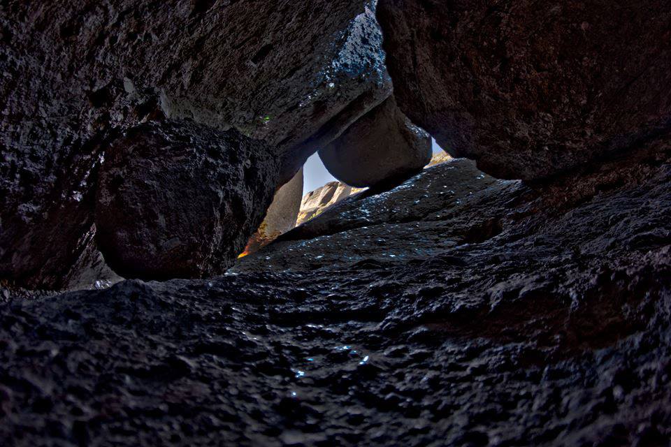
Bear Gulch and Balconies are talus caves formed where enormous boulders lodged above narrow stream channels. They are not limestone caverns with developed chambers. Water levels, storms, and bat activity influence access. Bear Gulch Cave is especially important habitat for a maternity colony of Townsend’s big eared bats, so portions close seasonally to protect roosting animals.
Gear That Matters at Pinnacles
- Headlamp: A phone light leaves no backup and occupies one hand inside the caves.
- Three liters of water per person: Carry more during warm weather or when combining loops.
- Grippy footwear: Cave rocks, polished steps, and High Peaks handrail sections can be slick.
- Sun protection: Use a brimmed hat, sunscreen, and light long sleeves on exposed ridges.
- Compact binoculars: Condors often circle far above the High Peaks before moving closer.
- Warm layer and rain shell: Winter mornings and shaded cave corridors feel much colder than open slopes.
Day One: Condor Gulch, High Peaks, and Bear Gulch
Begin at Bear Gulch and follow Condor Gulch Trail uphill, continue across the High Peaks, then descend by Rim Trail toward Bear Gulch Reservoir and Moses Spring Trail. Depending on minor route choices and whether the cave bypass is needed, expect roughly 6 to 7 miles with about 1,400 feet of cumulative climbing. Most hikers need four to six hours, excluding a long condor watching stop.
Climb Condor Gulch Before the Heat Builds
Condor Gulch gains elevation steadily through chamise, gray pine, buckwheat, and seasonal wildflowers. The first major viewpoint, Condor Gulch Overlook, sits about one mile from the trailhead and looks across the eroded volcanic formations. Beyond the overlook, the grade continues toward the junction with High Peaks Trail. This exposed ascent accounts for much of the day’s sustained effort, so maintain a measured pace rather than pushing through the cooler first mile.
Use the Overlook to Start Scanning for Condors
California condors have wingspans approaching 9.5 feet and often ride thermals above the ridges from late morning onward. Look for broad, flat wings with white patches beneath the leading edges. Turkey vultures are smaller, hold their wings in a shallow V, and rock from side to side. Many condors carry numbered wing tags that can be read through binoculars.
Cross the Steep and Narrow High Peaks Trail
The High Peaks route reaches its most technical terrain around Scout Peak and the Steep and Narrow section. Rock steps have been cut directly into the volcanic breccia, and metal handrails assist hikers across short exposed traverses. The trail is maintained, but several passages feel airy and require deliberate foot placement. Large packs, trekking poles, and fear of heights can make these sections awkward.
On the ridge, coarse rock presses through thin shoe soles, wind moves across the gaps, and voices from the switchbacks below fade quickly. The trail rounds a fin of orange gray breccia, then the view opens over folds of chaparral toward the Salinas Valley. Condors may pass at eye level here, their flight feathers making a low rustling sound when they bank close to the ridge.
Take the Bypass if Exposure Is a Concern
Hikers uncomfortable with the handrail sections can use the Tunnel Trail alignment to avoid the most exposed portion of High Peaks Trail. This alternative still provides volcanic scenery and substantial elevation, but it sacrifices some of the best ridge walking. Treat the bypass as a planned route choice rather than waiting until fatigue affects balance.
Descend to Bear Gulch Reservoir and the Cave
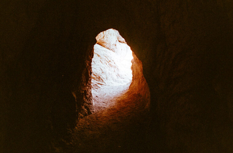
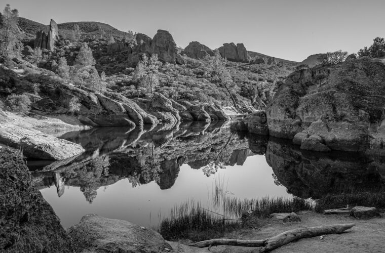
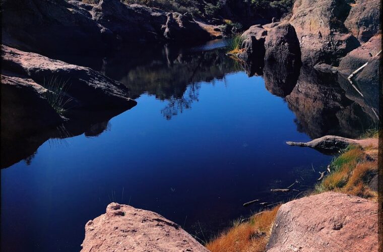
Continue toward Rim Trail and descend to Bear Gulch Reservoir, a small impoundment enclosed by boulders and volcanic walls. From the reservoir, Moses Spring Trail leads toward Bear Gulch Cave. When the cave route is open, expect low ceilings, stone steps, tight turns, and areas where water may cover the floor. Keep the headlamp on before entering rather than trying to adjust equipment in darkness.
A marked bypass allows hikers to remain outside when the cave is closed or when confined passages are uncomfortable. Below the cave, Moses Spring Trail returns through a shaded ravine toward Bear Gulch. The final descent is easier on the lungs but can be hard on tired knees, particularly after the high rock steps above Scout Peak.
Day Two: Balconies Cave and the Western Cliffs
From the Chaparral trailhead, follow Balconies Trail into the west side’s broad volcanic canyon. The standard Balconies Cliffs and Cave loop covers about 2.4 miles and generally takes 90 minutes to two hours. Although the elevation gain is modest compared with the High Peaks circuit, progress through the cave involves crouching, scrambling over boulders, and negotiating slick rock. Complete the cave first, then return above it on Balconies Cliffs Trail for open views across the formations.
Enter the Talus Passage from Below
Balconies Trail initially follows relatively level ground beneath Machete Ridge, a prominent rock wall used by experienced climbers. Near the cave junction, the canyon narrows and the route enters a jumble of house-sized boulders. Painted arrows and trail markers indicate the passage, but darkness can obscure them. Pack trekking poles before entering so both hands remain available, turn on headlamps, and maintain space between hikers where loose gravel collects on sloping rock.
Expect Scrambling Rather Than a Developed Cave Walk
Some sections require stepping across shallow water, ducking beneath wedged rocks, or using hands to climb polished surfaces. Conditions become more demanding after rain, when runoff moves through the canyon and rock holds become slick. Anyone unable to manage the scramble can remain on Balconies Cliffs Trail, which bypasses the enclosed passage and reconnects with the main route.
Return Above the Canyon
Balconies Cliffs Trail climbs onto the ledges above the cave before traversing exposed chaparral slopes. From these higher sections, look back toward Machete Ridge and the vertical walls enclosing the canyon. Prairie falcons often patrol these cliffs with rapid wingbeats, while condors usually appear broader and slower. Morning light reaches the west-facing formations gradually, making the return leg warmer than the shaded approach.
| Day two option | Approximate distance | Physical demand | Best use |
|---|---|---|---|
| Balconies Cave and Cliffs loop | 2.4 miles | Moderate, with cave scrambling | A shorter recovery day after High Peaks |
| Chaparral to Balconies without entering the cave | About 2 miles round trip | Easy to moderate | Families or hikers avoiding confined spaces |
| Juniper Canyon toward High Peaks | Variable, up to roughly 6 miles round trip | Strenuous, sustained climbing | Extra ridge time and condor watching |
Adjust the Second Day to Your Energy Level
The compact Balconies loop leaves room for a longer lunch, wildlife observation, or an additional climb. Hikers who recovered well from day one can follow Juniper Canyon Trail from Chaparral toward the High Peaks. This trail rises sharply through chaparral and volcanic gullies, eventually meeting Tunnel Trail and the upper network. Set a turnaround time before climbing because the descent can take longer when legs are already tired from the previous day.
Add Juniper Canyon for More Elevation
Juniper Canyon provides a quieter approach to the High Peaks than Condor Gulch, but it gains elevation quickly and receives substantial afternoon sun. A climb to the Tunnel Trail junction adds several miles and roughly 1,000 feet of ascent, depending on the turnaround point. Carry the same water supply used for day one. There is no dependable drinking water along the route, and the canyon’s enclosed lower slopes can feel hotter than the breezy ridge above.
Use a Conservative Turnaround Plan
- Allow enough daylight to descend the rocky switchbacks before dusk.
- Turn around early if heat, foot soreness, or knee pain changes your pace.
- Save at least one liter of water for the return to Chaparral.
- Stop at open overlooks rather than blocking narrow trail junctions while scanning for condors.
This approach to How to Spend 2 Days in Pinnacles National Park balances one demanding circuit with a flexible second outing. It also protects the itinerary from cave closures. If Balconies Cave is inaccessible, the cliffs route still supplies a complete loop, while Juniper Canyon adds distance and elevation for hikers seeking a fuller day.
Frequently Asked Questions
Two days provide enough time to experience both entrances without rushing between them. The answers below address the restrictions and route decisions most likely to affect the trip, particularly for families, pet owners, and visitors concerned about enclosed cave terrain.
Are dogs allowed on the hiking trails?
Pets are not allowed on Pinnacles hiking trails. Their access is generally limited to developed areas such as paved roads, campgrounds, and designated picnic areas, so arrange care before planning either day’s hike.
Do I need a permit to hike the High Peaks or caves?
A standard day hike does not generally require a backcountry permit, but park admission requirements still apply. Use the official-site logistics check described earlier for current entrance fees and any temporary access controls.
Are the caves suitable for children?
Older children comfortable with darkness, crouching, and short scrambles may enjoy them with close supervision. Carry one headlamp per person, and use the bypass if a child cannot maintain three points of contact on wet or uneven rock.
Can I visit both entrances in one day?
It is physically possible, but the long drive around the park consumes time better spent hiking. Assigning one entrance to each day reduces driving and allows an early trailhead start on both sides.
How much time should I allow each day?
Reserve five to seven hours for the High Peaks and Bear Gulch circuit, including wildlife stops. The Balconies loop takes around two hours, while adding Juniper Canyon can turn day two into a four to six hour outing.
A Two-Day Plan That Fits the Terrain
Begin on the east side with Condor Gulch, the High Peaks, Bear Gulch Reservoir, and Moses Spring Trail. That sequence tackles the greatest elevation gain while legs are fresh and places the exposed climb in the cooler morning. Spend the second day at Chaparral, moving through Balconies Cave before returning over the cliffs. Add Juniper Canyon only when temperature, daylight, and energy remain favorable.
The result is a practical survey of Pinnacles’ defining terrain: volcanic breccia ridges, talus caves, chaparral canyons, and condor habitat. Separate lodging and driving decisions by entrance, carry enough water for exposed climbs, and treat cave access as a condition-dependent part of the route. With those choices made before arrival, both days remain focused on the trail rather than avoidable logistics.
Want to keep exploring? Browse all our Pinnacles guides and articles for more trip-planning tips and ideas.
Gear & Essentials
Tell us about your trip and we will add what else you will want:
The basics
Worth having in the car whatever the park.
For this trip
As an Amazon Associate we earn from qualifying purchases, at no extra cost to you.