New River Gorge National Park and Preserve
New River Gorge National Park Adventure Guide: Rafting, Hiking, Climbing, and Scenic Overlooks
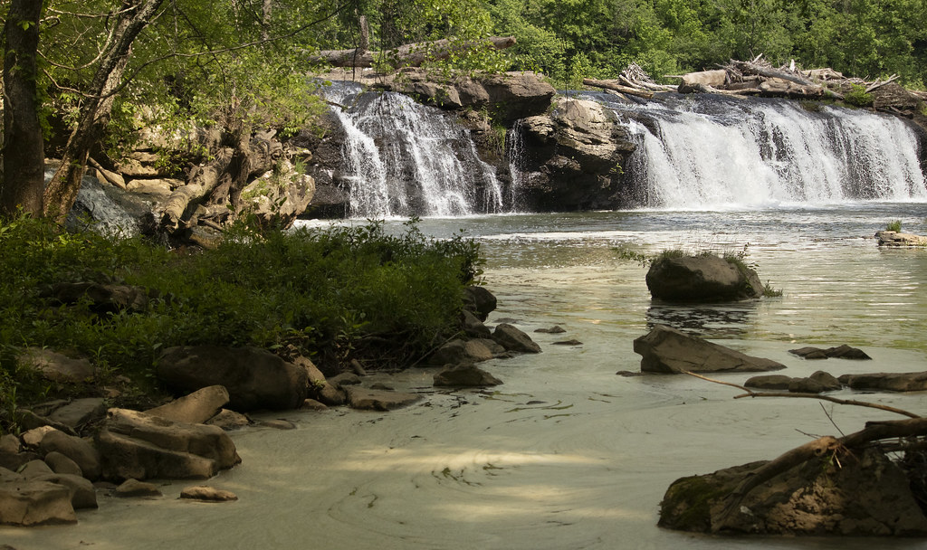
Photo: watts_photos via Flickr (CC BY 2.0)
Our New River Gorge National Park Adventure Guide begins at Diamond Point just after sunrise, where coarse Nuttall sandstone presses through the soil and the forest floor drops abruptly toward the New River. Water moves more than 800 feet below, hidden behind layers of oak and hemlock, while train wheels echo along the canyon. The scale becomes clear when the 3,030 foot New River Gorge Bridge appears across the gorge, its arch suspended above the river corridor.
New River Gorge National Park and Preserve follows 53 miles of river through southern West Virginia. Adventures are spread among separate access areas rather than concentrated around one entrance. Successful trips require matching the right base area with a hike, rafting section, climbing crag, or overlook. This first half covers the park’s geography, driving and parking strategy, physical demands, and two essential rim trails.
Understanding the Gorge Before Choosing an Adventure
The New River cuts through the Appalachian Plateau, exposing layers of sandstone, shale, and coal. Resistant Nuttall sandstone forms the cliffs used by climbers and the ledges crossed by hikers. Softer layers eroded into steep forested slopes, while coal seams encouraged the development of mining settlements such as Kaymoor and Nuttallburg. The river is geologically older than the surrounding Appalachian landforms, despite its name.
The northern gorge around Fayetteville
Canyon Rim is the most useful orientation point for first-time visitors. It sits beside US 19 near Fayetteville, close to the bridge, Endless Wall Trail, Long Point Trail, Fayette Station Road, and many established climbing areas. The Lower New River rafting run also finishes near this part of the gorge. Travelers prioritizing hiking, climbing, or whitewater should usually spend at least one full day here.
Grandview and the southern river corridor
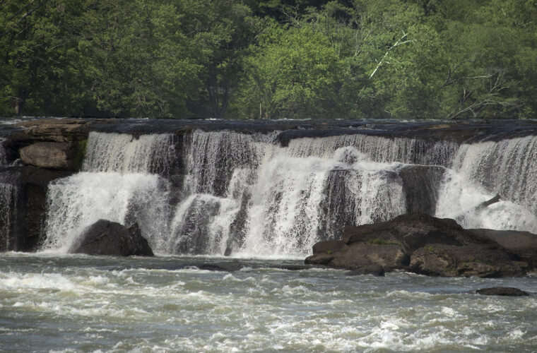
Grandview lies roughly 40 minutes south of Canyon Rim by road and overlooks a broad horseshoe bend in the New River. Its trails follow the rim through mature hardwood forest, reaching Turkey Spur and several exposed sandstone viewpoints. Farther south, Sandstone Falls spans approximately 1,500 feet across the river. Reaching the falls requires driving through Hinton and approaching on the river’s west side, since no direct road crosses the gorge there.
Road Access, Parking, Fees, and Permits
Interstate 64 serves Beckley and the southern park areas, while US 19 crosses the gorge near Fayetteville. The bridge makes north to south travel fast, but roads descending to the river are narrow, steep, and slower than map distances suggest. Cellular service fades in the canyon, so our team recommends downloading maps before leaving the rim.
Canyon Rim and the bridge area
Canyon Rim has the park’s primary visitor contact point and a short boardwalk descending to bridge viewpoints. Parking here is better suited to orientation and the overlook than to accessing nearby backcountry trails. Bridge Walk tours use the maintenance catwalk beneath the bridge and operate separately from ordinary park trails, with advance booking commonly required.
Trailhead parking requires an early start
Endless Wall has small parking areas at Fern Creek and Nuttall, both along Lansing Edmond Road. Long Point uses a separate gravel access south of Fayetteville. These lots can fill on fair-weather weekends, especially during autumn foliage. Parking along road shoulders can damage vegetation or obstruct emergency access, so have a second trail ready rather than creating an unofficial space.
Fayette Station Road and river access
Fayette Station Road forms an approximately 8 mile one-way scenic route from the rim to the river and back. It includes sharp turns, steep grades, low-clearance concerns in places, and a narrow bridge near river level. Large vehicles and trailers need extra planning. The park has generally not charged an entrance fee, but commercial activities, organized events, and some guided experiences may require fees or permits. Confirm current access, fee, and permit details on the official park site.
Matching Trails to Time and Fitness
Distances can appear modest because many routes begin near the rim, but elevation loss changes the effort sharply. A descent toward a mine site or river access must be regained on the return. Summer humidity, loose sandstone, exposed roots, and wet leaves also make the terrain more tiring than a smooth path of equal length.
Core trail comparison
| Trail | Distance | Typical difficulty | Primary feature |
|---|---|---|---|
| Endless Wall | 2.4 miles point to point, plus road connection | Moderate | Cliff-top overlooks and sandstone walls |
| Long Point | 3.2 miles round trip | Moderate | Direct view of the New River Gorge Bridge |
| Grandview Rim to Turkey Spur | About 3.2 miles one way | Moderate | River bends and layered gorge views |
| Castle Rock | About 0.6 mile loop | Moderate to strenuous | Narrow sandstone passages and exposed terrain |
| Kaymoor Miners | About 2 miles round trip | Strenuous | Mine remains and 821 steps toward the coke ovens |
Gear that suits gorge trails
Water drains quickly from exposed sandstone, but shaded soil and wooden steps can remain slick after rain. Footwear needs dependable tread rather than heavy insulation. Even short hikes deserve more water than their mileage suggests because humid air limits cooling.
- Traction: Wear hiking shoes with a firm rubber sole for wet rock, roots, and leaf-covered slopes.
- Water: Carry at least one liter per person for a short rim hike, with more for summer or connected routes.
- Navigation: Save an offline map because intersecting climber paths can resemble official trails.
- Sun and insect protection: Rim overlooks are exposed, while wooded sections support ticks and mosquitoes.
- Layering: Pack a light rain shell because thunderstorms can develop quickly above the plateau.
Walking the Two Essential Bridge View Trails
Endless Wall and Long Point show the gorge from opposite perspectives. Endless Wall follows the cliff line and reveals the canyon in sections. Long Point crosses a wooded plateau before ending at one broad viewpoint. Both fit into a half day, although combining them during summer requires additional water and an early start.
Endless Wall Trail from Fern Creek
Starting at Fern Creek gives the route a logical progression. The path enters a mixed oak forest, crosses Fern Creek on small bridges, and approaches the cliff through rhododendron and hemlock. Side paths lead toward climbing access, so remain on the signed trail and avoid approaching unprotected cliff edges.
Diamond Point and the Nuttall exit
Diamond Point is the principal overlook, reached after roughly the first half of the hike from Fern Creek. Beyond it, the trail repeatedly pulls away from and returns to the rim before ending at the Nuttall parking area. Completing the outing as a loop requires a roadside walk of roughly half a mile along Lansing Edmond Road. Hiking with two vehicles avoids that exposed connection.
Long Point Trail and its final approach
Long Point begins gently through second-growth forest and passes a wetland area where the tread can become muddy. The final section grows rockier and descends slightly before reaching an exposed sandstone point. The bridge fills the upstream view, with the river and railway corridor far below. Keep children and dogs close because the viewpoint has substantial unguarded drops and little room to move away from other groups.
Rafting and Climbing in New River Gorge National Park
The Lower New River is the park’s principal commercial rafting section. Trips commonly run from Cunard to Fayette Station, covering roughly 8 miles through a sequence of Class III and Class IV rapids, with some features rated Class V at particular water levels. Named rapids include Upper and Lower Railroad, Keeneys, Double Z, and Fayette Station. Water volume changes the route through each rapid, so guided trips remain the practical choice for visitors without substantial whitewater experience.
Most climbing occurs on hard Nuttall sandstone cliffs between 30 and 120 feet high. The rock provides small edges, horizontal cracks, and steep faces, but many established routes are rated 5.9 or harder. Endless Wall, Kaymoor, and Beauty Mountain contain hundreds of routes reached by steep approach paths. New climbers should book a qualified guide rather than relying on gym grades, since outdoor protection, anchor evaluation, and cliff-edge movement introduce separate skills.
What the Lower New feels like from a raft
Below Cunard, the current gathers speed between dark boulders and folded sandstone walls. The raft floor flexes underfoot while the guide calls strokes over the sound of breaking water. Between rapids, the gorge rises high enough to conceal roads and buildings. Near Fayette Station, the steel bridge appears overhead, 876 feet above the river, and its arch changes from a thin line into a structure spanning the entire sky.
Choosing a rafting trip
Guided Lower New runs
First-time rafters should describe their swimming ability, fitness, and previous paddling experience honestly when booking. Outfitters set minimum ages according to water level and trip format. Helmets and personal flotation devices are normally supplied, while participants generally bring secure footwear, quick-drying clothing, sunscreen, and any necessary medication in an agreed waterproof container.
Private boating responsibilities
Private paddlers need the ability to read high-volume rapids, recognize undercut rocks, organize rescue systems, and select lines that change with river gauge levels. Put-in and take-out logistics also require separate vehicles. Cold water can create hypothermia risk even when the air feels warm, making thermal protection and a properly fitted whitewater flotation device essential.
Planning a climbing day
Approach trails descend from the rim and frequently branch toward individual walls. Carry a current climbing guidebook, wear a helmet, and keep equipment contained near cliff edges. Local sandstone can remain damp in shaded corners after rain. Climbers should inspect fixed hardware, avoid blindly trusting slings left in place, and protect trees from rope abrasion when setting anchors.
Seasonal Conditions and a Practical Packing Plan
Spring brings strong river flows, blooming redbud, and wet trail surfaces. Summer adds heat and humidity, although the forest canopy shades many approaches. Autumn usually provides cooler hiking and climbing temperatures, accompanied by crowded overlooks during peak foliage. Winter opens long views through bare hardwoods, but ice can form on steps, bridges, cliff approaches, and shaded sections of trail.
Thunderstorms deserve particular attention because exposed overlooks and cliff tops provide little protection from lightning. Move away from rim edges when thunder is audible and postpone climbing when rock, ropes, or anchors are wet. This New River Gorge National Park Adventure Guide also recommends separating hiking equipment from river clothing, since a soaked cotton layer becomes uncomfortable and potentially dangerous during a cool shuttle ride.
Conditions by season
| Season | Typical advantage | Primary concern |
|---|---|---|
| March through May | Higher river flows and spring wildflowers | Mud, rain, and variable temperatures |
| June through August | Long daylight and full forest canopy | Humidity, thunderstorms, and dehydration |
| September through November | Cooler climbing weather and foliage | Busy parking areas and slippery fallen leaves |
| December through February | Open views and fewer visitors | Ice, short daylight, and cold water |
Pack for the activity, not the mileage
- For Kaymoor: Bring trekking poles if they help on stairs, extra water, and enough energy for the sustained climb back to the rim.
- For Grandview: Carry traction-focused footwear because stone steps and narrow passages hold moisture.
- For rafting: Use closed, secure shoes and synthetic layers. Leave loose sandals, cotton sweatshirts, and valuables behind.
- For climbing: Add a helmet, route information, anchor materials appropriate to the objective, and a headlamp for delayed exits.
- For every outing: Carry a paper or offline map, basic first aid supplies, food, and a rain layer.
Building a manageable adventure day
Pair activities by location rather than trying to cross the park repeatedly. A Lower New rafting trip combines naturally with Canyon Rim or Fayette Station Road. Endless Wall and a guided climbing session can occupy a separate day. Grandview and Sandstone Falls belong together geographically, although their trails and overlooks still require several hours once driving and stops are included.
Frequently Asked Questions
New River Gorge trips often involve separate trailheads, river access points, and commercial meeting locations. Leave time for winding roads and shuttle movements rather than estimating the day from hiking mileage alone. The answers below address the practical questions that most often affect an itinerary.
Do I need a permit to hike or climb?
Ordinary day hiking and recreational climbing generally do not require individual permits. Commercial guiding, organized events, research, and other special uses may require authorization, as explained in the earlier logistics section.
Are dogs allowed on the trails?
Leashed pets are allowed on many park trails, with a leash no longer than 6 feet. Cliff edges, metal stairs, hot sandstone, and crowded overlooks can make routes such as Long Point and Kaymoor difficult for some dogs.
Can children hike Endless Wall or Long Point?
Many active children can manage either trail, but both reach unguarded sandstone cliffs. Adults should maintain direct control near overlooks and choose Long Point only if the group can handle rocky footing on the final approach.
How many days should I spend in the park?
Two full days allow one northern gorge hiking day and one rafting, climbing, or southern sightseeing day. Three days provide enough time to add Grandview and Sandstone Falls without rushing between distant access areas.
Can visitors swim in the New River?
The river contains strong currents, rapids, submerged hazards, and abrupt depth changes. Swimming should be limited to places and conditions appropriate for the visitor’s skills, with a properly fitted flotation device used around moving water.
Putting the Gorge Plan Together
A successful visit starts with one geographic zone and one primary activity each day. Use Fayetteville and Canyon Rim for bridge views, Endless Wall, Long Point, Lower New rafting, and major climbing areas. Reserve a separate block for Grandview and Sandstone Falls, since the winding road network makes them poor additions to an already full northern itinerary.
Match the route to the return effort, begin before small trailhead lots fill, and prepare for wet rock, humidity, exposed cliffs, and limited cellular service. With those constraints handled, the gorge becomes straightforward to explore: rim trails explain its scale, the river reveals its depth, and the sandstone cliffs show how geology continues to shape every adventure.
Want to keep exploring? Browse all our New River Gorge guides and articles for more trip-planning tips and ideas.
Gear & Essentials
Tell us about your trip and we will add what else you will want:
The basics
Worth having in the car whatever the park.
For this trip
On the water
As an Amazon Associate we earn from qualifying purchases, at no extra cost to you.