










Mather Point
| Type | Picnic Area |
|---|---|
| Facilities | Restrooms · Parking · Shuttle stop |
At a glance
- Area: Grand Canyon
- Place type: Picnic area
- Best known for: Broad canyon views, photography, sunrise, and sunset
- Amenities: Picnic tables, amphitheater, interpretive exhibits, and scenic viewpoints
- Facilities: Restrooms, parking nearby, and a shuttle stop
- Accessibility: Wheelchair accessible
- Visitor center: Grand Canyon Visitor Center
- Airports: Flagstaff Pulliam Airport (FLG) and Phoenix Sky Harbor International Airport (PHX)
Why visit
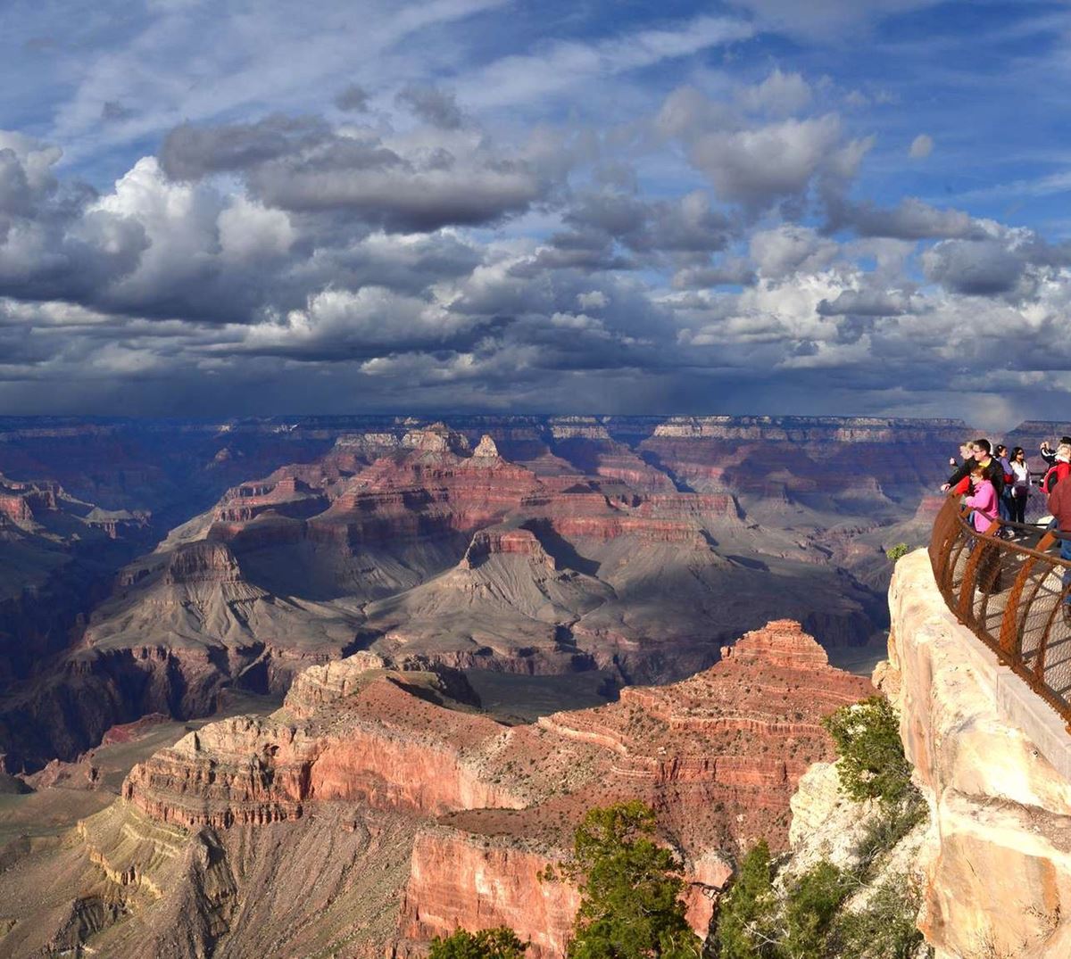
Mather Point gives many South Rim visitors their first view into the Grand Canyon. Its wide outlook reveals dramatic formations across the canyon.
Clear conditions can provide views more than 30 miles east and more than 60 miles west. Small sections of the Colorado River are visible below.
Visitors may also see Phantom Ranch at the canyon bottom. Numerous trails can be seen crossing the surrounding landscape.
The viewpoint is popular throughout the year for sunrise and sunset. Arrive early to watch the canyon’s colors shift as the light changes.
Getting there
Mather Point is a short walk from the Grand Canyon Visitor Center and its parking lots 1–4. There is no parking directly at the viewpoint.
Parking is available nearby, including bus parking about 0.1 miles away and RV parking about 0.2 miles away. A restroom is at the site.
The free Kaibab/Rim Route, also called the Orange Route, stops at Mather Point. The Grand Canyon Visitor Center shuttle stop is about 0.2 miles away.
The Grand Canyon Visitor Center Transit Pavilion is also about 0.2 miles away. An information kiosk is the same distance from Mather Point.
Tusayan, Arizona, is about 6 miles away by straight-line distance. Williams is about 56 miles away, and Flagstaff is about 65 miles away.
The park can also be reached through Desert View, or the East Entrance. It is 32 miles east of the village via US 89, Cameron, and SR 64.
What to see and do
Look across the canyon from the scenic viewing areas and photograph the formations. On clear days, the long sightlines extend east and west.
Look below for scattered glimpses of the Colorado River. Phantom Ranch and several trails across the canyon landscape may also be visible.
Sunrise and sunset draw visitors throughout the year. Arriving early provides time to find a viewing place before the colors begin changing.
Picnic tables make Mather Point suitable for a meal or break. Historical and interpretive information and exhibits are available in the area.
An amphitheater is about 0.1 miles away. A theater and shelter are also about 0.1 miles from the viewpoint.
History and nature
Mather Point is named for Stephen Tyng Mather, the National Park Service’s first director. He was a wealthy Chicago businessman and an active conservationist.
Mather supported public lands and moved to Washington, D.C., in 1915. He helped establish the National Park Service and became its first director in 1917.
He promoted access, development, and public use of parks until leaving office in 1929. He considered exceptional scenery central to creating national parks.
Mather worked to establish parks before development changed their lands. He hoped enthusiastic visitors would support parks and share that support with elected officials.
During his leadership, the National Park Service expanded to include Grand Canyon, Shenandoah, Great Smoky Mountains, and Mammoth Cave National Parks.
He also helped define how National Park Service areas would be developed while remaining protected for future generations. His work established a lasting foundation for the agency.
The canyon’s visible natural features include extensive rock formations and limited views of the Colorado River. Trails can be seen crossing the landscape below.
When to go
Mather Point is used for sunrise and sunset viewing throughout the year. Arrive early enough to experience the changing light and colors.
Weather varies greatly across Grand Canyon National Park because elevations range from about 2,500 feet at the bottom to about 8,400 feet on the North Rim.
Winters are generally cold and snowy. Summers can include periods of excessive heat.
Temperatures inside the canyon are commonly 20 to 30 degrees warmer than temperatures on the rims. Conditions may change quickly, so check the forecast before visiting.
Both the South Entrance and Desert View entrance operate 24 hours per day, 7 days per week.
Accessibility
Mather Point is wheelchair accessible. The site has restrooms, picnic tables, interpretive information, scenic viewing areas, and a shuttle stop.
There is no parking at the viewpoint itself. Nearby visitor center parking lots connect to Mather Point by a short walk.
The free Kaibab/Rim Route stops at the viewpoint. The visitor center’s other shuttle facilities are about 0.2 miles away.
Fees and rules
Grand Canyon National Park entrance fees are:
- Private vehicle: $35
- Motorcycle: $30
- Per person: $20
- Nonresident: $100
Credit cards and America the Beautiful passes are accepted at the entrances. Cash is not accepted.
The South Entrance Station near Tusayan handles the most traffic. Lines between 9:30 a.m. and 4 p.m. can produce waits of up to 2 hours.
The East Entrance at Desert View usually has shorter waits. Follow posted rules and leave no trace during the visit.
Nearby trails and places
The Grand Canyon Visitor Center Trail begins here and is about 0.8 miles as mapped. Mather Point Trail is about 0.1 miles away and about 0.7 miles as mapped.
Village Greenway is about 0.2 miles away and about 2.5 miles as mapped. Kaibab Greenway is about 0.3 miles away and about 2.2 miles as mapped.
Tusayan Greenway is about 0.3 miles away and about 6.4 miles as mapped. Trailer Village Trail is about 0.7 miles away and about 0.4 miles as mapped.
Nearby facilities and destinations include:
- Restroom: At Mather Point
- Bus parking: About 0.1 miles away
- Amphitheater: About 0.1 miles away
- Theater: About 0.1 miles away
- Shelter: About 0.1 miles away
- Grand Canyon Visitor Center shuttle stop: About 0.2 miles away
- Drinking water: About 0.2 miles away
- Grand Canyon Visitor Center Transit Pavilion: About 0.2 miles away
- RV parking: About 0.2 miles away
- Information kiosk: About 0.2 miles away
Before you go
Check current conditions, weather forecasts, and park alerts on the National Park Service website. Conditions can change quickly across the park’s large elevation range.
Carry water, pack layers, and arrive early for sunrise or sunset. Use nearby parking or the free shuttle because no parking is available at Mather Point.
Traffic can be heaviest at the South Entrance from 9:30 a.m. to 4 p.m. Consider the East Entrance when its route fits the trip.
Questions
Is there parking at Mather Point?
There is no parking directly at Mather Point. Parking lots 1–4 by the Grand Canyon Visitor Center are within walking distance.
Does a shuttle stop at Mather Point?
Yes. The free Kaibab/Rim Route, also called the Orange Route, stops at Mather Point.
What can visitors see from Mather Point?
Visitors can see broad canyon formations, several trails, Phantom Ranch, and small sections of the Colorado River.
How far can visitors see from Mather Point?
On clear days, views may extend more than 30 miles east and more than 60 miles west.
Is Mather Point wheelchair accessible?
Yes. Mather Point is wheelchair accessible and has nearby parking, restrooms, picnic tables, and shuttle service.
Is Mather Point good for sunrise and sunset?
Yes. It is popular for both throughout the year. Arrive early to see the colors change.
Who was Mather Point named after?
It honors Stephen Tyng Mather, a conservationist who became the National Park Service’s first director in 1917.
Are there restrooms and drinking water near Mather Point?
Restrooms are at the site. Drinking water is about 0.2 miles away.
Nearby
Trails
Places
- Restroom
- Bus Parking
- Amphitheater
- Theater
- Shelter
- Grand Canyon Visitor Center
- Drinking Water
- Grand Canyon Visitor Center Transit Pavillion
On the map
10 trails14 places to see16 visitor services
Facts on this page draw on the National Park Service: Mather Point (nps.gov)