










Murie Ranch Trail
| Length | about 0.6 miles as mapped by NPS |
|---|---|
| Surface | Earth |
| Open to | Hiking |
| Route | One way (out and back doubles it) |
| High point | about 6,450 ft |
| Low point | about 6,440 ft |
At a glance
- Length: About 0.6 miles one way as mapped by the National Park Service
- Typical walk: The NPS describes the full outing as 1.1 miles round trip
- Time: Typically 40 minutes
- Route: Out and back when returning to the starting point
- Difficulty: Easy
- Surface: Earth
- Use: Hiking
- Season: Spring, summer and fall
- Time of day: Day
- Start: Murie Ranch Trailhead at the Craig Thomas Discovery and Visitor Center
- End: Murie Ranch
- Elevation: About 6,450 feet at the mapped start and about 6,440 feet at the end
- Parking: Craig Thomas Discovery and Visitor Center
Why hike it
Murie Ranch Trail offers a short, easy walk from the visitor center to one of Grand Teton’s important historic places. The path winds through woods before reaching the ranch.
Visitors can explore the ranch area before returning along the same route. The ranch preserves the legacy of influential conservationists and the ideas discussed at their home.
Getting to the trailhead
Park at the Craig Thomas Discovery and Visitor Center. The trail starts behind the Moose statue outside the building. A trailhead is available there.
The visitor center and Olaus Murie’s Studio are at the trail’s location. The route starts near Murie Ranch Trailhead and ends near the Murie Ranch.
Moose, Wyoming, is at the trail’s location. Jackson, Wyoming, is about 12 miles away in a straight line. Nearby airports are Jackson Hole Airport and Idaho Falls Regional Airport.
Visitors can enter Grand Teton National Park at any time. However, motor vehicle access and visitor services change during the year.
On the trail
The mapped route covers about 0.6 miles from the visitor center to Murie Ranch. Its ends are in different places, so returning on foot doubles the mapped route.
The NPS describes the usual outing as 1.1 miles round trip with about 50 feet of elevation gain. Its average slope is 3%. The trail is flat but narrow.
Elevation estimates from the mapped route place its high point at about 6,450 feet and low point at about 6,440 feet. The one-way route descends about 10 feet without a mapped climb. That descent becomes the climb on the return.
The Craig Thomas Discovery and Visitor Center is at about mile 0. Murie Ranch is at about mile 0.6. After reaching the ranch, visitors can explore or return to the visitor center.
What you will see
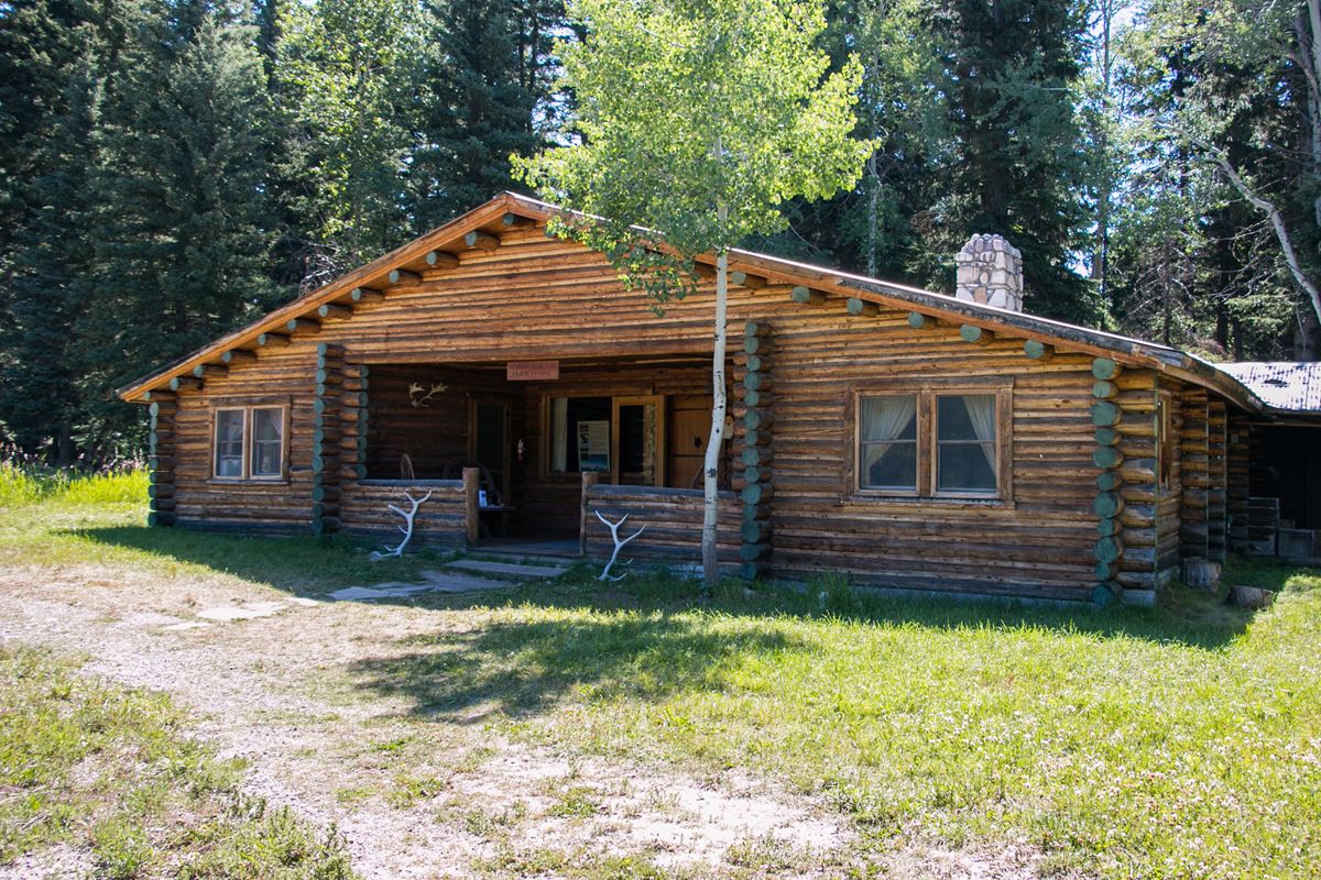
The trail follows a winding path through the woods. Its destination is the rustic Murie Ranch, where conservation research, writing and advocacy took place.
Olaus Murie’s Studio and the Murie Homestead Cabin are nearby. The cabin is about 0.1 miles away. The ranch itself stands at the route’s far end.
History and nature
Brothers Olaus and Adolph Murie married sisters Margaret and Louise. They acquired the STS Ranch in 1945. It later became known as the Murie Ranch.
The ranch served as the home of Olaus and Mardy Murie. Both became highly influential figures in the American conservation movement. Their work helped develop modern approaches to wilderness protection and public-land expansion.
Research, publications and advocacy were central to life at the ranch. Scientists, authors and environmental leaders gathered there for decades to exchange ideas and coordinate major conservation work.
Conversations at the ranch contributed to the Wilderness Act of 1964 and the Alaska Lands Act of 1980. These laws preserved millions of federally owned acres and reinforced American wilderness conservation.
Murie Ranch is now a National Historic Landmark. The designation recognizes the Muries’ enduring role in protecting valued landscapes across the nation.
When to go
The NPS lists spring, summer and fall as seasons for this daytime hike. Daily docent-led ranch tours are offered during summer. Consult the park calendar for current schedules and details.
Weather can change sharply throughout the year. Snow and frost can occur during any month in Grand Teton National Park.
April, May and June bring mild days, cool nights, rain and snow. July and August usually have warm days and cool nights. Afternoon thunderstorms are common.
September, October and November alternate sunny days with cold nights, rain and occasional snowstorms. From December through April, sunny periods occur between storms. Nights are frigid, and snow covers the mountains and valley.
Accessibility
The NPS describes the hike as 1.1 miles round trip with about 50 feet of elevation gain. The average slope is 3%.
Although the trail is flat, it is narrow and has an earth surface. Access begins from parking at the Craig Thomas Discovery and Visitor Center.
Permits, fees and rules
Grand Teton National Park’s listed entrance fees are:
- Private vehicle: $35
- Motorcycle: $30
- Per person: $20
- Commercial sedan: $25
The trail is open to hiking. Follow posted rules and leave no trace. Check current park alerts before traveling because access and visitor services vary by season.
Nearby trails and places
Several services and points of interest are close to Murie Ranch Trail:
- At the trail: Olaus Murie’s Studio and Craig Thomas Discovery and Visitor Center
- About 0.1 miles away: Murie Homestead Cabin
- About 0.2 miles away: Discovery Spot: Wildlife Walk and A Boat’s Purpose
- About 0.2 miles away: Moose Post Office and Moose Post Office Parking
- About 0.2 miles away: Moose locale and Moose Overflow Parking D
- About 0.3 miles away: Moose Boat Launch
Nearby mapped routes include Teton Park Rd, about 0.4 miles away and about 7.9 miles long. The Multi Use Pathway Moose to Gros Ventrre Jct Trail is about 0.5 miles away and about 5.4 miles long.
Menor’s Ferry West Trail is about 0.5 miles away and about 0.3 miles long. Moose Jct to Antelope Flats Rd is about 0.6 miles away and about 1.2 miles long.
Before you go
Check current conditions, alerts and the summer ranch-tour calendar on the park’s NPS website. Confirm visitor center services and motor vehicle access before departure.
Carry water and pack layers for changing temperatures. Afternoon thunderstorms are common in July and August. Snow or frost remains possible during any month.
Questions
How long is Murie Ranch Trail?
It is about 0.6 miles one way as mapped by the National Park Service. The NPS describes the usual outing as 1.1 miles round trip.
How long does the Murie Ranch hike take?
The typical duration is 40 minutes.
Where does Murie Ranch Trail begin?
It begins behind the Moose statue outside the Craig Thomas Discovery and Visitor Center.
Where should visitors park for Murie Ranch Trail?
Park at the Craig Thomas Discovery and Visitor Center.
Is Murie Ranch Trail difficult?
The NPS rates it easy. The route is flat but narrow, with an average slope of 3%.
What seasons are recommended for Murie Ranch Trail?
The NPS lists spring, summer and fall for this daytime hike.
Are tours available at Murie Ranch?
Daily docent-led tours are offered during summer. Consult the park calendar for the latest schedule and tour information.
Why is Murie Ranch historically important?
Conservation leaders met there, and discussions helped inspire the Wilderness Act of 1964 and Alaska Lands Act of 1980.
Nearby
Trails
Places
- Olaus Murie’s Studio
- Craig Thomas Discovery and Visitor Center
- Murie Homestead Cabin
- Discovery Spot: Wildlife Walk
- A Boat’s Purpose
- Moose Post Office
- Moose Post Office Parking
- Moose
On the map
6 trails13 places to see8 visitor services
Facts on this page draw on the National Park Service: Murie Ranch Trailhead (nps.gov)