











Great Smoky Mountains National Park
Abrams Falls
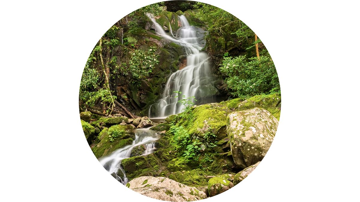
| Type | Waterfall |
|---|---|
| Elevation | about 1,470 ft |
At a glance
- Place: Abrams Falls
- Park: Great Smoky Mountains National Park
- Area: Cades Cove, Tennessee
- Type: Waterfall and Cades Cove point of interest
- Elevation: About 1,470 feet
- Trail distance: About 5 miles round trip
- Typical hiking time: 120 minutes, or 2 hours
- Trailhead: Abrams Falls Trailhead on Cades Cove Loop Road
- Amenity: Scenic viewpoint and photo spot
- Swimming: Strongly discouraged because of the undertow and hazardous conditions
Why visit
Abrams Falls is one of the park’s most popular waterfall hikes throughout the year. Abrams Creek carries a substantial volume of water because it drains the entire Cades Cove basin.
The creek drops over a sandstone ledge into one of the park’s broadest and deepest plunge pools. The waterfall’s powerful flow makes it especially dramatic despite its limited height.
National Park Service information describes the drop as about 25 feet. The app guide gives a height of about 20 feet. Both sources emphasize the force and volume of the water.
Getting there
The hike begins at the Abrams Falls Trailhead parking area. It sits at the far western end of Cades Cove Loop Road, between signposts 10 and 11.
The route is about 5 miles round trip. The National Park Service gives a typical duration of 120 minutes, or 2 hours.
Sugarlands Visitor Center is about 20 miles away. Gatlinburg, Tennessee, and Pigeon Forge, Tennessee, are each about 22 straight-line miles away. Cherokee, North Carolina, is about 33 straight-line miles away.
Travelers may use McGhee Tyson Airport or Asheville Regional Airport. No airport-to-trailhead distances are provided.
The park’s primary roads operate continuously throughout the year when weather permits. These include Newfound Gap Road, also called US-441, Little River Road, and Laurel Creek Road. Secondary roads close seasonally.
What to see and do
The main activity is hiking to Abrams Falls. The trail passes through rhododendron corridors and forests containing hemlock, pine, and oak. Several creek crossings occur along the route.
At the falls, Abrams Creek pours over sandstone into a wide, deep pool. Hemlock and rhododendron grow along the creek banks. The falls and pool provide a designated scenic viewpoint and photo opportunity.
Do not enter the pool based on its size or appearance. Swimming is strongly discouraged. The current near the waterfall can be more powerful than it seems, and the pool has an undertow and dangerous conditions.
History and nature
Abrams Creek drains the whole Cades Cove basin. That broad drainage area supplies the heavy flow that gives Abrams Falls its force.
The creek also supports 3 fish species considered rare, threatened, or endangered within the park. Otters were returned to this area and are sometimes spotted near the waterfall.
The route’s vegetation includes rhododendron, hemlock, pine, and oak. Rhododendron forms corridor-like sections along the trail, while rhododendron and hemlock also border the creek.
The waterfall flows across a sandstone ledge. Its plunge pool is among the park’s widest and deepest.
When to go
Abrams Falls is a popular hike year-round. Access still depends on road, trail, construction, and weather conditions.
A dated National Park Service notice scheduled trail closures from August 24 through September 30. During that project, the trail was closed Mondays through Thursdays for footlog bridge replacement and safety work.
That notice allowed hiking Fridays through Sundays and on Labor Day. Because the source does not specify a year, check current National Park Service alerts before relying on that schedule.
Weather can change substantially across Great Smoky Mountains National Park. Park elevations range from about 875 feet to about 6,643 feet, and terrain strongly influences local conditions.
Temperatures may differ by 10–20 degrees Fahrenheit between the mountain base and summit. Clear weather at lower elevations does not ensure favorable conditions higher in the park.
Accessibility
The provided information identifies Abrams Falls as a hiking destination reached by about 5 miles of round-trip trail. The route includes multiple creek crossings.
No details are provided about wheelchair access, accessible parking, trail surfacing, grades, steps, rest areas, or accessible facilities. Check the park’s current accessibility information before visiting.
Fees and rules
No entrance fee or place-specific fee is listed in the provided information.
Swimming below Abrams Falls is strongly discouraged. The waterfall produces an undertow, and currents near the falls are deceptively strong. Follow all posted closures and safety rules.
Primary roads are open at all hours throughout the year when conditions allow. Seasonal closures affect secondary roads.
Nearby trails and places
Spruce Double, a peak, is about 0.7 miles away. Sugarlands Visitor Center is about 20 miles away.
The National Park Service identifies Hen Wallow Falls and Lynn Camp Prong Cascades as similar points of interest. No routes, distances, or access information are provided for them.
Gatlinburg and Pigeon Forge are each about 22 straight-line miles from Abrams Falls. Cherokee is about 33 straight-line miles away.
Before you go
Check current conditions, construction notices, road status, trail closures, and park alerts on the National Park Service website. Pay particular attention to Cades Cove access and any active footlog bridge work.
Carry water and pack layers. Weather may vary sharply with elevation and terrain. Allow for the about 5-mile round trip and multiple creek crossings.
Stay out of the plunge pool because of the undertow and powerful currents. Follow posted rules, protect creekside plants and wildlife, and leave no trace.
Questions
Where is Abrams Falls in Great Smoky Mountains National Park?
It is in the Cades Cove area of Tennessee. The trailhead is at the far western end of Cades Cove Loop Road, between signposts 10 and 11.
How long is the hike to Abrams Falls?
The route is about 5 miles round trip. The typical time is 120 minutes, or 2 hours.
How tall is Abrams Falls?
National Park Service information gives a height of about 25 feet, while the app guide describes it as about 20 feet.
Can visitors swim at Abrams Falls?
Swimming is strongly discouraged because the pool has an undertow and dangerous currents. Water near the falls can be deceptively powerful.
What does the Abrams Falls Trail pass through?
The trail winds through rhododendron corridors and forest containing hemlock, pine, and oak. It also passes multiple creek crossings.
What wildlife lives near Abrams Falls?
Abrams Creek supports 3 rare, threatened, or endangered fish species in the park. Reintroduced otters are occasionally seen near the falls.
Is Abrams Falls open year-round?
The hike is popular year-round, but weather, seasonal roads, construction, or closures can affect access. Check current National Park Service alerts.
How far is Abrams Falls from Gatlinburg?
Gatlinburg, Tennessee, is about 22 straight-line miles away. This is not a driving distance.
Nearby
Places
On the map
7 trails27 places to see6 visitor services
Facts on this page draw on the National Park Service: Abrams Falls (nps.gov)