











Great Smoky Mountains National Park
Andrews Bald
| Type | Peak |
|---|---|
| Elevation | about 5,910 ft |
At a glance
- Place type: Peak and grassy bald
- Park area: Clingmans Dome Road
- Elevation: About 5,910 feet
- Access: Hike from the Clingmans Dome parking area on Forney Ridge Trail
- Round trip: 3.6 miles
- Typical time: 2 hours, or 120 minutes
- Known for: Summer azaleas, an open meadow, mountain views, and photography
- Park significance: A point of interest along Forney Ridge Trail
Why visit
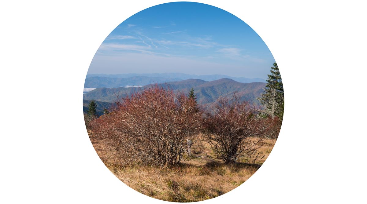
Andrews Bald is a broad meadow of grasses and heath in the park's high country. It is the highest grassy bald in the park. Its open setting makes it a scenic viewpoint and photo spot.
Views extend south across the Fontana Lake basin and into North Carolina. Distant mountains form the backdrop. In late June, deep-purple Catawba rhododendron flowers spread across the bald.
Getting there
Park at Clingmans Dome and follow Forney Ridge Trail for about 1.8 miles to Andrews Bald. The route descends through high-elevation spruce-fir forest before reaching the open bald. The complete hike is 3.6 miles round trip.
Primary park roads operate 24 hours daily throughout the year when weather allows. These include Newfound Gap Road, also designated US-441, Little River Road, and Laurel Creek Road. Secondary roads close seasonally.
Sugarlands Visitor Center is about 10 miles away. Cherokee, North Carolina, is about 11 miles away. Gatlinburg, Tennessee, is about 12 miles away. Pigeon Forge, Tennessee, is about 17 miles away. These figures are straight-line distances, not driving distances.
The listed regional airports are McGhee Tyson Airport, identified by the code TYS, and Asheville Regional Airport, identified by AVL.
What to see and do
The main activity is the hike from Clingmans Dome to Andrews Bald. Allow around 2 hours for the round trip. The destination offers open space, long southern views, and seasonal flowers.
The trail passes through high-elevation spruce-fir forest on its descent. At the bald, look across the Fontana Lake basin toward North Carolina and the distant mountains.
Plant life changes through the year. Depending on the season, hikers may encounter blackberries, raspberries, Fraser firs, and bluets. Bluets are small blue wildflowers also known as innocence or Quaker ladies.
Late June brings Catawba rhododendron into bloom. The deep-purple flowers can cover large areas of the bald. Andrews Bald is also known for summer flowering azaleas.
Use established routes and follow posted rules while viewing flowers or taking photographs. The open meadow is the principal scenic and photographic feature.
History and nature
Andrews Bald takes its name from cattle herder Andrew Thompson, who moved livestock onto the grassy area during the 1840s. Another account records the pioneer’s name as Andres Thompson and says later usage altered it.
Research indicates grassy balds may have remained open because large animals grazed there. Early grazers may have included mastodons or woolly mammoths. Bison, elk, and deer may have continued that role later.
Without grazing or active management, surrounding plants can move into the meadow. The National Park Service periodically clears encroaching vegetation to retain the bald’s open character.
The surrounding forest includes spruce and Fraser fir. The bald itself is an open community of grass and heath, with berries and wildflowers appearing seasonally.
When to go
Summer is a notable season for flowers. Azaleas bloom during summer, while Catawba rhododendron typically produces its deep-purple display in late June. Other plants, including bluets, blackberries, and raspberries, appear according to the season.
Weather can differ sharply between the park’s lower areas and high elevations. Temperatures may change by 10–20 degrees Fahrenheit between the mountain base and summit areas. Clear conditions below do not ensure clear or comfortable weather near Andrews Bald.
Road access also varies by season. Main roads remain open year-round when weather permits, while secondary roads have seasonal closures. Check current conditions before traveling to the Clingmans Dome area.
Accessibility
Andrews Bald is reached by hiking about 1.8 miles from the Clingmans Dome parking area on Forney Ridge Trail. The route descends through high-elevation forest and returns for a 3.6-mile round trip.
The supplied information does not identify accessible facilities or an accessible route at Andrews Bald.
Fees and rules
The supplied information does not list a fee specific to Andrews Bald. Follow all posted park rules at the Clingmans Dome parking area, along Forney Ridge Trail, and on the bald.
Leave no trace and avoid damaging grasses, heath, berries, or flowers. Remain aware of any notices related to road access, trail conditions, or active vegetation management.
Nearby trails and places
Forney Ridge Trail is about 0.4 miles away in the mapped nearby-place data. The trail is about 5.3 miles as mapped by the National Park Service. It provides the hiking approach from Clingmans Dome to Andrews Bald.
Several mapped features are about 0.8 miles away:
- Flat Top Gap: A mountain pass or saddle
- #68 Steel Trap: A campsite
- Rock Slab Falls: A waterfall
Gregory Bald is another similar grassy point of interest in Great Smoky Mountains National Park.
Before you go
Check current conditions, road status, trail notices, and alerts on the park’s National Park Service website. Secondary roads may close seasonally, and weather can affect access.
Carry water and pack layers for changing high-elevation conditions. Follow posted rules, protect vegetation, and leave no trace.
Questions
How long is the hike to Andrews Bald?
The hike is 3.6 miles round trip, with about 1.8 miles between Clingmans Dome and Andrews Bald.
How long does the Andrews Bald hike take?
The typical round-trip time is 2 hours, or 120 minutes.
Where do you park for Andrews Bald?
Park at Clingmans Dome and take Forney Ridge Trail to the bald.
What can you see from Andrews Bald?
The bald offers southern views across the Fontana Lake basin, into North Carolina, and toward distant mountains.
When do flowers bloom at Andrews Bald?
Azaleas flower in summer, and Catawba rhododendron typically produces deep-purple blooms in late June.
What is the elevation of Andrews Bald?
Andrews Bald is about 5,910 feet in elevation.
Why is Andrews Bald named Andrews Bald?
It is named for cattle herder Andrew Thompson, also recorded as Andres Thompson, who brought livestock there during the 1840s.
What plants grow around Andrews Bald?
Seasonal plants include blackberries, raspberries, Fraser firs, bluets, grasses, heath, azaleas, and Catawba rhododendron.
Nearby
Trails
Places
- Flat Top Gap
- #68 Steel Trap
- Rock Slab Falls
On the map
4 trails9 places to see1 visitor service
Facts on this page draw on the National Park Service: Andrews Bald (nps.gov)