











Great Smoky Mountains National Park
Abrams Falls Trail
| Length | about 4.2 miles as mapped by NPS |
|---|---|
| Surface | Native |
| High point | about 1,760 ft |
| Low point | about 1,270 ft |
| Difficulty | Moderate |
At a glance
- Length: About 4.2 miles as mapped by the National Park Service; the stated hiking distance is 5.2 miles round trip.
- Route: Out and back
- Difficulty: Moderate
- Surface: Native
- Elevation: About 1,270 feet at the lowest point and about 1,760 feet at the highest point.
- Area: Cades Cove / Townsend
- Typical time: 2 hours
- Facilities: A year-round pit toilet is at the trailhead.
Getting to the trailhead
Abrams Falls Trail begins at Abrams Falls Trailhead in the Cades Cove area. It is near the western end of the one-way Cades Cove Loop Road.
Turn onto Abrams Falls Road between loop road signposts 10 and 11. Parking is available at the end of that road.
Allow up to 3 or 4 additional hours to travel the Cades Cove Loop Road. Sugarlands Visitor Center is about 19 miles away.
Gatlinburg is about 21 miles away, Pigeon Forge about 22 miles away, and Cherokee about 31 miles away. These are straight-line distances.
On the trail
The route passes through rhododendron, hemlock, and pine-oak forest. Spring wildflowers grow along the trail, which includes rocky creek crossings.
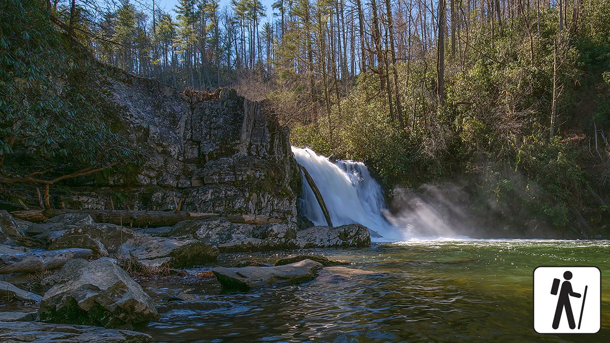
Abrams Falls drops about 25 feet over a sandstone ledge into a deep pool. Swimming is strongly discouraged because of slick rocks and a dangerous undertow.
The trail has occasional roots and rocks. Its mapped elevation ranges from about 1,270 feet to about 1,760 feet.
When to go
Spring brings wildflowers along the route. Check current conditions and alerts on the park’s National Park Service website before visiting.
Allow time beyond the hike for travel on the Cades Cove Loop Road. That portion of the trip can take up to 3 or 4 hours.
Before you go
A parking tag is required when parking in Great Smoky Mountains National Park for more than 15 minutes.
Pets are not permitted on Abrams Falls Trail. Within the park, pets are allowed on Gatlinburg Trail and Oconaluftee River Trail. They are also allowed in campgrounds, picnic areas, and on roads.
Carry water, pack layers, follow posted rules, and leave no trace. Check park alerts for closures or changing conditions before departure.
Questions
How long is Abrams Falls Trail?
It is about 4.2 miles as mapped by the National Park Service. The stated hiking distance is 5.2 miles round trip.
How difficult is Abrams Falls Trail?
The trail is rated moderate and has occasional obstacles, including roots and rocks.
How long does it take to hike Abrams Falls Trail?
The typical hiking time is 2 hours. Allow up to 3 or 4 additional hours for the Cades Cove Loop Road.
Can dogs hike Abrams Falls Trail?
No. Pets are permitted only on Gatlinburg Trail and Oconaluftee River Trail among the park’s trails.
Can visitors swim at Abrams Falls?
Swimming is strongly discouraged because slippery rocks and a dangerous undertow make the pool hazardous.
Nearby
Trails
Places
- Abrams Falls Pit Toilettes
- Abrams Falls Parking
- Abrams Falls Trail Trailhead
- Elijah (Leige) Oliver Cabin
- Elijah Oliver Barn
- #17 Little Bottoms
- Cable Mill Pit Toilet
- John Oliver Barn
On the map
5 trails17 places to see4 visitor services
Facts on this page draw on the National Park Service: Hike to Abrams Falls (nps.gov)