











Great Smoky Mountains National Park
Cosby Horse Trail
| Length | about 0.6 miles as mapped by NPS |
|---|---|
| Surface | Native |
| High point | about 2,570 ft |
| Low point | about 2,440 ft |
| Difficulty | Easy |
At a glance
- Length: About 0.6 miles as mapped by the National Park Service
- Route: Out and back
- Difficulty: Easy
- Surface: Native
- Elevation: About 2,440 feet to about 2,570 feet
- Use: Part of the park’s equestrian trail system
Getting to the trailhead
Lower Mount Cammerer Trail Trailhead and Low Gap Trail Access Trailhead are each about 0.2 miles away. Cosby Hiker Parking A is about 0.6 miles away.
The Cosby Campground Comfort Station is about 0.3 miles away. Cosby Campground and Cosby Group Camp are also nearby.
Sugarlands Visitor Center is about 19 miles away. Gatlinburg is about 17 miles away, while Pigeon Forge and Cherokee are each about 20 miles away.
The listed airports are McGhee Tyson Airport and Asheville Regional Airport. These distances do not represent driving distances.
On the trail
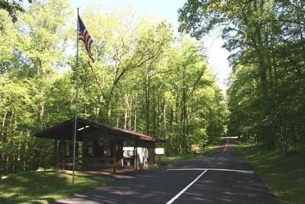
Cosby Horse Trail follows a native surface through forest. It belongs to the park’s designated network of trails maintained for equestrian use.
The mapped route ranges from about 2,440 feet to about 2,570 feet. It is rated easy and follows an out-and-back route.
Low Gap Trail Access connects at the trail. Cosby Nature Trail, Low Gap Trail, and Lower Mount Cammerer Trail are each about 0.3 miles away.
When to go
No seasonal timing is provided. Check current conditions and alerts on the park’s National Park Service website before leaving.
Before you go
Overnight stock use requires a stock permit. Overnight users must also book ahead using Recreation.gov.
Carry water, pack layers, and follow posted rules. Leave no trace during the visit.
Questions
How long is Cosby Horse Trail?
It is about 0.6 miles as mapped by the National Park Service.
Is Cosby Horse Trail difficult?
The trail is rated easy.
What type of route is Cosby Horse Trail?
It is an out-and-back route with a native surface.
What is the elevation of Cosby Horse Trail?
The mapped route ranges from about 2,440 feet to about 2,570 feet.
Do overnight horse parties need a permit for Cosby Horse Trail?
Yes. Overnight stock use requires a stock permit and a booking made beforehand on Recreation.gov.
Nearby
Trails
Places
- Lower Mount Cammerer Trail Trailhead
- Low Gap Trail Access Trailhead
- Cosby Campground Comfort Station
- Cosby AMile Postitheater Parking
- Cosby Group Campground Parking
- Cosby Group Camp
- Cosby Amphitheater
- Cosby Campground
On the map
3 trails9 places to see6 visitor services