











Great Smoky Mountains National Park
Jakes Creek Trail
| Length | about 3.6 miles as mapped by NPS |
|---|---|
| Surface | Native |
| High point | about 4,060 ft |
| Low point | about 2,220 ft |
| Difficulty | Moderate |
At a glance
- Location: Elkmont, Tennessee
- Route: Out and back
- Difficulty: Moderate
- Mapped length: About 3.6 miles as mapped by the National Park Service
- Stated hiking distance: 8.0 miles round trip
- Surface: Native
- Elevation: About 2,220 feet at the lowest point and about 4,060 feet at the highest
- Parking: A parking tag is required for stays longer than 15 minutes.
- Pets: Pets are not permitted on this trail.
Getting to the trailhead
Park at Jakes Creek Trail Trailhead Parking in Elkmont. The parking lot is about 0.4 miles from the mapped trail.
Sugarlands Visitor Center is about 4 miles away. Gatlinburg is about 6 miles away, and Pigeon Forge is about 10 miles away. Cherokee is about 19 miles away. These are straight-line distances, not driving distances.
McGhee Tyson Airport and Asheville Regional Airport are regional airport options.
On the trail
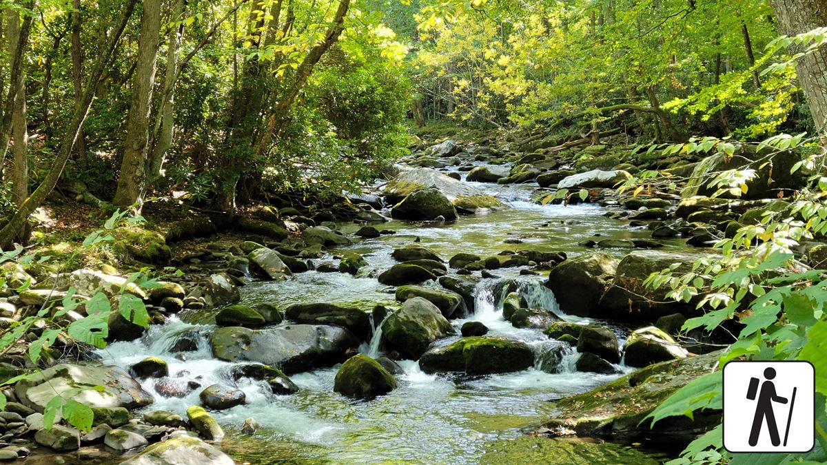
Jakes Creek Trail follows a creek corridor through old-growth hardwood forest. The route is mostly wide and relatively flat, with some rocks and roots. It becomes slightly steeper and rockier while maintaining a mild-to-moderate grade.
Historic buildings along the trail include Galyon Cabin, Hale Cabin, Cain Cabin, Baumann Cabin, Scruggs/Brisco Cabin, and Cook Cabin.
The creek takes its name from Jake Tulley. He was a hunter who constructed a cabin in the hollow during the early 1800s.
Cucumber Gap Trail is about 0.2 miles away and measures about 2.3 miles. Meigs Mountain Trail is about 0.3 miles away and measures about 6 miles. Jakes Creek Trail also connects with Miry Ridge Trail for longer loop options.
The National Park Service describes a separate loop combining Jakes Creek, Little River, and Cucumber Gap trails. That route covers 5.4 miles and typically takes 2 hours. It includes streamside scenery, historic structures, and spring wildflowers.
When to go
Spring brings abundant wildflowers along the trail. April is noted for particularly strong displays along the lower creek section.
Check current conditions and park alerts before leaving. Conditions on connected trails can change, especially near stream crossings during high water.
Before you go
A parking tag is required when parking in Great Smoky Mountains National Park for more than 15 minutes.
Pets are not allowed on Jakes Creek Trail. Within the park, pets may use only Gatlinburg Trail and Oconaluftee River Trail. They are also permitted on roads, in campgrounds, and in picnic areas.
Carry water, pack layers, follow posted rules, and leave no trace. Check the park’s National Park Service website for current conditions and alerts.
Questions
How long is Jakes Creek Trail?
It is about 3.6 miles as mapped by the National Park Service. The stated out-and-back hiking distance is 8.0 miles round trip.
How difficult is Jakes Creek Trail?
It is rated moderate. The trail is mostly wide and relatively flat, with rocks, roots, and some steeper sections.
Are pets allowed on Jakes Creek Trail?
No. Pets are not permitted on Jakes Creek Trail.
Is a parking tag required at Jakes Creek Trail?
Yes. A parking tag is required when parking for more than 15 minutes.
What can hikers see along Jakes Creek Trail?
The trail follows Jakes Creek through old-growth hardwood forest. It passes historic cabins and has notable spring wildflowers.
Nearby
On the map
3 trails25 places to see4 visitor services
Facts on this page draw on the National Park Service: Hike the Little River, Cucumber Gap, Jakes Creek Loop (nps.gov)