











Great Smoky Mountains National Park
Kephart Prong Trail
| Length | about 2.0 miles as mapped by NPS |
|---|---|
| Surface | Native |
| Route | One way (out and back doubles it) |
| High point | about 3,590 ft |
| Low point | about 2,730 ft |
| Up and down (one way) | about 840 ft up, 0 ft down |
At a glance
- Length: About 2 miles one way as mapped by the National Park Service
- Out-and-back distance: About 4 miles
- Typical time: 2 hours
- Surface: Native
- Elevation: About 2,730 feet to about 3,590 feet
- One-way climb: About 840 feet
- Features: Hardwood forest, mountain streams, historic camp remains, stairs, and 5 railed footbridges
Getting to the trailhead
The route begins near Kephart Prong Trailhead. Parking is available at 2 pullouts by the trailhead, but space is limited. Consider taking a shuttle.
The trailhead is at a small, paved pullout on Newfound Gap Road, also called US 441. A parking tag is required for stays longer than 15 minutes.
Sugarlands Visitor Center is about 11 miles away. Cherokee, North Carolina, is about 8 miles away, while Gatlinburg, Tennessee, is about 11 miles away. These are straight-line distances.
On the trail
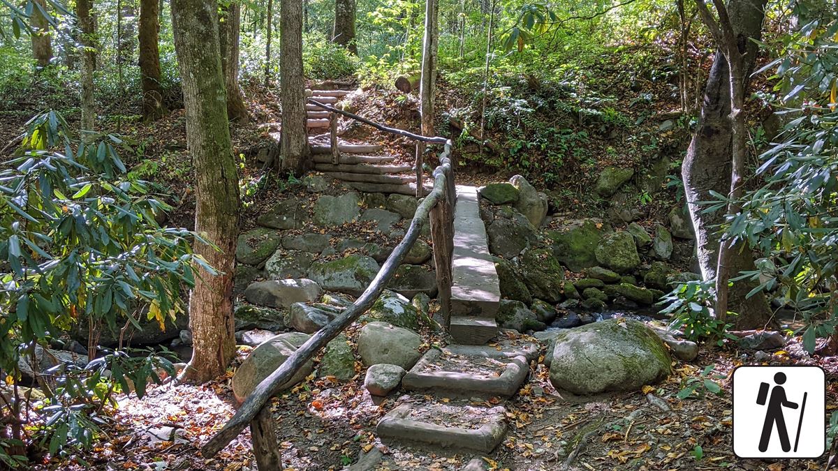
The trail follows a former paved jeep-road route through hardwood forest. It runs beside mountain streams and crosses them on 5 railed log footbridges. The route also includes stairs.
Remains of a historic CCC camp stand along the route. Kephart Shelter is near the trail’s end, at about mile 2. Staying overnight there requires a reservation and backcountry permit.
This is a one-way mapped route between the trailhead and shelter. Returning to the trailhead doubles the distance to about 4 miles.
When to go
Allow about 2 hours for the roundtrip hike. Check current conditions and alerts on the park’s National Park Service website before leaving.
The nearest listed restroom is at Collins Creek Picnic Area, which is open seasonally. Restrooms are also available at Oconaluftee Visitor Center.
Before you go
A parking tag is required when parking in Great Smoky Mountains National Park for more than 15 minutes. Limited trailhead parking makes a shuttle worth considering.
Pets are not permitted on Kephart Prong Trail. Within the park, pets may use only Gatlinburg Trail and Oconaluftee River Trail. They are also allowed in picnic areas, campgrounds, and on roads.
Carry water, pack layers, follow posted rules, and leave no trace.
Questions
How long is Kephart Prong Trail?
The trail is about 2 miles one way as mapped by the National Park Service, or about 4 miles out and back.
How long does it take to hike Kephart Prong Trail?
The typical roundtrip hiking time is 2 hours.
Where does Kephart Prong Trail end?
The mapped route ends near Kephart Shelter, about 2 miles from the trailhead.
Is parking available at Kephart Prong Trail?
Yes. Limited parking is available at small pullouts near the trailhead, and the National Park Service recommends considering a shuttle.
Are pets allowed on Kephart Prong Trail?
No. Pets are permitted only on Gatlinburg Trail and Oconaluftee River Trail among the park’s trails.
Nearby
Places
- Kephart Prong Trail Pullout Parking # 1
- Kephart Prong Trail Pullout Parking # 2
- Kephart Prong Trail Trailhead
- Kephart Shelter
- Kephart Prong Cemetery
- Quiet Walkway Parking # 6
- Kanati Fork Trail Trailhead
- Newfound Gap Pullout Parking at Mile Post 24.025
On the map
4 trails2 places to see2 visitor services
Facts on this page draw on the National Park Service: Hike Kephart Prong Trail to Historic CCC Camp (nps.gov)