











Great Smoky Mountains National Park
Smokemont Loop Trail
| Length | about 3.8 miles as mapped by NPS |
|---|---|
| Surface | Native |
| High point | about 3,550 ft |
| Low point | about 2,200 ft |
| Difficulty | Moderate |
At a glance
- Length: about 3.8 miles as mapped by the National Park Service
- Stated route: 6.0 mi loop
- Difficulty: Moderate
- Surface: Native
- Elevation: about 2,200 feet to about 3,550 feet
- Area: Smokemont Campground, NC
- Parking tag: Required when parking longer than 15 minutes
Getting to the trailhead
The trail begins across from campsite B31 in Smokemont Campground. Look for the sign identifying the Smokemont Self-Guided Nature Trail. Do not park in campsites.
Smokemont Loop Trail Trailhead Parking is about 0.2 miles away. Smokemont Campground Parking #6 is about 0.1 miles away. The campground restroom is about 0.2 miles away.
Cherokee, NC, is about 6 miles away in a straight line. Gatlinburg, TN, is about 15 miles away. Sugarlands Visitor Center is about 15 miles away.
On the trail
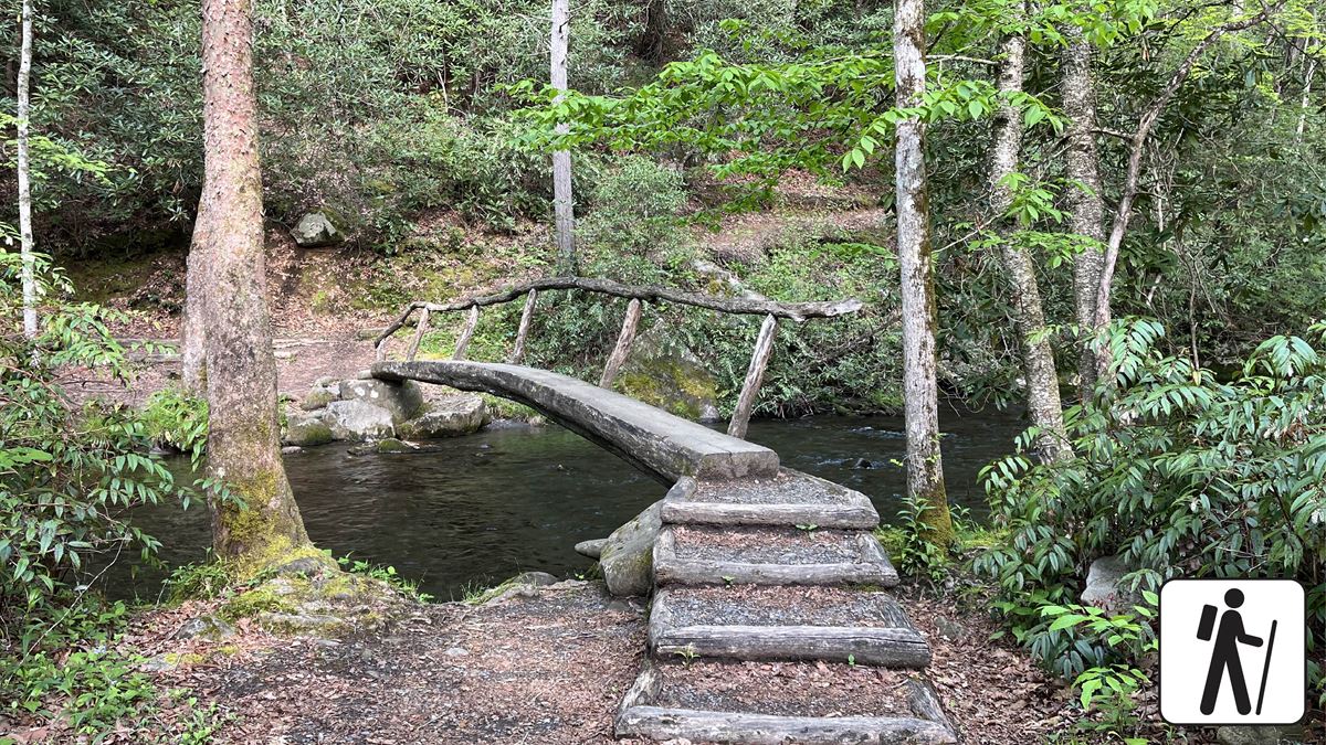
Cross two narrow foot log bridges with handrails. At the arrow sign, turn right to begin the loop. The route initially follows Bradley Fork upstream.
The trail then climbs through second-growth hardwood forest to a ridge. Views extend across Smokemont cove and toward the east and northeast.
The route curves around the mountain’s west side before descending through the Bradley Fork corridor. It returns to the creek and foot log bridges.
Expect some steep sections, with occasional roots and rocks. No designated accessible parking spaces are available.
The Smokemont area was once called Bradleytown. Its history includes early 1900s logging and the Champion Fibre Company. The community included stores, churches, sawmills, and barracks before the park was established.
Bradley Cemetery is about 0.1 miles from the trail. Smokemont Campground and Oconaluftee Ranger Station are also along the mapped route.
When to go
Hardwood foliage can turn crimson and gold during October. Wildflowers, leafy trees, birdsong, and ridge views are other features described along the route.
Check current conditions and alerts on the park’s National Park Service website before leaving.
Before you go
A parking tag is required for vehicles parked longer than 15 minutes. Follow posted parking rules and avoid using campground sites for trail parking.
Pets are not permitted on this trail. Within the park, trail access for pets is limited to Gatlinburg Trail and Oconaluftee River Trail. Pets may use roads, campgrounds, and picnic areas.
Carry water, pack layers, follow posted rules, and leave no trace.
Questions
How long is Smokemont Loop Trail?
It is about 3.8 miles as mapped by the National Park Service. The stated route is a 6.0 mi loop.
How difficult is Smokemont Loop Trail?
The trail is rated moderate. It includes some steep sections, occasional roots and rocks, and two narrow foot log bridges.
Where does Smokemont Loop Trail start?
It starts across from campsite B31 in Smokemont Campground, beside the Smokemont Self-Guided Nature Trail sign.
Are pets allowed on Smokemont Loop Trail?
No. Pets are permitted only on Gatlinburg Trail and Oconaluftee River Trail among park trails.
Is a parking tag required at Smokemont Loop Trail?
Yes. A parking tag is required when parking in the Smokies for more than 15 minutes.
Nearby
Trails
Places
- Smokemont Campground Parking #6
- Smokemont Nature Trail Trailhead
- Bradley Cemetery
- Smokemont Campground Registration Office Parking
- Smokemont Campground Comfort Station
- Smokemont Campground Parking #5
- Pullout Parking At Mile Post 27.1
- Smokemont Loop Trail Trailhead Parking
On the map
4 trails8 places to see4 visitor services
Facts on this page draw on the National Park Service: Hike Smokemont Nature Trail (nps.gov)