











Great Smoky Mountains National Park
Twentymile Loop Trail
| Length | about 2.9 miles as mapped by NPS |
|---|---|
| Surface | Native |
| Route | One way (out and back doubles it) |
| High point | about 2,560 ft |
| Low point | about 1,830 ft |
| Up and down (one way) | about 370 ft up, 880 ft down |
| Difficulty | Moderate |
At a glance
- Location: Twentymile, NC
- Mapped length: About 2.9 miles as mapped by the National Park Service
- Route: Point to point
- Difficulty: Moderate
- Surface: Native
- Elevation: About 1,830 feet to about 2,560 feet
- One-way elevation change: About 370 feet of climbing and about 880 feet of descent
- Conditions: Expect occasional roots and rocks. Some sections can be narrow, muddy, or rocky.
The mapped route begins near about 2,360 feet and ends near about 1,830 feet. Walking out and back doubles the distance. It also turns the one-way descent into climbing on the return.
Getting to the trailhead
Twentymile Trailhead is at the road’s end, just past Twentymile Ranger Station. A parking tag is required for parking longer than 15 minutes.
Sugarlands Visitor Center is about 22 miles away. Gatlinburg is about 24 miles away, Pigeon Forge about 26 miles, and Cherokee about 29 miles away. These are straight-line distances.
McGhee Tyson Airport and Asheville Regional Airport serve the broader area.
On the trail
Twentymile Loop Trail connects directly with Wolf Ridge Trail, Twentymile Trail, and Long Hungry Ridge Trail. This route passes through a remote area of the park with streams and shaded hardwood forest.
The trail is mapped near Proctor Field Gap. Twenty Mile Ridge and Turkey Cove are about 0.6 miles away. Campsite #95 Dalton Branch is about 0.7 miles away.
Sheep Knob, Moore Springs Branch Falls, and Upper Flats are about 0.8 miles away. Hickory Nut Gap, Campsite #92 Upper Flats, and Wolf Ridge are about 0.9 miles away.
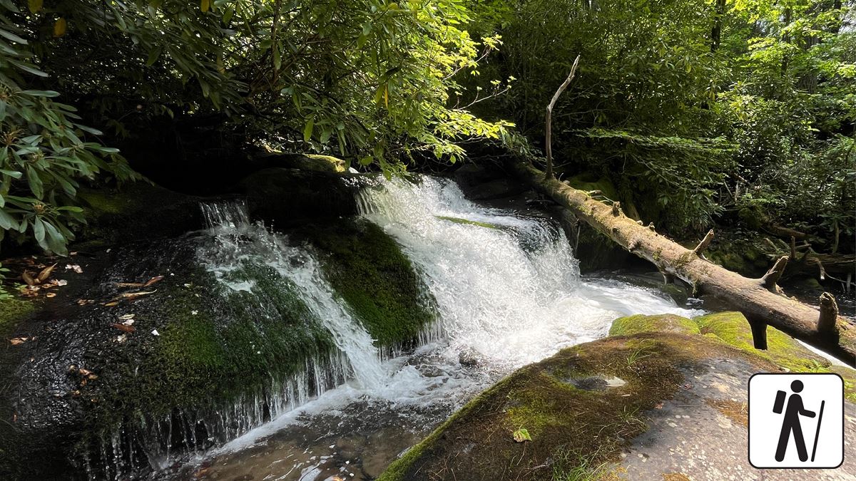
A separate hike to Twentymile Cascade begins on Twentymile Trail. It follows a wide gravel roadbed beside a mountain stream through mixed hardwood forest. Moss-covered rocks surround the cascade.
That cascade outing is 1.2 miles round trip and typically takes 2 hours. At the first junction, turn onto Wolf Ridge Trail. Continue beyond the first bridge. A footpath on the right leads to the cascade.
When to go
Check current conditions and alerts on the park’s National Park Service website before leaving. Mud may affect narrower parts of the longer loop.
Pack layers and carry water. Conditions can differ between the trailhead and higher points along the route.
Before you go
Pets are not permitted on Twentymile Loop Trail. Within the park, pets may use only Gatlinburg Trail and Oconaluftee River Trail. They are also allowed on roads, in campgrounds, and in picnic areas.
Restrooms are available near Deep Creek or outside the park before arrival. Follow posted rules, leave no trace, and obtain a parking tag when parking longer than 15 minutes.
Questions
How long is Twentymile Loop Trail?
It is about 2.9 miles as mapped by the National Park Service.
Is Twentymile Loop Trail an out-and-back trail?
No. It is a point-to-point route with its ends in different places. Returning on the same trail doubles the distance.
How difficult is Twentymile Loop Trail?
The trail is rated moderate. Expect roots, rocks, narrow stretches, and potentially muddy or rocky areas.
Are dogs allowed on Twentymile Loop Trail?
No. Pets are permitted only on Gatlinburg Trail and Oconaluftee River Trail among park trails.
Is a parking tag required at Twentymile Trailhead?
Yes. A parking tag is required when parking in the Smokies for more than 15 minutes.
Nearby
Places
- Proctor Field Gap
- Twenty Mile Ridge
- Turkey Cove
- #95 Dalton Branch
- Sheep Knob
- Moore Springs Branch Falls
- Upper Flats
- Hickory Nut Gap
On the map
1 trail2 visitor services
Facts on this page draw on the National Park Service: Hike to Twentymile Cascade (nps.gov)