










Indian Cove Nature Trail
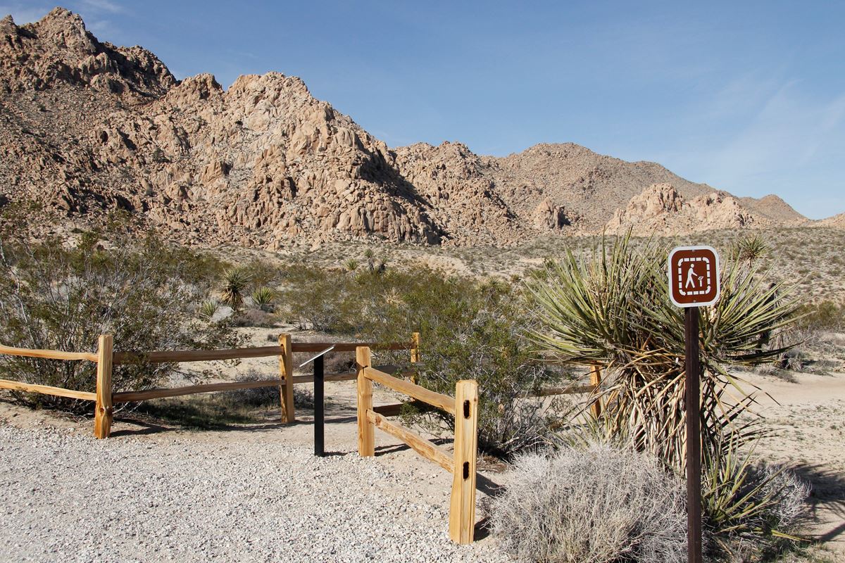
| Length | about 0.6 miles as mapped by NPS |
|---|---|
| Surface | Native |
| Open to | Hiking |
| Route | Loop |
| High point | about 3,350 ft |
| Low point | about 3,280 ft |
| Difficulty | Easy |
At a glance
- Distance: About 0.6 miles as mapped by the National Park Service
- Route: Loop ending where it begins
- Difficulty: Easy
- Typical time: 30–45 minutes; the NPS activity estimate is 35 minutes
- Surface: Native
- Use: Hiking
- Trailhead: Indian Cove Trailhead
- Location: Indian Cove Road area, at the campground’s west end
- Terrain: Mostly flat, gently rolling ground with soft sand and some stairs
- Trail width: Roughly 1.5–3 feet
- Shade: None
- Cell service: Unreliable
- Season: Closed in summer during seasonal campground closures
- Time of day: Dawn, day, or dusk
Why hike it
Indian Cove Nature Trail provides a short, easy introduction to the plants of Indian Cove. Interpretive panels explain local species and their traditional uses by Native Americans.
The gently rolling route has little overall elevation change, though it includes soft sand and stairs. Abundant winter rain can produce a colorful wildflower display during spring.
Getting to the trailhead
The trailhead is in Indian Cove, within the northern section of Joshua Tree National Park. Find it at the west end of Indian Cove Campground, in the Indian Cove Road area.
Parking is available for automobiles, buses, and RVs. Trailhead facilities include recycling, an accessible restroom, and a vault or composting toilet.
Indian Cove Campground is about 0.6 miles away. Joshua Tree Visitor Center is about 9 miles away. Visitor centers follow their own operating hours.
The nearby gateway communities are Twentynine Palms, about 7 straight-line miles away, and Joshua Tree, about 9 straight-line miles away. Yucca Valley is about 14 straight-line miles away.
Palm Springs International Airport and Ontario International Airport are regional arrival options. The provided information does not include driving routes or travel times from either airport.
On the trail
The hike begins and ends near Indian Cove Trailhead. It follows a loop of about 0.6 miles as mapped by the National Park Service.
The route is easy and mostly flat, with gentle rises, soft sand, and some steps. The NPS accessibility description gives an approximate 100-foot elevation gain. Mapped elevation modeling estimates about 50 feet of climbing and 60 feet of descent along the route.
The first mapped point is at about 3,350 feet, and the last is at about 3,340 feet. The estimated high point is about 3,350 feet, while the low point is about 3,280 feet.
The path is roughly 1.5–3 feet wide. Its surface is native rather than paved. Interpretive signs appear along the way and provide context for the surrounding landscape.
There is no shade, and cell service is unreliable. Plan for exposure even though the loop usually takes only 30–45 minutes.
What you will see
Desert plants are the main focus of the Indian Cove Nature Trail. Interpretive panels identify local plants and discuss how Native Americans traditionally used them.
The route’s gentle terrain keeps the emphasis on the plants and signs rather than a demanding climb. Following wet winters, spring can bring a vibrant display of wildflowers.
History and nature
The interpretive material connects Indian Cove’s plant life with Indigenous knowledge. Panels describe traditional Native American uses of plants found in the area.
Seasonal rain strongly affects what grows and blooms. Abundant winter rain may lead to more spring wildflowers. The National Park Service maintains separate wildflower-viewing information for current context.
Conditions are generally dry, with typical humidity below 25%. The exposed trail has no shade, so weather shapes the experience throughout the year.
When to go
The trail is associated with winter, spring, summer, and fall, but it closes during summer with seasonal campground closures. Check the current closure status before traveling to Indian Cove.
Spring and fall usually bring the park’s most comfortable temperatures. Average highs are around 85°F, and average lows are around 50°F. Park visitation rises as temperatures moderate in fall and reaches its peak during spring wildflower season.
Winter days are around 60°F, while nights can fall below freezing. Snow occasionally reaches higher elevations. Summer daytime temperatures exceed 100°F and may remain above 75°F at night.
The route can be used at dawn, during the day, or at dusk when open. Check the forecast before entering the park. Change plans when conditions are too extreme.
Joshua Tree National Park remains open 24 hours a day, 7 days a week, throughout the year. Some areas are restricted to day use, and visitor centers have separate schedules.
Accessibility
An accessible restroom is available at the trailhead. However, the trail has varied natural terrain, including soft sand, stairs, and a path roughly 1.5–3 feet wide.
The route is mostly flat. The NPS description notes an approximate 100-foot elevation gain, while mapped modeling estimates about 50 feet of climbing.
Service animals are welcome. They must remain on a leash no longer than 6 feet at all times.
Permits, fees and rules
Joshua Tree National Park charges a $30 entrance fee for a private vehicle. Motorcycle entry costs $25. The per-person entrance fee is $15.
Pets are not allowed on Indian Cove Nature Trail. They may be walked along the roads within Indian Cove Campground. Service animals are permitted under the leash requirement.
Follow all posted rules and seasonal closures. Summer closure of the nature trail corresponds with seasonal campground closures.
Nearby trails and places
Indian Cove Campground is about 0.6 miles away. The nature trail begins at the campground’s west end and offers access to interpretive signs about local plants.
Joshua Tree Visitor Center is about 9 miles away. Twentynine Palms, Joshua Tree, and Yucca Valley are the listed nearby gateway communities.
Before you go
Check current conditions, weather, closures, and alerts on the park’s NPS website. The trail closes in summer during the seasonal campground closure, and extreme temperatures may require changing plans.
Carry water and pack layers. There is no shade, humidity is typically low, and cell service can be unreliable. Tell a safety contact where you are going and when you expect to leave the park.
Use the available parking and restroom facilities at the trailhead. Follow posted rules, stay on the route, and leave no trace.
Questions
How long is Indian Cove Nature Trail?
It is about 0.6 miles as mapped by the National Park Service.
How long does Indian Cove Nature Trail take?
Allow about 30–45 minutes. The NPS activity estimate is 35 minutes.
Is Indian Cove Nature Trail easy?
Yes. It is rated easy, with mostly flat, gently rolling terrain, soft sand, some stairs, and minimal overall elevation change.
Where is the Indian Cove Nature Trail trailhead?
It is at the west end of Indian Cove Campground in the northern section of Joshua Tree National Park.
Is Indian Cove Nature Trail open in summer?
No. The trail closes during summer along with seasonal campground closures.
Are dogs allowed on Indian Cove Nature Trail?
No. Pets may use campground roads instead. Service animals are welcome and must remain on a 6-foot leash.
What can visitors see on Indian Cove Nature Trail?
Interpretive panels cover local desert plants and their traditional Native American uses. Wet winters can support colorful spring wildflowers.
Does Indian Cove Nature Trail have shade and cell service?
The trail has no shade, and cell service is unreliable.
Nearby
Places
On the map
1 trail1 place to see4 visitor services
Facts on this page draw on the National Park Service: Indian Cove Trailhead (nps.gov)