










DeLacy Creek Trail
| Length | about 7.1 miles as mapped by NPS |
|---|---|
| Surface | Earth |
| Open to | Hiking |
| High point | about 7,980 ft |
| Low point | about 7,790 ft |
At a glance
- Location: Southern Yellowstone National Park, near Craig Pass
- Distance: About 7.1 miles as mapped by the National Park Service
- NPS day-hike description: 5.8 miles, or 9.3 kilometers, there and back
- Typical time: 220 minutes, or 3.7 hours
- Elevation: About 7,790 feet to about 7,980 feet
- Surface: Earth
- Use: Hiking
- Seasons: Summer and fall
- Times: Day, night, dawn and dusk
- Amenities: Picnic tables and a vault or composting toilet
- Start: DeLacy Creek Trailhead, also identified as trailhead 7K2
- Parking: DeLacy Creek Parking Area
Why hike it
DeLacy Creek Trail follows the edge of a forest and crosses open meadows. It leads to the shore of Yellowstone’s largest backcountry lake.
The route offers opportunities to see sandhill cranes in meadows. Moose may appear near the shore, while water birds use the lake and surrounding area.
Getting to the trailhead
The trail lies in Yellowstone’s southern area, with its trailhead near Craig Pass. DeLacy Creek Parking Area provides parking at the trailhead.
The parking area is 8.8 miles west of West Thumb Junction. The mapped route begins at DeLacy Creek Trailhead, also called DeLacy Creek Trailhead 7K2.
Old Faithful Visitor Education Center is about 6 miles away. West Yellowstone, Montana, is about 25 straight-line miles away. Gardiner, Montana, is about 41 straight-line miles away. Cody, Wyoming, is about 80 straight-line miles away.
Possible arrival airports include Bozeman Yellowstone International Airport, identified as BZN, and Jackson Hole Airport, identified as JAC.
On the trail
The hike starts at DeLacy Creek Trailhead and travels beside a forest before entering open meadows. The day-hike destination is the backcountry lake’s shore.
The NPS describes the day hike as 5.8 miles, or 9.3 kilometers, out and back. It begins and finishes at the same trailhead. The broader NPS-mapped trail length is about 7.1 miles.
The mapped route ranges from about 7,790 feet to about 7,980 feet. These elevations come from an elevation model along the mapped route. A descent on the outbound leg becomes a climb when returning.
The typical duration is 220 minutes, or 3.7 hours. The surface is earth, and the listed activity is hiking.
The trail continues farther into Yellowstone’s extensive backcountry. The defined day hike ends at the lake, where hikers turn around and retrace their route. Review the Backcountry Situation Report before considering travel beyond that point.
What you will see
The trail passes forest edges and open meadows before reaching the lake. Wildlife sightings may include sandhill cranes, moose and water birds.
Watch meadow areas for cranes. Moose may be near the shoreline. Water birds may be visible on the water or around the lake.
History and nature
The trail reaches Yellowstone’s largest backcountry lake. Its meadows, forest margins and lakeshore create distinct places to watch for the listed wildlife.
Wild animals must never be fed, including birds. Feeding harms wildlife and can encourage aggressive behavior that requires intervention.
Store food, garbage, coolers and cooking equipment in a bear-resistant container. These items may be outside the container only while they are being used.
When to go
The listed seasons for DeLacy Creek Trail are summer and fall. The NPS lists day, night, dawn and dusk as possible times of use.
Weather in Yellowstone can change substantially within the same day. Summer daytime temperatures may rise above 70°F, or 21°C. A thunderstorm can lower temperatures by 20 degrees or more.
Snow is possible during every month. Winter nighttime temperatures often fall below 0°F, or -18°C. Bring rain gear, warm clothing and other layers, including during summer.
Yellowstone remains open daily throughout the year. However, nighttime operations and some seasonal services are limited. Entrance availability varies, and access dates depend on weather.
Accessibility
The trail has an earth surface. Its mapped elevations range from about 7,790 feet to about 7,980 feet.
A vault or composting toilet is available near the trailhead area. The DeLacy Creek Vault Toilet is about 0.2 miles away.
Permits, fees and rules
Yellowstone entrance fees are:
- Private vehicle: $35
- Non-commercial group: $20
- Motorcycle: $30
- Snowmobile: $30
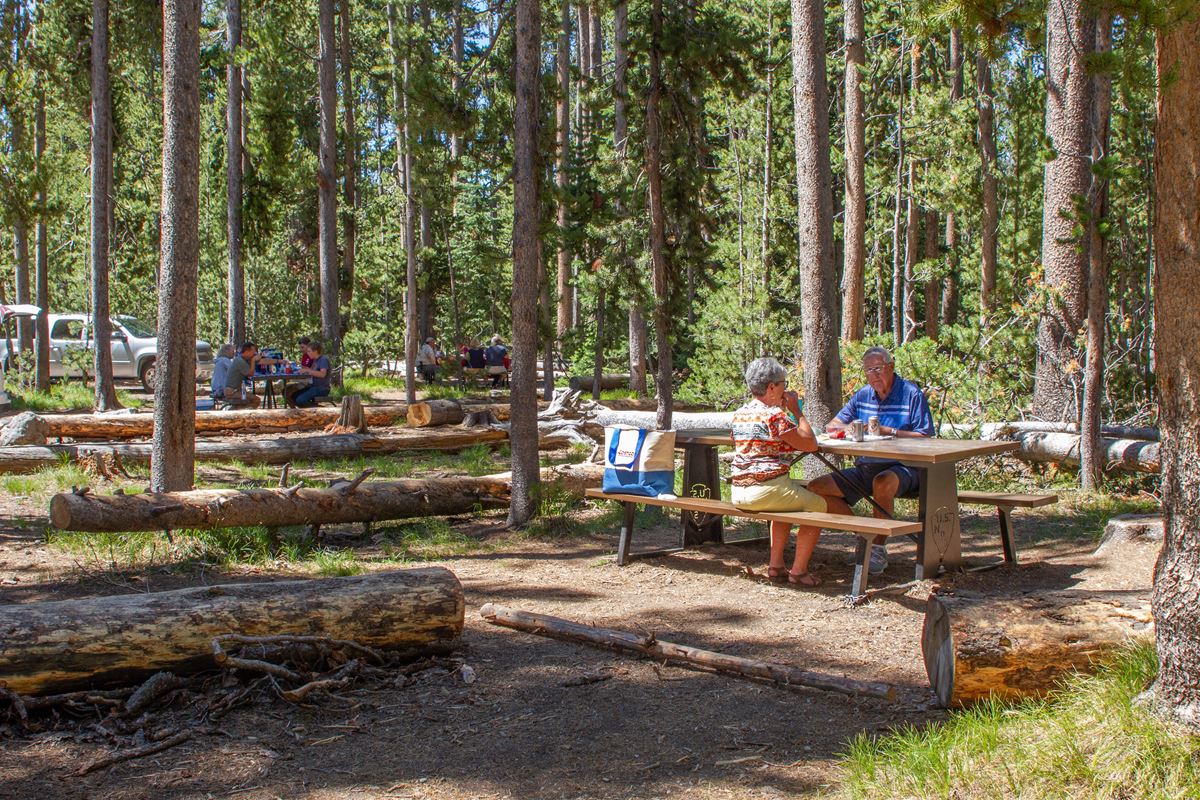
The nearby picnic area provides 10 tables and a single vault toilet. Fires are permitted only where a picnic area provides fire grates.
Liquid-fuel and gas stoves may be used for cooking at any location. Self-contained charcoal grills are also allowed for food preparation.
Picnic areas do not permit overnight camping. Camping elsewhere in Yellowstone is limited to designated campgrounds.
This is bear country. Carry bear spray and understand its proper use. Groups of at least 3 people are recommended, along with making noise where sightlines are restricted.
If a bear is encountered, do not run. Move backward slowly. Follow all posted instructions and current park rules.
Nearby trails and places
DeLacy Creek Parking, campsite 8S1 and DeLacy Creek Trailhead are mapped at the trail location. The picnic area and vault toilet are each about 0.2 miles away.
Campsite 8Q9 and Shoshone Point Parking are each about 0.5 miles away. Isa Lake and Isa Lake Parking are each about 0.9 miles away. Craig Pass is about 1 mile away.
Old Faithful Visitor Education Center is about 6 miles away.
Before you go
Check current conditions, alerts and entrance access on Yellowstone’s NPS website. Review the Backcountry Situation Report, particularly before traveling beyond the day-hike turnaround.
Carry water, bear spray, rain gear and a warm jacket. Pack layers because temperatures can change quickly. Secure food and scented supplies in a bear-resistant container.
Use the DeLacy Creek Parking Area for trailhead access. Follow posted rules, avoid feeding wildlife and leave no trace.
Questions
How long is DeLacy Creek Trail?
It is about 7.1 miles as mapped by the National Park Service. The NPS also describes the day hike as 5.8 miles there and back.
How long does DeLacy Creek Trail take?
The typical duration is 220 minutes, or 3.7 hours.
Where is DeLacy Creek Trail in Yellowstone?
It is in southern Yellowstone near Craig Pass, 8.8 miles west of West Thumb Junction.
Where do hikers park for DeLacy Creek Trail?
Parking is available at DeLacy Creek Parking Area beside the trailhead.
What wildlife can hikers see on DeLacy Creek Trail?
Hikers may see sandhill cranes in meadows, moose near the shore and water birds around the lake.
What is the elevation of DeLacy Creek Trail?
The mapped route ranges from about 7,790 feet to about 7,980 feet.
Are there toilets and picnic tables near DeLacy Creek Trail?
Yes. About 0.2 miles from the trail location, the picnic area provides 10 tables and a single vault toilet.
Can visitors camp at the DeLacy Creek Picnic Area?
No. Overnight camping is prohibited in picnic areas, and park camping is allowed only in designated campgrounds.
Nearby
Places
- Delacy Creek Parking
- 8S1
- DeLacy Creek Trailhead
- DeLacy Creek Vault Toilet
- DeLacy Creek Picnic Area
- 8Q9
- Shoshone Point Parking
- Isa Lake
On the map
3 trails2 places to see3 visitor services
Facts on this page draw on the National Park Service: DeLacy Creek Picnic Area (nps.gov)