










Pelican Creek Nature Trail
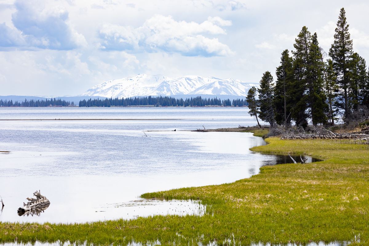
| Length | about 0.5 miles as mapped by NPS |
|---|---|
| Surface | Earth |
| Open to | Hiking |
| High point | about 7,760 ft |
| Low point | about 7,740 ft |
At a glance
- Location: Lake Area, in central Yellowstone
- Route: Loop beginning and ending at Pelican Creek Nature Trailhead
- Length: About 0.5 miles as mapped by the National Park Service
- NPS route description: 0.6 miles (1 kilometer)
- Typical time: 40 minutes
- Use: Hiking
- Surface: Earth
- Difficulty: Easy
- Elevation: Roughly about 7,740 feet to about 7,760 feet
- Seasons: Summer and fall
- Time of day: Dawn, day, dusk and night
- Amenities: Trailhead, information kiosk or bulletin board, and restroom
Why hike it
Pelican Creek Nature Trail provides a short introduction to several Yellowstone habitats. It passes through forest before reaching Yellowstone Lake’s shore and returning to its starting point.
The varied surroundings also make this a good birding walk. The National Park Service suggests allowing 40 minutes for the loop.
Getting to the trailhead
The trail lies in Yellowstone’s central section, within the Lake Area. Its trailhead is immediately east of the Fishing Bridge developed area.
Look for the trailhead at the western end of Pelican Creek Bridge. It is 1 mile (1.6 kilometers) east of Fishing Bridge Visitor Center.
Pelican Creek Nature Trailhead and Pelican Creek Bridge West Vault Toilet are each about 0.1 miles away. An information kiosk or bulletin board is available at the trailhead.
Old Faithful Visitor Education Center, the park’s main visitor center, is about 24 miles away. These gateway towns are measured by straight-line distance, not road distance:
- West Yellowstone, Montana, is about 37 miles away.
- Gardiner, Montana, is about 37 miles away.
- Cody, Wyoming, is about 64 miles away.
Bozeman Yellowstone International Airport (BZN) and Jackson Hole Airport (JAC) are airport options listed for the park.
On the trail
The route forms a loop from Pelican Creek Nature Trailhead. It runs through forest, reaches the lakeshore, and circles back to the same trailhead.
The mapped NPS distance is about 0.5 miles. The NPS visitor description rounds the full loop to 0.6 miles, or 1 kilometer. Walked distance may differ slightly from mapped distance.
The trail has an earth surface. Estimated elevation varies only from about 7,740 feet to about 7,760 feet along the mapped route.
Keep the group together and hike with at least 3 people. Tell someone the route and expected return time. Carry a map and know how to navigate.
Remain on established paths. Leaving trails is prohibited in thermal areas. Although NPS listings include night, hikers are instructed not to hike after dark.
What you will see
The loop moves through forest to the shore of Yellowstone Lake. This short transition introduces several of the park’s habitat types.
Birding is a principal activity along the route. Stay aware of the surroundings and watch for evidence of grizzly bears.
History and nature
The nature trail focuses on Yellowstone’s ecological variety rather than a single landscape. Forest and lakeshore environments occur along one compact loop.
Protect these habitats by leaving natural and cultural objects where they are. Collecting anything inside the park is prohibited.
Park waters are cold and fast. Swimming in Yellowstone’s rivers is discouraged, and river crossings are dangerous.
When to go
The listed seasons are summer and fall. The route is associated with dawn, daytime, dusk and night, but backcountry guidance says not to hike after dark.
Yellowstone’s weather can change substantially within one day. Summer highs may rise above 70°F (21°C). A thunderstorm can lower temperatures by at least 20 degrees.
Snow is possible during every month. Winter nighttime temperatures often fall below 0°F (-18°C). Pack rain gear, warm layers and a jacket, including during summer.
Yellowstone remains open every day throughout the year. However, nighttime and seasonal activities and services can be limited.
The park has 5 entrance stations, and some close seasonally. Entrance access dates depend on weather, so review current station information before traveling.
During thunderstorms, move toward lower ground. Avoid exposed areas and solitary tall trees. For lightning position, keep feet together and crouch on a foam pad.
Sitting on a pack is another option. Cover the ears with both hands.
Accessibility
Wheelchairs are the exception to the general ban on wheeled vehicles. Bicycles, strollers and other wheeled transportation are prohibited unless a location specifically permits them.
The trail surface is earth. Estimated elevation ranges from about 7,740 feet to about 7,760 feet.
Service-animal requirements are available through backcountry offices. Pets are not permitted on this trail.
Permits, fees and rules
Yellowstone entrance fees are:
- Private vehicle: $35
- Non-commercial group: $20
- Motorcycle: $30
- Snowmobile: $30
Fishing, watercraft use, horseback riding and backcountry overnight stays each require authorization. Contact the Center Backcountry Office at (307) 344-2160 for details.
Every watercraft requires an aquatic invasive species inspection. This includes boats, float tubes and stand-up paddleboards. Felt soles are prohibited.
Riders and packers must provide proof of a negative Coggins test completed within the preceding 12 months.
Backcountry food-storage rules apply to every user. Never leave food, garbage, toiletries, packs, coolers, water bottles or other attractants unattended.
Use an approved bear-resistant container or a food pole. Hung items must be 10 feet (3 meters) above ground and 4 feet (1 meter) from either side.
Carry at least 35 feet (11 meters) of rope. Sleep 100 yards (91 meters) from cooking and food-storage locations.
Camping is allowed only in designated campgrounds. Backcountry fires are limited to established fire rings within designated campsites. Put fires out completely before departing.
Bury human waste and toilet paper in a hole 6–8 inches (15–18 centimeters) deep. Choose a spot at least 100 feet (30 meters) from trails and water.
Practice Leave No Trace. Pets, hunting and firearm discharge are prohibited. Motorized vehicles cannot use trails.
In an emergency, call 9-1-1 or reach the nearest ranger station.
Nearby trails and places
Pelican Creek Nature Trailhead and Pelican Creek Bridge West Vault Toilet are about 0.1 miles away.
Several facilities are about 0.5 miles away:
- Pelican Creek Bridge East Vault Toilet
- Fishing Bridge RV Park Comfort Station
- Fishing Bridge RV Park Comfort Station B1
- Fishing Bridge Camper Services
- Fishing Bridge RV Park
Fishing Bridge RV Park Comfort Station A1 and Pelican Valley are about 0.6 miles away. Fishing Bridge Vault Toilet is about 0.7 miles away.
Before you go
Check current conditions, entrance access and park alerts on Yellowstone’s NPS website. All seasonal access dates depend on weather.
Carry water, a map, rain gear and warm layers. Follow posted requirements, stay on the established trail and leave no trace.
Watch for bear signs throughout the hike. Keep the party together, share the route with someone, and finish before dark.
Questions
How long is Pelican Creek Nature Trail?
It is about 0.5 miles as mapped by the National Park Service. The NPS also describes the complete loop as 0.6 miles or 1 kilometer.
How long does Pelican Creek Nature Trail take?
The typical duration is 40 minutes.
Where is Pelican Creek Nature Trail?
It is in Yellowstone’s central Lake Area, just east of Fishing Bridge and west of Pelican Creek Bridge.
Is Pelican Creek Nature Trail a loop?
Yes. It starts and finishes at Pelican Creek Nature Trailhead.
What can hikers see on Pelican Creek Nature Trail?
The route crosses forest, reaches the Yellowstone Lake shoreline and passes varied habitats. It is also a birding location.
Are pets allowed on Pelican Creek Nature Trail?
No. Pets are prohibited on the trail.
What is the elevation of Pelican Creek Nature Trail?
Estimated elevation ranges from about 7,740 feet to about 7,760 feet.
When is Pelican Creek Nature Trail open for hiking?
Summer and fall are the listed seasons. Yellowstone is open year-round, but services and entrance access can be seasonally limited.
Nearby
Places
- Pelican Creek Bridge West Vault Toilet
- Pelican Creek Nature Trailhead
- Pelican Creek Bridge East Vault Toilet
- Fishing Bridge RV Park Comfort Station
- Fishing Bridge RV Park Comfort Station B1
- Fishing Bridge Camper Services
- Fishing Bridge RV Park
- Fishing Bridge RV Park Comfort Station A1
On the map
1 trail1 place to see15 visitor services
Facts on this page draw on the National Park Service: Pelican Creek Nature Trailhead (nps.gov)