










Lower Yosemite Fall Viewing Area
| Type | Waterfall |
|---|---|
| Elevation | about 4,010 ft |
At a glance
- Place: Lower Yosemite Fall Viewing Area
- Area: Yosemite
- Type: Waterfall viewing area and photo spot
- Elevation: About 4,010 feet
- Access: Wheelchair accessible
- Trail surface: The entire Lower Yosemite Fall loop is paved
- Best flow: Late spring
- Open: Yosemite National Park is open 24 hours daily, 365 days per year
- Visitor services: Yosemite Valley Visitor Center is listed at the same location
Why visit
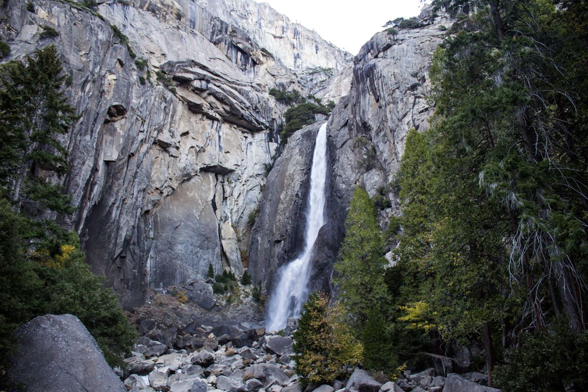
This viewing area provides a close look at Lower Yosemite Fall from the waterfall’s base. During strong spring flow, visitors can expect wind and mist.
Yosemite Falls combines Upper Yosemite Fall, a series of central cascades, and Lower Yosemite Fall. Together, they descend 2,425 feet, making Yosemite Falls one of North America’s tallest waterfalls.
The upper fall and middle cascades cannot be seen from this viewpoint. For a complete view, use Cook’s Meadow Loop or the western viewpoint on the Lower Yosemite Fall loop.
Getting there
The wheelchair-accessible eastern section of the Lower Yosemite Fall loop begins at the Yosemite Falls shuttle stop. It travels about 0.6 miles one way to the viewing area and crosses several braided streams.
The Lower Yosemite Fall Shuttle Stop is about 0.3 miles away. Bicycle racks stand at both the eastern and western trailheads because bicycles are prohibited on the loop and at the viewpoint.
Nearby gateway communities include El Portal, California, about 12 miles away in a straight line. Mariposa is about 27 miles away, and Oakhurst is about 29 miles away.
Air travelers may use Fresno Yosemite International Airport or San Francisco International Airport. The provided facts do not specify routes or ground transportation from either airport.
What to see and do
Watch Lower Yosemite Fall descend the cliffs directly ahead. Spring brings the strongest flow, along with spray and gusty conditions at the viewpoint.
Yosemite Creek supplies the waterfall entirely through melting snow. At peak flow in late spring, water can cross the upper fall’s edge at 2,400 gallons per second.
Under high-flow conditions, usually during April and May, a full moon may produce a moonbow in the waterfall’s mist. Its visibility depends heavily on flow, cloudless skies, and the moon’s position.
Visitors can also photograph the waterfall or continue around the paved Lower Yosemite Fall loop. Stay on the paved route throughout the area.
History and nature
The waterfall reflects Yosemite’s seasonal snow cycle. Yosemite National Park spans nearly 1,200 square miles of the Sierra Nevada. Park elevations range from about 2,000 feet to about 13,000 feet.
The park receives 95% of its precipitation from October through May. More than 75% falls between November and March. Much of Yosemite remains snow-covered from roughly November through May.
Winter creates distinctive ice features around Yosemite Falls. An ice cone forms below Upper Yosemite Fall and can grow beyond about 300 feet. It generally disappears by mid-April.
Frazil ice may develop in waterfalls and creeks during early spring. It forms when mist from the falling water becomes extremely cold.
When to go
The loop and viewing area can be visited throughout the year. Water levels vary sharply because Yosemite Creek relies entirely on snowmelt.
Late spring generally has the strongest waterfall flow. April and May can bring conditions favorable for moonbows when water volume, clear skies, and the moon’s angle align.
By late summer, the waterfall often has no water. Winter may bring rain or snow to Yosemite Valley, while much of the wider park is usually covered by snow from about November through May.
Accessibility
The full Lower Yosemite Fall loop has a paved surface. The eastern route is wheelchair accessible for about 0.6 miles one way between the Yosemite Falls shuttle stop and the viewpoint.
This route crosses several branching streams before arriving at the waterfall. The viewing area includes seating designed for transferring onto granite boulders positioned at wheelchair height.
Yosemite Exploration Center Parking, identified as wheelchair accessible, is about 0.4 miles away. Conditions can change with weather, snow, ice, water, and seasonal runoff.
Fees and rules
Yosemite National Park entrance fees are:
- Private vehicle: $35
- Motorcycle: $30
- Per person: $20
- Non-commercial groups: $300
Pets are allowed on the trail when leashed. Bicycles are not permitted anywhere on the Lower Yosemite Fall loop, including the viewing area.
Remain on the paved trail. Rocks and boulders upstream from the wooden footbridge over Yosemite Creek stay slippery, even when they appear dry. Leaving the route here frequently causes serious injuries.
Follow all posted rules and leave no trace. Yosemite National Park remains open 24 hours per day throughout the year.
Nearby trails and places
Cook’s Meadow Loop is about 0.4 miles away and about 0.4 miles as mapped. It provides a place to view the full height of Yosemite Falls.
Camp 4 West Trail is about 0.6 miles away and about 0.4 miles as mapped. The Valley Loop Trailhead is about 0.3 miles from the viewing area.
Several visitor facilities and destinations are close by:
- Yosemite Falls Restroom is about 0.3 miles away.
- Lower Yosemite Fall Shuttle Stop is about 0.3 miles away.
- Lower Yosemite Fall Picnic Area is about 0.3 miles away.
- Yosemite Falls is about 0.3 miles away.
- Girls’ Club and Mariposa County Library Yosemite Branch is about 0.4 miles away.
- Yosemite Valley Lodge Post Office is about 0.4 miles away.
- Yosemite Exploration Center Restroom is about 0.4 miles away.
- Yosemite Exploration Center Parking is about 0.4 miles away.
- Indian Village of Ahwahnee is an exhibit and wayside about 0.4 miles away.
Before you go
Check current conditions and alerts on the park’s National Park Service website. Seasonal runoff, snow, ice, mist, and dry late-summer conditions can substantially change the visit.
Carry water and pack layers. Spring spray can make the viewpoint windy and wet. Keep to paved surfaces, obey bicycle restrictions, and leash pets.
Use the wooden footbridge to cross Yosemite Creek. Do not climb onto the rocks or boulders above it, regardless of how dry they look.
Questions
Is Lower Yosemite Fall Viewing Area wheelchair accessible?
Yes. The eastern route is paved and wheelchair accessible for about 0.6 miles one way from the shuttle stop.
Can the full Yosemite Falls be seen from the viewing area?
No. The upper fall and middle cascades are not visible from this viewpoint at the lower fall’s base.
Where can visitors see the full height of Yosemite Falls?
Cook’s Meadow Loop and the western viewpoint on the Lower Yosemite Fall loop offer views of the complete waterfall.
When does Lower Yosemite Fall have the strongest flow?
Flow is usually strongest in late spring because Yosemite Creek is supplied entirely by melting snow.
Does Lower Yosemite Fall run all year?
The viewing area is open year-round, but the waterfall often has no water by late summer.
Are pets allowed at Lower Yosemite Fall?
Yes. Leashed pets are permitted on the trail.
Are bicycles allowed at the viewing area?
No. Bicycles are prohibited on the loop and at the viewpoint. Racks are available at both trailheads.
Is it safe to climb on rocks near Yosemite Creek?
No. Rocks above the wooden footbridge are slippery even when dry, and off-trail travel frequently causes serious injuries.
Nearby
Places
- Yosemite Falls Restroom
- Lower Yosemite Fall Shuttle Stop
- Lower Yosemite Fall Picnic Area
- Yosemite Falls
- Valley Loop Trailhead
- Girls’ Club & Mariposa County Library Yosemite Branch
- Yosemite Valley Lodge Post Office
- Yosemite Exploration Center Restroom
On the map
7 trails7 places to see
Facts on this page draw on the National Park Service: Lower Yosemite Fall Viewing Area (nps.gov)