










West Rim Trail
| Length | about 14.4 miles as mapped by NPS |
|---|---|
| Surface | Native |
| Open to | Hiking |
| Route | One way (out and back doubles it) |
| High point | about 7,470 ft |
| Low point | about 4,280 ft |
| Up and down (one way) | about 4,040 ft up, 880 ft down |
At a glance
- Length: About 14.4 miles as mapped by the National Park Service
- Route: One way, with endpoints near West Rim and Lava Point trailheads
- Use: Hiking
- Mapped surface: Native
- Elevation: About 4,280 feet to about 7,470 feet
- One-way elevation change: About 4,040 feet of climbing and about 880 feet of descent
- Shorter outing: West Rim to Scout Lookout
- Typical Scout Lookout time: 3–4 hours
- Seasons: Winter, spring, summer and fall
- Times: Day, night, dawn and dusk
The endpoints are in different places. Walking the entire route out and back doubles the distance.
Why hike it
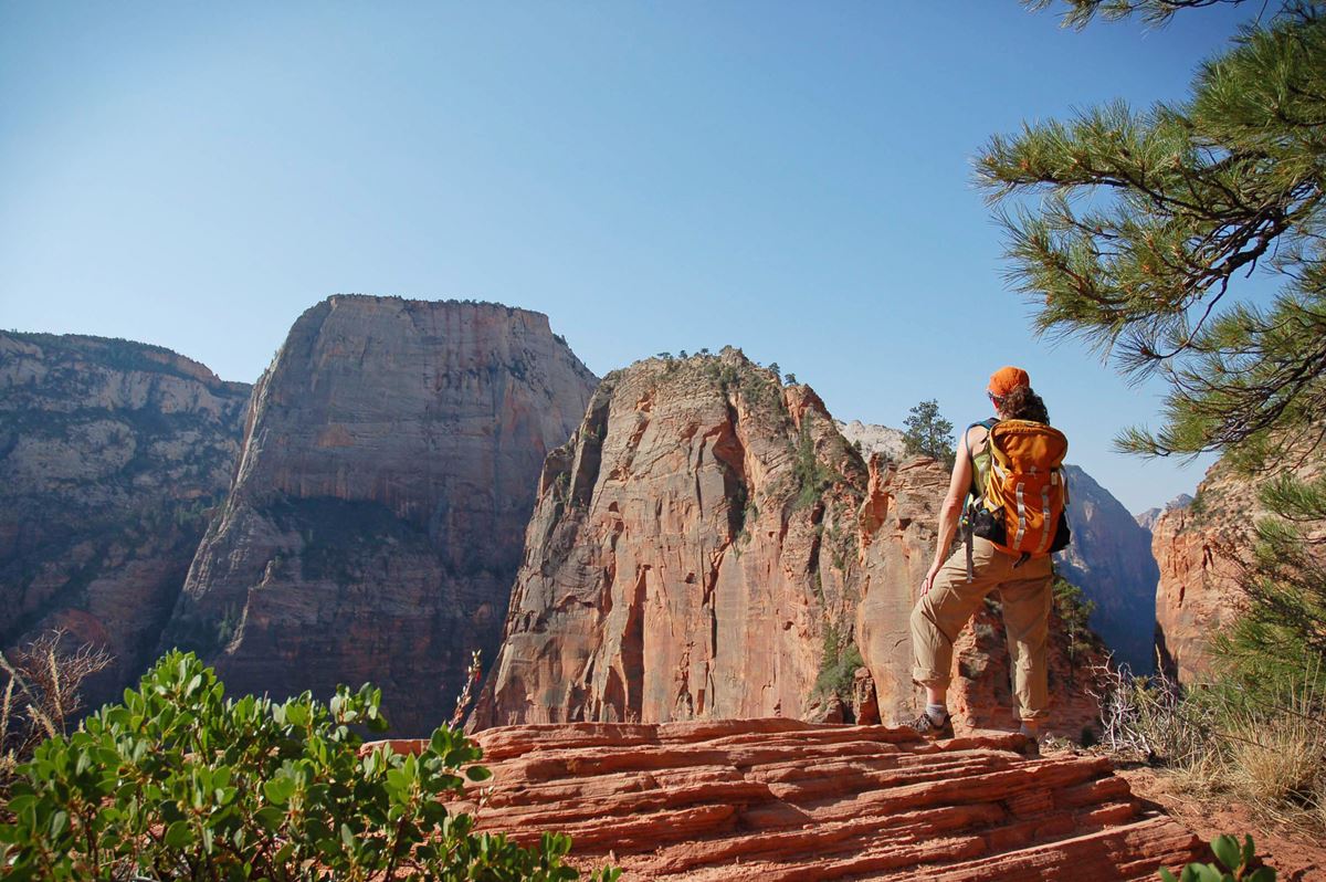
The West Rim Trail offers a strenuous climb above Zion Canyon. The route crosses the Virgin River and follows steep switchbacks along the canyon wall.
A popular shorter hike ends at Scout Lookout. This sandy, relatively level area has some shade and views across Zion Canyon.
California condors may be seen around the cliffs. They are an endangered species.
Getting to the trailhead
For the Scout Lookout hike, begin at The Grotto, shuttle stop #6. Cross the road, then cross the bridge to join the West Rim Trail.
The mapped route begins near West Rim Trailhead and The Zion Grotto. It ends near Lava Point Trailhead at about mile 14.4.
The Grotto has up-canyon and down-canyon shuttle stops. Its parking lot, drinking water and restroom are about 0.1 miles away.
West Rim Trailhead, Lava Point Trailhead and West Rim Trailhead are listed at the route. Lava Point Overlook is about 0.3 miles away.
Zion Canyon, the main visitor center, is about 5 miles away. Springdale, Utah, is about 6 straight-line miles away. Hurricane, Utah, is about 20 straight-line miles away.
Nearby airports include St. George Regional Airport and Harry Reid International Airport.
On the trail
From The Grotto, cross the Virgin River and begin climbing the canyon wall. A sequence of steep switchbacks gains elevation quickly.
The trail then becomes flatter in Refrigerator Canyon. This segment provides a break from the earlier heat and climbing.
The ascent soon resumes at Walter’s Wiggles. These 21 switchbacks lead toward Scout Lookout.
Scout Lookout is comparatively flat and sandy, with some shade. A junction here connects the West Rim Trail with the route to Angels Landing.
The shorter West Rim to Scout Lookout hike climbs about 1,000 feet above the canyon floor. NPS lists a typical duration of 3–4 hours, or about 200 minutes.
The full mapped route starts near an elevation of about 4,300 feet. Its final mapped point is about 7,470 feet.
Across the one-way route, hikers climb about 4,040 feet and descend about 880 feet. The lowest estimated point is about 4,280 feet.
On an out-and-back hike, the one-way descent becomes climbing on the return. The substantial elevation change and separated endpoints require careful route planning.
What you will see
The route rises from the Virgin River along the canyon wall. Refrigerator Canyon interrupts the exposed climbing before Walter’s Wiggles resumes the ascent.
Scout Lookout provides views of Zion Canyon from high above the canyon floor. The surrounding cliffs are habitat for endangered California condors.
Many hikers turn around at Scout Lookout after taking in the canyon views. Others continue along the West Rim Trail or toward Angels Landing.
History and nature
Walter’s Wiggles consists of 21 switchbacks on the climb toward Scout Lookout. It follows the flatter passage through Refrigerator Canyon.
California condors live among Zion’s cliffs. Scout Lookout is one place where hikers may watch for them.
The full trail’s mapped surface is native. The detailed NPS accessibility assessment covers the shorter route toward Scout Lookout and describes several surface types.
When to go
The trail is listed for winter, spring, summer and fall. It can be used during the day, at night, around dawn and at dusk.
Weather can vary sharply with elevation. Temperatures between day and night may differ by more than 30°F.
Summer temperatures often rise above 100°F. Zion’s monsoon period extends from mid-July through September, increasing flash-flood danger.
Storms and lightning can also threaten hikers. Winters are usually mild, but visitors should prepare for varied conditions in every season.
Accessibility
NPS accessibility details apply to a 1.9-mile, one-way portion of the trail. That assessed segment gains about 1,187 feet and loses about 63 feet.
Its typical grade is 12.9%, with a maximum grade of 43%. About 67% of the assessed route has a grade of at least 8.3%.
The typical cross slope is 3.7%, and the maximum is 18.7%. Tread width is typically 63 inches and narrows to 21 inches.
About 81.1% of the assessed surface is hard concrete. Another 17.3% is concrete covered by firm soil, while 1.7% is another surface type.
These figures describe the shorter assessed segment. The full mapped trail is listed with a native surface.
Permits, fees and rules
No permit requirement is listed for hiking the West Rim Trail to Scout Lookout. Continuing from the junction to the end of Angels Landing requires a recreation.gov permit.
Zion National Park entrance fees are:
- Private vehicle: $35
- Motorcycle: $30
- Snowmobile: $20
- Per person: $20
The park is open every day of the year. Follow posted trail rules and leave no trace.
Nearby trails and places
Kayenta Trail meets the area and is about 0.7 miles long. Wildcat Canyon Trail is about 0.1 miles away and about 5.7 miles long.
Barney’s Trail is about 0.5 miles away and about 0.3 miles long. Additional trails about 0.6 miles away include:
- Middle Emerald Pools Trail, about 0.9 miles
- Pathways Trail, about 0.4 miles
- Lower Emerald Pools Trail, about 0.7 miles
The Zion Grotto is about 0.1 miles from the mapped trail. The nearby Grotto area includes parking, drinking water, a restroom and two shuttle stops.
A restroom is also available at Scout Lookout, about mile 1.6. Scout Lookout has no drinking water.
Lava Point Overlook is about 0.3 miles away. The West Rim, Lava Point and West Rim Trailhead locations mark access around the route.
Before you go
Check current trail conditions, shuttle information, weather and park alerts on Zion National Park’s NPS website. Plan transportation between endpoints before attempting the full one-way route.
Carry water beyond The Grotto because Scout Lookout has none. Pack layers for elevation and temperature changes.
Avoid exposed terrain when storms or lightning threaten. During monsoon season, pay particular attention to flash-flood risk.
Use the restroom and fill water containers at The Grotto before starting. Follow posted rules and leave no trace.
Questions
How long is the West Rim Trail in Zion National Park?
It is about 14.4 miles as mapped by the National Park Service.
Where does the West Rim Trail start?
The mapped route starts near West Rim Trailhead and The Zion Grotto. The Scout Lookout hike begins at Grotto shuttle stop #6.
How long does it take to hike from The Grotto to Scout Lookout?
NPS lists a typical time of 3–4 hours, or about 200 minutes.
How much elevation does the full West Rim Trail gain?
The mapped one-way route has about 4,040 feet of climbing and about 880 feet of descent.
Is there water on the West Rim Trail?
Drinking water is available at The Grotto. There is no water at Scout Lookout.
Are there restrooms on the West Rim Trail?
Restrooms are available at The Grotto and Scout Lookout. The mapped facilities place them near miles 0 and 1.6.
Do hikers need a permit for Scout Lookout?
No permit requirement is listed for Scout Lookout. A permit is required to continue to the end of Angels Landing.
Is the West Rim Trail an out-and-back hike?
The full route is one way with different endpoints. Hiking it out and back doubles the distance.
Nearby
Trails
Places
- West Rim Trailhead
- Lava Point
- West Rim
- The Zion Grotto
- Grotto Restroom
- Grotto – Up Canyon
- Grotto – Down Canyon
- Drinking water
On the map
9 trails24 places to see7 visitor services
Facts on this page draw on the National Park Service: West Rim to Scout Lookout (nps.gov)