Visiting Grand Teton National Park with Limited Mobility: Accessible Views and Trails
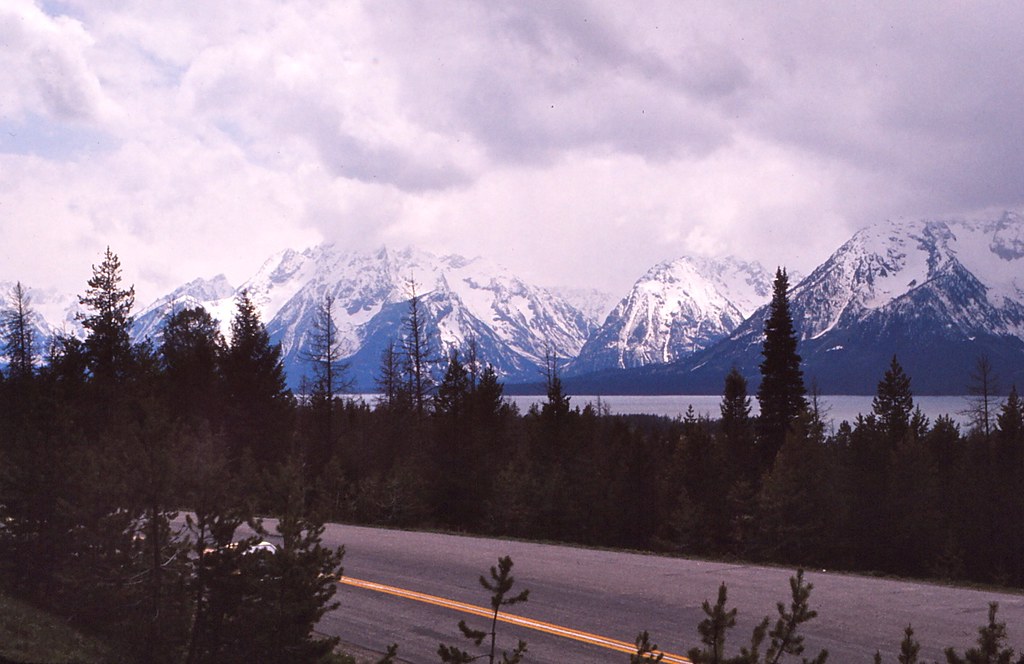
Photo: Ladycliff via Flickr (CC BY 2.0)
Visiting Grand Teton National Park with limited mobility can begin at Oxbow Bend just after sunrise, when Mount Moran reflects in a broad reach of the Snake River and the only sounds are waterfowl, rustling cottonwoods, and an occasional elk calling from the willows. The viewpoint requires little movement from the vehicle, yet it reveals the park’s defining scale: a 12,610 foot mountain rising beyond wetlands formed by a slow, shifting river.
Grand Teton works unusually well for travelers who experience fatigue, use wheelchairs or walkers, or cannot manage steep and uneven trails. Many major landscapes are visible from paved roads, pullouts, lakeside developed areas, and short paths. Our guide follows the park’s main driving corridors, identifies the most practical viewpoints, and separates genuinely manageable routes from trails whose gentle appearance hides roots, gravel, or abrupt grades.
Visiting Grand Teton National Park Starts with Understanding the Terrain
The park occupies Jackson Hole, a high valley bordered by the Teton Range on the west and the Gros Ventre Range on the east. Most developed visitor areas sit between approximately 6,300 and 6,800 feet, while Grand Teton reaches 13,775 feet. Even without hiking uphill, the elevation can increase breathlessness and fatigue. Allow extra time for transfers, drink regularly, and schedule shorter stops during the first day if arriving from near sea level.
Why the Mountains Rise So Abruptly
The Tetons rise directly from the valley because movement along the Teton Fault lifted the western block and dropped the basin beneath Jackson Hole. Glaciers later carved U shaped canyons and deep lake basins, producing the sharp skyline seen from Jenny Lake and Teton Park Road. There are few foothills to block the range, so roadside viewpoints provide unusually complete mountain views without requiring elevation gain.
Accessible Does Not Mean Identical at Every Stop
Conditions vary from paved, nearly level walks to compacted paths with cross slopes, loose gravel, roots, and narrow edges. A power wheelchair may handle a surface that challenges a manual chair, while someone using a cane may find distance more limiting than texture. Snowbanks, construction, and temporary closures can also alter access. Current fees, road openings, facility status, and formal accessibility designations should be confirmed on the official park site before departure.
- Paved viewpoints: Usually the easiest choice for wheelchairs, walkers, and travelers who need frequent seating or vehicle access.
- Roadside pullouts: Often provide excellent views, but traffic, gravel shoulders, and uneven transitions can complicate unloading.
- Developed lakeshores: Jenny Lake, Jackson Lake Dam, and Colter Bay provide short routes near parking, though surfaces differ.
- Natural surface trails: Distances may look modest, but roots, loose stones, and drainage channels frequently determine usability.
A Practical Driving Framework for Visiting Grand Teton National Park with Limited Mobility
Two principal roads create the park’s classic scenic circuit. US 89, 191, and 26 follows the open eastern valley, passing Mormon Row access, Snake River Overlook, Oxbow Bend, and the Moran area. Teton Park Road runs closer to the mountains through Moose, Jenny Lake, Signal Mountain, and Jackson Lake Junction. Together they form a roughly 42 mile loop, excluding side trips and the drive south to Jackson.
The Eastern Highway Favors Frequent Vehicle Based Views
The eastern corridor is the stronger choice when transfers are difficult. Broad pullouts reveal the entire range across sagebrush flats, river terraces, and wetlands. Snake River Overlook frames the river below the central peaks, although mature trees obscure portions of the historic composition photographed by Ansel Adams. Oxbow Bend gives a closer wetland view, with Mount Moran dominating the western horizon.
Teton Park Road Reaches Lakes and the Mountain Front
The western corridor places visitors beneath glacial peaks and beside Jenny and Jackson lakes. Driving north from Moose, turnouts face Teewinot Mountain, Mount St. John, and the Cathedral Group. Traffic and parking pressure are greatest around Jenny Lake from late morning through afternoon. Our team recommends arriving early, then continuing north toward Signal Mountain and Jackson Lake when the central area becomes crowded.
| Corridor or zone | Defining experience | Mobility considerations |
|---|---|---|
| Eastern highway | Panoramic range, river, and wildlife views | Many scenes can be viewed from or near a vehicle |
| Teton Park Road | Close mountain walls and glacial lakes | Developed stops are practical, but popular parking areas fill early |
| Moose-Wilson Road | Forest, wetlands, and wildlife habitat | Narrow roadway and limited stopping opportunities require careful planning |
| Signal Mountain Road | Elevated views across Jackson Hole | Seasonal, winding road with short walks at upper viewpoints |
Accessible Views with Minimal Walking in Grand Teton National Park
Grand Teton’s most revealing viewpoints occupy different habitats. Pairing a mountain front stop with a wetland or river overlook shows how glaciers, faulting, and flowing water shaped the valley. It also improves wildlife opportunities because elk and pronghorn favor open flats, while moose, beavers, and waterfowl concentrate near willow lined channels and ponds.
Visiting Grand Teton National Park from the Mountain Front
Jenny Lake presents the range at close range, with Cascade Canyon opening between Teewinot Mountain and Mount St. John. The developed visitor area includes short paved connections toward the lake and boat dock, although grades and crowding vary by route. Farther north, Jackson Lake Dam provides a broad view across the reservoir toward Mount Moran and the northern Tetons, generally with less walking than a lakeshore trail.
Jenny Lake Shoreline
From the developed area, the sound of boat engines fades beneath wind moving through lodgepole pines. The pavement gives way near the shore, where cold air often comes off the lake even on a warm afternoon. Across the water, exposed rock walls rise more than a vertical mile, and Cascade Canyon appears as a deep notch rather than the shallow opening it resembles from the highway.
Signal Mountain Summit Road
A seasonal road climbs roughly five miles to overlooks on Signal Mountain, a forested ridge separated from the main Teton crest. The upper viewpoints look east across the Snake River and glacial outwash plains rather than directly into the tallest peaks. The road is narrow and winding, but it replaces a strenuous climb with a drive and very short approaches near the summit area.
River and Wetland Viewpoints
Oxbow Bend is most productive near dawn and dusk, when calmer water improves reflections and wildlife activity increases. Use the established pullout rather than stopping along the highway. At Snake River Overlook, the paved viewing area sits close to parking, but the route may include curb transitions and congested pedestrian space. Both locations have exposed conditions, with strong sun in summer and biting wind during spring and autumn.
Accessible Trails That Deliver a Real Sense of Place
Distance alone is a poor measure of accessibility. A quarter mile over loose gravel can demand more effort than a longer paved promenade. At Grand Teton, the most dependable short experiences cluster around Jenny Lake, Colter Bay, and Jackson Lake Dam. Travelers should inspect the first section of any natural surface route before committing, particularly after rain or spring snowmelt.
Visiting Grand Teton National through Jenny Lake’s Developed Area
The connections between parking, the visitor area, the boat dock, and the lakeshore create a flexible outing that can be shortened at several points. This is preferable to attempting the full Jenny Lake Loop, which covers more than seven miles and includes rocks, roots, changing grades, and narrow sections. Boat transportation can reduce walking for some itineraries, but dock ramps and boarding conditions should be evaluated for the individual traveler.
Colter Bay and the Jackson Lake Shore
Colter Bay provides close access to Jackson Lake in the park’s northern half. Developed paths around the visitor and marina zone are more manageable than the full Colter Bay Lakeshore Trail, a roughly two mile natural surface loop with roots, stones, and uneven sections. For a brief outing, concentrate on the marina approach and nearby lake views, where Mount Moran rises across the water and benches or developed edges may provide useful rest points.
Quieter Stops Beyond the Main Lake Corridors
Several lower traffic sites add cultural history and wildlife habitat without requiring a conventional hike. These stops have fewer developed surfaces than Jenny Lake, so they suit travelers who can manage a brief transfer or view the landscape from beside a vehicle. Morning generally brings firmer ground, cooler temperatures, and less congestion. Afternoon thunderstorms can leave unpaved parking areas muddy and create deep puddles at shoulder transitions.
Mormon Row and the Southern Valley
Mormon Row preserves homesteads established by Latter-day Saint settlers beginning in the 1890s. The T. A. Moulton Barn and John Moulton Barn stand against the central Teton skyline, roughly 13 miles north of Jackson by road. Parking areas and access roads may be gravel, while the ground around the buildings is rough pasture rather than a level walkway. Strong views remain available close to the vehicle, particularly near the northern barn cluster.
Blacktail Ponds and Cunningham Cabin
Blacktail Ponds Overlook surveys wetlands created where groundwater and old Snake River channels meet. The roadside position makes it useful for spotting elk, moose, sandhill cranes, and waterfowl without crossing a large developed area. Farther north, Cunningham Cabin interprets the valley’s ranching period, but reaching the structure involves a natural surface path. Travelers unable to negotiate ruts or uneven grass can still examine the historic setting from the parking area.
Seasonal Conditions Change the Mobility Equation
The most practical period for Visiting Grand Teton National generally extends from late spring into early autumn, when the principal roads and developed lakeside areas are open. Conditions can still shift rapidly at valley elevations above 6,000 feet. Snow may cover path edges in May, summer afternoons can exceed 80 degrees Fahrenheit, and September mornings frequently begin below freezing. Shade is limited at exposed overlooks such as Mormon Row and Snake River Overlook.
Choosing a Travel Window
| Period | Typical conditions | Mobility planning priority |
|---|---|---|
| May to early June | Cool mornings, lingering snow, wet natural surfaces | Favor paved stops and expect muddy shoulders |
| Late June to August | Warm days, thunderstorms, heavy visitation | Start early and carry sun and rain protection |
| September to October | Cold mornings, shorter days, possible early snow | Use layered clothing and finish drives before dark |
| Winter | Deep snow and extensive seasonal road closures | Plan around plowed corridors and specialized transport |
Wind, Smoke, and Altitude
Wind across Jackson Lake can lower the effective temperature quickly and make balance difficult for people using canes or walkers. Regional wildfire smoke may also reduce visibility and aggravate respiratory conditions during late summer. Check the air quality forecast before committing to a long driving circuit. At altitude, headaches, nausea, unusual fatigue, and shortness of breath warrant rest and descent rather than pushing through another stop.
Build a Day Around Energy, Access, and Wildlife
A successful route limits repeated transfers and alternates exposed viewpoints with developed rest stops. Begin on the eastern highway while morning light reaches the range, then cross toward Jackson Lake before central parking areas become busy. Save Jenny Lake for early morning or late afternoon. Moose-Wilson Road demands greater attention because it is narrow, wildlife can stop traffic, and convenient pullouts are scarce.
A Low-Transfer Scenic Sequence
- Start at Mormon Row for sunrise light on the barns and central peaks.
- Continue north to Snake River Overlook and Oxbow Bend.
- Use Jackson Lake Dam for a broad mountain view with a short approach.
- Pause in the developed Colter Bay area for food, rest, or a lakeshore look.
- Return south on Teton Park Road, adding Signal Mountain or Jenny Lake only if energy permits.
Wildlife Distance and Roadside Safety
Remain at least 100 yards from bears and wolves and 25 yards from other wildlife, including moose, elk, and bison. A moose near a paved path can eliminate an otherwise accessible route, so wait or leave rather than attempting to pass. Carry bear spray where it can be reached immediately, and make sure everyone understands how to remove its safety clip. Never position a wheelchair or mobility device in the traffic lane for a photograph.
Plan for the Views You Can Reach Comfortably
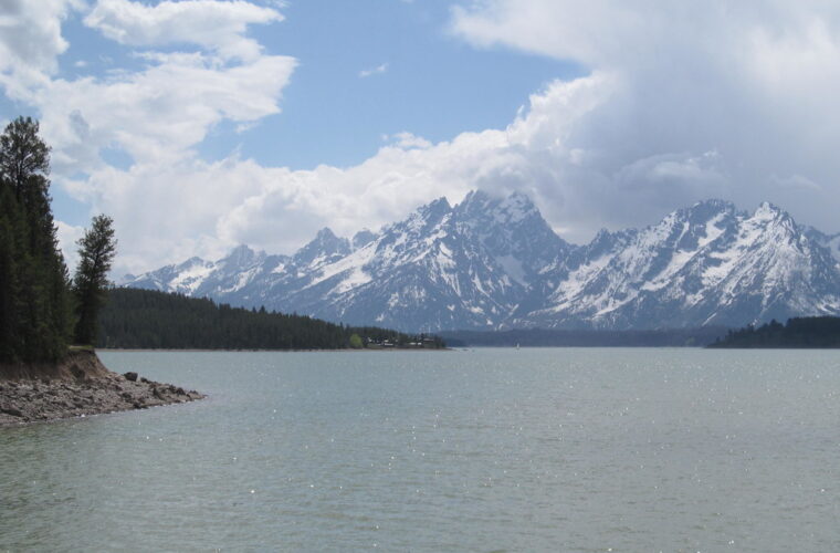
Grand Teton rewards careful selection. Oxbow Bend reveals the river ecosystem, Jackson Lake Dam opens a wide view toward Mount Moran, and the Jenny Lake developed area places visitors directly beneath the fault-block range. Combining those locations creates a complete sense of the park without depending on long trails, steep grades, or repeated difficult transfers.
Match each stop to the traveler’s surface tolerance, stamina, and transfer needs rather than relying on distance alone. Begin early, preserve flexibility for weather and wildlife, and treat natural surface paths as optional additions. With that approach, limited mobility still allows close contact with the park’s glacial lakes, historic valley floor, wetlands, and abrupt mountain skyline.
Want to keep exploring? Browse all our Grand Teton guides and articles for more trip-planning tips and ideas.
Gear & Essentials
Tell us about your trip and we will add what else you will want:
The basics
Worth having in the car whatever the park.
For this trip
Traveling with kids
Bringing a pet
RVing
Backcountry
Winter conditions
On the water
Photography
Accessibility
As an Amazon Associate we earn from qualifying purchases, at no extra cost to you.