Visiting Olympic National Park with Limited Mobility: Accessible Views and Trails
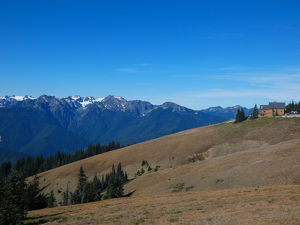
Photo: concrete&fells via Flickr (CC BY 2.0)
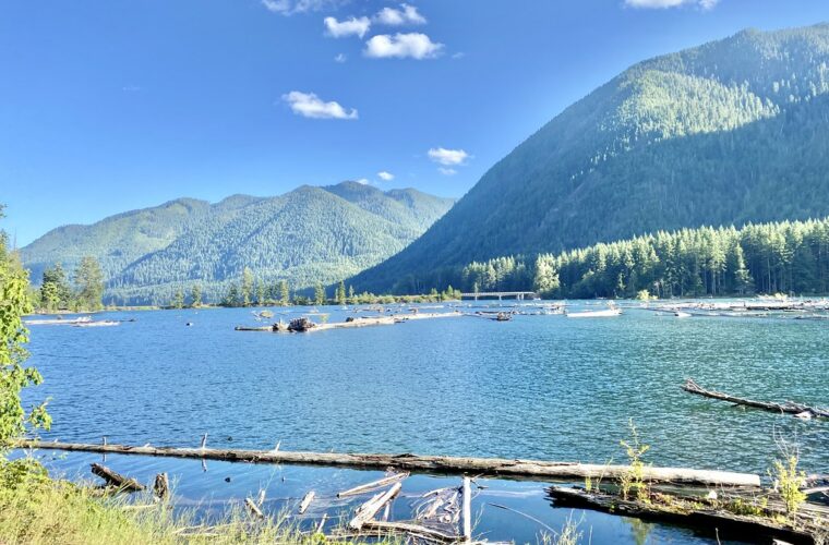
Visiting Olympic National Park at sunrise can begin beside Lake Crescent, where mist hangs over blue water and the forest muffles nearly every sound. At the accessible Bovee’s Meadow area, the shoreline lies close to the parking area, Douglas firs rise overhead, and the lake’s glacially carved basin stretches toward Mount Storm King. Cool air settles along the water even when nearby Port Angeles is warmer.
For travelers with limited mobility, Olympic requires careful route planning. The park covers nearly one million acres and wraps around the Olympic Mountains rather than crossing them. Its principal areas are separated by long drives, and conditions range from alpine snowfields to temperate rain forest and driftwood beaches. Our team recommends treating each corridor as a distinct outing, then matching viewpoints and short trails to your walking range, wheelchair or scooter, and tolerance for grades or rough surfaces.
Visiting Olympic National Park with Limited Mobility Starts with Understanding Its Geography
Olympic occupies most of Washington’s Olympic Peninsula, with US Highway 101 forming the main driving loop around its outer edge. No public road crosses the mountainous interior. A route between Hurricane Ridge and the Hoh Rain Forest, for example, returns to Highway 101 and takes roughly three hours without substantial stops. Building an itinerary around two adjacent regions saves energy and avoids spending the day transferring in and out of a vehicle.
Four landscapes separated by substantial drives
The most practical accessible itinerary divides the park into four zones: Hurricane Ridge, the Lake Crescent and Elwha corridor, the western rain forests, and the Pacific coast. Port Angeles is the primary base for the northern side. Forks provides access to the Hoh and northern beaches, while the Lake Quinault area works better for the southwestern rain forest and southern coast. The Quinault and Hoh valleys may look close on a map, but their approach roads are separate.
| Park zone | Defining experience | Mobility advantage | Main limitation |
|---|---|---|---|
| Hurricane Ridge | Alpine views near 5,242 feet | Major scenery from developed viewpoints | Steep trails and lingering snow |
| Lake Crescent and Elwha | Glacial lake and lowland waterfall | Short paved approaches | Several famous trails have roots and grades |
| Hoh and Quinault | Temperate rain forest | Roadside forest and short nature routes | Mud, roots, and crowded parking |
| Pacific coast | Sea stacks, surf, and driftwood | Some views require little walking | Sand, cobbles, logs, and steep access paths |
Why mileage can mislead
Roads entering Olympic’s valleys are slow, narrow, and sometimes winding. A destination 20 miles from Highway 101 can require considerably more time than an urban trip of the same distance. Wildlife, road repairs, winter storm damage, and single lane sections can add delays. Restrooms, food, fuel, and cellular service also become less dependable after leaving the highway, so complete those stops in gateway communities before entering a long corridor.
How to Plan an Accessible Day When Visiting Olympic National Park
Limited mobility means different things at different times. A paved path can still be difficult when it climbs continuously, while a compact gravel overlook may work well for someone using a cane. Olympic’s heavy rainfall creates another variable: wet leaves, moss, exposed roots, and wooden surfaces become slippery. Assess surface, grade, distance from parking, and the availability of places to sit rather than relying solely on a trail’s mileage.
Choose one signature area and one nearby stop
A manageable northern day might pair Hurricane Ridge with Lake Crescent. On the west side, combine the Hoh Rain Forest with a roadside coastal viewpoint rather than adding another rain forest valley. Travelers who need frequent breaks should plan the highest priority location first, when energy is strongest and parking areas are less congested. A midday rest can be more useful than squeezing in a third region.
A Practical Mobility Checklist for Visiting Olympic National Park
- Measure total movement: Include parking lots, restroom approaches, ramps, and the return to the vehicle, not only the signed trail distance.
- Carry mobility equipment: Bring the cane, trekking poles, rollator, wheelchair, or scooter that works on the expected surface. Standard indoor scooters may struggle with compact gravel.
- Pack for rain: Use a waterproof outer layer and shoes with reliable tread. Umbrellas can be awkward on narrow forest paths.
- Bring food and water: Services are concentrated in gateway communities and a small number of developed areas.
- Download information: Save maps before entering the valleys because mobile coverage is inconsistent.
Seasonal conditions that affect access
July through September generally brings the driest weather and the broadest road access, but also the largest crowds. Hurricane Ridge can retain snow into early summer, while the Hoh and Quinault remain rainy even during otherwise settled periods. Autumn storms scatter branches and leaves across paths. Winter brings short daylight, mountain snow, coastal wind, and occasional road closures. Current road status, entrance requirements, facility availability, and accessibility notices should be confirmed on the official park site.
Visiting Olympic National Park’s Northern High Country
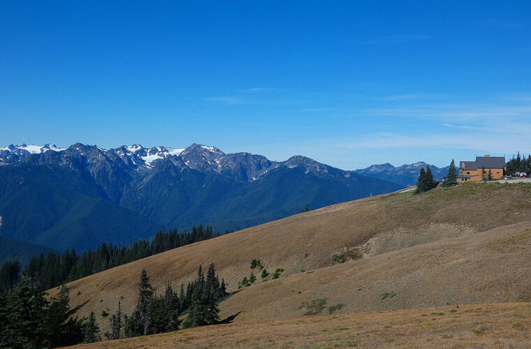
Hurricane Ridge provides the park’s most efficient large scale mountain experience for visitors who cannot hike far. The paved road climbs approximately 17 miles from Port Angeles into the Olympic Mountains, gaining thousands of feet through lowland forest and montane terrain. Near its upper end, open slopes reveal Mount Olympus, glacier cut valleys, and the jagged Bailey Range. Clear days may also bring views north across the Strait of Juan de Fuca toward Vancouver Island.
Hurricane Ridge viewpoints
The developed ridge area allows visitors to experience alpine scenery close to parking, although grades and temporary facility layouts can affect the easiest route. Meadows around the ridge support black tailed deer, Olympic marmots, avalanche lilies, and lupines. Stay on hardened surfaces where possible because the short growing season makes alpine vegetation vulnerable to trampling. Binoculars help reveal distant snowfields and animals without requiring additional walking.
What the elevation feels like
Stepping out at Hurricane Ridge can mean a temperature drop of 15 to 20 degrees Fahrenheit compared with Port Angeles. Wind moves across the exposed slope, ravens call above the parking area, and ridgelines appear in layers beyond the meadows. Even a short walk can feel harder at elevation and on a continuous grade. Pause before committing to a trail, then judge breathing, balance, and weather from the nearest viewpoint.
Trails to approach cautiously
The paved Hurricane Hill Trail is approximately 3.2 miles round trip and gains about 700 feet. Its smooth surface can suggest an easy outing, but sustained climbing and steep sections make it unsuitable for many manual wheelchair users and tiring for travelers with limited stamina. The shorter Cirque Rim and High Ridge routes also include grades and uneven transitions. The immediate developed area usually delivers the best effort to scenery ratio.
Visiting Olympic National Park: Accessible Views at Lake Crescent and Elwha Valley
Lake Crescent sits about 20 miles west of Port Angeles in a deep basin carved by Pleistocene glaciers. The lake reaches a maximum depth of more than 600 feet, and its unusually clear, nutrient poor water often appears blue or turquoise. Highway 101 follows the southern shore, making this one of Olympic’s easiest major landscapes to incorporate into a limited mobility itinerary.
Accessible shoreline scenery at Bovee’s Meadow
Bovee’s Meadow, near the eastern end of the lake, offers a short approach to shoreline views and picnic space. Paved and firm surfaces around the developed area are more manageable than the forest trails farther west. Mountain shadows reach the water early, so morning visits can be cool. Afternoon light better illuminates the lake, although summer parking pressure increases as the day progresses.
Madison Falls in the Elwha corridor
Madison Falls is one of Olympic’s most useful short waterfall stops. A paved route of roughly 0.1 mile leads through lowland forest to a viewpoint near the 76 foot cascade. The approach is brief and comparatively gentle, allowing visitors to experience sword ferns, moss covered trunks, and the damp Elwha understory without tackling a rooty trail. The Elwha River itself has been reshaping its channel since two large dams were removed between 2011 and 2014.
Popular routes that require more mobility
Marymere Falls Trail begins near Lake Crescent and covers approximately 1.8 miles round trip. It crosses forest floor, bridges, roots, and a steep final approach with stairs, so the waterfall viewpoint is generally a poor choice for wheelchairs or severe balance limitations. The Moments in Time Trail is shorter, but surface conditions can vary through its forested loop. Travelers should inspect the beginning of either route and turn around before roots, mud, or grades exceed their comfort level.
Rain Forest Experiences Beyond the Main Trails
The western valleys receive roughly 12 to 14 feet of precipitation in an average year, supporting Sitka spruce, western hemlock, bigleaf maple, and dense curtains of epiphytic moss. Visitors do not need to complete the Hall of Mosses to understand this ecosystem. Roadside pullouts, developed visitor areas, and the drive beneath the Hoh canopy reveal nurse logs, fern covered forest floors, and trees whose broad root systems spread across shallow, saturated soil.
The shortest option in the Hoh Rain Forest
Use the Mini Trail before considering longer loops
The Hoh Mini Trail is an approximately 0.1 mile paved loop near the visitor center. It provides the valley’s most manageable introduction for wheelchair users and travelers with limited stamina, although wet leaves and moss can make the pavement slick. The nearby Hall of Mosses Trail covers about 0.8 mile and includes roots, steps, and uneven ground. Its short mileage understates the balance and joint strength required.
Lake Quinault rewards a driving based visit
The approximately 31 mile Quinault loop circles the lake and lower rain forest, with portions of the northern side on gravel road. Waterfalls, enormous conifers, and glimpses of the Quinault River appear close to the road. Merriman Falls can be viewed beside South Shore Road with minimal walking. The half mile Maple Glade Trail presents more difficulty because roots, damp natural surfaces, and changes in grade occur beneath the canopy.
| West side option | Approximate distance | Surface | Primary mobility concern |
|---|---|---|---|
| Hoh Mini Trail | 0.1 mile loop | Pavement | Slippery leaves and moss |
| Hall of Mosses | 0.8 mile loop | Natural tread and boardwalk | Roots, steps, and grades |
| Maple Glade Trail | 0.5 mile loop | Natural tread | Uneven and frequently damp ground |
| Quinault loop drive | About 31 miles | Paved and gravel road | Potholes and rough pullout edges |
Seeing the Pacific Coast Without Crossing the Beach
Olympic protects more than 70 miles of wilderness coastline, but most beaches create serious mobility barriers. Loose sand absorbs energy from every step, cobbles roll underfoot, and driftwood logs can be several feet high. Tides also push visitors toward unstable piles of wood. Travelers who remain near developed overlooks can still watch sea stacks, migrating gray whales, bald eagles, and winter surf without attempting a beach walk.
Rialto Beach has immediate coastal scale
The end of Mora Road reaches Rialto Beach, where the surf and offshore rocks are visible near the parking area. The transition onto the beach consists of loose stones and driftwood, so wheelchair users should treat the paved area as the practical endpoint. Hole in the Wall lies approximately 1.5 miles north along the beach and requires walking over cobbles, around logs, and through areas controlled by the tide. It is unsuitable for a limited mobility outing.
Ruby Beach requires a steep return climb
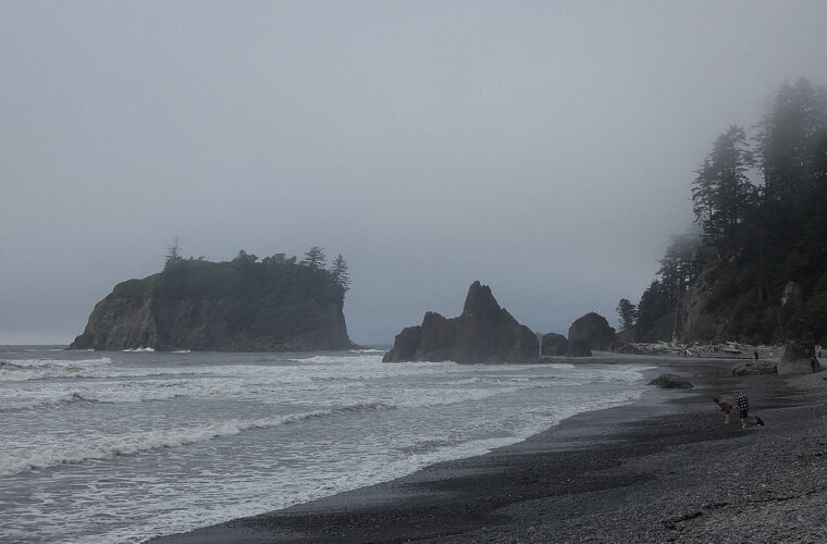
Ruby Beach is known for Abbey Island and its concentration of sea stacks, yet the access path descends from the parking area through forest to the shore. The route is short, roughly 0.2 mile each way, but its grade, uneven surface, and driftwood barrier make the uphill return demanding. Travelers who cannot manage that descent should choose roadside coastal viewpoints farther south rather than assuming the brief distance guarantees easy access.
Keep the tide line out of the itinerary
Coastal conditions change within hours. Rising water can cover firm sand and force walkers onto cobbles or logs, while sneaker waves can reach well above the visible surf line. A mobility aid does not provide reliable stability on saturated sand. For any coastal stop:
- Remain landward of wet driftwood during high surf.
- Keep mobility equipment away from salt water and loose sand.
- Use binoculars for wildlife and offshore rock formations.
- Turn back before fatigue affects balance on the return route.
Kalaloch works well as a scenic driving corridor
Highway 101 follows the coast near Kalaloch, creating several opportunities to experience the Pacific without committing to a long trail. Bluff top viewpoints provide a better mobility fit than stairways descending to numbered beaches. Coastal fog is common even during summer, while winter storms bring powerful wind and salt spray. Allow time for several short stops because visibility can improve dramatically over a few miles.
Building a Realistic Itinerary for Visiting Olympic National Park with Limited Mobility
Visiting Olympic National Park with limited mobility works best when scenery from the vehicle and developed viewpoints forms the core plan. Choose Hurricane Ridge for mountain scale, Lake Crescent for calm shoreline access, and either the Hoh or Quinault corridor for temperate rain forest. Add the coast only when drive time and energy allow. This approach still covers the park’s defining ecosystems while limiting exposure to roots, sand, steep grades, and long transfers.
Keep one alternative ready for rain, snow, or fatigue. Madison Falls can replace a longer forest outing, Bovee’s Meadow can substitute for Marymere Falls, and a coastal overlook can replace a beach descent. Olympic’s size makes restraint valuable. Two carefully selected landscapes usually create a fuller day than four hurried stops, especially when every transfer, restroom approach, and change of surface consumes additional energy.
Want to keep exploring? Browse all our Olympic guides and articles for more trip-planning tips and ideas.
Gear & Essentials
Tell us about your trip and we will add what else you will want:
The basics
Worth having in the car whatever the park.
For this trip
Traveling with kids
Bringing a pet
RVing
Backcountry
Winter conditions
On the water
Photography
Accessibility
As an Amazon Associate we earn from qualifying purchases, at no extra cost to you.