5 Best Fall Hikes in Great Basin National Park
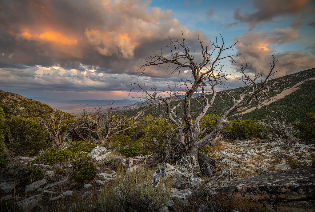
Photo: Andrew V Kearns via Flickr (CC BY 2.0)
Our Best Fall Hikes Great Basin list favors routes with reliable autumn color, cool hiking temperatures, and access to the park’s striking elevation zones. The strongest window usually runs from mid September into early October, when aspens turn along Baker Creek and Lehman Creek while Wheeler Peak, at 13,063 feet, may already receive its first snow. Conditions can shift quickly because the park rises from roughly 5,000 feet to Nevada’s second highest summit.
Five routes stand out: Alpine Lakes Loop, Bristlecone Trail, Wheeler Peak Summit Trail, Baker Lake Trail, and Lehman Creek Trail. They range from a short alpine circuit to demanding summit and canyon hikes. Most visitors enter from Baker, Nevada, then use Wheeler Peak Scenic Drive or Baker Creek Road to reach the relevant trailheads.
Why Fall Works So Well at Great Basin
September generally brings clearer afternoons and lower heat exposure than midsummer, particularly on longer routes through Baker Creek and Lehman Creek. Daytime temperatures can still feel warm near the park entrance, while exposed terrain above 10,000 feet may be windy and close to freezing. This vertical temperature difference makes elevation more important than the date printed on the calendar.
Best Fall Hikes Great Basin Timing by Elevation
Autumn color progresses downhill. Aspen groves near the Wheeler Peak trailhead and Alpine Lakes Loop often begin changing first, followed by stands along Lehman Creek and Baker Creek. The transition can occur within several weeks, and strong wind may strip high elevation leaves quickly. Rabbitbrush and mountain mahogany provide subtler color at lower elevations after the alpine aspens have passed their peak.
Early Fall Above 10,000 Feet
Mid September offers the best balance for Wheeler Peak, Stella Lake, Teresa Lake, and the ancient bristlecone pine grove. Trails are commonly dry, but hikers should expect frost, thin ice around shaded water, and abrupt afternoon temperature drops. A light snowfall can obscure sections of the summit route even when roads remain clear.
Late Fall in the Creek Corridors
By October, Baker Creek and Lehman Creek become better bets for lingering foliage. These lower routes pass white fir, ponderosa pine, Douglas fir, and scattered aspen rather than continuous open alpine terrain. Shorter daylight and colder canyon shade make an early start important, especially on Baker Lake Trail.
How Fall Compares With the Rest of the Year
Great Basin has pronounced seasonal access changes. Wheeler Peak Scenic Drive climbs from desert foothills to a trailhead near 10,000 feet, so snow can close its upper portion long before winter conditions reach Baker. Baker Creek Road provides lower elevation alternatives, although storms can leave unpaved sections muddy or rutted.
| Season | Typical conditions | Crowd pattern | Trail access | Best uses |
|---|---|---|---|---|
| Spring | Snow at high elevations, cool valleys, muddy thawing trails | Light outside holiday weekends | Upper scenic drive commonly snowbound | Lower canyon walks and desert wildflowers |
| Summer | Warm valleys, mild alpine days, afternoon storms | Highest annual visitation | Broadest access to high trails | Summits, lakes, backpacking, cave tours |
| Fall | Cold mornings, changing aspens, possible early snow | Moderate, then light after foliage peaks | Usually broad in September, increasingly weather dependent in October | Foliage, bristlecones, cool long hikes, stargazing |
| Winter | Deep mountain snow, freezing nights, quiet valleys | Very light | Upper road and alpine trail access restricted by snow | Snow travel and low elevation solitude |
How Crowds Affect the Trail Experience
Fall weekends concentrate visitors at the Wheeler Peak trailhead because Alpine Lakes Loop, Bristlecone Trail, and the summit route begin from the same general area. The practical consequences are limited parking, slower travel on the winding scenic drive, and more company around Stella Lake. Baker Creek routes disperse hikers across longer trails and usually feel quieter after the first mile.
Roads, Reservations, and Seasonal Access
Day hiking generally does not require a trail permit, while cave tours, developed camping, and some organized activities may involve fees or reservations. Lehman Caves tours are separate from hiking and can fill well ahead of autumn weekends. Check current road status, tour availability, fees, campground procedures, and weather alerts on the official park site before leaving Baker.
Choosing Among the 5 Best Fall Hikes in Great Basin National Park
The right route depends on elevation tolerance, available daylight, and whether foliage or high alpine scenery matters more. Great Basin’s thin, dry air becomes noticeable near the Wheeler Peak trailhead, particularly for visitors arriving directly from low elevation. A modest distance can feel substantially harder above 10,000 feet.
5 Best Fall Hikes in Great Basin National Park: Route Comparison
| Trail | Approximate distance | Main fall appeal | Difficulty |
|---|---|---|---|
| Alpine Lakes Loop | 2.7 mile loop | Stella Lake, Teresa Lake, high aspen patches | Moderate |
| Bristlecone Trail | 2.8 miles round trip | Ancient trees beneath Wheeler Peak | Moderate |
| Wheeler Peak Summit Trail | About 8.6 miles round trip | Alpine tundra and expansive basin views | Strenuous |
| Baker Lake Trail | About 12 miles round trip | Aspen corridors and a subalpine lake | Strenuous |
| Lehman Creek Trail | About 6.8 miles one way | Full elevation transect through changing forest | Strenuous |
A Decision Framework for Your Hiking Day
- Choose Alpine Lakes Loop for a half day with two lakes and relatively modest mileage.
- Choose Bristlecone Trail when ancient trees and geology matter more than foliage density.
- Choose Wheeler Peak only with stable weather, strong fitness, and enough daylight for exposed terrain.
- Choose Baker Lake for a full day among aspens with fewer hikers than the scenic drive corridor.
- Choose Lehman Creek for changing vegetation across several thousand feet of elevation and a planned vehicle shuttle.
The High Country’s Two Most Accessible Fall Walks
Alpine Lakes Loop for Water and Aspen Color
Beginning near the end of Wheeler Peak Scenic Drive, Alpine Lakes Loop links Stella and Teresa lakes beneath Wheeler Peak’s limestone and quartzite ridges. The 2.7 mile circuit gains roughly 600 feet and crosses open forest where aspens interrupt stands of Engelmann spruce and limber pine. Hiking clockwise places Stella Lake early in the route and saves Teresa Lake for the return side of the loop.
Why Bristlecone Trail Belongs Among the Best Fall Hikes Great Basin Offers
Bristlecone Trail climbs from the same high trailhead toward a grove of Great Basin bristlecone pines, some thousands of years old. Their dense wood, sparse needles, and twisted dead sections reflect prolonged exposure to wind, cold, and nutrient poor limestone soils. Interpretive signs help distinguish living tissue from polished deadwood, which can remain standing for centuries.
Inside the grove, pale trunks rise from loose gray rock while Wheeler Peak fills the open sky above them. Gravel shifts underfoot, resin catches the dry air, and the wind moves through short clusters of needles with a faint hiss. The exposed slope feels colder than the parking area, even in direct sun, and the mountain’s scale becomes apparent when the trail emerges from the surrounding conifers.
Three Longer Routes for Strong Fall Hikers
The remaining routes demand more time, climbing, or transportation planning than the two high country walks. Start around sunrise to preserve daylight and to reduce exposure to afternoon wind near ridgelines. Carry all needed water because springs and streams can be seasonal, difficult to treat, or absent on exposed sections. Trekking poles help on loose limestone, steep switchbacks, and leaf covered rocks.
Wheeler Peak Summit Trail
The summit route climbs roughly 2,900 feet from the Wheeler Peak trailhead to 13,063 feet. Forest gives way to alpine tundra, a broad saddle, and increasingly loose rock near the top. Turn around if clouds build, wind affects balance, or snow conceals the route. The summit has no shelter, and temperatures can be far colder than conditions near Baker.
Baker Lake Trail
Baker Lake sits near 10,700 feet below the ridges connecting Wheeler Peak and Pyramid Peak. The trail follows Baker Creek through mixed conifer forest and several aspen stands before climbing into a glacially shaped basin. Its substantial elevation gain makes pacing important. Fallen leaves can hide loose stones, while shaded stream crossings may hold morning ice during October.
Lehman Creek Trail
Lehman Creek Trail connects the lower Lehman Creek area with the Wheeler Peak trailhead, gaining nearly 3,000 feet when traveled uphill. Hiking the full route one way requires two vehicles or a prearranged pickup. Starting low reveals the park’s ecological layers in sequence, from pinyon and juniper woodland to fir, spruce, aspen, and high elevation conifers.
Preparing for Rapid Autumn Weather Changes
Great Basin’s dry air encourages rapid heat loss after sunset, and exposed ridges amplify wind chill. A calm morning near Lehman Caves can coincide with freezing conditions around Stella Lake. Obtain a detailed forecast for the elevation of the hike rather than relying on Baker’s valley forecast. Recent precipitation also matters because shaded snow can persist after sunny slopes have dried.
A Layering System for the Best Fall Hikes Great Basin
Carry layers that can be adjusted without unpacking the entire bag. Cotton retains moisture and becomes uncomfortable during exposed rest stops, so synthetic or wool clothing is more practical. The following equipment addresses the largest autumn risks rather than simply adding weight.
| Condition | Useful equipment | Reason |
|---|---|---|
| Cold wind above treeline | Insulating layer, wind resistant shell, gloves | Limits heat loss on Wheeler Peak and exposed bristlecone slopes |
| Early snow or ice | Traction devices and trekking poles | Improves footing when a thin frozen layer covers rock |
| Short daylight | Headlamp with spare power | Provides a margin for slow descents and route finding |
| Intense high elevation sun | Sunglasses, sunscreen, brimmed hat | Reduces exposure where tree cover is sparse |
Set Turnaround Rules Before Starting
Choose a turnaround time based on sunset, pace, and the slowest person in the group. On Wheeler Peak, reaching the saddle with deteriorating weather is a clear reason to descend. On Baker Lake Trail, hikers moving slower than two miles per hour should reassess well before the final climb. Save offline maps because cellular coverage is unreliable across the mountain interior.
Build the Right Fall Hiking Itinerary
Acclimatization improves both comfort and judgment. Visitors arriving from low elevations should spend their first day on Alpine Lakes Loop or the Bristlecone Trail rather than attempting Wheeler Peak immediately. Headache, unusual fatigue, nausea, and poor coordination can indicate altitude illness. Descending is the appropriate response when symptoms worsen despite rest and hydration.
One Full Day in the Park
Begin with Alpine Lakes Loop shortly after sunrise, then add the Bristlecone Trail if weather and energy remain favorable. Both use the same high elevation trailhead, which minimizes driving. Return to lower elevations during the afternoon and leave enough time for overlooks along Wheeler Peak Scenic Drive. This plan combines lakes, aspens, ancient trees, and broad mountain views without committing to a summit.
Two Days With a Strenuous Hike
Use the first day for acclimatization and the second for Wheeler Peak or Baker Lake. Choose Wheeler Peak for open tundra and long views across Nevada’s basin and range country. Select Baker Lake when forest color, creek habitat, and relative shelter from ridgeline wind have higher priority. Lehman Creek works best when transportation has been arranged before anyone starts hiking.
Gear & Essentials
Tell us about your trip and we will add what else you will want:
The basics
Worth having in the car whatever the park.
For this trip
Traveling with kids
Bringing a pet
RVing
Backcountry
Winter conditions
On the water
Photography
Accessibility
As an Amazon Associate we earn from qualifying purchases, at no extra cost to you.
Choosing From the Best Fall Hikes Great Basin Offers
The strongest itinerary matches trail elevation to the stage of autumn. Mid September generally favors Wheeler Peak, the alpine lakes, and the bristlecone grove. Later trips have better odds of finding color along Baker Creek and Lehman Creek, although October storms can remove leaves and restrict high road access with little warning.
Use Alpine Lakes Loop or Bristlecone Trail for a shorter first day, then select Wheeler Peak, Baker Lake, or Lehman Creek according to weather, fitness, and transportation. An early start, conservative turnaround time, and clothing for freezing wind make these five hikes safer and more rewarding during Great Basin’s brief fall season.
Want to keep exploring? Browse all our Great Basin guides and articles for more trip-planning tips and ideas.