











Great Smoky Mountains National Park
Cosby Nature Trail
| Length | about 0.6 miles as mapped by NPS |
|---|---|
| Surface | Native |
| Route | Loop |
| High point | about 2,320 ft |
| Low point | about 2,210 ft |
| Difficulty | Easy |
At a glance
- Length: About 0.6 miles as mapped by the National Park Service
- Difficulty: Easy
- Route: The mapped route is out and back, while the trail is also described as a loop ending where it starts
- Surface: Native
- Elevation: About 2,210 feet to about 2,320 feet
- Permit: Not required
Getting to the trailhead
The route starts near Cosby Group Camp. Cosby Amphitheater and its parking lot are at the trail.
The Cosby Campground Comfort Station and Cosby Group Campground Parking are about 0.1 miles away. Additional hiker parking is about 0.2 miles away.
Sugarlands Visitor Center is about 19 miles away. Gatlinburg is about 17 miles away, while Pigeon Forge and Cherokee are each about 20 miles away.
The listed airports are McGhee Tyson Airport and Asheville Regional Airport. These distances are not provided.
On the trail
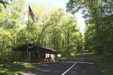
This short forest path is mostly flat and intended for relaxed observation of the natural surroundings. It suits families, casual visitors, and those seeking a less strenuous walk.
The mapped route gains about 90 feet and descends about 70 feet in one direction. Its first mapped point is about 2,280 feet.
Cosby Group Camp is near the beginning. Lower Mount Cammerer Trail Trailhead is near the route’s mapped endpoint at about 0.6 miles.
Low Gap Trail and Lower Mount Cammerer Trail meet this area. Low Gap Trail Access is about 0.1 miles away.
When to go
Check current conditions and alerts on the park’s National Park Service website before choosing when to visit.
Before you go
No permit is required. Carry water, pack layers, follow posted rules, and leave no trace.
The trail has a native surface. Check current conditions before visiting, especially when weather could affect the path.
Questions
How long is Cosby Nature Trail?
It is about 0.6 miles as mapped by the National Park Service.
Is Cosby Nature Trail difficult?
The trail is rated easy and follows a brief, mostly flat forest route.
Is Cosby Nature Trail a loop?
It is described as a loop ending where it starts, though the mapped route type is out and back.
Do you need a permit for Cosby Nature Trail?
No permit is required.
Is there parking near Cosby Nature Trail?
Yes. Parking is available at Cosby Amphitheater, with other parking areas about 0.1 to 0.2 miles away.
Nearby
Trails
Places
- Cosby AMile Postitheater Parking
- Cosby Amphitheater
- Cosby Campground Comfort Station
- Cosby Group Campground Parking
- Lower Mount Cammerer Trail Trailhead
- Low Gap Trail Access Trailhead
- Cosby Group Camp
- Cosby Hiker Parking A
On the map
3 trails6 places to see6 visitor services