Olympic National Park in Spring: What to Expect and What to Do
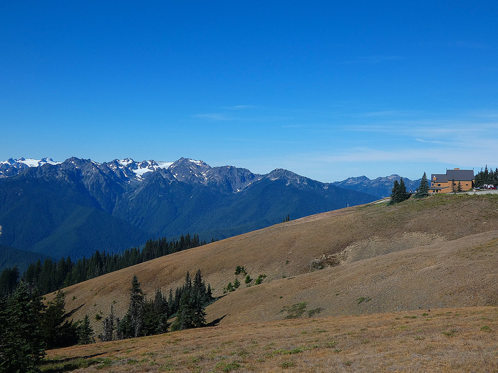
Photo: concrete&fells via Flickr (CC BY 2.0)
Olympic National Park spring trips cross three distinct environments, from a rain forest receiving roughly 12 feet of precipitation a year to alpine ridges still buried in snow. The park covers nearly one million acres of Washington’s Olympic Peninsula, with no road crossing its mountainous center. A visit therefore requires choosing among separate entrances rather than following one continuous sightseeing loop.
Spring rewards travelers with swollen waterfalls, active wildlife, lower visitation than summer, and moss at its most saturated green. It also brings temporary road closures, muddy lowland trails, tidal hazards, and deep snow above roughly 3,000 to 4,000 feet. This guide explains how conditions change from March through May, which areas are realistically accessible, and how spring compares with other times of year.
Olympic National Park in Spring at a Glance
The park’s geography controls every itinerary. Hurricane Ridge rises above Port Angeles on the north side, Lake Crescent and Sol Duc occupy glacial valleys farther west, and the Hoh and Quinault rain forests drain toward the Pacific. The wilderness coast forms another separate zone. Driving from Port Angeles to the Hoh Rain Forest generally takes about two hours without stops, so trying to combine distant regions in one day sacrifices trail time.
Three Landscapes, Three Versions of Spring
Low elevations usually provide the most reliable spring access. Trails beside Lake Crescent, in the Hoh valley, and around the Staircase area may be snow-free while Mount Olympus, elevation 7,980 feet, and the surrounding Bailey Range remain fully wintry. Pacific beaches are accessible throughout much of the season, but storms, driftwood, creek crossings, and tide cycles can alter what is safely walkable.
Inside the Hoh Rain Forest, spring precipitation feeds curtains of licorice fern, club moss, and epiphytic moss growing across bigleaf maples. On the 0.8-mile Hall of Mosses loop, packed earth feels soft beneath damp needles, water taps steadily from the canopy, and the air remains cool even when open roads are warming. The forest’s scale becomes clearest where moss-covered branches extend over the trail like low ceilings.
Why Elevation Matters More Than the Calendar
Spring arrives from the coastline upward. Red alder leafs out in river valleys while subalpine meadows remain snow-covered. A warm week can clear low trails quickly, yet it does little to open Obstruction Point Road, Deer Park Road, or high routes near Hurricane Ridge. Visitors seeking hiking rather than snow travel should build plans around valleys, lakes, rain forests, and beaches.
Olympic National Park Spring Conditions: What to Expect Each Month
March, April, and May produce noticeably different trips. Daylight increases rapidly, river flows rise with rain and snowmelt, and the snowline retreats uphill. Temperatures also vary sharply across the peninsula. A calm afternoon near Lake Quinault can coincide with freezing wind at Hurricane Ridge and heavy surf along the coast.
March: Winter Persists Above the Valleys
March provides the quietest version of spring, particularly on weekdays. Snow and ice commonly affect Hurricane Ridge access, and chains or approved traction equipment may be required when the road opens. Lower routes such as the 1.2-mile Spruce Nature Trail in the Hoh and the 2.1-mile Staircase Rapids Loop are better foundations for an itinerary, although flooding, fallen trees, and saturated ground remain possible.
Best March Priorities
- Rain forest walks: Explore short Hoh or Quinault trails where moss, nurse logs, and winter-fed streams dominate the landscape.
- Waterfalls: Visit Marymere Falls by a roughly 1.8-mile round-trip trail from the Lake Crescent area.
- Storm watching: Observe the Pacific from a safe distance and stay away from logs that can roll unexpectedly in surf.
April: Longer Days and Powerful Waterfalls
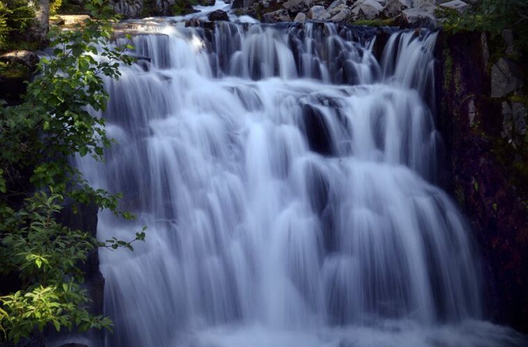
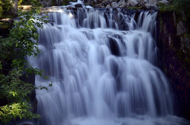
April often offers the strongest balance of low crowds and improving lowland access. Sol Duc Falls, reached by a forest trail of approximately 1.6 miles round trip when the access road is open, carries substantial spring flow through a narrow basalt gorge. Roosevelt elk frequently use low river valleys, while migrating gray whales may be visible from elevated coastal viewpoints.
Rain remains part of the experience. Waterproof footwear matters because boardwalks become slick, puddles occupy trail depressions, and vegetation can soak trousers even after precipitation stops. Coastal plans must account for tide tables rather than daylight alone. Headlands around places such as Hole-in-the-Wall can become impassable as water rises.
May: Broader Access and Growing Demand
May brings warmer lowland afternoons, leafed-out forests, and heavier weekend use around Lake Crescent, the Hoh Rain Forest, and accessible beaches. Lower trails dry between storms, but high-country snow remains deep enough to obscure paths and create hazardous runout zones. Summer-style ridge hiking should not be assumed merely because conditions feel mild near sea level.
Where May Works Best
May suits travelers who want longer day hikes without peak summer traffic. Consider the Hoh River Trail as an out-and-back walk, the Moments in Time Trail beside Lake Crescent, or the beach route from Rialto toward Hole-in-the-Wall when tides allow. Turnaround points should reflect river conditions, daylight, and the slow pace created by mud or cobbles.
How Spring Compares With the Rest of the Year
Spring occupies the transition between stormy lowland winters and the park’s short high-country season. It favors flexible visitors who value forests, waterfalls, and wildlife over guaranteed alpine access. The comparison below shows how the season changes practical trip planning.
Seasonal Tradeoffs at a Glance
Conditions vary from year to year because the Olympic Mountains intercept moisture directly from the Pacific. Heavy snow seasons delay ridge access, while warm spring weather can accelerate melt and increase river volume. These patterns matter more than fixed calendar dates.
| Season | Crowds | Typical Conditions | Road and Trail Access | Best Uses |
|---|---|---|---|---|
| Winter | Lowest | Frequent rain, coastal storms, mountain snow | Many high roads and trails closed or snow-covered | Rain forests, storm watching, snow recreation |
| Spring | Low to moderate | Rain, snowmelt, variable temperatures | Lowlands improve gradually, high country remains snowy | Waterfalls, wildlife, forests, quiet beaches |
| Summer | Highest | Drier, warmer, longest daylight | Broadest road and alpine trail access | Backpacking, ridges, long hikes, camping |
| Autumn | Moderate, then declining | Cooler weather and increasing storms | Good early access, followed by seasonal closures | Forest color, elk activity, lower-elevation hiking |
What Spring Crowds Change on the Ground
Spring visitation is lighter than summer, but demand concentrates at a few accessible locations. Parking pressure can develop at the Hoh Rain Forest, Marymere Falls, Rialto Beach, and popular Lake Crescent stops on sunny May weekends. Arriving early creates more than a parking advantage: trails are quieter, wildlife is more active, and coastal winds are often lighter before afternoon.
Distance also disperses visitors. Short nature loops receive concentrated use, while hikers thin out quickly along the Hoh River Trail or beyond the first viewpoints on a beach walk. Because the park lacks an internal road across the mountains, congestion on one approach cannot be solved by taking a quick alternate entrance.
Roads, Trails, and Spring Reservations
Access changes incrementally rather than opening across the park all at once. US Highway 101 connects the peninsula’s gateway communities, while spur roads lead toward Hurricane Ridge, Sol Duc, the Hoh, Quinault, Staircase, and coastal trailheads. Washouts, snow, downed trees, and maintenance can affect those spurs independently.
Roads That Shape an Olympic National Park Spring Trip
Hurricane Ridge Road climbs about 17 miles from Port Angeles into subalpine terrain, gaining enough elevation for conditions to differ completely from town. Spring operations can be limited by snow removal, ice, visibility, and parking capacity. Obstruction Point and Deer Park generally belong to a later, snow-free travel season rather than a spring driving plan.
West-side valleys sit much lower, but their roads remain exposed to flooding and treefall. Sol Duc access is seasonal, while the Hoh and Quinault corridors may be reachable during periods when mountain roads are not. Check current road status, entrance requirements, campground availability, wilderness permit release dates, and facility operations on the official park site before departure.
Permits and Reservations to Plan Around
Day hiking generally requires no trail reservation, although park admission rules still apply. Every wilderness overnight requires a permit, and quota-controlled areas can fill once reservation inventory is released. Popular summer objectives such as Seven Lakes Basin are often still snowbound during spring, but lower Hoh River and coastal itineraries may become practical earlier.
Backcountry beach camping requires careful attention to designated sites, tide restrictions, and food-storage regulations. Some coastal passages use fixed ropes to cross steep headlands, and these routes can be unsafe when wet or when the tide blocks the beach below. Spring backpackers should choose camps only after matching the route to tide tables, creek levels, and their comfort on slippery terrain.
Choose the Season That Matches Your Priorities
The best month depends on which landscape matters most. Travelers focused on mossy forests, high-volume waterfalls, and quiet roads gain the most from April or early May. Those who consider Hurricane Ridge, alpine wildflowers, and high-country backpacking essential should choose summer. Autumn works well for Roosevelt elk viewing and lower-elevation hiking, although Pacific storms become increasingly likely as the season progresses.
Choose Spring for Water, Wildlife, and Solitude
Olympic National Park spring travel suits photographers, waterfall seekers, and hikers comfortable changing plans after checking conditions. Strong river flow adds drama to Madison Falls, Sol Duc Falls, and cascades throughout the Quinault drainage. Roosevelt elk remain in low valleys where forage is accessible, and black-tailed deer commonly appear near forest margins. Cloud cover also reduces the harsh contrast that complicates photography beneath dense rain forest canopies.
Wait for Summer if Alpine Access Is Essential
High routes require patience. Hurricane Hill rises to 5,757 feet, and lingering snow can cover the paved trail well after Port Angeles has entered mild spring weather. Longer objectives such as Klahhane Ridge, Grand Valley, and Seven Lakes Basin depend on snowpack, road openings, and backcountry travel skills. Visitors unwilling to use traction devices or navigate across snow should plan these routes during the established snow-free period.
Build an Itinerary Around Geography
A practical visit groups adjacent locations instead of circling the peninsula each day. Port Angeles serves the north side, including Hurricane Ridge, Lake Crescent, and the Elwha Valley. Forks places travelers closer to the Hoh and beaches such as Rialto, Second Beach, and Ruby Beach. The Lake Quinault area works as a southern base for rain forest walks and the Quinault River valley.
A Focused Three-Day Spring Plan
- Day one: Explore Lake Crescent, walk to Marymere Falls, and add the Elwha Valley if road access and daylight permit.
- Day two: Enter the Hoh early, complete the nature loops, then follow the Hoh River Trail for a distance suited to trail conditions.
- Day three: Select Rialto Beach or Ruby Beach using the tide forecast, then leave time for roadside viewpoints without rushing after dark.
This sequence minimizes backtracking while preserving flexibility. A mountain weather window can justify moving Hurricane Ridge to the clearest day, while sustained coastal wind may favor a forest itinerary. Spring daylight supports full days outside, but road speeds around Lake Crescent and the western peninsula are slower than mileage suggests because of curves, wildlife, construction, and limited passing opportunities.
When to Add Another Night
A fourth night is worthwhile for travelers visiting both Quinault and the northern park. Lake Quinault lies well south of the Hoh entrance, and its network of short trails, giant conifers, and river viewpoints deserves several hours. Extra time also protects the trip from a washout day. Heavy rain may make a beach unpleasant while producing excellent conditions for forest photography and waterfall viewing.
Prepare for Cold Water and Fast Weather Changes
Spring emergencies often begin with wet clothing rather than extreme temperatures. A 50°F afternoon can become dangerous when rain, wind, and perspiration remove body heat. Cotton dries slowly in the rain forest. Synthetic or wool layers, a waterproof shell, dry socks, and a protected insulating layer provide a safer system. Carry the same essentials on short trails because cellular coverage is inconsistent outside gateway communities.
Traction, Navigation, and River Edges
Microspikes can help on firm snow near developed mountain areas, but they do not make steep slopes safe. An ice axe requires training, and snowshoes become inefficient when melt creates deep, waterlogged snow. In valleys, avoid walking onto gravel bars without checking escape routes. Rain or snowmelt upstream can raise braided rivers and side channels even when local skies remain dry.
Give Wildlife Working Space
Roosevelt elk can weigh more than 1,000 pounds, and cows may become defensive around calves in late spring. Use a telephoto lens and retreat if an animal changes direction, stops feeding, or watches you continuously. Store food according to park rules, keep crumbs out of vehicles and camps, and never approach black bears. Along the coast, harbor seals resting on rocks or beaches also need space, particularly during pupping season.
What to Do in Olympic National Park in Spring
Spring works best when the itinerary follows elevation and weather rather than a rigid checklist. Build the trip around lowland forests, lakes, waterfalls, and tide-safe beaches, then treat mountain access as a condition-dependent addition. Staying near the region planned for the following morning reduces driving and improves the chance of reaching popular trailheads before parking pressure develops.
Pack for prolonged moisture, compare coastal tides with hiking times, and leave room to exchange one region for another. These habits turn uncertain spring conditions into useful choices. Visitors who understand the peninsula’s separate entrances and sharp elevation changes can experience powerful rivers, active wildlife, and remarkably quiet trails without expecting summer access from a transitional season.
Want to keep exploring? Browse all our Olympic guides and articles for more trip-planning tips and ideas.
Gear & Essentials
Tell us about your trip and we will add what else you will want:
The basics
Worth having in the car whatever the park.
For this trip
Traveling with kids
Bringing a pet
RVing
Backcountry
Winter conditions
On the water
Photography
Accessibility
As an Amazon Associate we earn from qualifying purchases, at no extra cost to you.