Olympic National Park: The Perfect One-Day Itinerary
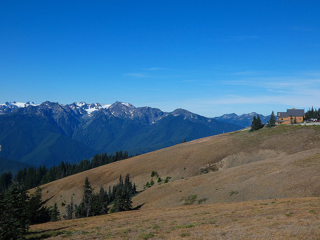
Photo: concrete&fells via Flickr (CC BY 2.0)
Our Olympic National Park Perfect one-day plan succeeds by ignoring nearly two-thirds of the park. Olympic protects about 922,000 acres, yet no road crosses its mountainous interior. Trying to combine Hurricane Ridge, the Hoh Rain Forest, and the Pacific coast produces six or more hours behind the wheel before hikes, meals, or wildlife stops.
The workable strategy concentrates on the park’s north side. Starting in Port Angeles, the route climbs from sea level to Hurricane Ridge, descends into the Elwha Valley, and continues west to glacially carved Lake Crescent. In one long day, you experience subalpine terrain, old-growth forest, waterfalls, and one of Washington’s deepest lakes without racing around the Olympic Peninsula.
Why Olympic National Park Requires a Focused Route
The central mountains control every drive
Mount Olympus rises to 7,980 feet near the center of the peninsula, surrounded by glaciers, steep river valleys, and roadless wilderness. US 101 wraps around this interior rather than crossing it. Port Angeles to the Hoh Rain Forest takes roughly two hours each way, while reaching Rialto Beach generally requires about 90 minutes. Combining either place with Hurricane Ridge turns the day into a driving tour.
The north-side route works because its major landscapes sit along a relatively compact corridor. Hurricane Ridge Road begins just south of Port Angeles, the Elwha River entrance lies west of town, and Lake Crescent occupies a deep basin beside US 101. The complete day covers approximately 90 to 100 road miles, depending on viewpoints and meal stops.
What Belongs in the Perfect Olympic National Park Day
We treat Hurricane Ridge, Lake Crescent, and one forest waterfall as the essential stops. Hurricane Ridge provides the broadest mountain views, while Lake Crescent reveals the effects of Ice Age glaciation at lower elevation. Madison Falls is the efficient waterfall stop. Marymere Falls requires a longer forest walk but rewards visitors with a 90-foot cascade descending through basalt cliffs.
- Must stop: Hurricane Ridge and its principal viewpoints.
- Must stop: Lake Crescent, including the shore near Barnes Point.
- Choose one: Madison Falls for speed or Marymere Falls for a fuller forest hike.
- Skip on this route: Hoh Rain Forest, Rialto Beach, Cape Flattery, and Quinault.
- Optional only with a very early start: Sol Duc Falls, which adds a lengthy road detour and a 1.6-mile round-trip hike.
Olympic National Park: The Perfect One-Day Itinerary at a Glance
A Practical Olympic National Park One-Day Route from Port Angeles
Begin before 7 a.m. in Port Angeles, especially from late spring through early autumn. Morning usually brings lighter traffic on Hurricane Ridge Road and a better chance of seeing the Olympic Mountains before afternoon cloud forms. After the ridge, descend toward US 101 and continue west instead of returning to town for lunch.
| Day | Stop | Highlight | Approximate drive time |
|---|---|---|---|
| One day, early morning | Port Angeles to Hurricane Ridge | Mountain viewpoints and Hurricane Hill | 40 to 45 minutes |
| Late morning | Hurricane Ridge to Madison Falls | Elwha Valley forest and short waterfall walk | About 1 hour |
| Midday | Madison Falls to Lake Crescent | Barnes Point, lakeshore, and picnic lunch | About 30 minutes |
| Afternoon | Marymere Falls trail | Old-growth forest and 90-foot waterfall | Minimal driving from Barnes Point |
| Evening | Lake Crescent to Port Angeles | Return along US 101 | About 30 minutes |
Why this order saves time
Hurricane Ridge is the least flexible stop because high-elevation weather and road access can change quickly. Placing it first protects the day’s main objective. Lake Crescent and the Elwha Valley sit beside lower-elevation roads and remain easier to visit later, even when clouds cover the mountains. The route also avoids retracing US 101 until the final return to Port Angeles.
Do not schedule a fixed lunch stop in town between the ridge and Lake Crescent. That detour consumes valuable daylight and puts you back into midday traffic. Carry breakfast, lunch, and water from Port Angeles, then eat beside Lake Crescent or at a designated picnic area encountered along the route.
Logistics for the Perfect Olympic National Park Day
Sleep near the starting line
Port Angeles is the most efficient base for this itinerary. Staying in town the previous night places you near fuel, groceries, and the Hurricane Ridge Road approach. Lodging ranges from conventional hotels to small inns and vacation rentals. Park campgrounds may suit travelers continuing around the peninsula, but they add packing time and may place you farther from the first turn.
Sleeping in Seattle creates a much harder day. The drive requires either a ferry connection or a long road approach around Puget Sound, and ferry queues can disrupt an early schedule. Travelers arriving from the Seattle area should reach Port Angeles the evening before and plan a second night there unless continuing west after Lake Crescent.
Fuel, food, and connectivity
Fill the tank and buy food in Port Angeles. Services become sparse west of town, and mobile reception weakens around Lake Crescent, the Elwha Valley, and mountain road corridors. Download an offline map before leaving lodging. Printed park maps remain useful because navigation applications sometimes suggest routes that are seasonally closed or unsuitable.
- Carry at least two liters of water per person during warm weather.
- Pack a lunch that can be eaten without cooking.
- Download the route and trail maps for offline use.
- Bring a warm layer and waterproof shell, even when Port Angeles is sunny.
- Check Hurricane Ridge Road status, entrance requirements, and seasonal tire or chain rules on the official park site.
Morning on Hurricane Ridge
Climbing from Port Angeles into the subalpine zone
Hurricane Ridge Road gains more than 5,000 feet in approximately 17 miles. The ascent passes through dense Douglas-fir and western hemlock forest before entering open subalpine meadows near the ridge. Temperature commonly drops by 15 to 25 degrees Fahrenheit compared with Port Angeles, and lingering snow can cover trails well into early summer.
The Hurricane Hill Trail
If skies are clear and everyone can manage a moderate climb, make Hurricane Hill the morning’s main hike. The paved trail is about 3.2 miles round trip with roughly 700 feet of elevation gain, ending near 5,757 feet. Allow 90 minutes to two hours, including viewpoint stops. Black-tailed deer and Olympic marmots frequent the meadows, while feeding or approaching them damages their natural behavior.
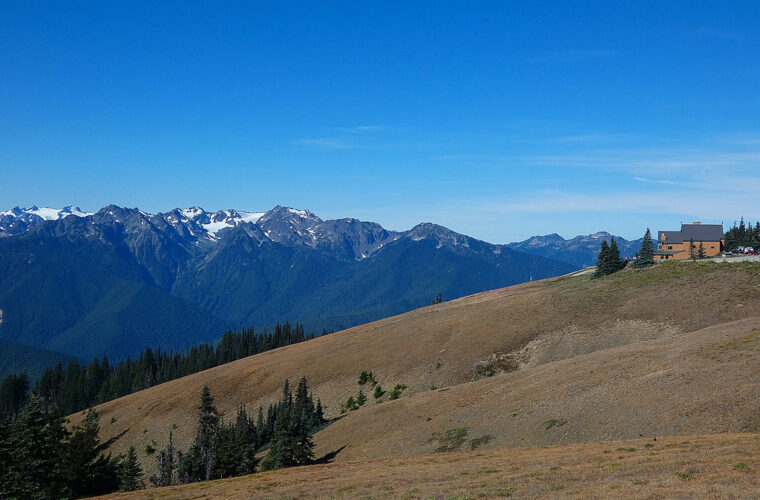
Near the upper switchbacks, pavement presses firmly underfoot while wind moves across slopes almost bare of trees. The Strait of Juan de Fuca appears behind you, often with Vancouver Island beyond it, while serrated Olympic summits fill the southern horizon. Even on a warm day in Port Angeles, exposed hands can become cold here within minutes when clouds cross the ridge.
Shorter alternatives when time or weather intervenes
Visitors unable to complete Hurricane Hill can use the shorter paths and viewpoints around the main ridge area. These provide immediate views into the Bailey Range and toward Mount Olympus when visibility cooperates. In fog, limit the stop rather than waiting indefinitely. Clouds can persist against the windward slopes for hours, and the lower forests and Lake Crescent remain worthwhile in overcast conditions.
Late Morning in the Elwha Valley
Use Madison Falls as the efficient forest stop
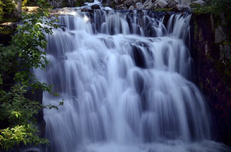
From the Hurricane Ridge area, descend to US 101 and follow the Elwha entrance toward Madison Falls. The paved walk is approximately 0.2 mile round trip and ends at a cascade about 60 feet high. Its nearly level surface makes it the best choice for groups with limited time, young children, or tired legs after Hurricane Hill. Spend 20 to 30 minutes here, including the walk beneath bigleaf maples, sword ferns, and moss-covered conifers.
Read the landscape shaped by dam removal
The Elwha River once contained two major dams that blocked salmon from more than 70 miles of habitat. Removal of Elwha Dam and Glines Canyon Dam was completed between 2011 and 2014, allowing the river to rebuild channels and move sediment toward the Strait of Juan de Fuca. Accessible sections of the valley reveal young floodplain vegetation beside mature forest. Stay on designated roads and trails because erosion, washouts, and river migration continue to reshape this corridor.
Afternoon at Lake Crescent
Choose Barnes Point for lunch and shoreline views
Lake Crescent occupies a glacier-carved basin with a measured depth of approximately 624 feet. Low nitrogen levels restrict algae growth, contributing to the lake’s unusual clarity and blue-green appearance. Barnes Point provides convenient access to the shore and the Marymere Falls trail system. Eat the lunch carried from Port Angeles here, keeping food secured from ravens, squirrels, and black-tailed deer. Allow at least two hours if Marymere Falls is part of the afternoon.
Walk to Marymere Falls
The Marymere Falls route covers about 1.8 miles round trip through old-growth forest. The path begins near Barnes Point, passes beneath Douglas-fir and western redcedar, and crosses Barnes Creek before climbing to two waterfall viewpoints. Most of the route is gentle, but the final approach includes stairs and steeper, uneven ground. Budget 60 to 90 minutes. Return before dusk because dense canopy makes the trail noticeably darker than the open lakeshore.
Leave Mount Storm King for another day
The Mount Storm King trail begins from the same general area, which tempts ambitious visitors into adding it. That climb gains roughly 2,000 feet in about two miles, with steep upper sections and exposed terrain beyond the maintained trail. It requires several hours, dry conditions, and strong footing. Combining it with Hurricane Hill would crowd out the Elwha stop and Marymere Falls, so it does not belong in this Olympic National Park Perfect one-day route.
- With two hours: Eat at Barnes Point and hike to Marymere Falls.
- With one hour: Walk the lakeshore and complete part of the Moments in Time trail.
- With 30 minutes: Visit the shore, photograph the lake, and begin the return to Port Angeles.
Adjusting the Route for Season and Daylight
Match the hiking plan to mountain conditions
Summer supplies the longest hiking window, but it also brings heavier traffic and limited parking at popular trailheads. Autumn often delivers cooler temperatures and clearer mountain air, with shorter afternoons. Winter and early spring can place Hurricane Ridge under deep snow while rain falls at Lake Crescent. Road openings, traction requirements, and high-elevation access can determine whether the ridge belongs in the day at all.
| Season | Likely conditions | Best adjustment |
|---|---|---|
| Late spring | Snow on ridge trails, wet forest paths | Use shorter ridge viewpoints and carry waterproof footwear |
| Summer | Long daylight, busy parking areas, warmer exposed trails | Start early and complete Hurricane Hill before midday |
| Autumn | Cool mornings, changing weather, earlier sunset | Shorten the Lake Crescent stop before daylight fades |
| Winter | Snow and restricted mountain access, rain near the lake | Build the day around the Elwha Valley and Lake Crescent |
Use a lower-elevation backup plan
If Hurricane Ridge is inaccessible, do not replace it with the Hoh Rain Forest unless lodging and the following day’s route already point west. Spend the morning in the Elwha Valley, then walk Marymere Falls and the approximately 0.6-mile Moments in Time loop at Lake Crescent. With additional daylight, continue west toward the Sol Duc Valley. That alternative preserves the day’s forest, river, and lake experiences without gambling several hours on a distant peninsula crossing.
Completing Your Perfect Olympic National Park One-Day Itinerary
This itinerary succeeds because every major stop serves a different purpose. Hurricane Ridge supplies elevation and broad mountain geography. The Elwha Valley explains one of the largest ecosystem restoration projects in National Park Service history. Lake Crescent adds glacial geology, old-growth forest, and a waterfall hike within one compact afternoon area. Keeping those experiences in a logical westbound sequence protects hiking time and reduces unnecessary backtracking.
Return to Port Angeles after Marymere Falls, or continue west only if overnight lodging is already arranged along US 101. Pack food before departure, save maps offline, and treat Hurricane Hill as the adjustable element when clouds, snow, or fatigue interfere. With that flexibility, one day provides a coherent introduction to Olympic National Park rather than a rushed circuit around a roadless mountain interior.
Want to keep exploring? Browse all our Olympic guides and articles for more trip-planning tips and ideas.
Gear & Essentials
Tell us about your trip and we will add what else you will want:
The basics
Worth having in the car whatever the park.
For this trip
Traveling with kids
Bringing a pet
RVing
Backcountry
Winter conditions
On the water
Photography
Accessibility
As an Amazon Associate we earn from qualifying purchases, at no extra cost to you.