10 Best Hikes in Olympic National Park
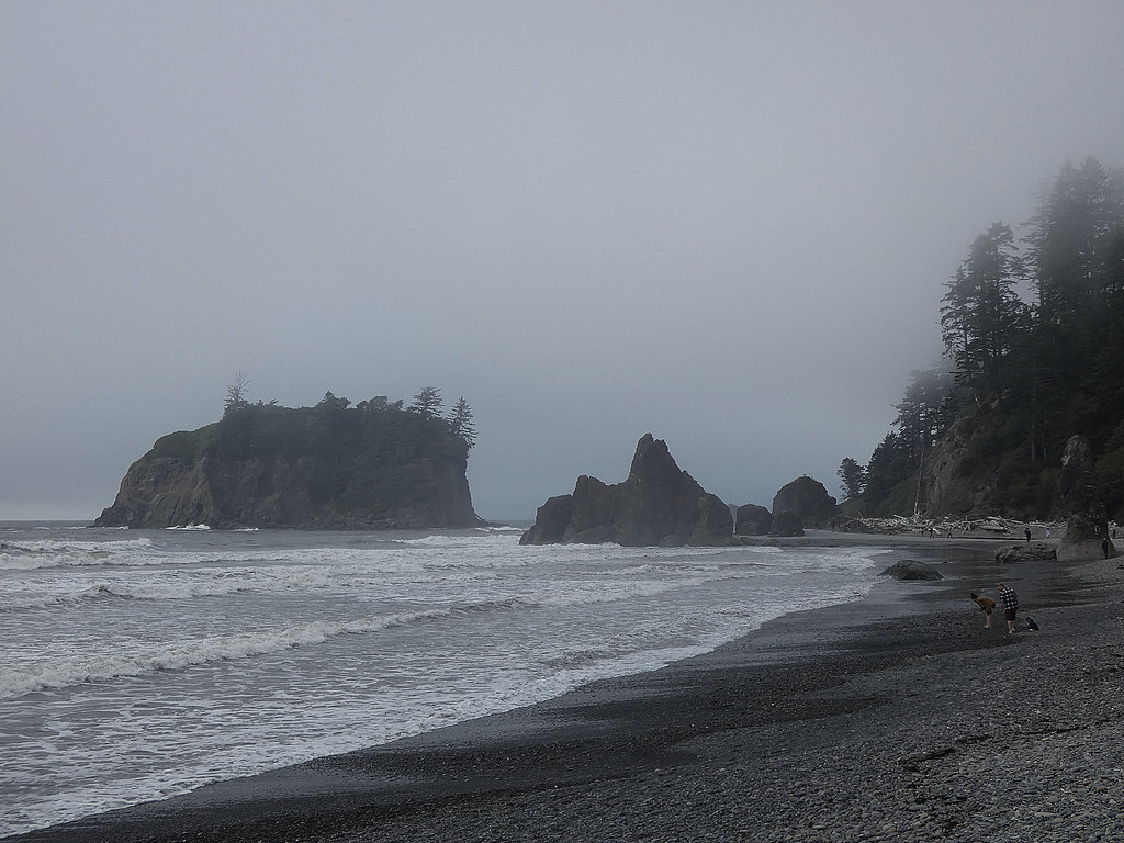
Photo: concrete&fells via Flickr (CC BY 2.0)
To choose the 10 Best Hikes Olympic National Park visitors must account for three separate worlds: glaciated mountains, temperate rain forest, and a wave-cut Pacific coast. Our selections balance those signature landscapes with realistic day hikes and two backpacking routes. Trail lengths range from a 0.8-mile rain forest loop to expeditions exceeding 18 miles. Olympic has no road crossing its mountainous interior. Trailheads sit at the ends of separate approach roads, so hikes that appear close on a map can require several hours of driving between them. Build each day around one corridor, such as Hurricane Ridge or Lake Crescent.
Olympic has no road crossing its mountainous interior. Trailheads sit at the ends of separate approach roads, so hikes that appear close on a map can require several hours of driving between them. Build each day around one corridor, such as Hurricane Ridge, Lake Crescent and Sol Duc, the Hoh Rain Forest, or the wilderness coast.
How to navigate a park divided by mountains
The key hiking corridors
Port Angeles is the practical base for Hurricane Ridge, Lake Crescent, and the Elwha Valley. Forks provides better access to the Hoh Rain Forest and northern beaches. The Quinault and Kalaloch areas anchor the southwestern side. Driving from Port Angeles to the Hoh trailhead generally takes about two hours without lengthy road delays, while Forks is roughly 45 minutes from the Hoh entrance.
The Olympic Mountains rose from marine sediments and volcanic rocks scraped from the ocean floor as tectonic plates converged. Mount Olympus reaches 7,980 feet and supports major glaciers, yet it lies only about 33 miles from the Pacific. That compressed geography produces sharp weather gradients. Western valleys commonly receive several times the annual precipitation recorded around Port Angeles, which sits in the northeastern rain shadow.
When the 10 Best Hikes Olympic routes are most accessible
Lowland rain forest and coastal trails remain viable through much of the year, although winter brings saturated ground, swollen creeks, windfall, and short daylight. Hurricane Ridge and the High Divide retain snow much later. Alpine routes usually become straightforward from mid-summer into early autumn, while October storms can quickly restore winter conditions at elevation.
- Spring: Choose waterfalls and rain forest walks. Expect snow above roughly 3,000 to 4,000 feet and strong runoff at unbridged streams.
- Summer: Use the longest daylight for Hurricane Ridge, High Divide, and wilderness coast routes. Popular trailheads fill early.
- Autumn: Look for clearer mountain air, vine maple color, and fewer insects. Rain and early snow become increasingly likely.
- Winter: Favor Lake Crescent, the Hoh, and accessible beaches, while carrying traction where overnight freezing creates ice.
10 Best Hikes in Olympic National Park at a glance
Distances, climbing, and ideal uses
Distances below are approximate round-trip figures. Coastal mileage depends on the exact turnaround point, while backpacking totals vary with camps and side trips. Elevation gain is especially important here because wet roots, loose beach cobbles, and steep forest tread can make a modest distance substantially harder than its mileage suggests.
| Hike | Distance | Approximate gain | Best feature |
|---|---|---|---|
| Hall of Mosses | 0.8-mile loop | 100 feet | Old-growth rain forest |
| Hoh River to Five Mile Island | About 10 miles | 300 feet | River corridor and giant trees |
| Hurricane Hill | 3.2 miles | 650 feet | Accessible alpine panorama |
| Mount Storm King | About 4 miles | About 2,000 feet | Lake Crescent overlook |
| Marymere Falls | 1.8 miles | About 300 feet | 90-foot waterfall |
| Rialto Beach to Hole-in-the-Wall | About 3.3 miles | Minimal | Sea stacks and tidal arch |
| Second Beach | About 2 miles | About 300 feet | Forest-to-beach transition |
| Sol Duc Falls | 1.6 miles | About 200 feet | Multi-channel waterfall |
| High Divide and Seven Lakes Basin | About 19 miles | About 4,000 feet | Olympus views and alpine lakes |
| Enchanted Valley | About 26 miles | About 1,700 feet | Backcountry valley and waterfalls |
Permits and trailhead planning
High Divide, Enchanted Valley, and overnight coastal itineraries require wilderness planning, with permits or reservations applying to many camps. Hurricane Ridge road access, seasonal facilities, entrance charges, and wilderness procedures can change. Confirm current details on the official park site before fixing an itinerary. Carry a downloaded map because mobile coverage disappears across much of the interior and western peninsula.
Northern summits on the 10 Best Hikes Olympic list
Hurricane Hill for the broadest alpine view
A short climb above Hurricane Ridge
Hurricane Hill delivers the strongest mountain panorama for its moderate mileage. From the trailhead beyond the Hurricane Ridge area, the paved route climbs through subalpine meadows to a summit around 5,700 feet. The Bailey Range, Mount Olympus, Strait of Juan de Fuca, and Vancouver Island can all appear in clear weather. Black-tailed deer and Olympic marmots frequent these slopes, but visitors should keep their distance and never feed them.
The exposed upper trail has little protection from wind or afternoon sun. Lingering snow can cover the route into early summer, and fog may erase the view even when Port Angeles is dry. Start early for cooler climbing and a better chance of unobstructed ridgelines.
Mount Storm King for steep, exposed terrain
Understanding the maintained endpoint
Mount Storm King rises sharply above Lake Crescent, gaining roughly 2,000 feet in about two miles. The trail begins near the Marymere Falls route before turning uphill through Douglas fir forest. Persistent switchbacks lead to the end of the maintained trail. Beyond it, an unofficial path continues across loose soil and exposed slopes where fixed ropes have sometimes been present. Their condition and reliability should never be assumed.
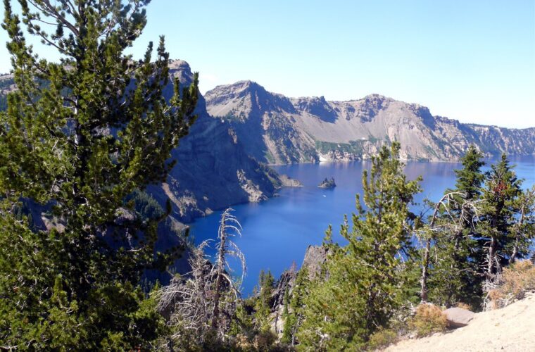
From the upper ridge, Lake Crescent fills the basin below in a long blue arc, enclosed by forested peaks carved by Pleistocene ice. The descent is often harder than the ascent because dry dust, wet roots, and steep grades reduce traction. Hikers uncomfortable with exposure should stop at the maintained endpoint or select Hurricane Hill instead.
Rain forest walks on the 10 Best Hikes Olympic list
Hall of Mosses for a concentrated old-growth experience
The Hall of Mosses loop begins near the Hoh Rain Forest visitor area and passes beneath Sitka spruce, western hemlock, bigleaf maple, and Douglas fir. Some maples carry dense curtains of club moss, licorice fern, and other epiphytes that absorb moisture from the humid air. The short loop has gentle grades, but roots and wet wooden surfaces can be slippery.
Inside the densest grove, the ground feels springy with decomposing needles while moss-softened branches spread overhead like low ceilings. Water drips long after rainfall has stopped, and nearby voices fade behind enormous trunks. Cool air pools under the canopy even when the open parking area feels warm. That sensory compression explains why this brief walk deserves a place beside Olympic’s longer routes.
Hoh River Trail to Five Mile Island
The Hoh River Trail extends deep into the park toward Glacier Meadows and Mount Olympus, but Five Mile Island makes a practical day-hike turnaround. The mostly level route follows the glacier-fed Hoh through old-growth forest, gravel bars, and openings where the silty river divides into braided channels. Roosevelt elk tracks and droppings are common, although the animals themselves often remain screened by vegetation.
Expect mud, shallow standing water, and occasional downed trees outside the driest summer period. Five Mile Island is a geographic area rather than a guaranteed dry island, since river channels migrate across the floodplain. Turn around earlier if daylight, flooding, or trail conditions make the full distance unreasonable.
Waterfall trails near Lake Crescent and Sol Duc
Marymere Falls through lowland forest
Marymere Falls provides a manageable companion hike to Mount Storm King. The shared approach begins near Lake Crescent, crosses beneath a canopy of Douglas fir and western red cedar, then follows Barnes Creek toward the falls. A short loop climbs to viewpoints of the 90-foot cascade dropping through a narrow basalt cleft. The stairs beside the falls become slick from spray, so shoes with tread are useful even during otherwise dry weather.
Sol Duc Falls and its river gorge
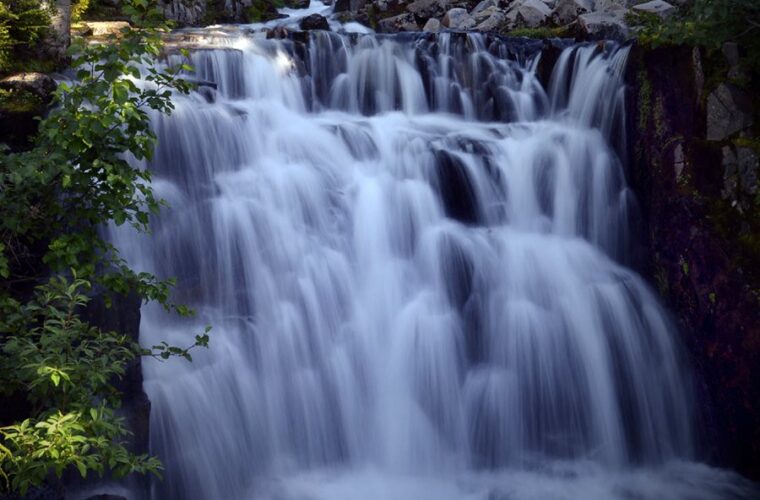
Sol Duc Falls divides into several channels before plunging roughly 50 feet into a dark, narrow gorge. The standard approach passes old-growth forest and crosses small streams on its way to the bridge overlooking the waterfall. Spring runoff creates the greatest volume, while autumn rain restores strong flow after summer. The gorge edge remains hazardous beyond the developed viewpoints because moss can conceal wet rock and unstable footing.
These two waterfall hikes serve different corridors. Marymere fits naturally into a Lake Crescent day, while Sol Duc Falls requires following Sol Duc Road into its own valley. Combining either walk with a distant Hoh or coastal trail creates unnecessary driving. Pair Marymere with lakeshore time, or use Sol Duc Falls as a shorter alternative when clouds obscure the High Divide.
Pacific shore routes shaped by tides
Rialto Beach to Hole-in-the-Wall
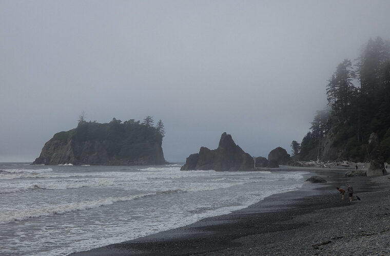
From Rialto Beach, walk north across cobbles and packed sand toward Hole-in-the-Wall, a wave-cut arch in a headland about 1.6 miles away. James Island, offshore sea stacks, driftwood trunks, and intertidal shelves define the route. Progress slows where loose cobbles roll underfoot. The arch and nearby tide pools should be approached near low tide, with enough time to return before waves restrict passage around the headland.
Second Beach and the Quillayute Needles
Second Beach begins with a forest descent before emerging beside a prominent sea stack and the offshore Quillayute Needles. The final access often involves crossing large driftwood logs, which become slippery after rain. The beach is broad enough for an unhurried out-and-back walk, but hikers must distinguish damp sand from an incoming tide line. Never climb sea stacks or enter caves while swell is reaching their bases.
| Coastal condition | Practical response |
|---|---|
| Rising tide | Leave headlands before water blocks the return route |
| Large driftwood | Stay well above logs during heavy surf because waves can move them |
| Wet cobbles | Shorten strides and allow more time than ordinary trail mileage suggests |
| Offshore earthquake | Move immediately toward high ground if shaking is strong or prolonged |
Two backpacking journeys into Olympic’s interior
High Divide and Seven Lakes Basin
The High Divide loop climbs from the Sol Duc drainage past Deer Lake into subalpine terrain surrounding Seven Lakes Basin. Heart Lake and the ridge near Bogachiel Peak provide key landmarks, while clear conditions reveal Mount Olympus and the Blue Glacier across the interior. The route’s roughly 4,000 feet of climbing, lingering snowfields, exposed ridge weather, and limited camping zones make it unsuitable as an improvised first backpacking trip.
Enchanted Valley along the East Fork Quinault
Enchanted Valley follows the East Fork Quinault River for approximately 13 miles from the Graves Creek area. Pony Bridge, broad gravel bars, old-growth forest, and waterfalls descending the valley walls mark the approach. The historic chalet dates to the early 1930s and stands in an active river corridor that continues to shift. Stream crossings and muddy tread become more difficult during snowmelt or sustained rain.
Backcountry equipment that earns its weight
The final two routes on our 10 Best Hikes Olympic selection require preparation for saturated vegetation, rapid temperature changes, and wildlife encounters. Food storage rules apply in designated areas, and bears should never gain access to packs or camp kitchens. A reliable backcountry kit includes:
- A waterproof shell and insulating layer, even during summer
- A topographic map, compass, and offline navigation
- A water filter suitable for silty or tannin-stained sources
- Trekking poles for snow, mud, and river approaches
- Dry storage for sleep systems and emergency clothing
Choosing from the 10 Best Hikes in Olympic National Park
Match the trail to the park corridor, season, and weakest member of the group. Hall of Mosses and Marymere Falls suit limited time. Hurricane Hill provides alpine scenery without committing to a backpack. Rialto Beach rewards careful tide planning, while the Hoh River Trail offers adjustable mileage. Mount Storm King demands comfort with steep, exposed terrain, and Sol Duc Falls supplies a safer poor-weather alternative.
High Divide and Enchanted Valley belong on itineraries built around wilderness travel rather than squeezed between roadside stops. Olympic’s geography rewards focused days: one watershed, one coast segment, or one mountain corridor at a time. That approach reduces driving, leaves room for weather delays, and gives each of these ten hikes enough time to reveal the landscape that makes it distinctive.
Want to keep exploring? Browse all our Olympic guides and articles for more trip-planning tips and ideas.
Gear & Essentials
Tell us about your trip and we will add what else you will want:
The basics
Worth having in the car whatever the park.
For this trip
Traveling with kids
Bringing a pet
RVing
Backcountry
Winter conditions
On the water
Photography
Accessibility
As an Amazon Associate we earn from qualifying purchases, at no extra cost to you.