5 Best Hikes in Mount Rainier National Park
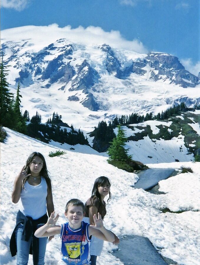
Photo: Stabbur's Master via Flickr (CC BY-SA 2.0)
The best hikes Mount Rainier National Park offers are the Skyline Trail, Burroughs Mountain, Tolmie Peak, Spray Park, and Naches Peak Loop. Together they cover the park’s defining landscapes: active glaciers, alpine tundra, subalpine wildflower meadows, volcanic ridges, old growth forest, and fire lookout views. They also range from a moderate 3.5 mile loop to a demanding 9.4 mile summit route.
Choosing among them depends heavily on geography. Mount Rainier rises to 14,410 feet, and roads approach separate sides of the mountain without forming a convenient loop around it. Paradise serves the south side, Sunrise opens the northeast, and Mowich Lake reaches the northwest by a long gravel road. Our team recommends choosing one primary area per day rather than losing hiking time driving between trailheads.
How the 5 Best Hikes in Mount Rainier National Park Compare
Each selected trail provides a distinct view of Mount Rainier’s geology and ecology. Skyline passes close to the Nisqually Glacier, Burroughs Mountain crosses exposed tundra, and Tolmie Peak frames the volcano above Eunice Lake. Spray Park is strongest for flower meadows and waterfalls, while Naches Peak Loop delivers broad Cascade views with the least climbing.
Best Hikes Mount Rainier: Five Routes at a Glance
Distances and elevation gains below are approximate because side trips and minor route variations affect recorded totals. Difficulty also changes with snow, heat, visibility, and acclimatization. A moderate trail at sea level can feel substantially harder above 6,000 feet.
| Trail | Area | Distance | Elevation gain | Best for |
|---|---|---|---|---|
| Skyline Trail | Paradise | 5.5 miles | About 1,700 feet | Glaciers and wildflower meadows |
| Burroughs Mountain | Sunrise | Up to 9.4 miles | About 2,500 feet | High tundra and close mountain views |
| Tolmie Peak | Mowich Lake | 5.6 miles | About 1,600 feet | Fire lookout photography |
| Spray Park | Mowich Lake | About 6 miles | About 1,300 feet | Waterfalls and flower displays |
| Naches Peak Loop | Chinook Pass | 3.5 miles | About 500 feet | A shorter scenic loop |
What Separates These Five Routes
Mount Rainier is an active stratovolcano mantled by 25 named glaciers. Its ice has carved deep radial valleys, while lahars and glacial rivers continue to reshape lower elevations. These trails reveal different parts of that system rather than repeating the same viewpoint. Use the following priorities to narrow the list:
- Choose Skyline for the strongest first visit and the closest accessible look at major glaciers.
- Choose Burroughs Mountain for sustained high elevation hiking above most trees.
- Choose Tolmie Peak for a lookout, lake, and mountain composition in one hike.
- Choose Spray Park for meadow ecology and a quieter full morning on foot.
- Choose Naches Peak Loop for limited time, moderate effort, or a family outing.
Orientation Shapes Every Mount Rainier Hiking Day
Trail selection should begin with the entrance and overnight base, not mileage alone. Paradise and Sunrise sit on opposite sides of the volcano, and travel between them commonly consumes much of a morning once winding roads and viewpoint stops are included. Snow closes high roads seasonally, while summer crowd controls, entrance procedures, and trailhead access rules can change. Confirm current roads, fees, reservations, and closures on the official park site before departure.
Paradise and the Glaciated South Side
Paradise sits at roughly 5,400 feet beneath the Nisqually and Paradise glaciers. It is reached from the Nisqually Entrance through Longmire, with the final road climbing through dense forest into subalpine parkland. Skyline Trail begins here, alongside shorter paths to Myrtle Falls and Alta Vista. Summer parking fills early, and fog can erase mountain views even when lower valleys remain sunny.
This side receives enormous winter snowfall, so packed snow often lingers across Skyline well into summer. Wildflowers generally follow snowmelt rather than a fixed calendar. Avalanche lilies appear first, followed by lupine, paintbrush, bistort, and western anemone. Staying on established tread protects plants that survive a very short growing season.
Sunrise and the Mountain’s Drier Northeast Flank
Sunrise stands at about 6,400 feet, making it the park’s highest developed road access. The northeast side lies partly in Rainier’s rain shadow and usually has thinner forest, broader tundra, and longer views toward Mount Fremont and the White River valley. Burroughs Mountain begins from this corridor and feels markedly more alpine than trails of similar length around Paradise.
The exposed terrain brings practical consequences. Wind can lower apparent temperatures quickly, shade is scarce, and thunderstorms are more serious above the trees. Snowfields may obscure junctions early in the season. Hikers heading beyond First Burroughs should carry navigation, insulation, sun protection, and enough water for several hours of exposed climbing.
Mowich Lake and the Remote Northwest Corner
Mowich Lake provides access to both Tolmie Peak and Spray Park, but reaching it requires a slow approach on an unpaved road. The lake sits near 4,900 feet in a basin surrounded by forest and glacially sculpted ridges. This district has fewer developed services than Paradise or Sunrise, so arrive with food, water treatment, fuel, and a backup plan if trailhead parking is unavailable.
Skyline Trail Leads the 5 Best Hikes in Mount Rainier National Park
Skyline is our strongest overall recommendation because its 5.5 mile loop compresses Rainier’s major features into one hike. From Paradise, the trail climbs roughly 1,700 feet past flower meadows, marmot habitat, glacier overlooks, and open volcanic slopes. Panorama Point, around 6,800 feet, looks south toward Mount Adams, Mount St. Helens, and Mount Hood in clear weather.
The Clockwise Route to Panorama Point
A clockwise circuit tackles the steepest climbing early. From the main Paradise trail area, hikers ascend toward Glacier Vista before continuing to Panorama Point. The Nisqually Glacier appears below as a fractured river of gray and white ice, bordered by loose moraines left as the glacier retreated. Above the viewpoint, the Skyline route crosses barren ground where vegetation thins under wind, snow, and repeated freeze cycles.
What the Upper Trail Feels Like
Near Panorama Point, pavement and meadow tread give way to rougher volcanic gravel. Wind moves freely across the slope, meltwater runs under lingering snow, and the busy Paradise complex disappears below the ridge. The mountain fills most of the northern sky. Rockfall and ice movement occasionally produce low cracks from the glacier, while marmot whistles carry across the open basin.
Snow, Wildlife, and Turnaround Decisions
Early season snow can make the upper loop a navigation problem rather than a routine walk. Traction may help on firm morning snow, but steep, icy traverses require judgment and suitable experience. If clouds cover the route or tracks scatter in several directions, returning by the known approach is safer than forcing the complete loop.
Marmots commonly forage beside Skyline, and mountain goats sometimes cross distant ridges. Give both species room, never feed them, and secure salty gear because habituated animals may investigate packs or trekking pole grips. Black bears also use the Paradise meadows, particularly where berry producing shrubs grow near forest edges.
Two Distinct Hikes Along the Sunrise Corridor
Burroughs Mountain and Naches Peak Loop occupy the drier eastern side of Mount Rainier, yet they demand very different days. Burroughs climbs into an exposed alpine landscape directly beneath the Emmons Glacier and the mountain’s summit cone. Naches circles a lower ridge near Chinook Pass, moving between subalpine forest, small lakes, and open views across the Cascades. Their trailheads are separated by road, so each works best as the center of a separate outing.
Burroughs Mountain Rewards a Staged Approach
From Sunrise, the route commonly passes Shadow Lake and climbs through the White River side of the trail system. First Burroughs reaches approximately 7,160 feet, while Second Burroughs rises to about 7,400 feet. The terrain consists of pale volcanic soil, scattered rock, and low tundra plants shaped by wind and a short growing season. The Emmons Glacier spreads below Rainier’s northeast face, providing the route’s defining view.
Choose the Right Burroughs Turnaround
First Burroughs gives a satisfying alpine hike when weather or energy rules out the longer route. Second Burroughs adds a broad summit plateau and a closer perspective on the mountain. Third Burroughs, near 7,800 feet, requires a steep descent into a saddle followed by another climb, which adds significant effort to the return. Check the sky before committing because thunderstorms, strong wind, and poor visibility leave few sheltered options.
Naches Peak Loop Favors a Relaxed Pace
Naches Peak Loop begins near Tipsoo Lake and shares part of its route with the Pacific Crest Trail. Its modest elevation gain makes time for photography, flower identification, and stops beside tarns. The western portion provides the most recognizable Rainier views, especially when calm water reflects the mountain. Dogs are prohibited on the national park portion of this loop, even though regulations differ on nearby national forest trails.
Tolmie Peak and Spray Park Reveal Mowich Lake’s Range
The two Mowich Lake hikes begin in the same remote district but soon separate into different landscapes. Tolmie Peak follows part of the Wonderland Trail toward Ipsut Pass before climbing to Eunice Lake and a historic fire lookout. Spray Park heads toward Spray Falls and a broad meadow basin beneath Hessong Rock and Mount Pleasant. Starting early leaves enough daylight for the slow gravel-road exit.
Tolmie Peak Builds Toward One Precise View
The trail initially rolls through forest before descending and climbing toward Eunice Lake. From the lake, switchbacks gain the ridge below Tolmie Peak’s lookout at approximately 5,939 feet. The final viewpoint aligns dark conifer forest, blue-green Eunice Lake, and Mount Rainier’s northwest face. Clear mornings usually provide better definition on the glaciers, while afternoon haze can soften distant details.
Eunice Lake Deserves Time on the Return
At the lookout, weathered boards sit above steep slopes, wind presses against the structure, and Rainier rises across the valley at a scale that photographs flatten. The descent to Eunice Lake feels warmer and quieter as trees block the wind. Its shoreline is sensitive and easily damaged, so use established resting areas rather than cutting across meadow vegetation for a reflection shot.
Spray Park Trades a Summit for Meadow Country
Spray Park begins on forested trail and passes the spur to Spray Falls, where water drops roughly 350 feet over a cliff. The main route then climbs steeply into a sequence of subalpine meadows. Flower timing varies with snowmelt, but lupine, avalanche lily, beargrass, and paintbrush commonly appear during the short summer season. Turn around before the trail descends toward Carbon River unless planning a much longer route.
Match Conditions and Equipment to the Route
The Best Hikes Mount Rainier visitors choose should reflect snow cover and visibility as much as fitness. July can still bring continuous snow to Burroughs Mountain or Skyline, while exposed slopes become hot and dry later in summer. Autumn offers sharper visibility and fewer insects, but daylight contracts quickly and overnight frost can leave shaded tread icy.
Seasonal Conditions at a Glance
| Period | Likely trail conditions | Best approach |
|---|---|---|
| Late spring | Deep snow at high trailheads and limited road access | Favor lower forest trails |
| Early summer | Patchy snow, high stream flow, and obscured junctions | Carry navigation and traction suited to conditions |
| Mid to late summer | Drier tread, wildflowers, heat, and heavy trail use | Start early and carry ample water |
| Early autumn | Cold mornings, clearer air, and possible early snow | Pack insulation and a headlamp |
A Practical Pack for Rainier’s High Trails
Conditions can shift from warm sun to cold cloud within an hour, particularly above the tree line. Cotton clothing becomes uncomfortable when wet, and phone batteries drain faster in cold air. Every party should carry enough equipment to navigate and wait safely if an injury, snowfield, or weather change slows the return.
- Topographic map, compass, and an offline digital map
- Water, food, and a treatment method for emergencies
- Waterproof shell, insulating layer, gloves, and warm hat
- Sun protection, sunglasses, and sturdy footwear
- Headlamp, first aid supplies, and emergency shelter
- Trekking poles for snow, loose volcanic soil, and steep descents
Choosing Among the 5 Best Hikes in Mount Rainier National Park
Skyline remains the most complete introduction, Burroughs delivers the strongest high-alpine experience, and Tolmie Peak supplies the classic lookout composition. Spray Park suits hikers drawn to waterfalls and meadow ecology. Naches Peak Loop provides the most accessible combination of modest mileage and expansive scenery. Selecting by district first keeps the day focused and prevents long transfers between disconnected roads.
Build flexibility into the plan because Rainier frequently creates its own cloud and wind. Keep a shorter route available for poor visibility, begin exposed hikes early, and turn around when snow or weather exceeds the group’s experience. With those decisions made before reaching the trailhead, these five routes provide a practical cross-section of the glaciers, tundra, forests, lakes, and volcanic ridges that define Mount Rainier National Park.
Want to keep exploring? Browse all our Mount Rainier guides and articles for more trip-planning tips and ideas.
Gear & Essentials
Tell us about your trip and we will add what else you will want:
The basics
Worth having in the car whatever the park.
For this trip
Traveling with kids
Bringing a pet
RVing
Backcountry
Winter conditions
On the water
Photography
Accessibility
As an Amazon Associate we earn from qualifying purchases, at no extra cost to you.