Big Bend National Park Road Trip: A 3-Day Itinerary for First-Time Visitors
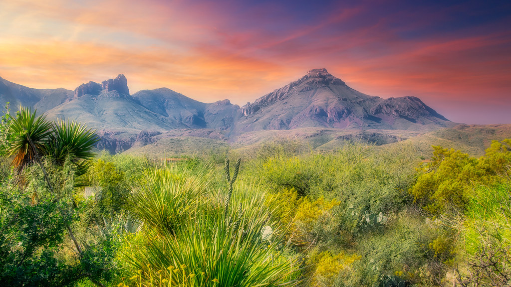
Photo: GLYancy via Flickr (CC BY 2.0)
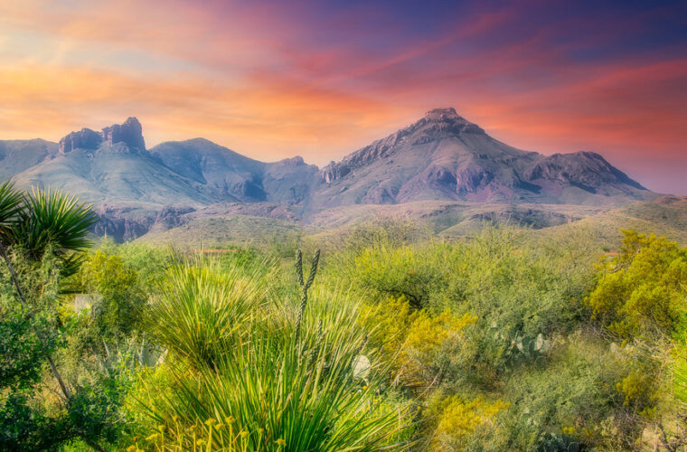
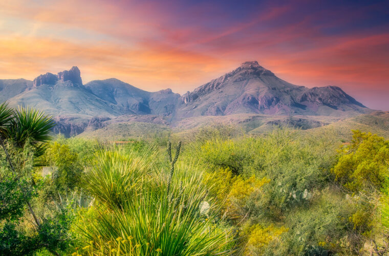
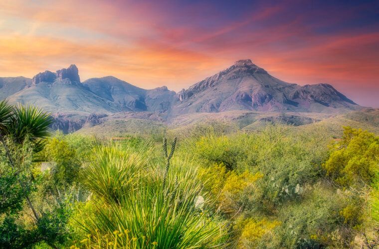
A Big Bend National Park Road Trip works best as a three-day loop based around the Chisos Basin, with the first day for the mountain interior, the second for the west-side desert and Santa Elena Canyon, and the third for the Rio Grande corridor. The park covers more than 800,000 acres in a broad bend of the Rio Grande, where the Chisos Mountains rise from the Chihuahuan Desert and roads between major trailheads take longer than their map distance suggests.
For most first-time visitors arriving from Marathon, Alpine, or Terlingua, the practical goal is to avoid crossing the park repeatedly. This itinerary enters from the north at Persimmon Gap or the west via Study Butte, uses Chisos Basin as the central overnight area, then saves Rio Grande Village and the Hot Springs Historic District for the final morning or afternoon. The route combines paved scenic drives with short walks, one substantial hike, and enough margin for heat, wind, wildlife, and slow-moving traffic on the park’s two-lane roads.
Plan the route around Big Bend’s three distinct regions
Why Chisos Basin makes the most efficient overnight base
Chisos Basin sits at roughly 5,400 feet, enclosed by volcanic peaks including 7,825-foot Emory Peak and 7,484-foot Casa Grande. That elevation puts it above the desert floor, which commonly exceeds 90°F in late spring and summer, and it places you near the junction of the park’s main paved roads. From the basin, the west entrance of the Ross Maxwell Scenic Drive is about 10 minutes away, while Panther Junction is roughly 20 minutes northeast. The approach road is steep, narrow, and unsuitable for oversized vehicles, so check your vehicle length before committing to a basin stay.
Visitors who cannot camp or lodge in the basin can use accommodations in Terlingua or Study Butte, west of the park boundary. That arrangement makes Day 2 especially easy because the Ross Maxwell Scenic Drive begins near the western side of the park. It adds meaningful driving on the mountain and east-side portions of the itinerary, however. Marathon is a sensible base only for the first or last night, since Persimmon Gap is about 70 miles south of town and the Chisos Basin lies much farther into the park.
A three-day sequence that limits backtracking
| Day | Primary stops | Best highlight | Approximate driving |
|---|---|---|---|
| Day 1 | Persimmon Gap, Fossil Discovery Exhibit, Panther Junction, Chisos Basin | Window Trail or Basin Loop at sunset | Marathon to Chisos Basin, about 2 hours 15 minutes |
| Day 2 | Ross Maxwell Scenic Drive, Homer Wilson Ranch, Castolon, Santa Elena Canyon | Santa Elena Canyon Trail | Chisos Basin to Santa Elena Canyon, about 1 hour 15 minutes each way |
| Day 3 | Panther Junction, Rio Grande Village, Hot Springs Historic District, Boquillas Canyon | Rio Grande corridor and canyon walk | Chisos Basin to Rio Grande Village, about 35 minutes |
Set up the vehicle and supplies before entering the park
Distances, fuel, and phone service require advance planning
Big Bend is remote even by West Texas standards. The paved road from Panther Junction to Santa Elena Canyon covers about 44 miles, and the park’s principal roads can feel slow because of low speed limits, steep grades, wildlife, and photo stops. Download offline maps before arriving. Cellular coverage is inconsistent in the Chisos Basin, along the Ross Maxwell Scenic Drive, and near canyon trailheads, while the higher ground around Panther Junction can be more reliable.
Arrive with a full tank and enough water and food for a full day away from developed areas. Limited services may be available inside the park, but a delayed delivery, mechanical problem, or seasonal disruption can change that plan quickly. Campground, lodging, entrance, and vehicle regulations can also change, so confirm current details on the official park site before departure. Tell someone outside your group where you plan to hike, especially if you are driving an unpaved road such as Old Ore Road or River Road.
Pack for desert heat and mountain weather on the same day
The park’s elevation range is one reason a three-day visit needs more than a standard desert daypack. Rio Grande Village lies near 1,850 feet, while the Chisos Basin is more than 3,500 feet higher. Summer afternoons can be dangerously hot at the river even when the basin is tolerable, and winter cold fronts can bring freezing temperatures, high winds, and occasional ice to mountain roads. Carry layers rather than assuming the forecast for one part of the park applies everywhere.
Road trip essentials for each day
- At least one gallon of drinking water per person per day, plus extra in the vehicle.
- Sun hat, sunscreen, sunglasses, and long sleeves for exposed desert trails.
- Closed-toe footwear with traction for loose volcanic gravel and canyon rock.
- A paper park map, offline navigation, tire repair supplies, and a spare tire in good condition.
- Headlamp, basic first-aid kit, salty snacks, and an insulating layer for sunset in the Chisos.
Day 1: Enter through the desert and settle into the Chisos Mountains
Use the north entrance for fossils, broad desert views, and orientation
From Marathon, enter through Persimmon Gap on U.S. 385 and allow time for the 39-mile drive to Panther Junction. This northern approach crosses open desert grassland where creosote bush, lechuguilla, ocotillo, and mesquite occupy shallow limestone soils. Pronghorn and mule deer are often easiest to spot early or late in the day. The Fossil Discovery Exhibit, about eight miles north of Panther Junction, provides a useful first stop because it explains the 130-million-year-old Cretaceous environments preserved in the park, including fossils from an ancient coastal plain and inland river systems.
At Panther Junction, collect a paper map and assess the forecast before heading to Chisos Basin. The six-mile Basin Junction Road climbs sharply into the mountains through volcanic tuff and rhyolite formations. Plan to arrive with daylight remaining, since the basin is where the itinerary’s first evening hike begins. If you entered from Study Butte instead, drive directly toward the basin and save the Fossil Discovery Exhibit for the morning of Day 3, when it fits naturally with the east-side route.
Choose a first-night walk based on energy and daylight
Window Trail for a longer sunset outing
The Window Trail descends 2.8 miles from the Chisos Basin trailhead to a narrow rock pour-off framing the desert far below. The route follows Oak Creek through shaded sections lined with oak, juniper, and occasional maple, then gradually becomes more exposed as it drops toward the Window. The return is uphill, and the last two miles can feel demanding after a travel day. Start early enough to be back before dark, carry water, and stay clear of the slick pour-off edge.
At the Window, polished bedrock slopes toward a notch between the cliffs, with the Chihuahuan Desert opening beyond it in a wide, flat band of pale distance. The air often cools quickly after sunset at basin elevation, and canyon wrens call from the walls while hikers climb quietly back along the creek bed. This is one of the clearest places to understand Big Bend’s scale: the basin feels enclosed until the rock gap suddenly directs your view hundreds of miles toward western Texas and Mexico.
A shorter alternative for arrival day
If you reach the basin late, walk the 1.8-mile Basin Loop Trail instead. This easy circuit passes beneath volcanic cliffs and gives close views of the Chisos flora, including pinyon pine, Texas madrone, and alligator juniper. It is also a practical way to look for birds, from Scott’s orioles in warmer months to Montezuma quail in dense cover. Finish before full darkness, eat dinner near your overnight site, and prepare for an early departure down the Ross Maxwell Scenic Drive on Day 2.
Day 2: Drive the west side from volcanic highlands to Santa Elena Canyon
Make deliberate stops along the Ross Maxwell Scenic Drive
The Ross Maxwell Scenic Drive runs about 30 miles from near the Chisos Basin junction to Santa Elena Canyon, descending through a sequence of volcanic mesas, desert badlands, and limestone layers. Begin in the morning, before the western exposures become hottest. The first essential stop is the Homer Wilson Ranch overlook, where the remains of a 1920s ranch house sit below the road and the Blue Creek drainage cuts through the foothills. The view also introduces the geology of the western park, where erosion has exposed tilted and fractured rock layers beneath the Chisos volcanic complex.
Continue to Sotol Vista, a high overlook with broad sightlines across the western desert toward the Sierra Ponce in Mexico. Farther south, the Mule Ears Viewpoint looks toward twin volcanic plugs that resemble upright ears above the plain. Castolon, near the end of the drive, developed as a military outpost and farming community beside the Rio Grande. Its historic buildings illustrate how the border landscape supported small settlements long before the area became a national park.
Walk into the limestone walls of Santa Elena Canyon
The Santa Elena Canyon Trail is a 1.7-mile round trip walk that begins near the river, crosses Terlingua Creek on a short approach, then climbs a series of steps before following the Rio Grande into the canyon. The walls rise roughly 1,500 feet overhead, exposing thick layers of Cretaceous limestone. After rain, Terlingua Creek can be impassable or muddy, so inspect conditions at the trailhead and do not attempt to cross moving water.
Plan to return toward Chisos Basin before dusk, using the same scenic drive rather than attempting remote back roads after dark. Desert animals become more active after sunset, and the road’s curves, dips, and open-range character reward a slow return. Day 3 shifts to the Rio Grande Village side of the park, where lower elevation, historic hot springs, and the Boquillas Canyon corridor require an earlier start in warm weather.
Day 3: Follow the Rio Grande through the park’s eastern lowlands
Start at Rio Grande Village before the desert heats up
Leave the Chisos early and drive toward Rio Grande Village, where the elevation drops to about 1,850 feet and morning temperatures rise quickly from spring through early fall. Begin with the Rio Grande Village Nature Trail, a short route that crosses a low hill above the campground and overlooks a wetland beside the river. The contrast with the dry uplands is immediate: cottonwoods, reeds, dragonflies, and migrating birds concentrate around water that supports life far beyond the riverbank.
The overlook also gives a useful view into Mexico, where the Sierra del Carmen forms a dark limestone wall beyond the Rio Grande floodplain. Look for black vultures circling on thermals, vermilion flycatchers near vegetation, and roadrunners working the open ground. Carry water even for this brief walk. The river corridor can feel hotter and more humid than the Chisos Basin, particularly when wind is light.
Visit the Hot Springs Historic District with time to explore
From Rio Grande Village, continue toward the Hot Springs Historic District, reached by a short unpaved access road that can become rough or temporarily unsuitable after heavy rain. The area preserves traces of the early twentieth century resort established around geothermal springs beside the river. The remains include stone foundations, a bathhouse area, and buildings associated with J. O. Langford, who promoted the mineral water as a treatment for ailments.
Read the landscape as well as the history
The thermal water emerges along fractures where groundwater circulates deep enough to warm before returning to the surface. Soaking in the historic concrete pool has long been part of a Big Bend National Park Road Trip, but the site sits directly beside the Rio Grande and requires basic river awareness. Do not enter the river, avoid walking through dense vegetation where snakes may shelter, and keep food secured because the lowland habitat attracts wildlife.
Finish with the Boquillas Canyon Trail
Boquillas Canyon lies farther east, where the Rio Grande cuts through limestone walls that rise several hundred feet above the water. The Boquillas Canyon Trail is about 1.4 miles round trip, beginning across sandy ground before climbing a low ridge above the river. The trail then descends to a shaded section near the canyon mouth, where you can see how the river has carved a narrow passage through rock that once formed part of an ancient sea floor.
Allow enough daylight to drive out of the park without rushing. Visitors returning toward Marathon can use the Persimmon Gap Road, while those headed west can retrace the route through Panther Junction toward Study Butte and Terlingua. This final day works best when you treat it as a lower mileage exploration day, with long pauses at the river rather than trying to add remote roads or a major mountain hike.
Adjust the plan for heat, cold, and seasonal road conditions
Spring and fall reward early starts
March through April and October through November generally provide the most manageable temperatures for combining hikes with scenic driving. Those months also bring the greatest visitor demand, especially during school breaks and holiday weekends. Start popular trails early, fill the vehicle before entering the park, and expect the Chisos Basin to feel cooler than the west-side desert even on a warm afternoon.
Spring winds can be strong across the open desert, particularly at Sotol Vista and other exposed overlooks. Wind dries skin quickly and can make hats, maps, and lightweight gear difficult to manage. Carry an extra layer for the Basin and secure loose items before opening vehicle doors at overlooks.
Summer and winter require different priorities
From late May through September, build the itinerary around dawn, shade, and short walks. Complete Santa Elena Canyon, Boquillas Canyon, and the Hot Springs area in the earliest part of the day, then use the hottest hours for driving, exhibits, meals, or rest. Summer thunderstorms can create fast runoff in arroyos and temporarily affect unpaved roads, even when skies appear clear several miles away.
Winter often provides excellent visibility and comfortable midday hiking temperatures in the desert, but cold fronts can bring freezing conditions to the Chisos Mountains. Keep flexible plans for the Basin, especially if rain or ice is forecast. The lower Rio Grande corridor is usually warmer, making Day 3 a sensible choice when mountain conditions are uncomfortable.
Frequently Asked Questions
Are dogs allowed on a Big Bend road trip?
Dogs may accompany visitors in developed areas, campgrounds, and on roads when leashed, but they are prohibited on park trails, in the backcountry, in buildings, and on the Rio Grande. The heat and lack of shade also make long periods in a parked vehicle dangerous.
Do I need reservations or permits?
An entrance pass is required, and camping, lodging, and backcountry travel each have separate rules. Check the official Big Bend National Park website before departure for current camping availability, reservation procedures, and backcountry permit requirements.
Is three days enough for first time visitors?
Three days is enough to see the Chisos Mountains, Ross Maxwell Scenic Drive, Santa Elena Canyon, and the Rio Grande corridor without spending most of the visit driving. Add a fourth day if you want to hike to Emory Peak, explore unpaved roads, or include the Boquillas Crossing.
Can a regular passenger car handle this itinerary?
Yes, the principal route to Panther Junction, Chisos Basin, Rio Grande Village, Santa Elena Canyon, and Boquillas Canyon uses paved roads. Avoid Old Ore Road, River Road, and other primitive routes unless you have an appropriate high clearance vehicle, current road information, recovery supplies, and experience driving remote desert terrain.
Is Big Bend suitable for children?
Families can comfortably focus on the Fossil Discovery Exhibit, Basin Loop Trail, Santa Elena Canyon Trail, and Rio Grande Village Nature Trail. Keep children close near pour offs, steep canyon edges, the river, and hot springs, and give each person their own water supply rather than relying on a shared bottle.
Make the miles work for you
This three-day route gives first-time visitors a clear progression through Big Bend’s major landscapes: high volcanic mountains on Day 1, the dry western desert and limestone canyon on Day 2, and the river corridor on Day 3. Sleeping near the Chisos Basin reduces unnecessary crossing of the park and leaves more time for trails, overlooks, geology, and historic sites.
Success here comes from respecting distance and temperature. Fuel up before the long drives, carry more water than you expect to use, download maps, and begin exposed hikes early. With those basics covered, the park’s roads connect three very different environments in a compact itinerary that still leaves room to stop when the landscape calls for more time.
Want to keep exploring? Browse all our Big Bend guides and articles for more trip-planning tips and ideas.
Gear & Essentials
Tell us about your trip and we will add what else you will want:
The basics
Worth having in the car whatever the park.
For this trip
As an Amazon Associate we earn from qualifying purchases, at no extra cost to you.