Big Bend National Park in Winter: Weather, Hikes, Camping, and What to Pack
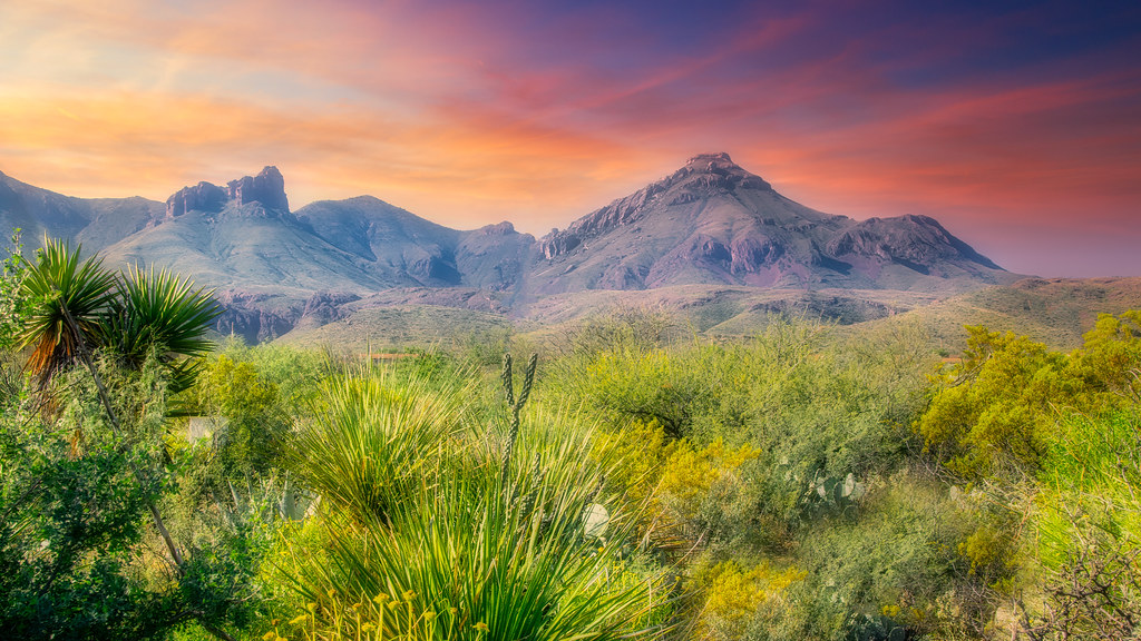
Photo: GLYancy via Flickr (CC BY 2.0)
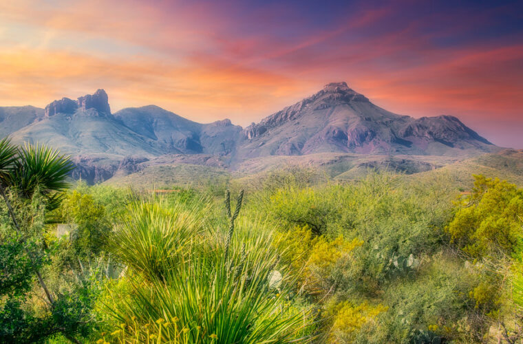
Big Bend National Park in winter can begin with frost whitening the roofs of Chisos Basin Campground while sunrise reaches the rust-colored cliffs above the Window. At roughly 5,400 feet, the air feels sharp, boot soles scrape over gravel, and the first light arrives on the upper canyon walls before it warms the tents below. By afternoon, campers beside the Rio Grande may be sitting in shirtsleeves under cottonwoods.
That elevation range defines a winter camping trip here. Big Bend spans river desert near 1,800 feet, mountain woodland above 7,000 feet, and the 7,832-foot summit of Emory Peak. Our team recommends choosing a campground by temperature tolerance, vehicle type, and planned hikes rather than treating every part of the park as interchangeable. Winter brings comfortable desert walking, cold mountain nights, short daylight, and occasional weather systems capable of producing snow or ice in the Chisos Mountains.
Winter conditions change sharply with elevation
From December through February, many lower desert afternoons are mild enough for long hikes, while overnight lows can approach freezing. The Chisos Basin commonly runs colder because it sits thousands of feet above the Rio Grande. Strong cold fronts can push freezing air onto the desert floor and cover mountain roads with ice. Conversely, exposed lower trails may still feel hot under direct sun, particularly on calm afternoons.
Desert-floor weather near the Rio Grande
Rio Grande Village and Cottonwood Campground occupy the warmer end of the park’s winter climate. Daytime temperatures often support hiking in light layers, but dry air allows heat to escape quickly after sunset. A pleasant afternoon can become a cold evening within an hour. Campsites near the river also experience occasional wind, blowing dust, and substantial temperature differences between shaded ground and open sun.
Winter rain is generally limited, yet storms matter in a landscape of arroyos and washes. Never pitch a tent in an unofficial low spot simply because it looks sheltered. Desert drainage channels can carry runoff from distant slopes, and clay-rich ground becomes sticky after rain. Campers should also expect very low humidity, which increases water loss even when the temperature feels cool.
Mountain cold in the Chisos Basin
The Basin’s higher elevation produces colder nights, more wind exposure, and a greater chance of snow or freezing fog. The access road descends through tight curves from Panther Junction, and ice can make this route temporarily hazardous. Mountain shadows also reach some campsites well before the published sunset, reducing the time available to dry damp gear or cook in comfortable temperatures.
A winter sleeping system for the Basin should be selected for below-freezing conditions rather than the afternoon forecast. Cold air settles into low sections of the campground, while exposed sites receive stronger gusts. Bring a sleeping pad with meaningful insulation, since rocky ground conducts heat away from the body even inside a warm sleeping bag.
Typical winter patterns by camping area
| Camping area | Approximate elevation | Winter character | Main planning concern |
|---|---|---|---|
| Rio Grande Village | 1,850 feet | Mildest nights and warmest afternoons | Sun exposure and large daily temperature swings |
| Cottonwood | 2,170 feet | Cool river corridor with mature tree cover | Limited services and long drives to central park destinations |
| Chisos Basin | 5,400 feet | Cold nights with possible snow or ice | Mountain road conditions and vehicle length |
Choosing the right developed campground
Big Bend’s three principal developed campgrounds have distinct settings. Chisos Basin provides immediate access to mountain trails. Rio Grande Village works well for river, hot-spring, and eastern desert exploration. Cottonwood places campers near Santa Elena Canyon and the Ross Maxwell Scenic Drive. Driving between these areas takes time because the park covers more than 800,000 acres and roads curve around mountain ranges rather than crossing them directly.
Chisos Basin for hikers and tent campers
Chisos Basin Campground sits inside an eroded mountain basin ringed by volcanic peaks. Sites are relatively compact, terrain is uneven, and vegetation or rock outcrops provide partial separation rather than complete privacy. Shade varies considerably. Juniper, oak, and piñon grow around the basin, but many pads remain exposed during part of the day.
The steep, winding entrance road includes sharp curves that make the campground unsuitable for many large recreational vehicles and trailers. Vehicles around 24 feet or longer, and trailers around 20 feet or longer, are generally discouraged on this road. Campers should evaluate total vehicle length and turning ability before committing to the Basin.
Rio Grande Village for warmth and RV options
Rio Grande Village Campground occupies a broad area near the river, with cottonwoods providing valuable but inconsistent shade. The developed campground primarily serves tents and self-contained vehicles, while a separate concession-operated RV area traditionally provides full hookups. These are different camping experiences: the main campground has a more open, parklike layout, while the RV area prioritizes utility connections and larger rigs.
This location is useful for visiting Boquillas Canyon, the Rio Grande Village Nature Trail, and the Hot Springs Historic District. It is also much warmer than the Basin on many winter nights. Campers sensitive to cold often prefer it, although the tradeoff is a longer drive to mountain trailheads.
Cottonwood for quiet nights on the west side
Cottonwood Campground lies near Castolon and the lower end of the Ross Maxwell Scenic Drive. Large cottonwoods create more continuous tree cover than most park campgrounds, and the setting often feels quieter because it is removed from the central road network. Sites are generally simple, with no utility hookups, so campers must arrive prepared to manage power and water conservatively.
The location cuts morning travel time to Santa Elena Canyon, where limestone walls rise about 1,500 feet above the Rio Grande. It is less convenient for Chisos Basin hikes or eastern attractions. Campers building an itinerary around the west side may save several hours of cumulative driving by staying here.
Reservations, site selection, and RV planning
Winter is one of Big Bend’s busiest camping seasons, particularly around holidays, weekends, and school breaks. Developed sites may use a mix of advance reservations and other allocation methods, while primitive roadside campsites generally require a backcountry permit. Booking windows, fees, operating arrangements, and amenity availability can change, so confirm current details on the official park site before selecting dates.
Match the site to your shelter and vehicle
Do not rely on a campground name alone when booking. Review the individual site dimensions, parking configuration, tent-pad size, generator rules, and maximum occupancy. Some Basin sites fit a small tent and passenger vehicle comfortably but leave little room for a large family shelter. RV travelers should distinguish between a site that accepts an RV and one that supplies hookups.
- Tent campers: Look for a level pad, morning sun, and protection from prevailing wind.
- Small vans: Check parking length and whether the sleeping setup requires extending doors or awnings.
- Trailers: Include the tow vehicle when evaluating space and turning clearance.
- Large RVs: Favor lower-elevation areas with easier road geometry and verify hookup needs before booking.
Primitive roadside camping requires more preparation
Big Bend also has designated backcountry roadside campsites reached by paved, gravel, or rough high-clearance roads. These sites provide greater separation and darker surroundings, but they lack the convenience and regular traffic of developed campgrounds. Road difficulty varies widely, and dry tracks can become impassable after rain. Carry extra water, a full-size spare tire, a reliable jack, and a paper map that shows the exact access route.
Walks and hikes directly from camp
A well-chosen campground reduces winter driving and makes short daylight easier to manage. December days provide limited margin for a late trail start, especially in the mountains where ridges block the sun early. Keep a headlamp in your daypack even for short walks, and set a turnaround time based on sunset, terrain, and the slowest person in the group.
Trails from Chisos Basin
The Basin trail network begins close to the campground and visitor area, allowing campers to leave the vehicle parked. Routes range from short interpretive walks to strenuous climbs into the high Chisos. Snow or ice may persist on shaded upper slopes after exposed ground has dried.
Window Trail
The Window Trail descends through Oak Creek Canyon toward a narrow pour-off framing the western desert. From the main Basin trailhead, the round trip is roughly 5.6 miles, while campground access can shorten it. Remember that the return journey climbs back into the Basin, concentrating much of the effort late in the hike.
Lost Mine Trail
The Lost Mine Trail covers about 4.8 miles round trip and climbs roughly 1,100 feet to a ridge above Juniper Canyon. The trailhead has limited parking, so an early start is useful. Ice can linger on shaded switchbacks, and traction aids may be appropriate after winter precipitation.
Exploring the river country from lower-elevation camps
Rio Grande Village and Cottonwood place campers close to short trails that remain comfortable on many winter afternoons. Start exposed routes early, since limestone, gravel, and dark volcanic rock absorb solar heat even in January. Carry at least two liters of water for a short outing and more for longer routes. River access does not make untreated Rio Grande water safe to drink.
Boquillas Canyon and the Hot Springs district
The Boquillas Canyon Trail is about 1.4 miles round trip, climbing a low ridge before descending toward the river and canyon mouth. Near the Hot Springs Historic District, a roughly one-mile round-trip trail passes pictographs, homestead remains, and the riverbank thermal spring. Water levels, sediment, and temperature can affect conditions at the spring, so evaluate the site before entering.
Santa Elena Canyon from Cottonwood
The Santa Elena Canyon Trail covers about 1.7 miles round trip from the end of Ross Maxwell Scenic Drive. It crosses Terlingua Creek, climbs stone steps, and follows a bench inside the canyon. Creek depth can prevent passage after rain, even when the trailhead is dry.
Inside the canyon, packed sand and rounded gravel shift underfoot while voices rebound between limestone walls about 1,500 feet high. Winter shade can make the air noticeably cooler than the open desert. The Rio Grande occupies only part of the canyon floor, which reveals the scale of the rock corridor more clearly than the overlook outside it.
Pack for cold ground, wind, and strong sun
Camping in Big Bend National Park in winter requires equipment for several climates during one trip. A 25-degree night in the Basin and a warm afternoon beside the river can occur within the same itinerary. Layering works better than one heavy coat because hikers need to release heat during climbs and restore insulation quickly at shaded overlooks.
Build the sleep system from the ground up
A sleeping bag’s temperature rating assumes adequate insulation beneath it. For Basin camping, choose an insulated pad with an R-value around 4 or higher, then add a bag appropriate for freezing conditions. A closed-cell foam pad beneath an inflatable pad adds insulation and provides backup if sharp desert vegetation causes a puncture.
| Item | Recommended winter function | Why it matters |
|---|---|---|
| Insulated sleeping pad | Limits conductive heat loss | Rocky soil remains cold overnight |
| Wind-resistant tent | Handles gusts and blowing dust | Exposed sites receive little natural protection |
| Sun hat and sunscreen | Reduces ultraviolet exposure | Cool air can conceal sun intensity |
| Headlamp with spare batteries | Supports camp chores after sunset | Winter daylight is short |
| Water containers | Stores at least one gallon per person daily | Trailheads and primitive sites may lack water |
Prepare meals without depending on a fire
Do not plan on a wood campfire. Bring a reliable camp stove, sufficient fuel, and food that can be prepared when wind or cold makes cooking slow. Store food, cooking oil, toiletries, and trash securely in a vehicle or approved container. Javelinas, rodents, ravens, and coyotes quickly investigate unattended supplies.
- Pack insulated gloves that still allow you to operate stove controls.
- Carry a windscreen approved for the stove model.
- Bring extra drinking water for cooking and cleanup.
- Keep electrolyte mix available for warm desert hikes.
- Use hard-sided bins to contain food odors and protect supplies from rodents.
Frequently Asked Questions
Do I need a reservation to camp in winter?
Developed campgrounds commonly fill during winter weekends, holidays, and school breaks. Primitive roadside camping requires the appropriate backcountry authorization, while developed and concession-operated sites use separate booking systems.
Can dogs stay in Big Bend campgrounds?
Pets may stay in developed campgrounds but must remain under physical control. They are generally prohibited on park trails and in the backcountry, which sharply limits hiking options for visitors traveling with a dog.
Is winter camping suitable for children?
Yes, if the sleeping system handles freezing temperatures and the itinerary includes shorter walks. The Rio Grande Village Nature Trail, fossil exhibits, and brief roadside stops provide alternatives to steep mountain hikes.
Can I rely on mobile phone service?
No. Coverage is limited and inconsistent across the park. Download maps before arrival, carry printed directions, and establish meeting points before members of the group separate.
How much water should campers bring?
Plan for at least one gallon per person per day, with additional capacity for strenuous hikes and primitive sites. Never depend on springs, the Rio Grande, or seasonal pools as routine drinking sources.
Plan the campground around the day you want
Chisos Basin gives hikers the most direct access to mountain trails, Rio Grande Village favors warmer nights and eastern river sites, and Cottonwood reduces the drive to Santa Elena Canyon. Choosing among them affects morning temperatures, vehicle suitability, shade, hiking access, and the amount of each day spent behind the wheel.
A successful winter trip pairs a conservative sleeping setup with flexible daily plans. Leave room to shift a mountain hike after ice, move a desert walk to the cooler morning, or spend a windy afternoon exploring roadside geology and historic sites. With the right campground, layered clothing, ample water, and realistic drive times, winter reveals Big Bend at its most walkable and camp-friendly.
Want to keep exploring? Browse all our Big Bend guides and articles for more trip-planning tips and ideas.
Gear & Essentials
Tell us about your trip and we will add what else you will want:
The basics
Worth having in the car whatever the park.
For this trip
Winter conditions
As an Amazon Associate we earn from qualifying purchases, at no extra cost to you.