The Best Scenic Drives in and Around Chiricahua National Park
The best scenic drives in and around Chiricahua National Park combine a paved mountain road through Bonita Canyon, the broad desert approach from Willcox, and rougher forest roads crossing the Chiricahua Mountains. For a first visit, drive Arizona Route 186 and Arizona Route 181 to the park entrance, then follow Bonita Canyon Drive to Massai Point. Allow at least half a day for overlooks and short walks, or a full day if you plan to hike among the rhyolite pinnacles.
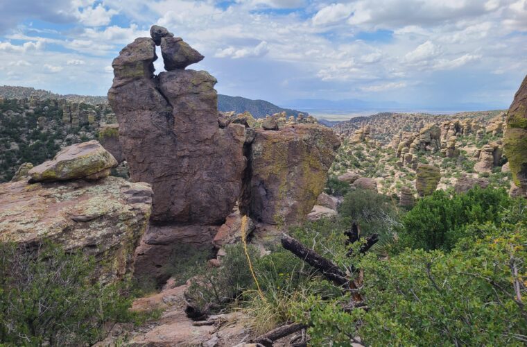
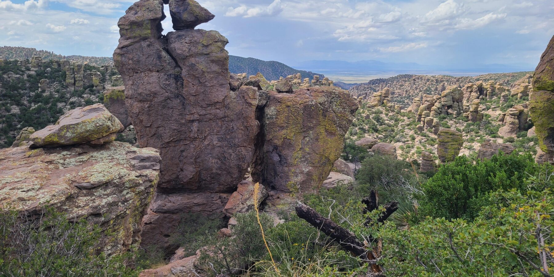
It was Chiricahua National Monument until October 2026, when it became Arizona’s fourth national park. The protected area occupies the northwestern side of the Chiricahua Mountains in southeastern Arizona, roughly 37 road miles from Willcox. Its defining formations originated about 27 million years ago, when the Turkey Creek Caldera erupted and deposited thick layers of volcanic ash. That material hardened into rhyolite tuff, then fractured and eroded into columns, balanced rocks, and narrow fins.
How the Drives Fit Together
Chiricahua does not have a network of paved touring roads. Most visitors use one main approach and one road inside the park. Arizona Route 186 crosses the Sulphur Springs Valley from Willcox, Arizona Route 181 leads toward the entrance, and Bonita Canyon Drive climbs from the visitor center area to Massai Point. The changing elevation turns this short road system into a compressed tour of southeastern Arizona ecology.
Distances, surfaces, and realistic driving times
The paved route from Willcox to Massai Point covers approximately 45 miles each way. Expect about 75 minutes of driving without stops because the final portion is narrow and winding. Pinery Canyon Road provides a separate, unpaved crossing between the park side of the mountains and Portal on the eastern side. Its condition varies with storms, erosion, and seasonal maintenance, so it belongs in a different category from the standard passenger-car itinerary.
| Road | Approximate distance | Surface | Best use |
|---|---|---|---|
| Willcox to park entrance | 37 miles | Paved | Main western approach and open-valley scenery |
| Visitor center to Massai Point | 8 miles | Paved | Rock formations, overlooks, and trail access |
| Pinery Canyon Road | About 25 miles across the range | Gravel and native surface | Backcountry scenery and access toward Portal |
What to settle before leaving Willcox
Fuel the vehicle, download offline maps, and carry drinking water before turning south from Willcox. Cellular coverage becomes unreliable near the mountains, and the park has no through road to Portal. Large recreational vehicles and trailers require extra planning because Bonita Canyon Drive contains tight curves and constrained parking areas. Entrance requirements, road restrictions, campground availability, and temporary closures can change, so confirm current details on the official park site before departure.
- Start with a full fuel tank.
- Carry water for driving and any planned walks.
- Save an offline map of Arizona Routes 186 and 181.
- Check tire pressure before attempting unpaved mountain roads.
- Keep food secured because coatimundis, squirrels, and other wildlife investigate unattended items.
Bonita Canyon Drive, the Park’s Essential Road
Bonita Canyon Drive begins near the visitor center at approximately 5,400 feet and climbs to Massai Point at about 6,870 feet. The eight-mile ascent passes Bonita Canyon Campground, historic Faraway Ranch access, oak woodland, and increasingly exposed volcanic formations. The road is paved throughout, but drivers should expect blind bends, limited shoulders, falling-rock debris after storms, and cyclists sharing the roadway.
Why Bonita Canyon Drive Comes First
The road reveals the park gradually. Lower Bonita Canyon contains Arizona sycamores, Emory oaks, alligator junipers, and Arizona cypress along seasonal drainage channels. Higher slopes support Apache pine and ponderosa pine, while gaps in the trees expose the gray, tan, and pale orange tuff. This elevation transition also explains why temperatures at Massai Point can be noticeably cooler than those in the Sulphur Springs Valley.
Pullouts and short walks worth prioritizing
Plan stops around trail access rather than attempting to photograph from the roadway. The half-mile Massai Point Nature Trail gives the quickest close look at balanced formations and distant mountain ranges. Echo Canyon Trail, reached from a separate trailhead near the upper road, descends through narrow rock corridors and can be combined with Hailstone and Ed Riggs trails for a loop of roughly 3.3 miles.
Massai Point at road’s end
At Massai Point, rough rhyolite lies underfoot and the pavement gives way to stone steps and an exposed ridge. Wind moves through the pines with a dry hiss, and the temperature often drops as soon as you leave the car. Beyond the railing, ranks of narrow pinnacles fill the basin below, while the Sulphur Springs Valley appears as a flat, bright floor far beyond the mountain’s broken western edge.
The Western Approach from Willcox
Arizona Route 186 supplies the scale that Bonita Canyon cannot. The road leaves the Interstate 10 corridor, crosses open grassland and desert scrub, and aims toward the dark mass of the Chiricahua Mountains. Dos Cabezas rises east of the route near the beginning of the drive, while agricultural fields and distant basin ranges illustrate the alternating valleys and mountains of Arizona’s Basin and Range province.
Drives Across the Sulphur Springs Valley
The most useful daylight is often early morning, when low sun defines the Chiricahuas ahead and illuminates dust, grass, and yucca across the valley. Late afternoon works better when returning toward Willcox because the western sky opens across the basin. Cattle and wildlife can enter the roadway, particularly around dawn and dusk, so the valley’s long sight lines should not encourage excessive speed.
Arizona Route 181 and the transition into the mountains
At the junction with Arizona Route 181, the route bends east toward the park and begins leaving the open basin. The terrain tightens around washes and oak-covered foothills before reaching the entrance corridor. Watch for white-tailed deer, wild turkeys, and javelinas near vegetated drainages. During the summer monsoon, localized downpours can place water and sediment across low sections even when sunshine remains visible a few miles away.
Choosing the Right Season and Direction
Spring and autumn provide the most dependable conditions for combining driving with short hikes. Spring days are often mild, though exposed overlooks can be windy. Autumn usually brings cooler nights and clearer air. Summer temperatures in the surrounding valleys can be severe, while the higher park road remains somewhat cooler. Afternoon thunderstorms are common during the monsoon period, generally from July into September.
Winter driving at higher elevations
Snow and ice sometimes affect the upper miles of Bonita Canyon Drive even when roads near Willcox are dry. Shaded curves retain ice longer than exposed overlooks, and freeze-thaw cycles can loosen stones from roadside slopes. Winter visitors gain quieter viewpoints and crisp long-distance visibility, but they should avoid assuming that desert conditions in the valley represent conditions at Massai Point.
When the light best reveals the rock formations
Morning light works particularly well along the upper road because angled sunlight creates separation between closely packed columns. Midday flattens their texture, especially under a cloudless sky. Late afternoon can produce stronger color on west-facing rock, but drivers should leave enough daylight for the winding descent. After dark, deer become harder to see and roadside pullouts are difficult to identify.
Pinery Canyon Road and the Crossing to Portal
Pinery Canyon Road, signed as Forest Road 42, extends the trip into Coronado National Forest and crosses the Chiricahua Mountains toward Portal. The route passes from dry oak woodland into pine forest before descending through Cave Creek Canyon on the eastern side. Loose rock, washboarding, ruts, and storm damage make ground clearance and durable tires more important than four wheel drive during dry, maintained conditions.
Climbing the western slope
The western ascent begins near Arizona Route 181 outside the park boundary and follows Pinery Creek into a progressively narrower canyon. Oak, juniper, and Apache pine replace the grasslands below. Occasional openings reveal the Sulphur Springs Valley and the Dragoon Mountains. Drivers should use lower gears on sustained grades, leave room for oncoming vehicles, and avoid stopping on blind curves where the usable road surface narrows.
Onion Saddle and the mountain crest
Near Onion Saddle, at roughly 7,600 feet, side roads and trails reach the higher country beneath Chiricahua Peak, the range’s 9,759 foot summit. Temperatures here can be 15 to 25 degrees Fahrenheit cooler than in the valleys. The crest also divides two watersheds: runoff west of the divide drains toward the Sulphur Springs Valley, while eastern drainages feed Cave Creek and the San Simon Valley.
Descending through Cave Creek Canyon
The eastern descent enters one of Arizona’s most biologically diverse mountain corridors. Cave Creek Canyon supports sycamores, cypress, oaks, and pines within a short vertical range. Birders come for elegant trogons, painted redstarts, Mexican chickadees, and numerous hummingbird species. Black bears also inhabit the range, so food and scented items should remain secured whenever the vehicle is unattended.
| Segment | Landscape | Main driving concern |
|---|---|---|
| Route 181 to Pinery Canyon | Grassland, oak foothills, volcanic slopes | Loose gravel and washboarding |
| Pinery Canyon to Onion Saddle | Steep forested canyon and mountain crest | Ruts, narrow curves, and changing weather |
| Onion Saddle to Cave Creek Canyon | Pine forest, cliffs, and riparian woodland | Long descent and possible storm debris |
| Cave Creek Canyon to Portal | Rock walls, sycamores, and open foothills | Wildlife and occasional creek crossings |
Building a Drive That Matches Your Vehicle and Time
The Best Scenic Drives Around Chiricahua work best when divided by road surface rather than combined automatically into one large loop. A standard passenger car is appropriate for the paved approach and Bonita Canyon Drive. Pinery Canyon Road requires a separate judgment based on tire condition, recent rainfall, ground clearance, and the driver’s comfort with steep gravel roads far from immediate services.
A strong one day sequence
Leave Willcox early enough to cross the Sulphur Springs Valley in morning light, then continue directly to Massai Point before parking becomes more constrained. Walk the nature trail or part of Echo Canyon, descend slowly through Bonita Canyon, and stop near Faraway Ranch for a different view of the lower landscape. Return through the valley before dusk, when deer and cattle become harder to detect.
- Carry breakfast or lunch from Willcox rather than relying on food near the park.
- Photograph the mountain front from a safe pullout along the valley approach.
- Drive to Massai Point before making lower canyon stops.
- Choose one short upper elevation trail instead of rushing through several.
- Allow additional daylight for the descent and the return across open range.
When to add the mountain crossing
Reserve Pinery Canyon and Portal for a full day without a fixed evening arrival. The crossing demands slower speeds than its mileage suggests, and birding stops in Cave Creek Canyon can easily add several hours. Starting from the western side places the steeper, rougher climb earlier in the day. Beginning near Portal gives morning access to the canyon’s active bird habitat before climbing toward Onion Saddle.
Clear reasons to turn around
Turn back if muddy ruts deepen, water is moving across the road, thunderstorms are building over the crest, or tire traction becomes uncertain. Dry washes can rise rapidly after rain falls upstream. A vehicle should carry a full size spare tire, jack, tire gauge, basic compressor, extra water, and a paper map in addition to downloaded navigation. Travel plans should also identify the intended road and expected return time.
Gear & Essentials
Tell us about your trip and we will add what else you will want:
The basics
Worth having in the car whatever the park.
For this trip
As an Amazon Associate we earn from qualifying purchases, at no extra cost to you.
Choosing Your Drive
First time visitors should prioritize Arizona Routes 186 and 181 with the paved climb to Massai Point. That combination explains the region clearly: an immense basin, an isolated mountain range, changing plant communities, and the volcanic pinnacles created from Turkey Creek Caldera deposits. It also leaves enough time for overlooks and a short trail without committing to remote forest roads.
Pinery Canyon Road adds forest, elevation, solitude, and the eastern cliffs around Cave Creek Canyon. Choose it when road conditions, vehicle clearance, and available daylight support a slower crossing. With those decisions made before leaving pavement, the Chiricahuas become easier to explore at their natural pace, from bright valley grasslands to shaded pine forest and weathered rhyolite towers.