Best Things to Do in Wind Cave National Park Above and Below Ground

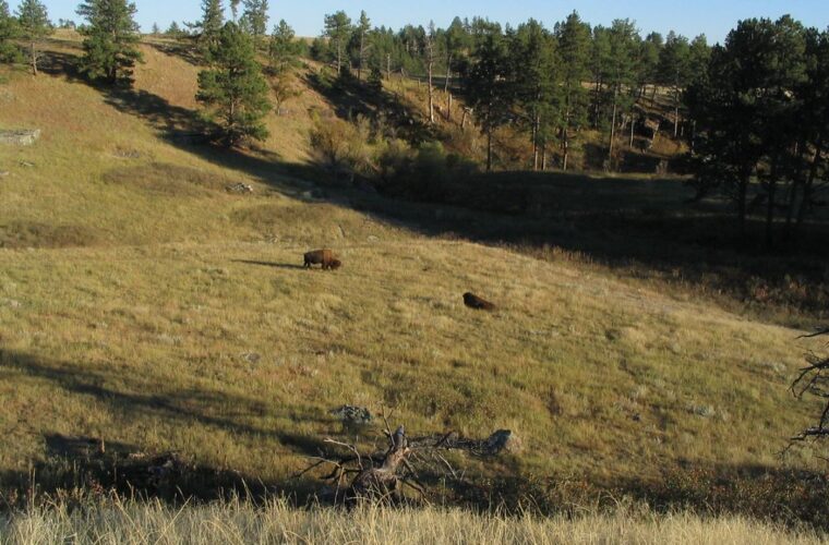
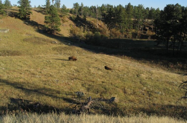
Photo: Ken Lund via Flickr (CC BY-SA 2.0)
The Best Things to Do in Wind Cave National Park begin with a surprise: most of the park experience happens in open sunlight, even though the protected cave is among the longest and most complex on Earth. Beneath the mixed grass prairie lies a three dimensional maze containing more than 150 surveyed miles of passages, yet the surface supports bison, elk, pronghorn, prairie dogs, and one of the largest remaining natural grasslands in the Black Hills region.
Established in 1903, Wind Cave was the first national park created specifically to protect a cave. Its visitor center and cave entrance sit along U.S. Highway 385, about 15 minutes north of Hot Springs and roughly 30 minutes south of Custer. A useful visit combines one scheduled cave tour with a wildlife drive and a short surface hike, rather than treating the cave as the park’s only attraction.
Two interconnected landscapes define the park
Wind Cave protects nearly 34,000 acres where the southern Black Hills meet the Great Plains. Elevations rise from approximately 3,560 feet near the southern boundary to 5,013 feet on Rankin Ridge. That range creates an ecological transition from dry prairie and ponderosa pine savanna to cooler forested slopes, all positioned above a limestone cave system with multiple underground levels.
Boxwork makes the cave globally significant
Wind Cave is especially important for its boxwork, a honeycomb pattern of thin calcite blades projecting from ceilings and walls. Calcite filled fractures in the limestone before groundwater dissolved the softer surrounding rock. The resistant veins remained behind as fins. Wind Cave contains the great majority of the world’s known boxwork, with particularly dense displays visible on several developed tour routes.
The cave formed mainly within the Mississippian age Pahasapa Limestone, deposited in a shallow sea more than 300 million years ago. Its name comes from air moving through the small natural entrance. Changes in atmospheric pressure cause the cave to inhale or exhale as its enormous interior air mass equalizes with outside conditions.
The surface protects a working prairie ecosystem
Above the cave, grasses such as western wheatgrass, blue grama, and little bluestem support herds of bison and pronghorn. Prairie dog colonies create shorter vegetation and burrow networks used by burrowing owls, badgers, and federally endangered black footed ferrets. Fire also shapes this landscape by limiting pine expansion and renewing grass growth, so recently burned areas can become productive wildlife feeding grounds within a growing season.
Reserve a cave tour before building the rest of the day
Public access to Wind Cave is generally limited to ranger guided tours. Visitors cannot enter independently, and tour capacity is constrained by elevators, narrow passages, and safety requirements. Secure a tour time first, then arrange hikes and wildlife drives around it. Tour availability, ticket procedures, elevator operations, and accessible options can change, so confirm current details on the official park site before traveling.
Choose a route by stairs and formation type
The main tours overlap in character but differ substantially in duration and physical effort. All developed routes involve paved or constructed walkways, confined spaces, and sustained stair climbing. Mileage alone can be misleading because several hundred stairs underground require more effort than a level surface walk of the same distance.
| Typical tour | Approximate length | Typical duration | Best suited for |
|---|---|---|---|
| Garden of Eden | About 0.25 mile | About 1 hour | A shorter introduction with boxwork and cave popcorn |
| Natural Entrance | About 0.67 mile | About 75 minutes | Visitors interested in cave history, geology, and roughly 300 stairs |
| Fairgrounds | About 0.67 mile | About 90 minutes | A more strenuous route with upper and middle levels and roughly 450 stairs |
| Candlelight | About 1 mile | About 2 hours | Rugged travel, historic atmosphere, and limited lighting |
Expect cold air, tight turns, and steep stairways
Inside, the temperature stays near 54 degrees Fahrenheit throughout the year. The first cool draft is immediate, especially after crossing the sun warmed prairie. Footsteps and voices flatten against the limestone as the route descends through narrow turns. Boxwork hangs overhead like a lattice of stone, while electric lights reveal passage walls only a short distance ahead. The scale becomes apparent at stair landings, where one level drops from view and another passage continues above it.
Carry only what the cave environment permits
Travel light because larger belongings interfere with narrow passages and handrails. Cave protection rules also reduce the chance of introducing lint, food residue, or organisms into a stable underground environment. Our team recommends preparing at the vehicle before walking to the tour meeting point.
- Wear closed toe shoes with secure, slip resistant soles.
- Bring a light fleece or jacket, even when afternoon temperatures exceed 90 degrees outside.
- Leave food, gum, drinks, backpacks, and walking sticks outside the cave.
- Tell a ranger before the tour if stairs, low ceilings, darkness, or enclosed spaces may present a problem.
- Do not wear clothing or footwear used in another cave unless it has been properly cleaned to reduce the spread of white nose syndrome affecting bats.
Use the park roads as wildlife viewing corridors
Wind Cave has no single surface attraction equivalent to a geyser basin or canyon overlook. Its defining aboveground experience unfolds along the roads between the visitor center, Rankin Ridge, prairie dog colonies, and the park’s northern grasslands. Early morning and the final two hours of daylight generally provide the best wildlife activity, while midday is better reserved for a cave tour or shaded forest walk.
U.S. Highway 385 and Highway 87 provide the easiest circuit
U.S. Highway 385 crosses the park from north to south and passes the visitor center, cave area, and broad prairie habitat. Highway 87 turns northwest through rolling grassland and ponderosa pine toward Custer State Park. Traffic remains faster on these paved roads than on the gravel interior routes, so use designated pullouts rather than stopping in a travel lane when bison or pronghorn appear.
Give bison control of every encounter
Bison frequently cross roads or rest near pavement, and an animal that appears motionless can accelerate quickly. Remain inside the vehicle when a herd surrounds the road. On foot, maintain at least 25 yards from bison and other large mammals, and at least 100 yards from predators. A raised tail, head shaking, pawing, or a direct approach means you are already too close.
Gravel roads reveal the quieter prairie
NPS roads 5 and 6 reach less visited grasslands, prairie dog towns, and forest edges away from the main highway. Surfaces can become deeply rutted after rain, while winter snow and spring mud may make portions unsuitable for low clearance vehicles. Drive slowly around blind bends and scan fence lines for pronghorn, open slopes for elk, and prairie dog colonies for coyotes or badgers hunting near burrow entrances.
Hike from open grassland into the Black Hills
Wind Cave’s trail network shows how quickly the terrain changes above the cave. Short loops near the visitor center cross exposed prairie, while northern routes enter pine forest and rolling drainages. Most junctions are lightly signed, and shade is limited outside forested ridges. Carry water, save an offline map, and expect bison dung, prairie dog burrows, and uneven ground even on established paths.
Climb Rankin Ridge for the broadest view
The 1 mile Rankin Ridge loop climbs to the park’s highest point at 5,013 feet. The former fire lookout area provides views east across the Great Plains and west toward the higher Black Hills. Walk the loop clockwise for a steadier ascent on the old access road, followed by a narrower descent through ponderosa pine. Afternoon thunderstorms can expose the ridge to lightning, so morning is the safer choice during summer.
Explore the Lookout Point and Centennial trails
Lookout Point Trail runs approximately 2.2 miles one way through prairie, forest edges, and the Beaver Creek drainage. Connecting it with part of the Centennial Trail creates a loop of roughly 4.5 miles, depending on the chosen junctions. This area supports bison and elk, so hikers should scan beyond each rise before proceeding. Creek crossings can be muddy after heavy rain but are often dry later in summer.
Choose a shorter wildlife walk
The Prairie Vista Trail near the visitor center and the Elk Mountain Trail near the campground each cover about 1 mile. Prairie Vista is exposed and useful for observing grassland plants, while Elk Mountain passes through ponderosa pine and mixed grass habitat. Cold Brook Canyon offers a longer out and back option through a drainage frequented by wildlife, with fewer visitors than trails near the cave complex.
Build a day around distance, heat, and daylight
A practical one day plan starts with an early wildlife drive, places the cave tour near midday, and reserves late afternoon for Rankin Ridge or a short prairie trail. This sequence avoids peak surface heat and uses the hours when bison, pronghorn, and elk are more active. Allow extra road time whenever animals occupy the pavement because passing closely can provoke a charge.
Match the schedule to the season
| Season | Typical surface conditions | Best planning approach |
|---|---|---|
| Spring | Rapid weather changes, mud, wind, and occasional snow | Favor paved roads and keep an alternate short trail available |
| Summer | Hot exposed prairie, thunderstorms, and strong ultraviolet exposure | Hike early, tour the cave midday, and carry ample water |
| Autumn | Cool mornings, dry grass, and shorter daylight | Use afternoon warmth for hiking and watch for active elk |
| Winter | Snow, ice, wind, and limited surface services | Keep the route flexible and avoid unplowed gravel roads |
Pack for two different environments
The Best Things to Do in Wind Cave National Park require clothing for a cool cave and an exposed prairie on the same day. There is little dependable shade on grassland trails, and water sources should not be treated as potable. A vehicle kit also helps when gravel roads soften after rain or snow.
- Carry at least two quarts of water per person for a half day of surface hiking.
- Use sun protection, including a brimmed hat and sunscreen.
- Bring a warm layer reserved for the cave tour.
- Pack a paper map or downloaded map because mobile coverage is inconsistent.
- Keep binoculars accessible so wildlife can be observed without approaching it.
Frequently Asked Questions
Wind Cave is compact enough for a focused day trip, but cave access, wildlife delays, and changing weather reward advance planning. The answers below cover the decisions that most often affect an itinerary.
How much time should I spend at Wind Cave?
Allow four to six hours for one cave tour, a wildlife drive, and a short hike. A full day supports Rankin Ridge or a longer prairie loop without rushing between activities.
Can I enter Wind Cave without a guided tour?
No. Public cave access is through ranger guided programs rather than independent exploration. Check the park’s official website for current tour schedules, ticket procedures, fees, and elevator status.
Are dogs allowed on the trails?
Leashed pets are allowed on the Prairie Vista and Elk Mountain trails and in certain developed areas, but they are prohibited in the cave and on most backcountry trails. Keep pets well away from bison and prairie dog colonies.
Is Wind Cave suitable for children?
Many children can manage the shorter developed cave tours, but adults should consider darkness, confined passages, tour length, and the number of stairs. Prairie Vista and Elk Mountain provide manageable surface alternatives.
Can I visit Wind Cave in winter?
The park remains an important winter landscape, although snow and ice can affect trails and roads. Cave tour availability and visitor services may be reduced, so review official operating information before departure.
Plan one connected visit above and below ground
Wind Cave makes the most sense when its underground geology and surface ecology are treated as one protected system. Reserve the appropriate cave tour first, then add a wildlife drive and a trail matched to the day’s heat, wind, and road conditions. Rankin Ridge provides the clearest geographic overview, while Lookout Point and the interior gravel roads reveal quieter sections of the prairie.
A well paced day also leaves room for delays caused by bison, thunderstorms, or muddy roads. Start early, carry water, keep a warm layer ready for the cave, and observe every animal from a safe distance. That approach provides a complete view of Wind Cave National Park, from calcite boxwork deep underground to one of the Black Hills region’s most intact grassland ecosystems.
Want to keep exploring? Browse all our Wind Cave guides and articles for more trip-planning tips and ideas.
Gear & Essentials
Tell us about your trip and we will add what else you will want:
The basics
Worth having in the car whatever the park.
For this trip
As an Amazon Associate we earn from qualifying purchases, at no extra cost to you.