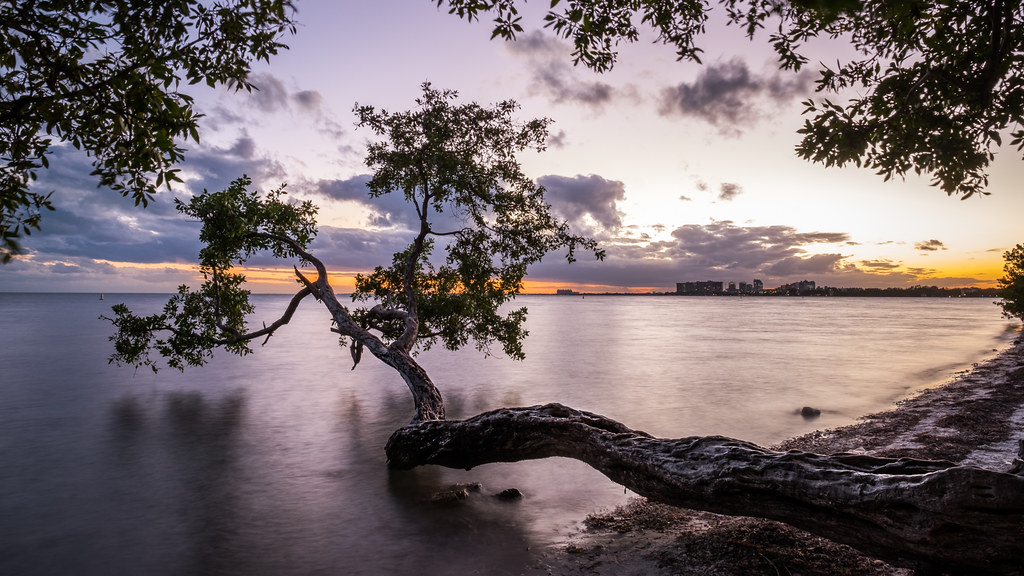
Biscayne National Park Travel Guide: Snorkeling, Boating, and Island Adventures

Photo: Judy Gallagher via Flickr (CC BY 2.0)
Our Biscayne National Park Travel Guide begins at Convoy Point just after sunrise, where the boardwalk crosses a fringe of red mangroves and Biscayne Bay shifts from slate gray to clear green. Small fish flicker beneath the roots, pelicans skim the channel, and the low Miami skyline sits across the water. The park feels open and quiet here, yet the mainland represents only a narrow edge of a predominantly marine landscape.
Biscayne protects 172,971 acres south of Miami, approximately 95 percent of them water. Its boundaries encompass mangrove shoreline, shallow Biscayne Bay, the northern Florida Keys, coral reefs, and part of the Florida Reef Tract. Reaching the visitor center is straightforward. Experiencing the islands, wrecks, and reefs requires a boat, guided excursion, or carefully planned paddle.
Understanding a park built around water
Biscayne lacks the familiar road loop of many national parks. No bridge connects the mainland entrance to Boca Chita Key, Elliott Key, Adams Key, or the offshore reefs. Visitors who arrive without water transportation can explore Convoy Point, walk beside the bay, join available programs, and launch a paddlecraft, but they will see only a small portion of the protected landscape.
Four ecosystems in one park
The park forms a cross section of subtropical South Florida. Mangrove forests stabilize the mainland shore and provide nursery habitat for fish. Biscayne Bay averages less than 10 feet deep, with seagrass beds supporting rays, sea turtles, lobsters, and juvenile reef species. The keys are low limestone islands covered by hardwood hammock, while the outer reef supports corals, sponges, and schools of tropical fish.
| Park zone | Defining features | Best way to experience it |
|---|---|---|
| Convoy Point | Mangroves, bay shoreline, visitor center | Walking, picnicking, paddling |
| Biscayne Bay | Shallow water, seagrass, sandbars | Boat tour, kayak, private vessel |
| Northern keys | Hardwood hammock, historic sites, protected harbors | Island landing and hiking |
| Outer reef | Coral formations, wrecks, open Atlantic water | Guided snorkeling or diving trip |
Why the limestone is so close to the surface
Biscayne’s islands and reefs occupy an exceptionally low landscape. Most land rises only a few feet above sea level. The keys consist largely of Key Largo Limestone, an ancient reef deposit exposed when sea levels were lower. Thin soils support gumbo limbo, poisonwood, mahogany, and other tropical hardwoods, while tidal channels cut through the islands and mangrove margins.
Planning the mainland arrival
The main entrance is at Convoy Point, east of Homestead at the end of Southwest 328th Street. It is roughly 40 miles from central Miami, although urban traffic can make the drive considerably longer than the distance suggests. There is no road through the park and no general road access to its islands, so transportation choices should be settled before arrival.
What to do at Dante Fascell Visitor Center
The Dante Fascell Visitor Center is the practical starting point for first visits. Exhibits explain the bay’s ecology, Indigenous history, shipwrecks, and coral reef system. Outside, the roughly 0.8-mile round trip Jetty Trail follows the waterfront past mangroves to an open view over the bay. It is level and easy, though sun exposure and insects can be significant.
Boat excursions and ranger activities depend on weather, season, staffing, and operator schedules. Entrance policies, tour availability, marina services, and island facilities also change, so confirm current details on the official park site before building a day around a specific departure.
What to carry from the mainland
Island shade, drinking water, food service, and emergency assistance are limited. Reef-safe sun protection helps reduce chemical exposure in sensitive marine habitat, but clothing remains the most reliable defense against tropical sun. Pack for the entire outing rather than assuming supplies will be available after departure.
- Refillable drinking water, plus extra for heat or delays
- Long-sleeved sun shirt, hat, and polarized sunglasses
- Secure footwear for limestone, docks, and wet boat decks
- Insect repellent, especially for Elliott Key and mangrove areas
- Dry bag for electronics, medication, and spare clothing
- Snorkeling equipment fitted before boarding, if it is not provided
Choosing between snorkeling, boating, and paddling
The right activity depends on wind, swimming confidence, navigation experience, and available time. A snorkeling excursion generally provides the easiest access to offshore reefs or wrecks. A boat trip centered on islands suits visitors interested in history and short walks. Paddling offers close contact with mangroves and shallow water, but distances and changing wind can turn an easy outbound route into a difficult return.
Snorkeling the reef and historic wrecks
Reef trips travel beyond the protected bay toward the Atlantic side of the keys, where water clarity is often better but waves are larger. Conditions determine whether operators visit coral patches, offshore reefs, or a shipwreck. Common marine life includes parrotfish, angelfish, barracuda, southern stingrays, nurse sharks, and green or loggerhead sea turtles.
The Maritime Heritage Trail
The Maritime Heritage Trail links six documented wrecks representing nearly a century of shipping history. Five can be explored by snorkel, while the sixth is primarily a dive site. The steel hulled schooner Mandalay, wrecked in 1966, lies in relatively shallow water and is among the more approachable sites when sea conditions cooperate. Mooring buoys help protect wrecks and surrounding coral from anchor damage.
Traveling by private boat
Private boating provides the greatest flexibility, but Biscayne Bay demands precise navigation. Broad stretches are only a few feet deep, and shoals, seagrass beds, channels, and tidal cuts can be difficult to distinguish in glare. Groundings damage propellers and living seagrass. Updated nautical charts, local weather forecasts, tide information, and a functioning depth finder are basic equipment rather than optional extras.
Paddling along the mangrove edge
Kayaks and canoes work best close to Convoy Point, in protected coves, and along sheltered island shorelines. Wind direction matters more than the apparent calm at launch. An easterly breeze can build chop across the open bay, while thunderstorms during the warmer months may develop rapidly. Paddlers should stay out of marked navigation channels and display the safety equipment required for their craft.
The island corridor from Boca Chita to Elliott Key
The park’s most accessible islands form a north to south corridor along the eastern side of Biscayne Bay. Boca Chita Key combines a compact harbor with a recognizable lighthouse. Elliott Key, the park’s largest island, provides a longer walk through tropical hardwood hammock. Adams Key and the quieter waterways around Jones Lagoon reveal a less visited side of the park.
Boca Chita Key and its harbor
Boca Chita’s 65-foot ornamental lighthouse was built in the 1930s by industrialist Mark Honeywell, who developed the island as a private retreat. The tower was never an official navigational light, but it now serves as the park’s visual landmark. A short path circles the developed portion of the island, passing the harbor, stone structures, mangroves, and open bay views.
The harbor can become busy on fair-weather weekends, and its entrance is narrow enough to require attention from arriving boaters. Beyond the maintained area, dense vegetation and mosquitoes limit casual wandering. The island works best as a short landing paired with time on the water rather than as a full day of hiking.
Elliott Key beyond the docks
Elliott Key is approximately seven miles long and represents the northernmost of the true Florida Keys. Spite Highway, a rough path created during a 1960s land dispute, runs along much of the island’s interior. Its name recalls efforts to clear a wide corridor before federal protection halted proposed development. Today, vegetation has narrowed the route into a shaded track through hardwood hammock.
What the inland walk feels like
Within minutes of leaving the shoreline, the breeze disappears beneath gumbo limbo and poisonwood. Crushed coral and exposed limestone shift underfoot, cicadas dominate the soundscape, and humid air settles between the trees. The trail is nearly level, but heat, insects, irregular footing, and few outward views make each mile feel longer than the elevation profile suggests.
Quieter corners beyond the main island stops
South of Elliott Key, the channels around Adams Key and Jones Lagoon reward travelers who can reach them with an appropriate shallow-draft boat or guided excursion. These areas receive less traffic than Boca Chita because they sit farther from common mainland launch points and require careful navigation through shoals. Their appeal comes from protected water, mangrove shorelines, birdlife, and the transition between open bay and narrow tidal passages.
Adams Key and the Cocolobo legacy
Adams Key once housed the Cocolobo Cay Club, a private retreat established during the early 20th century. Political leaders and wealthy visitors used the island for fishing trips and informal gatherings before it entered federal ownership. A short trail crosses tropical hardwood hammock near the harbor, where gumbo limbo, strangler fig, mahogany, and poisonwood grow in thin soil over limestone. Visitors should recognize poisonwood by its glossy leaves and avoid touching its bark or foliage.
Jones Lagoon by paddlecraft
Jones Lagoon lies among mangrove islands south of Adams Key. Its shallow, protected water suits kayaks and paddleboards transported by a larger vessel, although tides and wind still affect the return. Roseate spoonbills, white ibis, herons, rays, and small sharks may appear along the margins. Prop scars are a persistent threat in this habitat, so powerboat operators should approach through established channels and avoid crossing pale seagrass flats.
Matching the trip to weather and water
South Florida has a warm, wetter season and a milder, drier season, but daily marine conditions matter more than the calendar. A calm morning can provide clear reef water and an easy bay crossing, while an approaching front can produce steep chop. Offshore snorkeling depends on wind direction, wave height, currents, and visibility, so operators may substitute an island or protected bay site when the Atlantic is rough.
| Period | Typical pattern | Planning priority |
|---|---|---|
| December through April | Lower humidity, fewer thunderstorms, periodic cold fronts | Carry a wind layer and expect rough water after fronts |
| May through November | Heat, high humidity, frequent afternoon storms | Favor early departures and monitor lightning closely |
| June through November | Atlantic hurricane season | Keep plans flexible when tropical systems develop |
Heat and storm precautions
Exposed docks, boats, and open water provide little protection from ultraviolet radiation. Drink before becoming thirsty and replace electrolytes during prolonged activity. Thunder is a signal to leave exposed water, even when rain appears distant. Warm-season storms can create dangerous wind well ahead of the visible rain shaft, and a paddlecraft cannot reliably outrun one across Biscayne Bay.
Protecting the reef while staying safe
Coral can cut skin, and contact may injure colonies that took decades to grow. Snorkelers should remain horizontal, keep fins above the reef, and never stand on coral. Boaters should use established mooring buoys where available instead of dropping an anchor onto reef or seagrass. A practical safety check includes:
- Snorkel with a buddy and remain within comfortable swimming distance of the boat.
- Use a properly fitted flotation device when confidence or conditions warrant it.
- Secure loose equipment before entering the water.
- Watch for boat traffic and follow diver-down signaling requirements.
- Give manatees, turtles, crocodiles, and nesting birds ample space.
Frequently Asked Questions
Because Biscayne is primarily water, first-time visitors often underestimate how much transportation determines the day. Convoy Point works for a short mainland visit, but reefs, wrecks, and islands require additional planning. Our Biscayne National Park Travel Guide recommends choosing the desired experience first, then arranging the vessel, tour, or paddle route that can reach it safely.
Families should also consider time on the boat, swimming ability, sun exposure, and motion sensitivity. Island landings involve docks, uneven limestone, and insects, while reef excursions may require climbing a ladder from open water. Those details often matter more than trail mileage in deciding which outing fits the group.
Can you visit Biscayne National Park without a boat?
Yes. Convoy Point provides the visitor center, waterfront grounds, mangrove views, and the Jetty Trail. A boat is required to reach the major islands, offshore reefs, and Maritime Heritage Trail wrecks.
Can you snorkel from the mainland?
The mainland shoreline does not provide the clear reef snorkeling associated with Biscayne. The coral reefs and most worthwhile snorkel sites lie offshore and are normally reached by boat.
How much time should you spend in the park?
Allow two or three hours for Convoy Point alone. Reserve most of a day for an island or snorkeling excursion because loading, travel across the bay, safety briefings, and changing sea conditions all consume time.
Is Biscayne suitable for children?
Children who are comfortable around boats can enjoy the shallow bay, wildlife, and island landings. Select flotation equipment by body size, bring full sun coverage, and choose a protected-water trip for anyone new to snorkeling.
Are dogs allowed in Biscayne National Park?
Leashed pets are generally permitted around Convoy Point and in developed portions of Elliott Key, but they are restricted from several other islands and sensitive areas. Heat, sharp limestone, wildlife, and limited fresh water make island outings difficult for pets.
Building a practical Biscayne itinerary
A productive first visit begins at Convoy Point and continues onto the water. Pair the visitor center and Jetty Trail with one major excursion: an offshore snorkel, a Boca Chita and Elliott Key trip, or a paddle in protected mangrove water. Trying to combine distant reefs, multiple islands, and a long paddle in one day leaves little margin for wind, storms, or slower boat travel.
Biscayne rewards plans built around marine conditions rather than a rigid checklist. Choose transportation early, carry everything needed after leaving the mainland, and treat shallow water with care. With those decisions settled, the park’s defining features become accessible: coral communities, seagrass flats, limestone keys, historic wrecks, and mangrove channels within sight of metropolitan Miami.
Want to keep exploring? Browse all our Biscayne guides and articles for more trip-planning tips and ideas.
Gear & Essentials
Tell us about your trip and we will add what else you will want:
The basics
Worth having in the car whatever the park.
For this trip
On the water
As an Amazon Associate we earn from qualifying purchases, at no extra cost to you.