Black Canyon of the Gunnison National Park
Black Canyon of the Gunnison National Park Travel Guide: Best Hikes, Viewpoints, and Scenic Drives
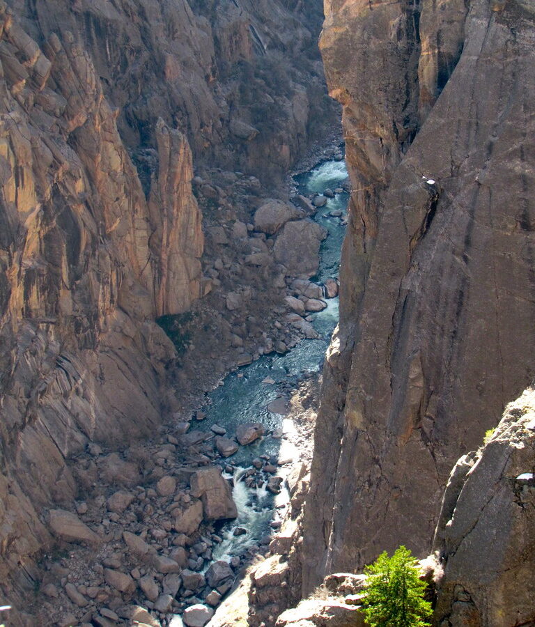
Photo: katerha via Flickr (CC BY 2.0)
Our Black Canyon of the Gunnison National Park Travel Guide starts with the decision that shapes the entire visit: choose the South Rim for the most viewpoints and easiest access, or the North Rim for quieter trails and a rougher, more isolated setting. Most first visits work best as one full day on the South Rim, combining the seven mile scenic road with short overlook walks and one rim trail.
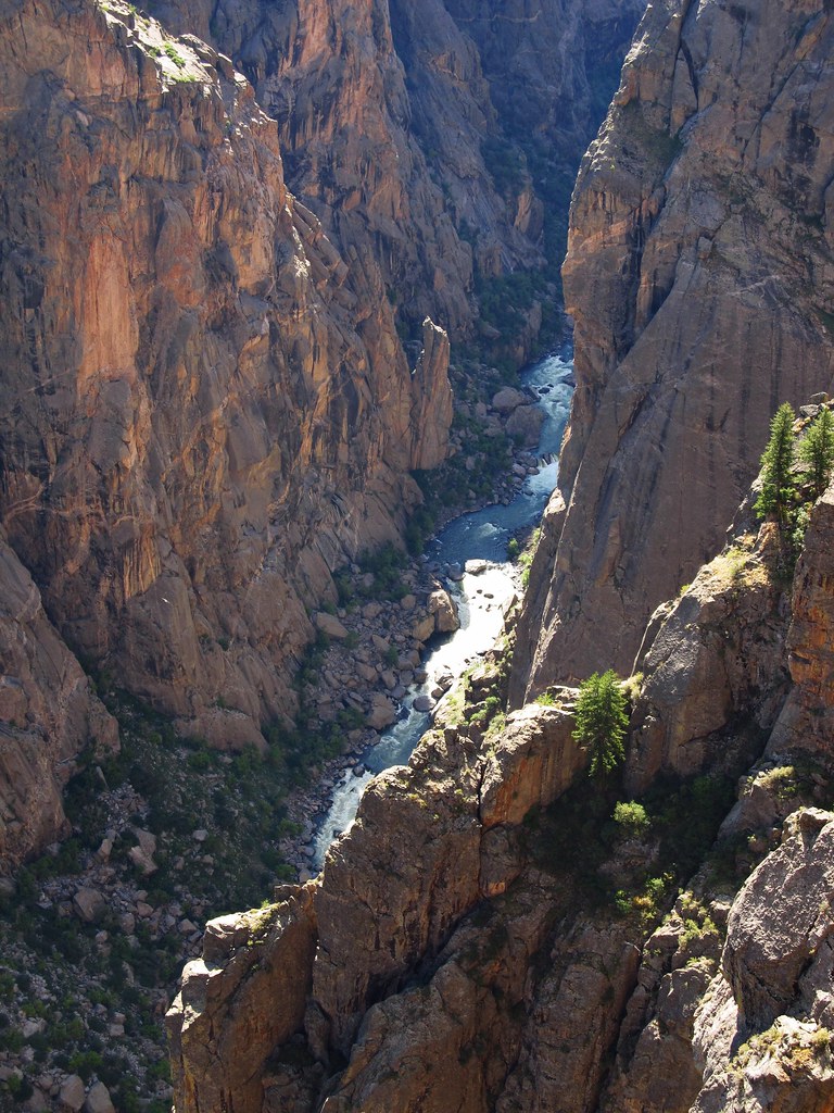
The park protects a particularly deep, narrow section of western Colorado’s Gunnison Gorge. At Warner Point, the canyon reaches 2,722 feet deep, while the river is only about 1,100 feet from the opposite rim at the Narrows. The South and North rims face each other across that gap, but no bridge connects them. Driving between them requires leaving the park and circling around the canyon, so treating them as separate destinations prevents a costly planning mistake.
Why this canyon looks and feels so severe
Black Canyon earns its name from the limited sunlight reaching its deepest sections. In places, the combination of sheer walls and a narrow opening leaves the lower canyon in shadow for much of the day. The Gunnison River helped create those proportions by cutting through resistant Precambrian rock while the surrounding landscape rose. Within the park, the river descends at an average of roughly 43 feet per mile, producing a steeper gradient than the Colorado River through Grand Canyon National Park.
Ancient rock exposed by a young canyon
The walls consist largely of gneiss and schist formed about 1.7 billion years ago, crossed by lighter bands of pegmatite. Those pale intrusions are especially visible on Painted Wall, where they resemble branching strokes across a dark cliff. Painted Wall rises about 2,250 feet above the river and is considered Colorado’s tallest cliff. The exposed rock is ancient, but most of the present canyon was carved during the past several million years as the Gunnison maintained its course through an uplifting landscape.
Three distinct park zones
The South Rim contains the visitor center, the main scenic drive, and the largest concentration of overlooks. The North Rim has a gravel approach, fewer developed facilities, and direct access to North Vista Trail. East Portal Road drops from the South Rim entrance area toward the Gunnison River below the canyon walls. Its sustained grades reach 16 percent, and the road has vehicle length restrictions, making it unsuitable for trailers and some larger recreational vehicles.
- South Rim: Best for a first visit, sunset viewpoints, short walks, and paved road access.
- North Rim: Best for solitude, rim hiking, and close views into the canyon from Chasm View.
- East Portal: Best for experiencing the river corridor and understanding the canyon’s vertical scale from below.
Getting oriented before choosing a rim
The South Rim entrance is about 15 miles east of Montrose, reached primarily by US 50 and Colorado Highway 347. Allow roughly 30 minutes from central Montrose under normal conditions. The North Rim is approached from the community of Crawford, with the final section generally traveled on an unpaved road. Standard passenger cars can usually manage the approach when it is dry, but washboarding, mud, and sharp stones can make progress slow.
How much time each area requires
A half day on the South Rim allows several major overlooks, but it leaves little room for a longer walk or the East Portal descent. A full day supports the scenic drive, Oak Flat Loop or Warner Point Nature Trail, and stops timed for changing light. The North Rim deserves at least half a day after the long approach. Combining both rims in one day creates several hours of driving outside the park and rarely produces a satisfying visit.
| Area | Typical visit | Road character | Primary experience |
|---|---|---|---|
| South Rim | Half day to full day | Paved seasonal scenic road | Overlooks and short rim hikes |
| North Rim | Half day to full day | Remote approach with gravel sections | Quiet viewpoints and North Vista Trail |
| East Portal | Two to three hours | Very steep seasonal road | River access and canyon walls from below |
Seasonal conditions change the itinerary
The rim elevations are around 8,000 feet, so snow can linger into spring and return early in autumn. Summer afternoons often bring thunderstorms, exposed overlooks, and lightning risk. Temperatures beside the river can be considerably warmer than those on the rim. Winter access is more limited, although sections of the South Rim can support snowshoeing and cross country skiing. Confirm current road openings, fees, restrictions, and facility availability on the official park site before departure.
The South Rim scenic road and its essential stops
South Rim Road runs about seven miles from the visitor center area to High Point, with numerous overlooks branching from the main route. The drive itself is short, but walking to the viewpoints changes the time calculation. Some overlooks sit close to their parking areas, while others require several hundred yards of uneven trail. Allow two to three hours for the major stops without a longer hike, and avoid trying to visit every pullout simply to complete the map.
The inner canyon from Gunnison Point to Chasm View
Gunnison Point
Gunnison Point, immediately behind the South Rim Visitor Center, provides the quickest orientation to the canyon’s structure. The view looks into steep tributary gullies and across fractured metamorphic walls rather than toward a single landmark. Nearby Rim Rock Trail follows the edge for about one mile between the visitor center and campground area, offering repeated canyon views with less pavement and traffic than the scenic road.
Chasm View
Chasm View reveals one of the narrowest and most enclosed sections visible from the South Rim. The river is difficult to see from some angles because the walls drop so abruptly. This is also a useful stop for judging the canyon’s scale before selecting a trail. Guardrails protect the developed platform, but adjacent terrain includes loose gravel, sharp ledges, and steep drop offs.
Painted Wall and the western overlooks
Painted Wall View
At Painted Wall View, the pale pegmatite veins become clear across the canyon, running through dark gneiss in forks and diagonal bands. Stand near the railing and the foreground seems to fall away immediately beneath your boots. Wind moves through the pinyon and juniper behind the overlook, while the Gunnison is reduced to a narrow sound far below. The cliff fills most of the opposite horizon, making its height easier to grasp than from wider panoramic stops.
Cedar Point and Sunset View
Cedar Point offers another strong angle on Painted Wall after a short walk through open woodland. Sunset View looks west beyond the deepest canyon, where the gorge begins widening toward lower country. Late light reaches these western formations more effectively than it reaches the inner chasm, but afternoon clouds can block the sun. Arriving early enough to compare both overlooks gives more flexibility than committing to a single sunset location.
The North Rim rewards a slower plan
The North Rim receives fewer visitors because reaching it requires a separate approach and more unpaved driving. Its overlooks feel less buffered from the canyon, and the small road network encourages walking rather than repeated parking stops. Services are limited compared with the South Rim, so visitors should arrive with drinking water, food, sun protection, and enough fuel to return to Crawford or continue through the surrounding rural road network.
Chasm View and the Narrows
North Rim Chasm View stands almost directly across from the South Rim’s central overlooks, but the perspective is more intimate. Nearby, the Narrows compresses the upper opening of the canyon to roughly 1,100 feet across while the river channel far below becomes much tighter. The short Chasm View Nature Trail passes through pinyon and juniper woodland, giving visitors a manageable walk before committing to the longer North Vista route.
Exclamation Point as the North Rim’s signature walk
North Vista Trail follows the rim from the campground area toward Exclamation Point, approximately three miles round trip. The route crosses exposed slopes and patches of Gambel oak before reaching an overlook above a pronounced bend in the Gunnison. Continuing to Green Mountain increases the outing to roughly seven miles round trip and adds substantial elevation gain, with broader views beyond the canyon toward the West Elk Mountains and surrounding plateaus.
Choose a rim hike that matches your footing
The park’s named rim trails range from level woodland walks to steep routes with loose rock and exposed edges. Mileage alone can mislead because an 8,000 foot elevation, intense sun, and repeated short climbs increase the effort. The following comparison covers the most useful options for visitors who want to extend the scenic drive without entering the inner canyon.
| Trail | Distance | Character | Best use |
|---|---|---|---|
| Oak Flat Loop | About 2 miles | Steep, rocky, roughly 400 feet of elevation change | Below-rim terrain without descending to the river |
| Warner Point Nature Trail | About 1.5 miles round trip | Rolling ridge with interpretive markers | Geology and western canyon views |
| North Vista to Exclamation Point | About 3 miles round trip | Exposed rim walking with moderate climbs | North Rim’s strongest short hike |
| North Vista to Green Mountain | About 7 miles round trip | Longer climb through oak and conifer woodland | Wide views beyond the canyon |
Oak Flat goes below the rim
Oak Flat Loop begins near the South Rim Visitor Center and descends through Douglas fir, Gambel oak, and rocky openings below the plateau edge. It never reaches the Gunnison, but steep grades and narrow sections make it substantially harder than the overlook paths. Hiking counterclockwise places much of the sharpest climbing near the end. Trekking poles help on gravel, particularly after rain or during autumn leaf fall.
Inner canyon routes require a different standard
No maintained trail connects either rim with the river. Routes such as the South Rim’s Gunnison Route descend roughly 1,800 vertical feet through gullies filled with scree, poison ivy, and unstable rock. A fixed chain assists on one especially steep section, but it does not turn the route into a constructed trail. Inner canyon travel requires a wilderness permit, route-finding ability, and enough time to climb out before darkness.
- Carry all drinking water needed for the descent and return.
- Wear footwear with strong traction and ankle support.
- Protect food from rodents and other wildlife.
- Expect poison ivy to grow taller and denser near the river.
- Turn around if loose rock or route-finding exceeds your experience.
East Portal reveals the canyon’s human history
East Portal Road provides the clearest way to understand how abruptly the plateau drops to the Gunnison. The descent twists through steep switchbacks before reaching the river corridor, where the walls block broad rim views and create a warmer microclimate. Drivers should use low gear rather than riding their brakes. Bicycles, trailers, and vehicles exceeding posted length limits are restricted because of the grade and tight curves.
The Gunnison Tunnel changed western Colorado
Near the bottom is the eastern entrance of the Gunnison Tunnel, a 5.8 mile irrigation tunnel completed in 1909. It carries water beneath the divide into the Uncompahgre Valley, helping transform dry land around Montrose into productive agricultural ground. The tunnel was one of the early major projects of the federal Reclamation Service and became a National Historic Civil Engineering Landmark.
Build East Portal into the right itinerary
Schedule the descent after the central South Rim overlooks and before evening light at Cedar Point or Sunset View. This sequence moves from broad geological context to the river that carved the gorge, then returns to the western rim for late-day views. The lower road ends within Curecanti National Recreation Area, so visitors following this Black Canyon of the Gunnison National Park Travel Guide will cross into a separately managed unit without encountering a conventional park boundary station.
Frequently Asked Questions
Can you visit both rims in one day?
You can, but the road journey around the canyon consumes several hours and leaves little time for trails. Give each rim its own day, or choose the South Rim when only one day is available.
Are dogs allowed on the trails?
Leashed pets are permitted in selected developed areas and on certain rim routes, but many trails exclude them. Heat, sharp rock, wildlife, and unguarded edges also make careful route selection essential.
Do I need a permit to hike to the river?
Yes, inner canyon travel requires a wilderness permit. Ordinary overlook walks and maintained rim trails do not require a backcountry permit.
Is Black Canyon suitable for children?
Families can use the developed overlooks and shorter nature trails, but adults must supervise children continuously near canyon edges. Warner Point Nature Trail and the visitor center overlooks provide manageable introductions without the hazards of inner canyon travel.
How long should a first visit last?
Plan one full day for the South Rim, including the scenic road, several overlook walks, and one moderate trail. Add another day for the North Rim or a slower exploration of East Portal.
Will a mobile phone work throughout the park?
Coverage is unreliable along both rims and often absent below them. Download maps before arriving, keep a paper park map in the vehicle, and avoid depending on a phone for inner canyon navigation.
Planning the visit around the canyon
A successful first trip pairs the South Rim scenic road with one trail rather than attempting every overlook. Gunnison Point establishes the canyon’s structure, Chasm View shows its narrowest character, and Painted Wall supplies the clearest view of its pegmatite geology. Oak Flat Loop adds physical depth, while East Portal explains the river and irrigation history hidden below the rim.
Travelers with a second day should choose the North Rim and walk to Exclamation Point, continuing to Green Mountain when weather, daylight, and fitness allow. Carry water, prepare for rapid changes at high elevation, and treat inner canyon routes as serious wilderness undertakings. With those decisions made before arrival, time in the park can focus on the features that distinguish Black Canyon: resistant ancient rock, extreme vertical relief, and a powerful river compressed into a remarkably narrow gorge.
Want to keep exploring? Browse all our Black Canyon of the Gunnison guides and articles for more trip-planning tips and ideas.
Gear & Essentials
Tell us about your trip and we will add what else you will want:
The basics
Worth having in the car whatever the park.
For this trip
As an Amazon Associate we earn from qualifying purchases, at no extra cost to you.