Capitol Reef National Park Itinerary: The Perfect 3-Day Road Trip

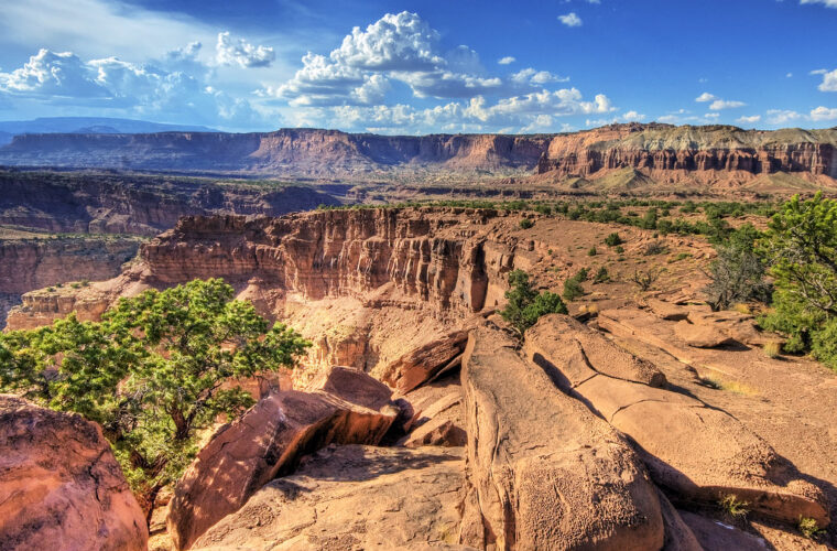
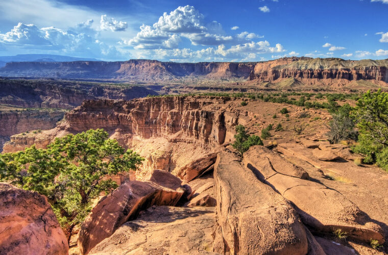
Photo: Wolfgang Staudt via Flickr (CC BY 2.0)
Our Capitol Reef National Park Itinerary uses three days to explore the Waterpocket Fold, a nearly 100 mile wrinkle in Earth’s crust where sandstone layers rise, tilt, and erode into domes, cliffs, canyons, and monoliths. The route combines the Fruita Historic District, Highway 24, the paved Scenic Drive, and a full day in the park’s more remote country without forcing long backtracking drives.
Base all three nights near Torrey or in the Fruita area, then treat each day as a separate spoke from that base. This plan covers the park’s essential overlooks and trails, explains which remote drives depend on road conditions, and leaves enough time for short walks among orchards and Fremont Culture rock art. Hiking distances and drive times below are approximate, since weather, photography stops, and unpaved roads can change the pace considerably.
How the three day route fits together
Use Torrey or Fruita as one consistent base
Torrey sits about 11 miles west of the Capitol Reef visitor center, generally a 15 minute drive on Utah Highway 24. It has the area’s broadest selection of lodging, groceries, restaurants, and fuel. Staying there avoids repacking each morning while keeping the park entrance close. Fruita places campers inside the historic district among orchards and cottonwoods, although campsite availability, seasonal services, and reservation procedures require more advance planning.
The itinerary starts with Highway 24 because it crosses the Waterpocket Fold and introduces the geology from several angles. Day two follows Scenic Drive into the tilted rock layers south of Fruita. Day three is reserved for Cathedral Valley or a weather safer alternative. That order puts the remote, condition dependent drive last, giving you time to check the forecast and ask about river depth, mud, and road damage before committing.
Approaching from Utah’s main road trip corridors
Most travelers arrive from Bryce Canyon and Grand Staircase country through Boulder on Utah Highway 12, or from Interstate 70 through Utah Highway 24. Highway 12 crosses Boulder Mountain above 9,000 feet, where snow, fog, and freezing temperatures can occur well after lower desert roads have cleared. The northern approach through Fremont River country is lower overall, but it still passes exposed plateaus where winter storms affect travel.
If Capitol Reef falls between Bryce Canyon and Moab, drive west to east through the park at the end of this stay. Highway 24 continues through Caineville’s gray bentonite hills to Hanksville, then connects with Interstate 70 or routes toward Moab. Travelers continuing west should reverse that sequence. Avoid changing hotels merely to save a few miles, since the park’s principal trailheads cluster around Fruita.
The itinerary at a glance
Three days of overlooks, trails, and backcountry roads
This schedule balances hiking with scenic driving rather than trying to cover every district. Capitol Reef has no single loop road connecting Fruita, Cathedral Valley, and the southern Waterpocket District. Remote roads can consume most of a day, so each deserves its own block of time. Drive estimates in the table represent typical time behind the wheel, excluding hikes, meals, and long viewpoint stops.
| Day | Primary stops | Main highlight | Approximate driving |
|---|---|---|---|
| 1 | Panorama Point, Fruita, petroglyph panels, Hickman Bridge | Highway 24 geology and a 1.8 mile natural bridge hike | 45 to 75 minutes from a Torrey base |
| 2 | Scenic Drive, Grand Wash, Cassidy Arch, Capitol Gorge | Deep canyons within the Waterpocket Fold | 1.5 to 2.5 hours, depending on spur roads |
| 3 | Cathedral Valley loop or southern Waterpocket District | Remote monoliths, desert badlands, and broad Fold views | 6 to 8 hours for Cathedral Valley |
Must see stops and optional additions
The Fruita Historic District, Highway 24 petroglyph panels, Hickman Bridge, and Scenic Drive belong in every first visit. Cathedral Valley is conditional because its roughly 58 mile loop includes unpaved roads, isolated terrain, and a Fremont River ford. After rain, clay rich surfaces can become impassable even for capable four wheel drive vehicles. Substitute paved Highway 24 hikes when thunderstorms, snow, or poor road reports make the loop unsuitable.
- Prioritize: Fruita, Hickman Bridge, Grand Wash, and at least one elevated view across the Waterpocket Fold.
- Add with extra energy: Cassidy Arch, the Fremont River Trail, Cohab Canyon, or the Capitol Gorge Tanks.
- Skip when conditions deteriorate: Cathedral Valley, South Draw Road, and long unpaved approaches through bentonite terrain.
- Save for a longer trip: Strike Valley Overlook and the southernmost Waterpocket District, which require substantial driving beyond the Fruita core.
Fuel, food, weather, and road preparation
Stock the vehicle before leaving Torrey
Fill the tank in Torrey before remote excursions. Fruita’s historic core is not a dependable place to buy fuel or a full day’s provisions, and Cathedral Valley has no services. Carry lunch, salty snacks, and at least one gallon of water per person for a warm weather backcountry day. Pack additional water for hiking, vehicle trouble, or an unexpected overnight delay. A paper map remains useful because navigation applications sometimes suggest unsuitable dirt road shortcuts.
Restaurant hours around Torrey can be limited outside the busiest travel months, so buy breakfast and trail food the previous evening. Orchard fruit may be available seasonally within Fruita under posted rules, but it should supplement rather than replace planned meals. Keep food secured inside the vehicle or approved storage. Mule deer regularly move through Fruita, and feeding wildlife changes their behavior around roads and campsites.
Expect weak reception and abrupt weather changes
Mobile service becomes unreliable inside canyons and across Cathedral Valley. Download maps before arrival and share the day’s route with someone who is not traveling with you. Summer thunderstorms can send water through Grand Wash and Capitol Gorge despite clear sky directly overhead. During winter, shaded trail sections hold ice while higher roads accumulate snow. Current fees, campground procedures, road reports, and temporary closures should be confirmed on the official park site.
Match the plan to the season
| Season | Typical conditions | Best adjustment |
|---|---|---|
| Spring | Cool mornings, variable wind, occasional snow at higher elevations | Hike midday and verify unpaved road conditions after storms |
| Summer | Hot exposed trails and afternoon thunderstorm risk | Start hikes near sunrise and leave washes when storms build |
| Autumn | Milder hiking temperatures and changing cottonwoods in Fruita | Reserve lodging early and allow time for orchard walks |
| Winter | Quiet roads, short daylight, ice, and possible snow | Favor Highway 24 and shorter trails over remote loops |
Day one: Highway 24, Fruita, and Hickman Bridge
Begin above the Fold at Panorama Point
Approach from Torrey and turn first toward Panorama Point, where the view reveals contrasting rock units before you enter the Fruita canyon corridor. Nearby Goosenecks Overlook looks into the entrenched bends of Sulphur Creek, while the short Sunset Point path reaches a broader west facing bench. Morning light is less dramatic here than evening light, but an early stop helps explain the landscape you will cross during the next three days.
Read the human history in Fruita
Continue to Fruita, a settlement established by Latter day Saint families in the late nineteenth century. Irrigation channels diverted Fremont River water into orchards planted with apples, pears, peaches, cherries, and other fruit. The schoolhouse, barn, farmhouse, and orchard grid show how a small agricultural community survived within a narrow floodplain. East of Fruita, boardwalks provide views of petroglyphs and pictographs associated with the Fremont Culture, whose people farmed this valley centuries earlier.
Climb to Hickman Bridge
Finish with the 1.8 mile round trip Hickman Bridge Trail, which gains roughly 400 feet from a trailhead beside Highway 24. The route climbs above the Fremont River, crosses exposed sandstone benches, and enters a shallow side canyon before reaching the natural bridge. Under the span, sand shifts beneath your shoes, voices echo against the alcove, and the shaded rock feels noticeably cooler than the sunlit approach. The bridge’s scale becomes clearest from the loop immediately behind it.
Day two: Scenic Drive and the Fold’s narrow canyons
Follow the paved road south from Fruita
Begin early on Scenic Drive, which runs beneath the red cliffs of the Waterpocket Fold before reaching the unpaved approaches to Grand Wash and Capitol Gorge. Pullouts reveal tilted layers of Wingate, Kayenta, and Navajo sandstone, each eroding into a different combination of cliffs, ledges, and rounded domes. Allow extra time for the short spurs because they enter confined canyons where vehicles move slowly and parking can fill.
Choose the right Grand Wash hike
Grand Wash Narrows
For a mostly level walk, enter Grand Wash from either Highway 24 or Grand Wash Road. The complete canyon route is about 4.4 miles one way, but many visitors walk only to the Narrows and return. Walls close to roughly 15 feet apart in places. The drainage carries dangerous flash floods, so turn around immediately if thunder develops or water begins flowing.
Cassidy Arch
The Cassidy Arch Trail leaves Grand Wash and climbs about 670 feet over approximately 3.1 miles round trip. Cairns mark sections across bare sandstone, and the final approach reaches a broad arch cut into the cliff top. Exposed slickrock and limited shade make this a morning hike. Families should keep children close near the arch because several edges have substantial drops.
End at Capitol Gorge
If the access road is dry and open, continue into Capitol Gorge for the roughly 2 mile round trip walk to the Pioneer Register and Tanks area. Settlers carved names into the canyon walls while following this former route through the Fold. The Tanks are natural potholes that may hold water after storms, though their presence is unreliable. Return to Torrey or Fruita for the night rather than adding another remote drive after dark.
Day three: Cathedral Valley or a safer trail day
Commit to Cathedral Valley only in good conditions
Cathedral Valley occupies the park’s northern district, where the Temples of the Sun and Moon rise from soft Entrada Sandstone and bentonite badlands. The loop usually begins or ends with a Fremont River ford on Hartnet Road. Water depth, mud, and recent erosion determine whether the crossing is safe. A high clearance vehicle is strongly preferred, and four wheel drive may be necessary after poor weather.
Key stops include the Bentonite Hills, Lower South Desert Overlook, Upper Cathedral Valley Overlook, Gypsum Sinkhole, Glass Mountain, and the Temples of the Sun and Moon. Begin with a full tank and enough supplies to handle a delay. Download navigation data before leaving Highway 24, since junctions are remote and cellular reception is generally absent. Return to the same lodging base after completing the loop.
Use paved access when the backcountry is unsuitable
A weather safe alternative combines Cohab Canyon with additional time around Fruita. Cohab Canyon is about 3.4 miles round trip from the campground area and gains roughly 440 feet through narrow side passages in the sandstone. Strong hikers can instead attempt Navajo Knobs, a strenuous route of roughly 9.4 miles with about 2,100 feet of elevation gain. Its summit provides one of the clearest high views along the Waterpocket Fold.
- After heavy rain: Avoid Cathedral Valley and all clay rich backcountry roads.
- During summer heat: Choose Cohab Canyon at sunrise, then spend midday in Fruita.
- With limited mobility or young children: Use Highway 24 overlooks, the petroglyph boardwalks, and short orchard walks.
- With a full hiking day: Carry extra water for Navajo Knobs and expect sustained exposure above the canyon.
Frequently Asked Questions
These practical answers cover the decisions most likely to affect a three day Capitol Reef National Park Itinerary, particularly vehicle choice, entry planning, and traveling with children or pets.
Do I need a reservation to enter Capitol Reef?
The park generally does not use timed entry for ordinary visits, although campgrounds and certain backcountry activities may have separate requirements. Check the park’s official website for current entrance fees, permits, and reservation procedures.
Can a regular passenger car follow this itinerary?
A passenger car can reach Fruita, Highway 24, Scenic Drive, and many principal trailheads. Cathedral Valley requires a separate decision based on clearance, river depth, mud, and the latest road report.
Is Capitol Reef suitable for children?
Yes. Fruita, the petroglyph panels, Grand Wash, and portions of Capitol Gorge work well for families. Hickman Bridge involves climbing and exposed heat, while Cassidy Arch has drop offs that require close supervision.
Are dogs allowed on the hiking trails?
Pets are prohibited on most park trails and in the backcountry. Leashed pets are permitted in specified developed areas and on a limited number of designated routes, so plan major hikes without them.
Can Capitol Reef be visited in one day?
One day is enough for Fruita, the petroglyph panels, Hickman Bridge, and part of Scenic Drive. Three days allow time for longer hikes and a separate remote district without compressing every stop into a rushed drive.
Putting the three days together
This route progresses from accessible landmarks to increasingly condition dependent terrain. Highway 24 and Fruita establish the park’s geology and settlement history, Scenic Drive brings you into the Waterpocket Fold, and the final day adds either Cathedral Valley’s remote formations or a substantial trail near the paved core. Keeping one lodging base minimizes packing and leaves flexibility when weather changes.
Start each morning with fuel, water, downloaded maps, and a realistic assessment of heat or storms. Protect the essential stops first, then add Cassidy Arch, Capitol Gorge, or Cathedral Valley only when time and conditions support them. That approach preserves the variety that makes a three day visit worthwhile while avoiding unnecessary exposure on isolated roads and flood prone canyon routes.
Want to keep exploring? Browse all our Capitol Reef guides and articles for more trip-planning tips and ideas.
Gear & Essentials
Tell us about your trip and we will add what else you will want:
The basics
Worth having in the car whatever the park.
For this trip
As an Amazon Associate we earn from qualifying purchases, at no extra cost to you.