Gates of the Arctic National Park and Preserve
Gates of the Arctic National Park Trip Planning Guide for a Remote Alaska Adventure
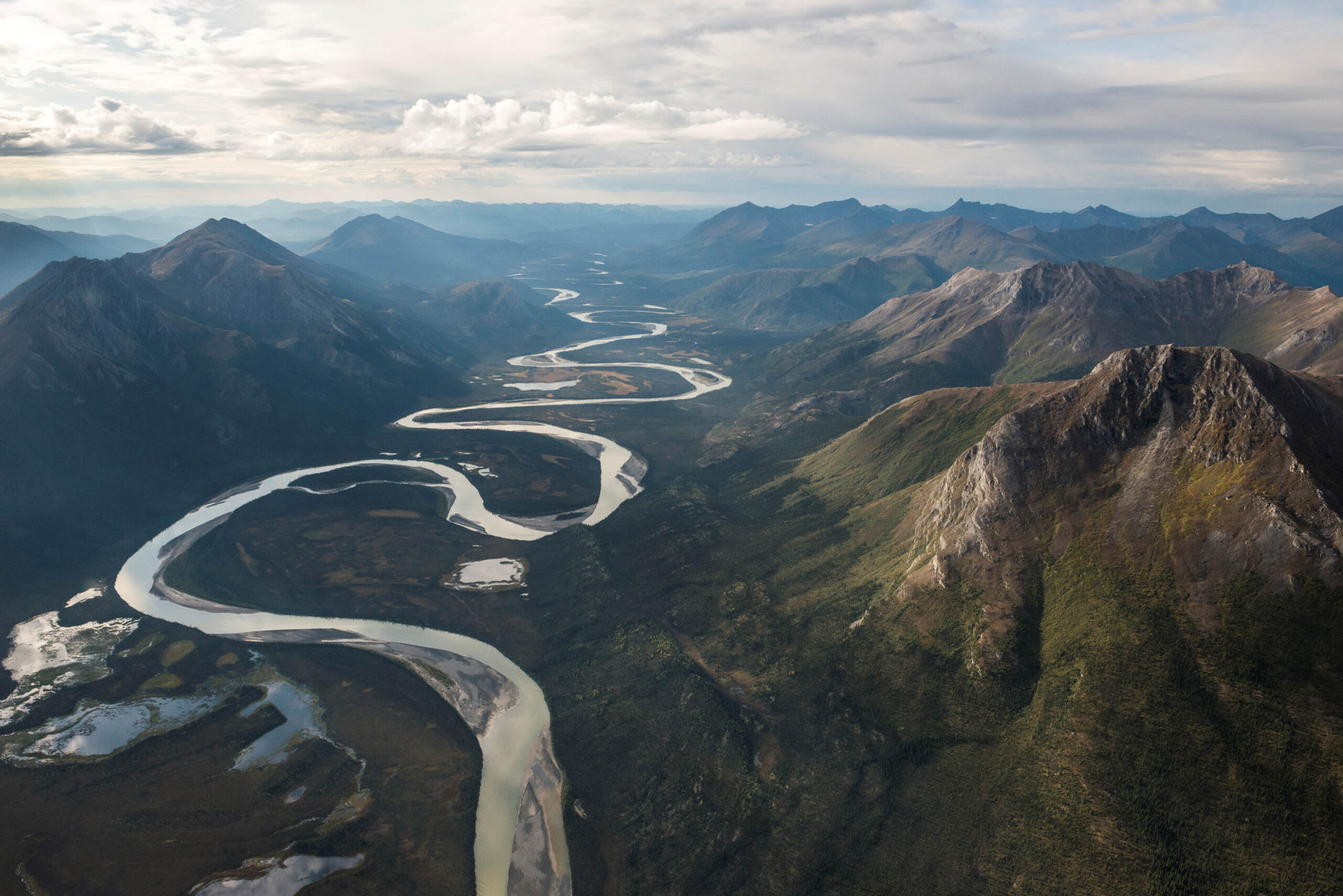
Photo: AlaskaNPS via Flickr (Public Domain Mark)
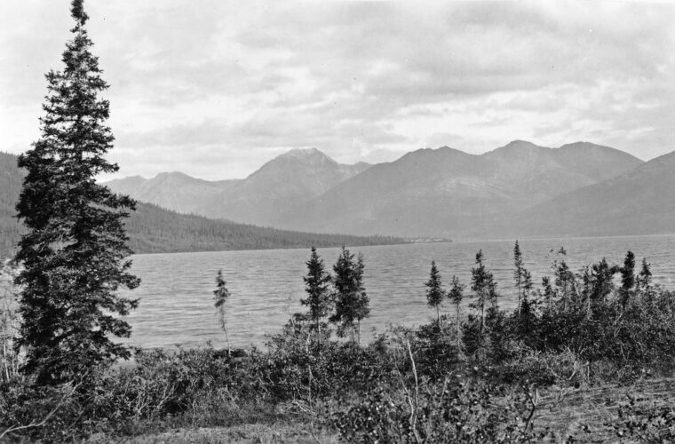
At Gates of the Arctic National Park, morning on the Alatna River begins with cold air sliding off the Brooks Range and the hiss of current against a gravel bar. Step from a tent and rounded stones shift underfoot, dwarf birch brushes your knees, and mountains rise directly from the valley without roads, buildings, or utility lines to interrupt their scale. A bush plane may be the only mechanical sound you hear for days.
This is an 8.4 million acre park and preserve north of the Arctic Circle, with no roads, maintained trails, developed campgrounds, or entrance stations. Reaching it usually requires an air taxi from a small Alaska community, followed by self-supported travel through tundra, river valleys, and mountain passes. Our guide begins with the geography, access choices, principal travel corridors, and seasonal realities that determine whether a Gates of the Arctic trip works.
Understanding a park without roads or established routes
The central Brooks Range defines the experience
Gates of the Arctic protects a broad section of the central Brooks Range, the northernmost major mountain chain in the United States. The range runs east to west across northern Alaska and forms the Continental Divide between rivers flowing toward the Arctic Ocean and those draining south and west through the Kobuk and Koyukuk systems. Glaciers carved its U-shaped valleys, cirques, and sharp ridgelines, while modern rivers continue to rearrange gravel bars and channels each summer.
Mount Igikpak, at 8,510 feet, is the park’s highest summit. Elevation figures alone can mislead visitors familiar with the Rockies because treeline here generally sits near 2,000 feet. A route crossing a 4,000-foot pass can involve prolonged exposure to wind, sleet, fog, and snowfields, despite its modest number on a topographic map. Permafrost, tussock tundra, boggy valley floors, and dense willow can reduce walking speeds to roughly one mile per hour.
Where the name came from
Wilderness advocate Robert Marshall coined the name in the 1930s after traveling the North Fork of the Koyukuk River. He described Frigid Crags and Boreal Mountain as a gateway into the central Brooks Range. These two massifs rise on opposite sides of the river north of the community of Wiseman, although the named “gates” are only one feature in a park considerably larger than many states.
The area became a national monument in 1978 and a national park and preserve through the Alaska National Interest Lands Conservation Act in 1980. Its boundaries encompass lands long used by Iñupiat and Koyukon Athabascan communities. Anaktuvuk Pass, an Nunamiut Iñupiat village inside the park, remains a living community rather than a visitor complex, and travelers should treat local land, homes, and cultural sites accordingly.
Choosing how to enter Gates of the Arctic
Air taxis are the practical starting point
Most independent trips begin in Fairbanks, followed by a commercial flight or drive to an air taxi base. Bettles and Coldfoot serve the park’s eastern and central valleys, while Kotzebue is useful for western routes involving the Kobuk or Noatak watersheds. Anaktuvuk Pass has scheduled air connections from Fairbanks, but onward wilderness transport and village logistics require advance planning.
Bush aircraft typically use floats on lakes or tundra tires on gravel bars and rough landing areas. Pilots choose sites according to aircraft type, river level, wind, surface condition, and recent reports. A location shown as a landing site in an old trip report may be unusable after flooding or channel migration. Build at least one weather day into both ends of the itinerary, and avoid booking an inflexible flight home immediately after the planned pickup.
| Approach | Best suited to | Principal constraint |
|---|---|---|
| Bettles | Alatna, John, North Fork Koyukuk, and central Brooks Range trips | Usually requires a connecting flight from Fairbanks |
| Coldfoot | Eastern park access and Dalton Highway based logistics | Long overland journey from Fairbanks before the bush flight |
| Anaktuvuk Pass | Overland trekking through broad tundra valleys | Community access requires cultural awareness and careful local coordination |
| Kotzebue | Kobuk and western Noatak watershed journeys | Longer wilderness flights into the western park |
Walking in from the Dalton Highway
The Dalton Highway runs east of the park but never enters it. Strong backpackers can begin near the highway and travel west across federal land, yet this is an expedition rather than a shortcut. Reaching the boundary may require crossing major rivers, navigating trailless tussocks, and carrying food for several additional days. Roadside parking security and legal access also need to be resolved before departure.
Air transport is expensive, but dividing a charter among a group can reduce the per-person cost. Aircraft payload limits matter as much as seat count. Folding canoes, packrafts, fuel, food barrels, and bear-resistant containers all consume capacity. Give the operator accurate passenger weights and a complete equipment list rather than assuming every bag will fit. Landing permissions, registration recommendations, commercial requirements, and current operating details should be confirmed on the official park site and with the chosen air carrier.
The river corridors that organize the wilderness
Six designated wild rivers
Six rivers associated with the park carry federal Wild and Scenic River designation: the Alatna, John, Kobuk, Noatak, North Fork of the Koyukuk, and Tinayguk. They function as natural travel corridors through country where overland progress is often slow. A float trip can cover considerably more ground than a backpacking route, but shallow channels, sweepers, aufeis, cold water, and isolated rapids demand competent judgment.
- Alatna River: A common choice for experienced wilderness paddlers, with clear water, mountain scenery, and long sections of generally manageable current after its upper reaches.
- John River: A north to south route from alpine Brooks Range terrain toward boreal forest, with water levels that can make upper sections technical or too shallow.
- North Fork Koyukuk: The historic route toward Frigid Crags and Boreal Mountain, combining broad valleys with views into the Arrigetch and central range.
- Noatak River: A long westward journey through an exceptionally intact Arctic watershed, often planned as a multiweek expedition.
- Kobuk River: A western corridor beginning in mountainous terrain and flowing toward the Kobuk Valley, with substantial distance and complex pickup logistics.
- Tinayguk River: A narrower tributary of the North Fork Koyukuk suited to travelers prepared for shallow, technical water and frequent maneuvering.
The Arrigetch Peaks and upper Alatna country
The Arrigetch Peaks form one of the park’s most distinctive granite landscapes. Their name derives from an Iñupiat word commonly translated as “fingers of the outstretched hand,” an apt description of the towers and spires rising above glacial valleys. Unlike much of the surrounding sedimentary Brooks Range, the Arrigetch is a granitic intrusion exposed by erosion and ice.
Access usually begins from the Alatna River, followed by an unmaintained approach into Arrigetch Creek or another adjacent drainage. There is no constructed Arrigetch trail. Hikers encounter wet tundra, brush, boulder fields, stream crossings, and fragile alpine vegetation before reaching the upper basins. Climbers need technical equipment and remote rescue capability, while backpackers can explore lower valleys without attempting the granite walls.
Season and daylight shape every itinerary
The short summer travel window
Most backcountry trips occur from mid-June through early September. Rivers may remain affected by breakup, ice, and high water in early summer. July generally brings the warmest conditions and nearly continuous daylight, along with mosquitoes and other biting insects. By August, insect pressure often declines, nights darken, and autumn color spreads across dwarf birch and tundra. Freezing temperatures and early snow become increasingly likely.
| Period | Typical advantages | Planning concern |
|---|---|---|
| Mid-June to early July | Very long daylight and lingering snow on high routes | Breakup conditions, high streams, wet ground, and intense insects |
| July | Warmest average conditions and broad air access | Mosquitoes, exposed river crossings, and variable wildfire smoke |
| August | Fewer insects, tundra color, and darker nights | Colder storms, shorter days, and possible snow at elevation |
| Early September | Autumn landscape and chances for aurora viewing | Hard freezes, snowfall, reduced daylight, and weather delays |
Weather margins belong in the route plan
Brooks Range weather can move from warm sun to cold rain or wet snow within hours. Valley temperatures may reach the 60s Fahrenheit during settled summer weather, while exposed passes can fall below freezing. Strong winds can ground aircraft even when visibility appears good at camp. A tent capable of handling prolonged wind and rain, full waterproof layers, insulating clothing, and dry storage for sleeping gear are baseline equipment.
Our team plans daily mileage conservatively and includes food for delays. On a trailless route, a ten-mile map segment may consume an entire day if it crosses tussocks, willow thickets, talus, or braided streams. River groups should also allow layover time for unsafe wind or water. A satellite communication device provides an essential link, but evacuation can still take many hours or longer when clouds, terrain, or aircraft availability prevent an immediate response.
Build the trip around one achievable objective
Match the route to your strongest skill
A first visit works best when the itinerary emphasizes either paddling or backpacking. Combining technical whitewater, difficult passes, and mountaineering compounds risk in a place where changing the pickup point may be impossible. Experienced backpackers commonly plan five to eight miles per day on open tundra, then reduce that estimate for brush, talus, or repeated river crossings. Paddlers must calculate progress from current speed, portages, wind exposure, and the availability of gravel bars for landing and camping.
Consider a base camp instead of a traverse
A fly in base camp can provide substantial exploration without committing the group to a continuous point to point route. Walker Lake, a deep glacial lake near the headwaters of the Kobuk River, gives access to surrounding valleys and slopes while keeping pickup logistics simple. The broad Oolah Valley near the North Fork Koyukuk provides another option for day hikes beneath limestone ridges. Base camps still require emergency reserves because aircraft cannot always return on schedule.
| Trip design | Useful duration | Primary challenge |
|---|---|---|
| Lake or valley base camp | 5 to 8 days | Choosing a reliable landing area and avoiding damage around one campsite |
| Trailless backpacking traverse | 7 to 12 days | Route finding, stream crossings, brush, and slow tundra travel |
| River expedition | 8 to 18 days | Water level, boat repair, cold water exposure, and pickup access |
Send the air taxi a marked topographic map showing preferred and alternate landing locations. Every group member should carry the coordinates, pickup date, aircraft frequency if supplied, and a written overdue plan. Satellite imagery helps identify gravel bars and channels, but recent pilot knowledge remains more valuable because rivers migrate and tundra surfaces become saturated.
Camp safely in a living Arctic ecosystem
Separate food from sleeping areas
Both grizzly and black bears occupy Gates of the Arctic National Park, although distribution varies with habitat. Store food, garbage, scented toiletries, and fishing equipment in approved bear resistant containers. Prepare meals downwind and well away from tents, keep bear spray accessible on land, and avoid camping beside animal carcasses or heavily used game trails. Dense willow deserves particular caution because visibility may shrink to a few yards.
Protect tundra and water
Gravel bars generally tolerate camping better than lichen covered benches or wet tundra. Move tents before flattened vegetation becomes lasting damage, and use a stove because firewood is scarce near treeline. Wash and dispose of wastewater away from lakes and streams. Human waste should be managed according to the surface, group size, and route, with toilet paper packed out rather than left beneath shallow Arctic soil.
- Carry an extra day or more of food for flight delays.
- Pack a repair kit for tents, boats, paddles, and stove systems.
- Keep one dry clothing layer reserved for camp emergencies.
- Use paper maps and a compass alongside electronic navigation.
- Leave antlers, archaeological material, and cultural objects where found.
Caribou, moose, wolves, Dall sheep, and nesting birds may react to people long before visitors recognize the disturbance. Give animals room to keep feeding or traveling, particularly during migration and calving periods. Fishing can supplement an itinerary but should never replace carried meals. Species distribution and angling success vary sharply between clear mountain tributaries, deep lakes, and silty rivers.
Frequently Asked Questions
How many days should I allow?
Allow at least seven days in the field for a meaningful trip, plus weather days before the flight home. Longer river journeys and traverses commonly require ten days or more because terrain, water, and aircraft delays can consume planned travel time.
Can children visit the park?
Capable teenagers with prior wilderness experience can participate in carefully selected base camp or gentle river itineraries. Younger children face serious challenges from cold water, insects, difficult evacuation, and the absence of developed facilities.
Will a mobile phone work?
Travelers should expect no cellular service in the backcountry. Carry a satellite messenger or satellite phone, spare power, and a communication schedule understood by a responsible contact outside the park.
Are dogs suitable for a trip?
Dogs add complications involving aircraft transport, wildlife encounters, river crossings, food weight, and waste. Owners must maintain close control and protect both wildlife and other travelers, especially around bears and nesting birds.
Can beginners visit without a guide?
Beginners should use an experienced wilderness guide or travel with partners skilled in Arctic navigation, first aid, bear safety, and cold water rescue. The lack of trails and rapid assistance leaves little margin for learning essential skills during the trip.
Prepare for the place that actually exists
A successful journey begins with conservative choices: one primary activity, a route suited to the group, verified aircraft payloads, flexible pickup timing, and enough food and insulation to wait out weather. Maps should be treated as planning tools rather than promises about walking speed, landing conditions, or navigable channels.
The reward is sustained travel through an intact Arctic landscape shaped by rivers, migration, permafrost, and seasonal light. Careful preparation allows visitors to experience that scale without depending on trails or developed infrastructure. Plan modest daily distances, protect tundra and wildlife, and leave enough time for the Brooks Range to determine the pace.
Want to keep exploring? Browse all our Gates of the Arctic guides and articles for more trip-planning tips and ideas.
Gear & Essentials
Tell us about your trip and we will add what else you will want:
The basics
Worth having in the car whatever the park.
For this trip
As an Amazon Associate we earn from qualifying purchases, at no extra cost to you.