Glacier Bay National Park and Preserve
Unforgettable Things to Do in Glacier Bay National Park

Photo: U.S. Department of the Interior via Flickr (CC BY-SA 2.0)
Unforgettable things to do in <a href="https://nationalparkgetaways.com/parks/glacier-bay-national-park-and-preserve/” class=”bpro-internal”>Glacier Bay National Park begin on the water because roads reach only a tiny corner of this 3.3 million acre Alaska wilderness. As recently as the mid 1700s, a single glacier filled nearly the entire bay. Its retreat opened more than 60 miles of fjords within a few centuries, leaving an unusually clear record of how bare rock becomes forest, wetland, and wildlife habitat.
Bartlett Cove provides the park’s visitor services and short trail system, but the defining landscape lies farther north among tidewater glaciers, seal pupping grounds, and peaks rising directly from the sea. Most travelers arrive through Gustavus, about 10 miles from Bartlett Cove, then explore by tour vessel, kayak, small boat, or aircraft. Planning around that geography is the key to experiencing Glacier Bay rather than seeing only its gateway.
Understand Glacier Bay’s unusual layout before choosing activities
Bartlett Cove is the land based gateway
Gustavus has no road connection to Juneau or the continental highway system. Visitors generally arrive by scheduled or chartered aircraft, with limited seasonal marine transportation providing another option. Ground transfers connect Gustavus with Bartlett Cove, where the park headquarters, public dock, campground area, cultural sites, and maintained trails are concentrated. Lodging and food choices remain limited compared with larger Alaska ports, so reserve transportation and accommodation before building the rest of the itinerary.
The main bay is a marine corridor
From Bartlett Cove, Glacier Bay runs north through Sitakaday Narrows before dividing into the West Arm and East Arm. The West Arm leads toward Margerie and Grand Pacific glaciers, while Johns Hopkins Inlet branches west beneath the Fairweather Range. The East Arm reaches toward Muir Inlet, where retreating ice has exposed broad valleys, recently deglaciated slopes, and extensive backcountry paddling routes. There are no roads linking these areas and few constructed facilities beyond Bartlett Cove.
Commercial day boats, overnight cruise ships, private vessels, charter boats, and sea kayaks share the protected waters. Vessel entry rules, kayak transport, camping procedures, and seasonal wildlife closures can affect a trip, particularly in Johns Hopkins Inlet and popular backcountry zones. Confirm current fees, permits, schedules, closures, and reservation requirements on the official park site before booking flights or lodging.
Season determines what is practical
| Period | Typical conditions | Best suited to |
|---|---|---|
| May | Cool days, lingering snow at higher elevations, and relatively quiet visitor traffic | Wildlife watching, photography, and early season boat travel |
| June and July | Longest daylight, regular marine access, cool rain possible, and busy services | Day boat excursions, kayaking, hiking, and extended itineraries |
| August | Increasing rainfall, active salmon streams, and darker evenings | Bear watching from a safe distance, forest walks, and marine trips |
| September | Fewer services, shorter days, colder storms, and early snow on surrounding peaks | Flexible travelers prepared for reduced operations |
Travel the length of the bay to reach its living glaciers
The full day boat trip provides the clearest introduction
For a first visit, the seasonal day boat from Bartlett Cove is the most efficient way to understand the park’s scale. A typical route covers well over 100 miles as it travels through whale feeding areas, sea lion haulouts, seabird colonies, and glacial fjords. Naturalists interpret both wildlife and the ecological sequence visible along the shore, from mature spruce and hemlock forest near Bartlett Cove to exposed rock and sparse pioneering plants near the active ice.
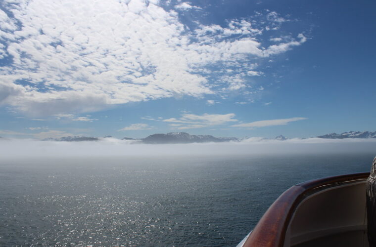
Passengers should treat the outing as a cold marine excursion even when Gustavus feels mild. Wind generated by the moving vessel, rain, and air draining from glaciers can make exposed decks considerably colder than shore. Bring waterproof outer layers, insulation, gloves, a warm hat, binoculars, and a dry cover for camera equipment. Wildlife is often distant, so binoculars contribute more than a phone’s digital zoom.
Margerie and Grand Pacific reveal two different glacier stories
Margerie Glacier
Margerie Glacier descends from the Fairweather Range and ends in a near vertical tidewater face roughly a mile wide. Its blue fractures and white towers make it easier to read than many debris covered glaciers. Boats maintain a safe distance because sections can calve without warning, sending ice and waves into the inlet. The glacier’s apparent stillness is deceptive: compressed ice continues moving downhill under its own weight.
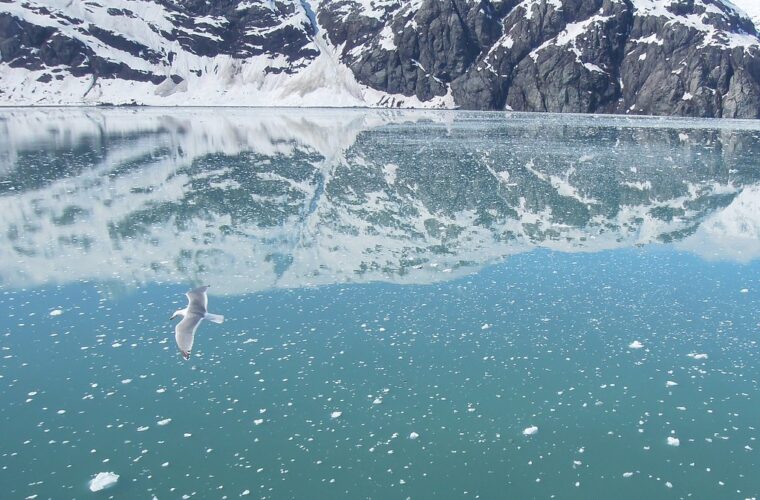
Near the glacier, the engine noise drops and small sounds become distinct. Meltwater runs from the ice, floating fragments tap against one another, and the face occasionally cracks with a report that arrives after the fracture becomes visible. Cold air settles over the deck. The scale becomes clear when gulls crossing the ice look like moving specks and the surrounding mountains disappear into cloud above the fjord walls.
Grand Pacific Glacier
Grand Pacific looks markedly different despite terminating beside Margerie. Rock and sediment darken much of its surface, demonstrating how glaciers transport entire landscapes rather than clean ice alone. Its long history also matters: Grand Pacific was part of the immense ice system that occupied Glacier Bay during the Little Ice Age. Comparing the two termini helps visitors distinguish active glacial erosion, debris transport, retreat, and vegetation succession.
Wildlife sightings change along the route
Humpback whales commonly enter the lower bay to feed, while Steller sea lions gather at rocky haulouts such as South Marble Island. The island also supports nesting seabirds, including tufted puffins, black legged kittiwakes, and cormorants. Harbor seals use floating ice farther up the bay as resting and pupping habitat. Brown bears may appear on beaches, mountain goats traverse steep slopes, and sea otters forage in protected water.
- Scan ahead of the vessel rather than following where other passengers are already pointing.
- Watch tide lines and river mouths for bears feeding or turning over rocks.
- Look for repeated blows before assuming a whale has moved away.
- Keep binoculars ready near South Marble Island, where several species can appear at once.
- Use a long lens without asking the vessel operator to approach wildlife more closely.
Spend time in Bartlett Cove rather than treating it as a dock
Walk from mature rainforest to tidal flats
The one mile Forest Loop Trail begins near the developed area and passes through Sitka spruce and western hemlock forest. Moss, devil’s club, ferns, and decaying nurse logs reveal a much later stage of succession than the raw terrain near the upper bay. The trail is short enough to fit around an arrival or departure, although wet roots and muddy sections still call for shoes with reliable traction.
For a longer outing, the Bartlett River Trail covers approximately 4 miles round trip through forest to an estuary influenced by the tide. The Bartlett Lake Trail continues inland for a total outing of roughly 8 miles round trip. These routes receive less traffic than the waterfront path, and dense vegetation limits long views. Carry bear spray where permitted, know how to use it, make noise in enclosed vegetation, and avoid surprising animals beside streams.
Follow the shoreline into Huna Tlingit history
The Tlingit Trail runs along the Bartlett Cove shoreline and connects natural history with the enduring presence of the Huna Tlingit. Glacial advance displaced Tlingit communities from their homeland, but families maintained cultural and subsistence relationships with the bay after the ice retreated. Xunaa Shuká Hít, the Huna Tribal House, expresses that history through carved interior posts, exterior house screens, and spaces designed for ceremony, interpretation, and community use.
Low tide exposes broad intertidal flats where ravens, black oystercatchers, and other shorebirds forage among cobbles and eelgrass. The tidal range can transform the cove within hours, so a beach that appears broad and easy to cross may disappear on the incoming tide. Check a local tide table before walking far along the shore, and keep clear of resting wildlife and culturally significant features.
Reach quieter water by kayak or from the air
Among the unforgettable things to do in Glacier Bay National Park, independent travel reveals the greatest contrast with a boat tour. Kayaks can enter coves too shallow for larger vessels, while flightseeing shows how the fjords connect with the Fairweather Range, Brady Icefield, and surrounding river valleys. Both depend heavily on weather, so allow schedule flexibility rather than placing either activity immediately before a departing flight.
Choose a paddling zone that matches your experience
Bartlett Cove provides relatively protected water for short outings, although tides, wind, cold water, and vessel traffic still require judgment. Extended trips usually involve carrying camping equipment or arranging marine transport farther into the bay. A loaded sea kayak handles differently from a recreational boat, and paddlers need wet exit practice, effective communication, and the ability to land on cobble beaches through small surf.
Beardslee Islands
The Beardslee Islands form a maze of forested islands, channels, reefs, and tidal passages northwest of Bartlett Cove. Their protected setting suits paddlers who want several days away from the main vessel corridor. Navigation deserves care because islands overlap visually, reefs emerge as tides fall, and narrow channels can develop strong currents. Sea otters, harbor seals, waterfowl, and intertidal life often provide the main wildlife interest.
Muir Inlet
Muir Inlet offers longer wilderness routes through landscapes exposed by twentieth century glacier retreat. Paddlers pass sparsely vegetated slopes, braided stream mouths, and sediment rich water before approaching McBride Glacier. Camps must account for changing tides and unstable terrain near recently deglaciated valleys. Glacial streams can rise after warm weather or heavy rain, making an easy landing difficult to cross several hours later.
Use flightseeing to understand the icefield
Aircraft departing from the Gustavus area can reveal features hidden from water level, including crevassed icefields, hanging glaciers, nunataks, and Mount Fairweather, which rises to 15,325 feet near the international boundary. Flights may cross rapidly between clear coastlines and cloud filled mountain valleys. Treat the aerial trip as weather dependent, keep essential medication with you, and avoid building the day around a guaranteed mountain view.
Match the itinerary to the park’s scale
A short visit can cover Bartlett Cove and one marine excursion. Additional days create room for poor weather, kayaking, and a closer look at Gustavus and the surrounding coastal plain. Since flights, boats, and ground transfers operate as separate pieces, leave enough time between connections to absorb delays caused by fog, wind, or low cloud.
| Time available | Strongest plan | Main limitation |
|---|---|---|
| One full day | Full bay boat trip, followed by an evening shoreline walk | No backup day for marine weather |
| Two to three days | Boat trip, Bartlett Cove trails, cultural interpretation, and a guided paddle | Limited reach into remote backcountry |
| Four or more days | Marine tour plus overnight kayaking or flightseeing | Greater equipment and logistics demands |
Use one day for a focused introduction
Travelers with a single full day should prioritize the longest available trip into the bay rather than combining several short activities. Keep the evening for the Bartlett Cove shoreline, where sunset can extend late into the night around the June solstice. An additional arrival night in Gustavus reduces the risk of a delayed flight eliminating the principal excursion.
Prepare carefully for an overnight backcountry trip
Remote beaches have no marked campsites, food storage structures, or dependable communication. Select tent sites above the highest recent tide line, secure boats against rising water, and avoid camping beside salmon streams or fresh bear sign. Fine glacial sediment can clog water filters, so let cloudy water settle before treatment and carry enough containers to collect from clearer sources.
- Pack rain gear separately from sleeping insulation.
- Carry a marine chart, compass, and navigation backup.
- Use a bear resistant food container and keep cooking areas away from tents.
- Bring repair materials for paddles, hulls, tents, and dry bags.
- Plan at least one alternate landing for every exposed crossing.
Frequently Asked Questions
Glacier Bay rewards realistic expectations about distance and access. These answers address the planning questions that most often determine whether a visitor reaches the upper bay or spends the trip only around Bartlett Cove.
How many days do you need in Glacier Bay?
Two to three full days allow time for a bay excursion, Bartlett Cove trails, and one weather dependent activity. Add several more days for an overnight kayak route or a meaningful buffer against flight and marine delays.
Can you visit without taking a cruise ship?
Yes. Independent travelers can fly or use seasonal marine transportation to reach Gustavus, then continue overland to Bartlett Cove. This approach provides access to the day boat, trails, kayaking, camping, and local flightseeing.
Is Glacier Bay suitable for children?
Families comfortable with a long day on a vessel can see glaciers and wildlife without strenuous hiking. Bring warm layers, rain protection, binoculars sized for smaller hands, snacks, and quiet activities for the lengthy travel between wildlife stops.
Can beginners kayak in Glacier Bay?
Beginners can take guided outings near Bartlett Cove, where instruction and local knowledge reduce navigation risk. Independent travel into exposed or remote water requires cold water skills, tidal planning, rescue practice, and prior experience in a loaded sea kayak.
Will seasickness be a problem?
Much of Glacier Bay is protected from open Gulf of Alaska swell, but wind can create choppy conditions in broad reaches and near exposed points. Travelers prone to motion sickness should prepare before departure and choose a seat near the vessel’s center when conditions become rough.
Plan for distance, weather, and time on the water
Glacier Bay becomes easier to plan once its marine geography is clear. Use Bartlett Cove as the logistical base, devote a full day to reaching the tidewater glaciers, and add kayaking or flightseeing only when the itinerary has room for weather changes. That sequence provides the broad glacial story first, then allows quieter exploration of islands, coves, and newly exposed landscapes.
The most successful visits also account for cold water, large tides, limited services, and long transportation links. Pack for rain and wind even during a favorable forecast, keep connections flexible, and choose activities that match actual paddling and backcountry experience. With those decisions made early, the park’s scale becomes an advantage rather than a logistical surprise.
Want to keep exploring? Browse all our Glacier Bay guides and articles for more trip-planning tips and ideas.
Gear & Essentials
Tell us about your trip and we will add what else you will want:
The basics
Worth having in the car whatever the park.
For this trip
As an Amazon Associate we earn from qualifying purchases, at no extra cost to you.