Glacier Bay National Park and Preserve
Glacier Bay National Park Travel Guide: Glaciers, Wildlife, Cruises, and Kayaking
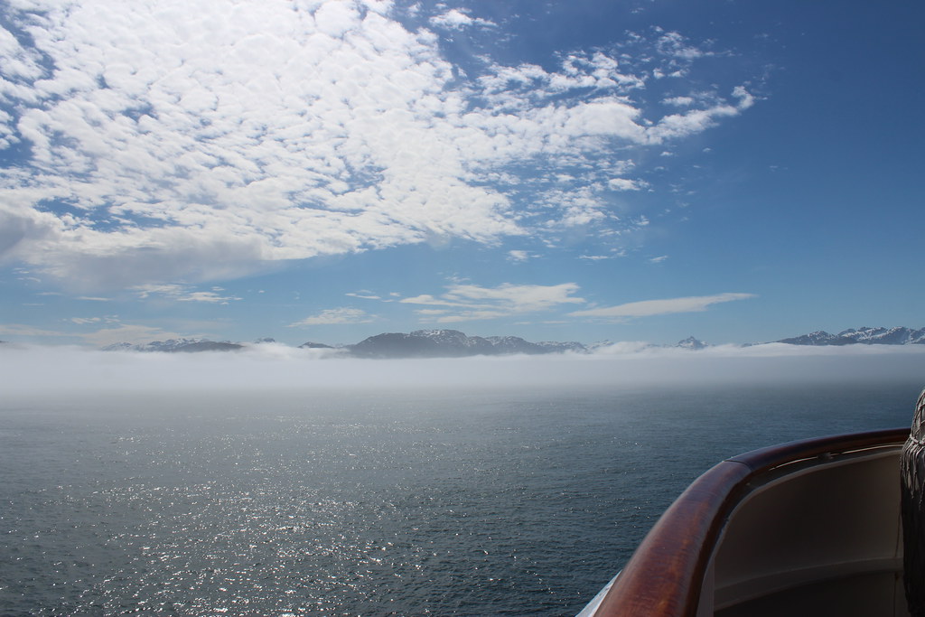
Photo: U.S. Department of the Interior via Flickr (CC BY-SA 2.0)
Our <a href="https://nationalparkgetaways.com/parks/glacier-bay-national-park-and-preserve/” class=”bpro-internal”>Glacier Bay National Park Travel Guide begins with the fact that nearly every major experience happens from the water: the park has no road into its 65-mile-long main bay, and tidewater glaciers, whale feeding grounds, seabird colonies, and seal nurseries are scattered among its fjords. Most visitors arrive through Gustavus, then travel about 10 miles by road to Bartlett Cove, where boats and kayaks enter the protected waters.
Glacier Bay preserves 3.3 million acres of Southeast Alaska, from temperate rainforest at sea level to the 15,300-foot summit of Mount Fairweather. This first half explains how the bay was formed, where wildlife concentrates, and how seasons, tides, and habitat determine what you are likely to see.
Understanding Glacier Bay’s Scale and Geography
A Fjord Revealed by Retreating Ice
When George Vancouver surveyed this coast in 1794, a wall of ice blocked the present bay near its mouth. The glacier subsequently retreated more than 60 miles, exposing deep fjords, raw sediment, and islands that plants and animals gradually recolonized. That rapid retreat created a living timeline of ecological succession. Older forest grows near Bartlett Cove, while the upper bay contains younger alder thickets, gravel slopes, bare rock, and freshly exposed glacial deposits.
The Main Bay and Its Two Arms
From Bartlett Cove, the main channel extends north toward the West Arm and East Arm. Most glacier sightseeing concentrates in the West Arm, where Margerie Glacier, Grand Pacific Glacier, Lamplugh Glacier, and Reid Glacier occupy separate inlets and valleys. Johns Hopkins Inlet branches farther west toward Johns Hopkins Glacier. The East Arm, known as Muir Inlet, receives fewer large vessels and offers extensive wilderness kayaking, although its glaciers have retreated inland from tidewater.
How Visitors Move Through the Park
Gustavus is the practical gateway, reached by scheduled air service and seasonal marine transportation. Bartlett Cove has the park’s primary visitor facilities, shoreline trails, kayak launch points, and boat departures. Beyond this developed corner, access is by tour vessel, cruise ship, private boat, or human-powered craft. Operating schedules, vessel rules, permits, fees, and seasonal wildlife closures can change, so confirm current details on the official park site before booking transportation.
- Large cruise ship: Best for covering most of the bay in one day, with limited control over stops or viewing angles.
- Day boat: A smaller-scale trip from Bartlett Cove that combines glaciers, marine mammals, seabirds, and shoreline wildlife.
- Kayak: Best for quiet coves, intertidal life, and multi-day observation, but distances, cold water, tides, and weather require careful planning.
- Bartlett Cove trails: The simplest option for rainforest, tidal flats, birds, and occasional mammals without committing to a boat trip.
Where Wildlife Concentrates Within the Bay
Bartlett Cove and the Lower Bay
Forest, Beach, and Intertidal Habitat
The 1-mile Forest Loop Trail begins near the Bartlett Cove waterfront and passes through spruce and hemlock forest, muskeg-like openings, and shoreline habitat. Look for red squirrels, river otters, porcupines, ravens, bald eagles, and varied thrushes. At low tide, exposed flats attract gulls, shorebirds, and black oystercatchers. Moose occasionally enter the forest and meadow edges, while both black and brown bears can travel the shoreline.
Whales and Sea Otters Near the Entrance
Humpback whales frequently feed in the lower bay and nearby Icy Strait, especially where currents concentrate capelin, herring, krill, and other prey. Scan for repeated blows rather than waiting for a breach. Sea otters often rest in rafts in protected water, sometimes wrapping themselves in kelp. Harbor porpoises move quickly and surface with little splash, while orcas appear less predictably and may range throughout the bay in pursuit of fish or marine mammals.
South Marble Island and Rocky Islets
South Marble Island is one of the bay’s most reliable wildlife stops. Steller sea lions haul out on exposed rock, where their barking carries across the water. Tufted puffins, common murres, pigeon guillemots, pelagic cormorants, and black-legged kittiwakes use the island and surrounding currents during the breeding season. Vessels must keep appropriate distances from colonies and haulouts because close approaches can flush birds or drive sea lions into the water.
Gloomy Knob and the Upper West Arm
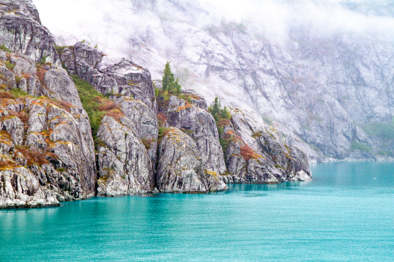
Gloomy Knob’s pale, steep limestone provides comparatively open terrain for mountain goats. Adults and kids can appear as small white marks far above the water, so binoculars are more useful than a long camera lens alone. Bears may forage along nearby beaches, particularly where sedges, roots, berries, carrion, or intertidal foods are available. Wolves inhabit the park but remain difficult to see because they range widely and often travel behind shoreline vegetation.
Glacier Inlets and Floating Ice
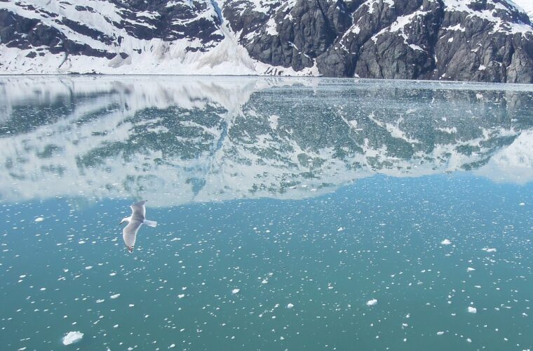
Harbor seals use icebergs and floating brash ice as resting platforms, particularly around Johns Hopkins Inlet. Females give birth and nurse pups in these relatively protected waters, which is why seasonal vessel restrictions may limit access. Glaucous-winged gulls and other birds forage around sediment plumes, while mountain goats sometimes cross the steep slopes above the fjord.
Near an active tidewater glacier, the air becomes noticeably colder and the water turns opaque with suspended rock flour. Small ice fragments click against the hull, followed occasionally by a crack that echoes between the valley walls. The glacier’s face can appear close before its scale becomes clear: seabirds vanish against it, and a section that looks like a small ledge may stand many stories above the water.
Wildlife and Natural Events by Season
What Changes From Spring Through Autumn
Glacier Bay’s wildlife calendar follows daylight, food availability, breeding cycles, and salmon movement. May brings migrating birds, emerging vegetation, and animals feeding along newly green shorelines. June and July provide the longest viewing days and the broadest overlap of marine mammals and nesting birds. By August and September, berry crops and salmon runs influence bear activity, while shortening days and stronger storms can reduce visibility and boating comfort.
| Period | Species and events | Productive areas |
|---|---|---|
| May | Migrating shorebirds, bald eagles, bears on sedge flats, early humpbacks | Bartlett Cove, lower bay beaches, protected coves |
| June | Harbor seal pupping, nesting seabirds, mountain goat kids, humpback feeding | Glacier inlets, South Marble Island, Gloomy Knob |
| July | Puffins and murres, sea lion activity, whales, widespread wildflowers | Lower bay, rocky islands, West Arm shorelines |
| August | Whales feeding, salmon movement, bears using streams and berry patches | Lower bay, stream mouths, Bartlett Cove forest edges |
| September | Late whale activity, bears near salmon streams, migrating birds | Sheltered lower bay, coves, tidal flats |
Tides Matter as Much as Time of Day
Large tidal changes repeatedly expose and flood Glacier Bay’s intertidal zone. A falling tide can reveal mussels, barnacles, marine worms, and stranded fish that attract bears, eagles, ravens, gulls, and oystercatchers. Rising water pushes feeding birds toward shore and may allow sea otters to forage over newly submerged flats. Kayakers must account for tidal currents around points and narrow passages, where water can move faster than paddling speed.
Weather Shapes What You Can See
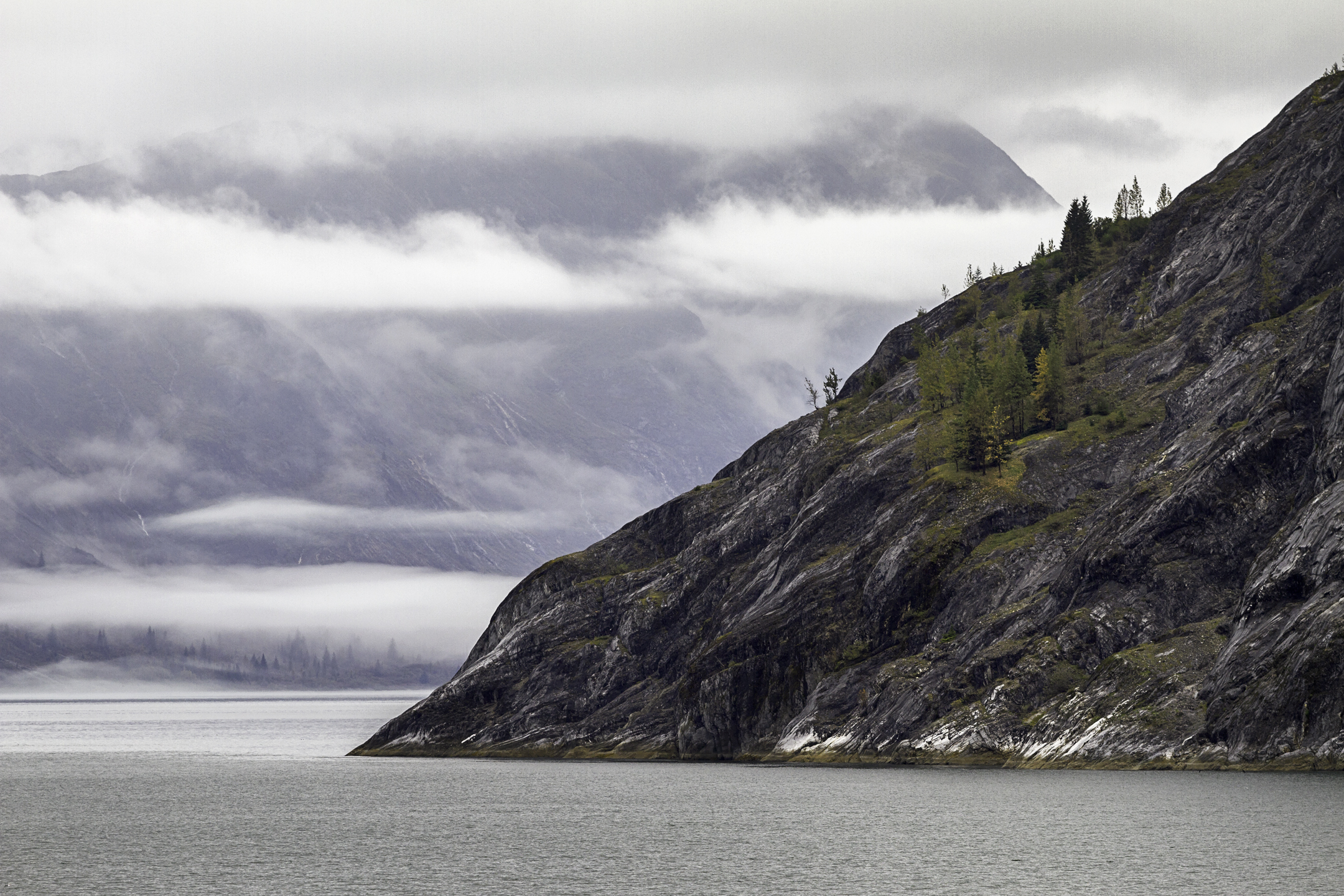
Summer temperatures near the water commonly remain cool, and rain, fog, wind, and brief periods of sun can occur during the same day. Low cloud may conceal the Fairweather Range while leaving shoreline wildlife visible. Wind creates glare and chop that make porpoises and otters harder to detect. Carry waterproof outer layers, warm insulation, gloves, binoculars, and lens protection even when the morning begins clear.
Reading Wildlife Behavior From a Boat or Kayak
Search the Habitat Before the Animal
Productive scanning begins with food and cover. On beaches, inspect the narrow line between forest and exposed tide flats, where bears can disappear behind alder within seconds. Around stream mouths, watch for circling gulls, concentrated bald eagles, and splashing salmon before searching for a bear. In open water, feeding birds often reveal forage fish. Dense groups of kittiwakes or murres diving repeatedly may precede the arrival of humpback whales, sea lions, or harbor porpoises.
Recognize the Most Useful Field Marks
Distance and rain often reduce wildlife to movement, silhouette, or color. A mountain goat usually appears as a stationary white patch on gray rock, while a resting harbor seal resembles a dark oval on ice. Sea otters float on their backs with head and feet visible. Brown bears have a pronounced shoulder hump and a dished facial profile, although identification from a moving vessel should rely on several features rather than coat color alone.
| Animal | First clue to watch for | Helpful equipment |
|---|---|---|
| Humpback whale | Tall blow followed by a rounded back | Binoculars with a wide field of view |
| Mountain goat | White shape above cliffs or avalanche chutes | Binoculars or a spotting scope |
| Sea otter | Dark head and raised paws in kelp | Polarized sunglasses |
| Brown bear | Movement along the beach and forest margin | Binoculars and a stabilized camera |
Let Behavior Determine Your Viewing Time
A single surfacing whale may remain difficult to relocate, but repeated feeding dives create a pattern. Note the direction of travel, the interval between breaths, and the position of nearby bird activity. Bears feeding on sedges may remain visible for several minutes, while animals crossing a beach can vanish quickly. Kayakers should stop paddling before raising binoculars. Drifting attention away from wind, current, and approaching vessels creates an avoidable capsize risk in cold water.
Responsible Encounters and Better Photographs
Give Animals Space to Feed and Rest
Wildlife should control every encounter. A bear that stops feeding, a sea lion lifting its head repeatedly, or birds leaving a nest ledge are signs that people or vessels are too close. Harbor seals on ice are especially vulnerable during pupping season. Paddlers should avoid separating mothers from pups, blocking travel along shore, or surrounding an animal between kayaks. Never approach floating ice closely because it can roll, split, or move suddenly in a tidal current.
- Use binoculars instead of approaching for a larger view.
- Keep food secured and never leave scraps on beaches or near camps.
- Avoid calling, clapping, or playing whale sounds to attract attention.
- Move parallel to wildlife rather than intercepting its route.
- Lower voices near colonies, haulouts, and shoreline feeding areas.
Photograph the Setting, Not Only the Subject
A long lens helps with goats and bears, but wider compositions explain Glacier Bay’s ecology. Include a bear’s sedge meadow, a seal’s field of brash ice, or seabirds above a tide rip. Fast shutter speeds help from a vibrating boat, while lens hoods and microfiber cloths reduce problems from rain and salt spray. Keep both eyes open when following whales through a viewfinder so you retain awareness of railings, other passengers, and sudden changes in vessel motion.
This Glacier Bay National Park Travel Guide recommends treating photographs as records of behavior rather than proof of proximity. Feeding, resting, nursing, and migration all consume limited energy. Backing away when behavior changes protects the animal and often produces better images, since relaxed wildlife resumes natural movement instead of watching the observer.
Frequently Asked Questions
How many days should I spend in Glacier Bay?
Allow at least two full days around Bartlett Cove: one for a boat trip into the bay and one for trails, shoreline observation, or kayaking. Add several days for a self-supported paddle into more distant coves.
Can children visit Glacier Bay safely?
Yes. Bartlett Cove trails and staffed boat excursions suit many families, provided children have warm waterproof clothing and close supervision near cold water. Long boat days can be tiring, so bring food, quiet activities, and binoculars sized for smaller hands.
Do I need kayaking experience?
Protected water can become rough quickly, and tides complicate landings and crossings. Independent paddlers should understand cold-water rescue, marine navigation, weather assessment, and food storage. Guided trips are the practical choice for travelers without those skills.
Are dogs allowed?
Pets have limited usefulness in a park reached largely by water and can disturb bears, nesting birds, and other wildlife. Regulations vary by location, and owners must keep pets controlled wherever they are permitted.
Can I see glaciers without taking a cruise ship?
Yes. Day boats from Bartlett Cove reach tidewater glacier country, while private vessels and properly prepared kayak expeditions provide other options. Bartlett Cove itself shows glacially shaped terrain but does not provide a close view of the upper bay’s tidewater glaciers.
Planning a Wildlife-Focused Glacier Bay Visit
The strongest itinerary combines habitats rather than chasing a single species. Pair Bartlett Cove’s rainforest and tidal flats with South Marble Island’s seabird colonies, Gloomy Knob’s alpine slopes, and the ice-filled inlets of the upper West Arm. That range improves the odds of seeing whales, sea otters, bears, mountain goats, seals, and nesting birds while revealing how each animal uses a different stage of the bay’s postglacial landscape.
Build flexibility into each day. Fog may hide high slopes, wind may shift whale activity, and tides can temporarily transform a quiet beach into productive feeding habitat. Binoculars, waterproof layers, patient scanning, and respectful distance matter more than an aggressive schedule. Glacier Bay rewards travelers who watch ecological clues, leave room for changing conditions, and allow wildlife to continue feeding, resting, and raising young without interference.
Want to keep exploring? Browse all our Glacier Bay guides and articles for more trip-planning tips and ideas.
Gear & Essentials
Tell us about your trip and we will add what else you will want:
The basics
Worth having in the car whatever the park.
For this trip
On the water
As an Amazon Associate we earn from qualifying purchases, at no extra cost to you.