Guadalupe Mountains National Park
Guadalupe Mountains National Park Guide: Best Hikes, Scenic Drives, and Travel Tips
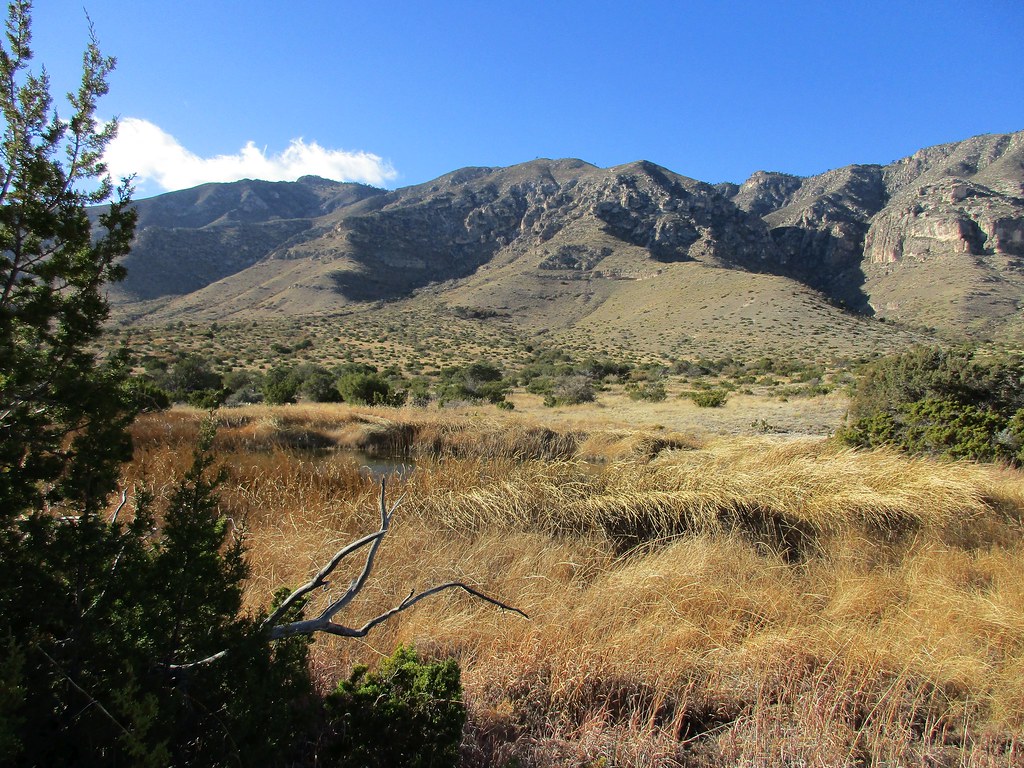
Photo: jaygannett via Flickr (CC BY-SA 2.0)
Our Guadalupe Mountains National Park Guide starts with the park’s defining fact: Guadalupe Peak rises to 8,751 feet, the highest point in Texas, above a Chihuahuan Desert basin nearly a vertical mile below. The same uplifted limestone ridge contains El Capitan, McKittrick Canyon, desert springs, conifer forest, and part of a fossil reef formed in a tropical sea about 260 million years ago.
Planning matters because the park has several widely separated entrances, no internal scenic loop, limited services, and frequent high winds. Our team explains how to organize the drive, choose a season, match hikes to your ability, and carry the supplies needed for a landscape where shade, water, and mobile reception can disappear quickly.
Understand the park before choosing a trail
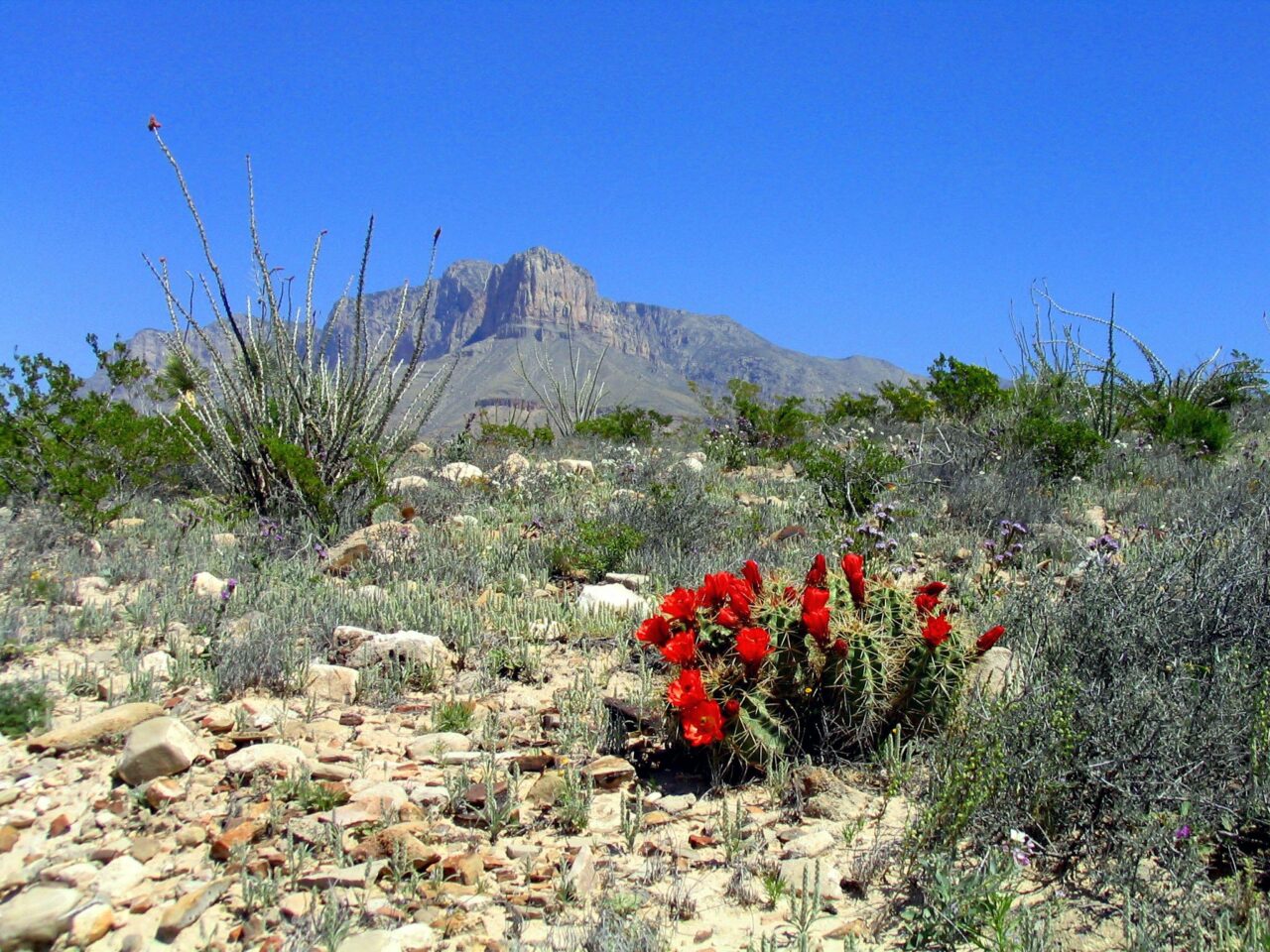
Guadalupe Mountains National Park protects more than 86,000 acres along the western edge of Texas, immediately south of the New Mexico line. Elevations range from roughly 3,600 feet near the Salt Basin to 8,751 feet on Guadalupe Peak. That range supports yucca and creosote flats, agave covered foothills, canyon maples, ponderosa pine, Douglas fir, and small high elevation forests that feel unexpectedly cool compared with the surrounding desert.
Pine Springs is the main planning hub
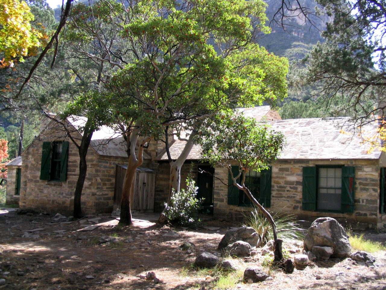
Pine Springs, reached directly from US 62 and US 180, provides access to Guadalupe Peak, Devil’s Hall, the Pinery ruins, and the Tejas Trail. It is the most practical starting point for a first visit because several signature hikes begin in the same area. El Capitan, the park’s distinctive 8,085 foot limestone prow, is visible from highway pullouts south of Pine Springs, especially when low morning or evening light defines the cliff bands.
McKittrick Canyon has controlled road access
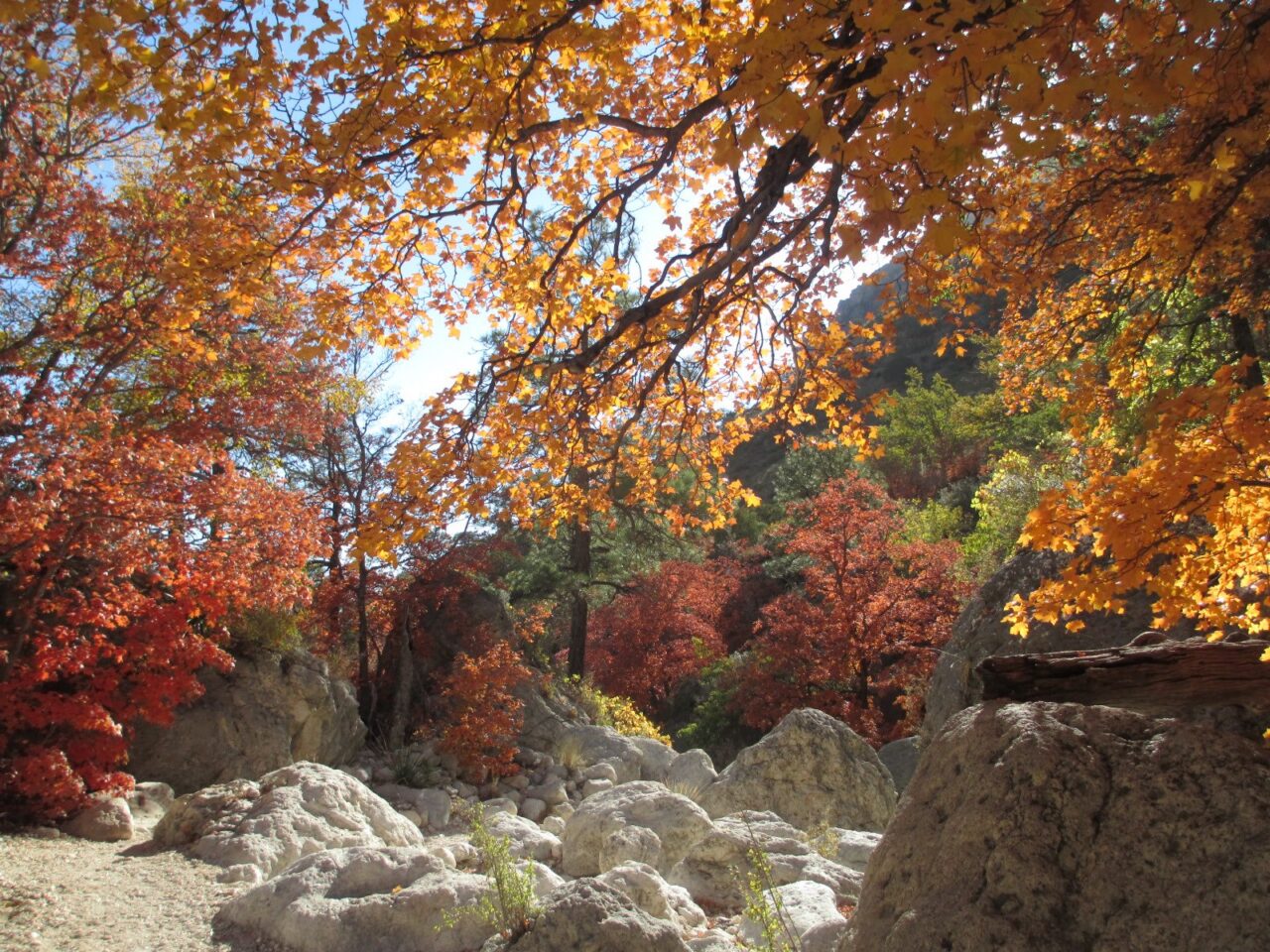
McKittrick Canyon lies about seven road miles northeast of Pine Springs and operates as a gated day use area. Trails lead to Pratt Cabin, the Grotto, the Hunter Line Cabin, and McKittrick Ridge. Bigtooth maples produce the park’s strongest autumn color, usually during a relatively short period from late October into November. The entrance road and trail access follow set daily schedules, so a late arrival can leave too little time for the longer canyon routes.
Dog Canyon and the Salt Basin require separate drives
Dog Canyon sits on the park’s remote northern side. Although it is close to Pine Springs on a map, the road route passes through New Mexico and covers roughly 100 miles. The Salt Basin Dunes occupy another isolated district west of the Guadalupe escarpment, reached through the Dell City area. Treat both as separate excursions rather than quick additions to a Pine Springs hiking day.
Choose dates around wind, heat, and elevation
Spring and autumn usually provide the broadest choice of trails, but neither season guarantees calm weather. Strong westerly winds can make exposed ridges uncomfortable or unsafe, particularly on Guadalupe Peak. Summer brings intense sun at lower elevations, while winter can put ice, snow, and freezing wind on shaded slopes. Temperatures often change dramatically between the desert floor and the summit ridge.
Seasonal conditions shape the hiking day
| Season | Typical advantages | Main planning concern |
|---|---|---|
| Spring | Mild temperatures and desert blooms in favorable years | Powerful winds, blowing dust, and rapid weather changes |
| Summer | Long daylight and cooler conditions at higher elevations | Extreme low elevation heat and afternoon thunderstorms |
| Autumn | Comfortable hiking weather and McKittrick Canyon foliage | Busy foliage periods and occasional high wind events |
| Winter | Clear air, quieter trails, and long distance views | Ice, snow, short daylight, and severe wind chill |
Start early, but check more than the temperature
Before committing to Guadalupe Peak or another exposed route, look at wind gusts, thunderstorm potential, overnight freezing levels, and recent precipitation. Summer storms can build after noon, placing hikers on open ridges during lightning. Winter moisture can freeze on north facing switchbacks even when the highway is dry. Current fees, access hours, closures, water availability, permits, and weather alerts should be confirmed on the official park site before departure.
Build a realistic travel plan
There is no road connecting the park’s major landscapes from inside its boundary. US 62 and US 180 serve as the primary approach and provide broad views of El Capitan, but the road does not climb into the mountains. Pine Springs is approximately 55 miles from Carlsbad, New Mexico, and about 110 miles from central El Paso, making both useful supply points rather than convenient places for midday errands.
Allow one objective for a short visit
With one full day, choose Guadalupe Peak, McKittrick Canyon, or a combination of shorter Pine Springs trails. Attempting to pair the summit with Dog Canyon or the Salt Basin Dunes creates excessive driving and leaves little margin for wind, heat, or a slower descent. Two days permit one strenuous mountain hike followed by Devil’s Hall, Smith Spring, or a scenic drive along the escarpment.
Carry the essentials into the park
Fuel, food, lodging, and general supplies are found outside the park, and mobile service is unreliable in canyons and backcountry terrain. Download maps before leaving town and bring enough water for the entire outing. For exposed hikes, our basic checklist includes:
- At least three to four liters of water per person for a strenuous full day
- Electrolytes and food that can be eaten without cooking
- A brimmed hat, sunscreen, sunglasses, and breathable sun protection
- A wind resistant outer layer, even when the desert forecast looks warm
- Footwear with reliable grip for loose limestone and rocky washes
- An offline map, headlamp, first aid supplies, and emergency insulation
Choose the Best Hikes in Guadalupe Mountains National Park
Mileage alone understates difficulty here. Loose rock, exposed slopes, sparse shade, and strong wind make a moderate distance feel harder than an equivalent forest walk. Elevation gain is the better first filter, followed by terrain and turnaround time. These approximate round trip figures help narrow the options before checking current trail conditions.
Compare the principal day hikes
| Trail | Distance | Approximate gain | Best suited to |
|---|---|---|---|
| Pinery Trail | 0.75 mile | Minimal | History, desert plants, and a short walk |
| Smith Spring Loop | 2.3 miles | About 400 feet | Spring ecology and moderate terrain |
| Devil’s Hall | 3.8 miles | About 550 feet | Rock scrambling and canyon scenery |
| McKittrick Canyon to the Grotto | 6.8 miles | About 600 feet | Geology, foliage, and historic structures |
| Guadalupe Peak | 8.4 miles | About 3,000 feet | Strong hikers prepared for exposure |
Guadalupe Peak demands a full effort
The Guadalupe Peak Trail climbs steadily from Pine Springs through desert scrub, around a shaded north facing slope, and onto an increasingly exposed upper ridge. Most hikers need much of the day because the ascent gains approximately 3,000 feet in just over four miles. Wind often intensifies above the forested section, and the rocky descent can take nearly as long as expected when legs are tired.
What the upper ridge feels like
Near the summit, pale limestone shifts underfoot and the trail narrows against open sky. The wind can drown out conversation, while the Salt Basin spreads far below as a bright, level plain. El Capitan appears beneath the summit rather than above it, revealing the scale of the escarpment. The final steps reach a stainless steel pyramid placed on the high point, with little shelter from gusts or sun.
When Devil’s Hall is the better choice
Devil’s Hall offers a shorter objective from Pine Springs, but its route follows a rocky wash where progress is slower than the mileage suggests. Hikers negotiate rounded boulders and a natural limestone staircase before reaching the narrow hall. Choose it when the summit is too windy, time is limited, or a group prefers scrambling to sustained climbing. Avoid entering the drainage when heavy rain or thunderstorms could produce fast moving runoff.
Use the highway views strategically
The park has no conventional scenic drive through its interior, so the best vehicle based views come from US 62 and US 180. The approach from the southwest reveals El Capitan rising nearly 3,000 feet above the desert, while the northern side crosses open grassland beneath the Guadalupe escarpment. Pull over only at designated areas because traffic moves quickly and road shoulders can be narrow or soft.
Photograph El Capitan from the south
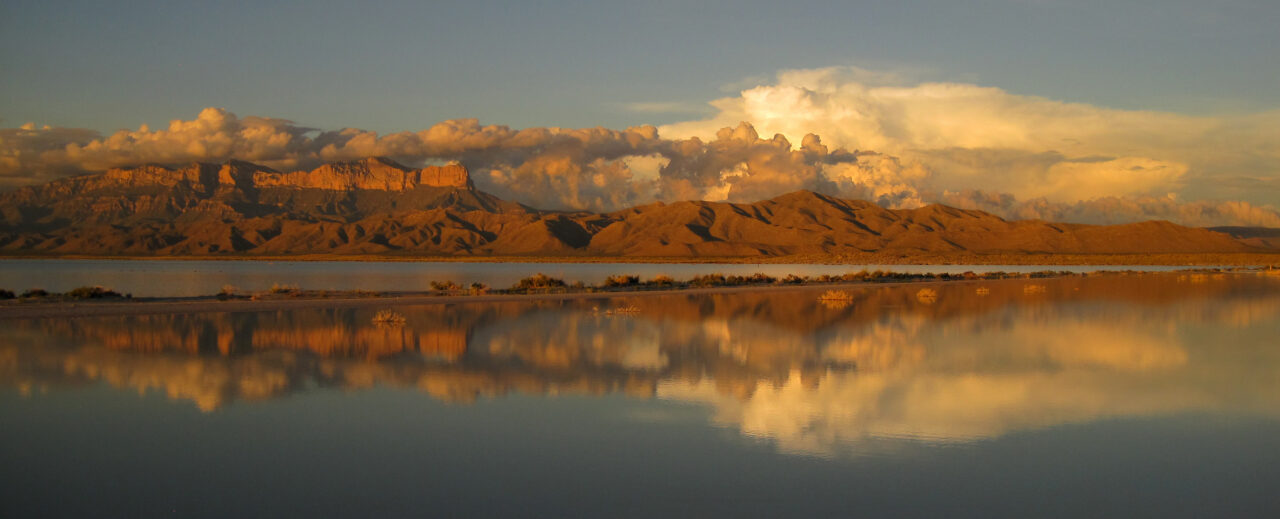
The broadest views of El Capitan appear south of Pine Springs, where the exposed edge of the Capitan Reef forms a sharp limestone prow. Morning light illuminates the mountain’s eastern face, while late afternoon light emphasizes horizontal rock layers. Wind can be severe along this corridor, particularly during spring and winter. Drivers of trailers, vans, and other high profile vehicles should review wind forecasts before crossing exposed sections of highway.
Combine the Salt Basin with the western approach
The Salt Basin’s white gypsum dunes lie west of the main mountain front and require a separate drive through the Dell City area. Their brightness can resemble snow from a distance, but the basin developed as mineral rich water evaporated from a closed desert depression. Plan this excursion for morning or late afternoon, when lower temperatures and angled light make the dunes easier to explore and photograph.
Prepare for the conditions that cause most problems
Our Guadalupe Mountains National Park Guide recommends making a turnaround plan before leaving the trailhead. Set a time based on remaining daylight rather than distance from the objective, then keep it even if the summit or canyon endpoint appears close. Slow travel over limestone, route finding in washes, and unexpected wind can consume the safety margin that hikers expected to use on the descent.
Pack for abrasion, exposure, and rapid cooling
Agave tips, thorny shrubs, and rough limestone can damage thin clothing and lightweight equipment. Long sleeves and durable trousers help on overgrown or rocky routes. A compact emergency layer matters because perspiration and wind can cool a hiker rapidly above 7,000 feet. Trekking poles improve stability during long descents, although they should be stowed when both hands are needed for Devil’s Hall scrambling.
| Risk | Early warning | Best response |
|---|---|---|
| Heat stress | Headache, nausea, unusual fatigue | Stop in shade, cool the body, drink gradually, and turn back |
| High wind | Difficulty walking straight or standing securely | Leave exposed ridges and descend below the crest |
| Lightning | Growing thunderheads or audible thunder | Move away from summits, isolated trees, and open ridgelines |
| Flash flooding | Heavy rain upstream or rising muddy water | Exit washes and climb to stable higher ground |
Avoid four common planning errors
- Do not rely on mobile navigation alone. Carry an offline map and identify major trail junctions in advance.
- Do not leave food, scented products, or trash accessible to wildlife at campsites or trailheads.
- Do not assume a cloudy morning eliminates sun exposure. Desert ultraviolet levels remain significant through thin cloud.
- Do not continue toward a summit when wind, thunder, injury, or water consumption has already exceeded the plan.
Keep a lower commitment alternative ready
If weather closes off exposed terrain, substitute the Pinery Trail or another short route near Pine Springs rather than waiting at a ridge trailhead. McKittrick Canyon can provide partial shelter from moderate wind, although flooding and controlled access remain considerations. If heat becomes the limiting factor, shift hiking to early morning and use the middle of the day for highway viewpoints or travel between districts.
Frequently Asked Questions
Several practical rules determine which activities fit a Guadalupe Mountains trip. The answers below cover the decisions most likely to affect an itinerary, particularly for visitors traveling with children, pets, or overnight equipment.
Are dogs allowed on the hiking trails?
Pets are prohibited on most park trails and in the backcountry. Leashed pets are permitted only in designated developed areas and on specifically identified routes, so consult the official pet map before arriving.
Do I need a reservation to enter?
General entry has historically not required a timed entry reservation, but camping, backcountry use, fees, and access procedures follow separate rules. Check the park’s official website for the requirements applying to your dates.
Is a permit required for backpacking?
Yes. Overnight backcountry travel requires a wilderness use permit and camping is limited to designated backcountry sites. Carry all necessary water because reliable natural water sources are generally unavailable.
How many days should I spend in the park?
Two full days suit most first visits, allowing one major hike and one shorter canyon or desert outing. Add a third day for Dog Canyon or the Salt Basin Dunes because both require substantial driving outside the main Pine Springs district.
Is the park suitable for children?
Short routes such as the Pinery Trail work well for many families, while Devil’s Hall and Guadalupe Peak require careful assessment of balance, endurance, weather, and exposure. Children should carry water only if an adult also has enough capacity to cover their needs.
Is the park open year round?
The park generally remains open throughout the year, but individual roads, gated districts, trails, and facilities can close because of weather, fire, wildlife activity, or maintenance. Verify current operating information before the long drive from regional supply towns.
Plan for the mountain you find
A successful visit begins with one well chosen objective, an early departure, and enough flexibility to change plans. Guadalupe Peak rewards strong hikers in stable conditions, McKittrick Canyon combines geology with seasonal color, and shorter Pine Springs routes provide worthwhile alternatives when wind or limited daylight rules out exposed terrain.
Bring water from outside the park, fuel before reaching the mountain corridor, download navigation resources, and leave room for slower travel over rocky ground. Those decisions turn a remote desert trip into a manageable itinerary while preserving the flexibility needed in a mountain range where elevation, temperature, and wind can change within a single afternoon.
Want to keep exploring? Browse all our Guadalupe Mountains guides and articles for more trip-planning tips and ideas.
Gear & Essentials
Tell us about your trip and we will add what else you will want:
The basics
Worth having in the car whatever the park.
For this trip
As an Amazon Associate we earn from qualifying purchases, at no extra cost to you.