Guadalupe Mountains National Park
How to Hike Guadalupe Peak in Guadalupe Mountains National Park
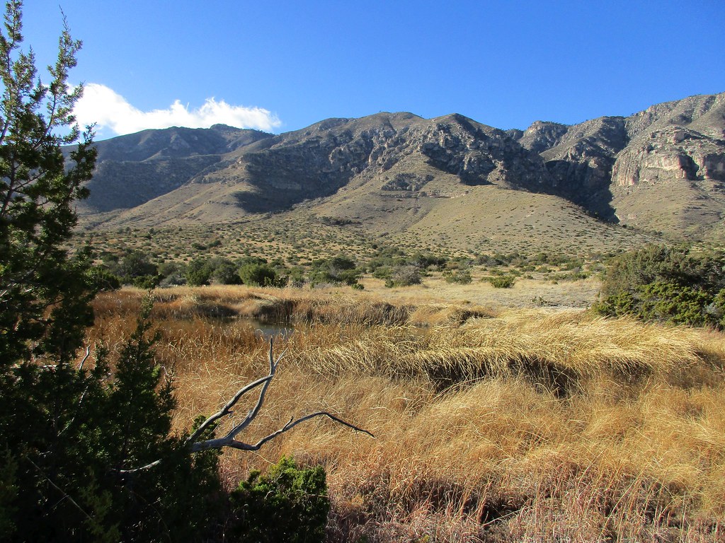
Photo: jaygannett via Flickr (CC BY-SA 2.0)
Learning how to hike Guadalupe Peak in Guadalupe Mountains National Park begins with one defining statistic: the trail climbs roughly 3,000 vertical feet to the 8,751 foot summit, the highest point in Texas. The standard route is an approximately 8.4 mile round trip from Pine Springs, usually requiring six to eight hours for a prepared hiker.
The summit overlooks the exposed limestone spine of the Guadalupe Mountains, the Chihuahuan Desert, and the broad salt flats west of the range. This guide explains how to reach the correct trailhead, assess the physical demands, choose suitable conditions, and understand the route before committing to the climb.
Hiking Guadalupe Peak in Guadalupe Mountains National Park
Guadalupe Peak Trail is a sustained mountain hike rather than a technical climb. It requires no scrambling under normal conditions, but the elevation gain, loose rock, limited shade, and frequent high winds make it considerably harder than its mileage suggests. Most of the climbing occurs on switchbacks, with only a few moderate stretches where hikers can recover. There is no dependable water anywhere along the route.
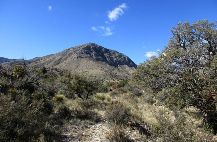
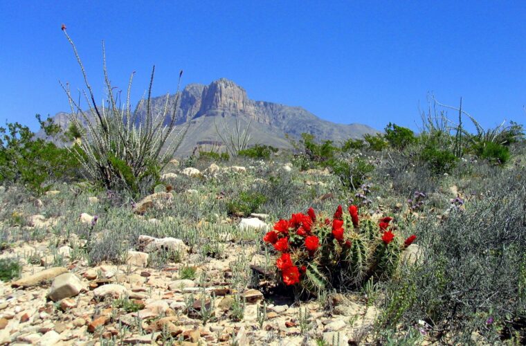
The trail crosses several ecological zones in a short distance. It begins among agave, sotol, prickly pear, and desert shrubs, then reaches cooler north-facing terrain with pinyon pine, juniper, ponderosa pine, and Douglas fir. That transition reflects nearly 3,000 feet of elevation change and the mountain’s abrupt rise above the surrounding desert.
Essential Trail Statistics
The following figures describe the standard out-and-back route from Pine Springs. Segment distances are approximate because GPS readings vary around tight switchbacks and cliff faces.
| Route segment | Approximate distance | Terrain and difficulty |
|---|---|---|
| Pine Springs to upper switchbacks | 1.5 miles | Steep, exposed, and consistently strenuous |
| Upper switchbacks to backcountry campground area | 1.6 miles | Rocky forest trail with shorter climbs and limited relief |
| Campground area to Guadalupe Peak | 1.1 miles | Exposed ridge travel followed by a steep summit approach |
| Complete round trip | About 8.4 miles | Roughly 3,000 feet of cumulative elevation gain |
Why the Mountain Is So Abrupt
Guadalupe Peak belongs to the Guadalupe Mountains, an uplifted section of the Capitan Reef. This massive limestone formation developed along the edge of a Permian sea more than 250 million years ago. Erosion removed softer surrounding material and left the resistant reef limestone standing above the Chihuahuan Desert. The same ancient reef forms El Capitan, the prominent cliff-fronted landmark visible beside Guadalupe Peak.
The geology directly affects the hiking surface. Expect angular limestone, embedded rock steps, and loose fragments that can roll underfoot. Trekking poles are particularly useful during the descent, when tired legs and unstable stones create more problems than the uphill grade.
Reaching the Pine Springs Trailhead
The Guadalupe Peak Trail begins in the Pine Springs developed area on the park’s eastern side, reached from US 62 and US 180. Pine Springs is roughly 110 road miles east of central El Paso and about 55 miles southwest of Carlsbad, New Mexico. Services are sparse along both approaches, and there is no fuel station inside Guadalupe Mountains National Park. Arrive with enough fuel for the return drive.
Drivers approaching from El Paso pass through long, open desert with few places to stop. From Carlsbad, the highway runs south toward White’s City before turning west toward the park. Mobile coverage becomes unreliable near the mountains, so our team recommends downloading directions, weather information, and the park map before leaving a larger town.
Parking at Pine Springs
Follow signs for Pine Springs, the visitor center, and trailhead parking rather than continuing toward the roadside El Capitan viewpoints. The Guadalupe Peak route begins near the Pine Springs campground and trailhead area. Parking can fill early during spring and autumn weekends, so a dawn arrival improves the chance of finding a space and gives hikers more daylight for the descent.
Parking layouts, entrance charges, pass acceptance, and facility availability can change. Confirm current details on the official park site before departure. Regardless of posted opening times for staffed facilities, plan to carry all the water and food needed for the full hike.
Fees and Permit Requirements
Guadalupe Mountains National Park charges an entrance fee, which may be covered by an eligible federal recreation pass. Standard day hikers generally do not need a separate trail permit for Guadalupe Peak. Anyone planning to sleep at the Guadalupe Peak backcountry campground must follow the park’s wilderness permit system and use the designated camping area rather than selecting an informal site.
Camping does not shorten the physical climb as much as some hikers expect because overnight equipment adds weight during the steepest lower switchbacks. The backcountry campground also has no water source. Most visitors are better served by starting early and completing the mountain as a day hike.
The Climb from Pine Springs to the High Country
From the trailhead, the route begins climbing almost immediately through open desert vegetation. Watch for signed junctions and remain on Guadalupe Peak Trail, since other paths in the Pine Springs network lead toward destinations such as Devil’s Hall, the Tejas Trail, and the Foothills Trail. The summit route is established and generally easy to follow, but missing a junction wastes valuable energy early in the day.
The first major section is also one of the most demanding. Repeated switchbacks climb the eastern and southern slopes above Pine Springs with little sustained shade. The grade exposes weaknesses in pacing quickly. A speed that feels comfortable for the first ten minutes can become exhausting after an hour, so begin at a pace that allows normal conversation.
The Exposed Lower Switchbacks
On the lower switchbacks, pale limestone shifts under each step while sotol leaves brush the trail edge. The campground and highway shrink below, but the slope continues rising overhead in stacked turns. Morning shade can feel cool against the rock, then direct sun reaches the same slope and raises the apparent temperature within minutes. Wind arrives in uneven bursts around the ridges, sometimes loud enough to cover conversation. This section makes the mountain’s scale clear long before the summit appears.
How to Pace the Opening Climb
Avoid using the switchback corners as shortcuts. Cutting bends damages thin desert soil and sends loose rock onto the trail below. Instead, use the established turns as natural pacing points. Brief standing breaks preserve momentum better than long seated stops, especially in cool or windy conditions where muscles stiffen quickly.
- Drink small amounts regularly rather than waiting until thirst becomes pronounced.
- Keep an easy, repeatable cadence through the steepest switchbacks.
- Yield carefully on narrow sections without stepping onto fragile vegetation.
- Reassess breathing, leg fatigue, water use, and weather after the first hour.
The Forested Traverse
Higher on the mountain, the trail bends onto a cooler aspect and enters scattered conifers. The grade becomes less relentless, although the path remains rocky and continues gaining elevation. Pinyon, juniper, ponderosa pine, and Douglas fir provide intermittent shelter, a marked change from the exposed Chihuahuan Desert below.
This middle section can create a false impression that the hardest work is finished. The route still has substantial climbing ahead, including the final approach above the backcountry campground. Use the gentler traverse to eat, adjust layers, and check the sky rather than accelerating. Clouds can build behind the ridge before hikers on the protected side have a clear view of them.
Choosing a Season and a Safe Weather Window
Spring and autumn generally provide the most manageable temperatures, but both seasons can bring severe wind. The Guadalupe Mountains stand directly in the path of strong regional airflows, and exposed ridges may be difficult or unsafe even when conditions at Pine Springs seem tolerable. Wind also increases dehydration and removes body heat rapidly once clothing becomes damp.
Summer brings intense heat at the trailhead and a risk of afternoon thunderstorms. Winter days may be clear and comfortable at lower elevations while snow, ice, or freezing wind affects the upper trail. Elevation makes summit conditions meaningfully different from forecasts for nearby desert communities.
Seasonal Conditions at a Glance
| Season | Typical advantages | Primary concerns |
|---|---|---|
| Spring | Mild lower-elevation temperatures and longer daylight | Strong wind, rapid temperature changes, and busy weekends |
| Summer | Long daylight hours | Desert heat, high water demand, lightning, and limited shade |
| Autumn | Cooler climbing temperatures and generally favorable daylight | Wind events and crowded trailhead parking |
| Winter | Cool desert conditions and fewer hikers | Short daylight, freezing temperatures, snow, and ice |
When to Turn Around
Turn back if thunder is audible, dark clouds are building near the ridge, wind prevents stable walking, or ice appears without warning on shaded sections. The upper route includes exposed terrain with few protected places to wait out lightning. A summit monument does not provide safe shelter.
Water consumption is another firm turnaround measure. Hikers who use half their supply before reaching the backcountry campground area should descend unless they have deliberately reserved additional water for the return. The downhill journey is faster for many people, but sun, dry air, and muscular effort continue to drive fluid loss.
Finishing the Route to the Summit
Beyond the forested traverse, the trail passes the Guadalupe Peak backcountry campground and returns to exposed limestone terrain. The campground sits below the summit ridge, so tents there receive little protection from strong winds. Day hikers should treat this area as a decision point: assess remaining water, daylight, cloud development, and leg fatigue before beginning the final steep climb.
From the Campground to the Ridge
The grade increases above the campground as the route crosses loose rock and works toward a saddle. El Capitan becomes increasingly prominent to the south, while views west extend across the salt flats toward the distant desert ranges. Several apparent high points can look like the summit from below, but the actual summit remains farther along the ridge.
The Bridge and Final Approach
A short wooden bridge crosses an exposed break in the rock near the upper route. The bridge is brief, but its location can feel uncomfortable during strong wind. Maintain three points of contact if using trekking poles, allow other hikers to clear the crossing, and avoid stopping where the trail narrows. The remaining approach follows rocky switchbacks toward the summit monument.
At the 8,751 Foot Summit
The summit is marked by a stainless steel pyramid installed in 1958. From the high point, El Capitan rises directly to the south, the Chihuahuan Desert spreads eastward, and the pale salt flats fill the basin to the west. Budget time for food, photographs, and an additional layer, but begin descending before fatigue or fading daylight turns the rocky trail into a slower proposition.
Pack for Exposure, Rock, and Dry Air
Understanding how to hike Guadalupe Peak in Guadalupe Mountains National Park includes planning for a route with no dependable water and large temperature differences between Pine Springs and the summit. Many hikers carry three to four liters of water per person, with greater quantities necessary during warm conditions. Add salty snacks and easily digested carbohydrates that can be eaten without an extended stop.
Footwear and Descent Support
Choose hiking shoes or boots with a firm outsole and reliable traction on angular limestone. Smooth road-running soles tend to slide on loose fragments, particularly during the descent. Trekking poles reduce strain on the knees and provide extra stability when gusts arrive unexpectedly, but they should be shortened slightly for the climb and lengthened for downhill travel.
Layers for the Upper Mountain
Carry a wind-resistant outer layer even when Pine Springs feels warm. A lightweight insulating layer is useful during cool mornings, winter outings, and summit stops. Sun exposure remains significant through much of the route, so include a brimmed hat, sunscreen, sunglasses, and clothing that covers the shoulders.
| Item | Trail-specific purpose | When it matters most |
|---|---|---|
| Three to four liters of water | Replaces fluids where no natural source is available | Exposed lower switchbacks and warm descents |
| Wind-resistant shell | Limits heat loss on the ridge and summit | Spring, autumn, and winter |
| Trekking poles | Improves balance on loose limestone | Upper trail and descent |
| Headlamp | Provides dependable light if the hike runs long | Early starts and short winter days |
| Offline map | Maintains navigation without mobile service | Junctions near Pine Springs |
Small Items That Prevent Large Problems
- Carry a headlamp with charged batteries, even when planning to finish before sunset.
- Bring blister treatment, adhesive bandages, and any essential medication.
- Store food securely inside the pack rather than leaving it unattended at rest stops.
- Pack an emergency blanket and whistle for an unexpected delay or injury.
- Use a paper map or downloaded map because mobile reception is unreliable.
Leave cotton sweatshirts and heavy glass containers behind. Cotton dries slowly after perspiration, while unnecessary weight becomes increasingly noticeable over 3,000 feet of climbing. A compact pack containing water, food, layers, navigation tools, and basic emergency supplies provides a better balance of preparedness and efficiency.
Frequently Asked Questions
These practical questions often determine whether the climb fits a visitor’s schedule and experience. Guadalupe Peak requires most of a day, and its combination of elevation gain, exposure, and loose footing deserves more planning than the mileage alone suggests.
How long does the Guadalupe Peak hike take?
Most prepared hikers need six to eight hours for the round trip. Strong hikers may finish sooner, while wind, heat, summit breaks, and careful movement over loose rock can extend the day.
Are dogs allowed on Guadalupe Peak Trail?
Pets are not allowed on Guadalupe Peak Trail. This restriction protects wildlife, reduces conflicts on narrow sections, and prevents paw injuries on hot or sharp rock.
Is Guadalupe Peak suitable for children?
Fit older children with experience on long, steep hikes may complete it with close adult supervision. The route is generally unsuitable for young children because of the sustained elevation gain, exposed terrain, and lack of water.
Can you hike Guadalupe Peak for sunrise?
A sunrise summit requires several hours of travel in darkness over rocky terrain. Only hikers experienced with night navigation should attempt it, carrying headlamps, backup lighting, warm layers, and a downloaded route.
Is there cell service on the trail?
Coverage is unreliable throughout the Pine Springs area and on the mountain. Download maps before arrival and leave the route and expected return time with someone who is not hiking.
Questions about current closures, emergency conditions, or trail damage should be resolved before leaving Pine Springs. Once above the lower switchbacks, descending to seek help can require hours, and wind may make voice communication difficult even within a hiking group.
Completing Guadalupe Peak Safely
A successful Guadalupe Peak hike depends on an early start, conservative pacing, adequate water, and a willingness to turn around when weather or fatigue changes the plan. The lower switchbacks demand restraint, the forested traverse provides a useful recovery period, and the exposed upper ridge requires renewed attention to wind, footing, and daylight.
Plan for a full mountain day rather than an 8.4 mile walk. With suitable conditions and the right equipment, the route provides a clear progression from Chihuahuan Desert vegetation to conifer forest and finally to the highest point in Texas. Reaching the summit is rewarding, but the hike is complete only after the long limestone descent back to Pine Springs.
Want to keep exploring? Browse all our Guadalupe Mountains guides and articles for more trip-planning tips and ideas.
Gear & Essentials
Tell us about your trip and we will add what else you will want:
The basics
Worth having in the car whatever the park.
For this trip
As an Amazon Associate we earn from qualifying purchases, at no extra cost to you.